
Tabernacle Township is a township in Burlington County, in the U.S. state of New Jersey. As of the 2020 United States census, the township's population was 6,776, a decrease of 173 (−2.5%) from the 2010 census count of 6,949, which in turn reflected a decline of 221 (−3.1%) from the 7,170 counted in the 2000 census. The township, and all of Burlington County, is a part of the Philadelphia-Reading-Camden combined statistical area and the Delaware Valley.
Millstone Township is a township in western Monmouth County, in the U.S. state of New Jersey. The Township is located within the Raritan Valley region and is a part of the New York metropolitan area. As of the 2020 United States census, the township's population was 10,376, a decrease of 190 (−1.8%) from the 2010 census count of 10,566, which in turn reflected an increase of 1,596 (+17.8%) from the 8,970 counted in the 2000 census.

Lacey Township is a township in Ocean County, in the U.S. state of New Jersey and is considered part of the Jersey Shore and South Jersey regions. As of the 2020 United States census, the township's population was 28,655, an increase of 1,011 (+3.7%) from the 2010 census count of 27,644, which in turn reflected an increase of 2,298 (+9.1%) from the 25,346 counted in the 2000 census. The 2010 population was the highest recorded in any decennial census. It was named for Continental Army General John Lacey.

Plumsted Township is a township in Ocean County, in the U.S. state of New Jersey. As of the 2020 United States census, the township's population was 8,072, a decrease of 349 (−4.1%) from the 2010 census count of 8,421, which in turn reflected an increase of 1,146 (+15.8%) from the 7,275 counted in the 2000 census. The 2010 population was the highest recorded in any decennial census.

Papakating Creek is a 20.1-mile-long (32.3 km) tributary of the Wallkill River located in Frankford and Wantage townships in Sussex County, New Jersey in the United States. The creek rises in a small swamp located beneath the eastern face of Kittatinny Mountain in Frankford and its waters join the Wallkill to the east of Sussex borough.
Swartswood State Park is a 3,460-acre (14.0 km2) protected area located in the Swartswood section of Stillwater and Hampton townships in Sussex County, New Jersey, in the United States. Established in 1915 by the state's Forest Park Reservation Commission, it was the first state park established by the state of New Jersey for the purposes of recreation at the state's third-largest freshwater lake. Today, Swartswood State Park is operated and maintained by the New Jersey Division of Parks and Forestry.

Merritt is an unincorporated community in Missaukee County in the U.S. state of Michigan. The community is centered between Butterfield Township to the south and Enterprise Township to the north. As an unincorporated community, Merritt has no legally defined boundaries or population statistics of its own but does have its own post office with the 49667 ZIP Code.

Green Creek is an unincorporated community located within Middle Township, in Cape May County, in the U.S. state of New Jersey. It is located on Route 47. It is a very low-lying area with a highest elevation of just above 20 feet (6.1 m). The community is located about 3 miles (4.8 km) west of Rio Grande and about 2 miles (3.2 km) from the Delaware Bay. It is mostly residential with areas of agriculture and commerce along the main road, Delsea Drive. The United States Postal Service ZIP Code is 08219. The post office was established in 1829 with Matthew Marcy as the first postmaster.
Cumberland is a small unincorporated community located within Maurice River Township in Cumberland County, in the U.S. state of New Jersey. For statistical purposes, Cumberland and neighboring Hesstown together comprise the Cumberland-Hesstown census-designated place.
Bunnvale is an unincorporated community located within Lebanon Township, Hunterdon County, in the U.S. state of New Jersey.

Phalanx is an unincorporated community located within Colts Neck Township in Monmouth County, in the U.S. state of New Jersey. It is located near the Swimming River Reservoir and is across from Brookdale Community College in Lincroft. The community is named for the North American Phalanx, a communal agricultural community that existed in the 19th century. The community disbanded in 1854 following a fire but the main residence stood until November 14, 1972 when another fire destroyed it. Homes began to replace the former farmland beginning in the late 1970s and is now the primary composition of the area.

Jackson Mills is an unincorporated community located within Jackson Township, in Ocean County, in the U.S. state of New Jersey. Jackson Mills is located near exit 22 on Interstate 195. It is also located nearby County Route 526 and Jackson Mills Lake. The site was originally home to a sawmill owned by William Jackson. Today surrounding the lake are some houses and townhomes, small businesses, and the Jackson Township Veterans Memorial Garden, though this area of the township is more rural than other more suburbanized portions of it due to the higher density of forest.

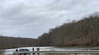
Atsion is an unincorporated community located within Shamong Township in Burlington County, in the U.S. state of New Jersey. The community is located next to Atsion Lake.

Burrs Mill is an unincorporated community located within Southampton Township in Burlington County, in the U.S. state of New Jersey. Found in a rural portion of the township near Route 70, it is located along its eponymous brook in a forested area within the Pine Barrens. A low density of houses surround nearby roads including Burrs Mill Road and Route 70's fire roads.

Apple Pie Hill is a hill in Tabernacle Township, Burlington County, New Jersey. It is 205 feet (62 m) tall, making it one of the highest points of the New Jersey Pine Barrens. A 60-foot-tall (18 m) fire tower stands atop the summit, offering views of the surrounding Pine Barrens. The skylines of Atlantic City and Philadelphia are visible from the top of the tower. It lies along the Batona Trail in Wharton State Forest, making it a popular hiking destination.
Townsbury is an unincorporated community located within Liberty Township in Warren County, in the U.S. state of New Jersey.

Wheatland is an unincorporated community within Manchester Township in Ocean County, in the U.S. state of New Jersey.

Cooleys Corner is an unincorporated community located within Upper Freehold Township in Monmouth County, in the U.S. state of New Jersey. The site of the settlement is within the Assunpink Wildlife Management Area, a New Jersey Department of Environmental Protection Division of Fish and Wildlife-operated preserved area in Monmouth and Mercer counties along the Assunpink Creek. Before the creation of the Assunpink Lake in the 1970s, the area consisted of farmland located at the intersection of Clarksburg Road and Imlaystown-Hightstown Road. Some farmland is still present in the area but is now mostly used by hunters. The main boat ramp to Assunpink Lake is located along the former Imlaystown-Hightstown Road.

The New Jersey Forest Fire Service (NJFFS) is an agency within the New Jersey Department of Environmental Protection. Founded in 1906 with a focus on wildland fire suppression and fire protection, the Forest Fire Service is the largest firefighting department within the state of New Jersey in the United States with 85 full-time professional firefighting personnel, and approximately 2,000 trained part-time on-call wildland firefighters throughout the state. Its mission is to protect "life and property, as well as the state's natural resources, from wildfire".
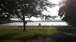
Bamber Lake is an unincorporated community located in Lacey Township, New Jersey, United States, west of the Garden State Parkway. The area is protected by the “New Jersey Pinelands Comprehensive Management Plan of 1979, which has placed limits on the development in these areas”. The two prominent roads for the area are Lacey Road and Dover Road, which provide the only direct routes to Bamber Lake. The lake has two beachfronts and a man-made dam with a walk across bridge. In addition to the lake, which can be used for fishing, swimming, and non-motorized watercraft, the area provides many recreational facilities including two playgrounds, a soccer field, a tennis court, and a basketball court. The area is also well known for its many trails for hiking and hunting.


