Atlantic Trading Estate

Last updated

Atlantic Trading Estate, Barry Atlantic Trading Estate, Barry - geograph.org.uk - 272828.jpg
Atlantic Trading Estate, Barry

The Atlantic Trading Estate is an industrial estate in Barry, Vale of Glamorgan, south Wales, UK. It is situated near the mouth of the Cadoxton River which flows into the Bristol Channel at the Bendricks to the south-east of Barry Docks. It is accessed via the Associated British Port-owned Wimbourne Road from Ffordd-y-Mileniwm near Weston Square, Cadoxton or from the public Hayes Road from the Main B4267 Sully Moors Road, south-west of the village of Sully. It is sometimes considered to be in Sully. It covers an area of 9.22 acres (3.73 ha). [1] It covers an area of 9.22 acres (3.73 ha). [1]

Contents

Archaeological excavation at the estate determined it had been used as a "prehistoric settlement and early Christian burial site". [2] There was evidence of a Bronze Age settlement, [3] as well as small, unenclosed inhumation cemeteries dating from the late-Roman through post-Roman periods. [4]

History

The estate was a Supply Reserve Depot prior to becoming a trading estate. [5] In 1971, the Official Report of the Standing Committees delivered to Parliament referred to "a new project called the Atlantic Trading Estate, on the seaboard near Barry", stating that "there are a considerable number of new undertakings, and it is creating a significant, though relatively small, amount of employment". [6] In November 2001, APC Panels sought permission to build a new factory and office development at the Atlantic Trading Estate. [7]

The estate, in a deprived area of the town, has long been the target of arson and vandalism. In April 2006, a fire broke out in the Arcade Buildings, a block of industrial units on the Atlantic Trading Estate. [8] In February 2007, car was set on fire, [9] and in September, a lorry trailer containing rubbish and tyres was set ablaze in a suspected arson attack. [10] In mid April 2008, a major fire broke out on the estate, affecting a derelict industrial unit housing, a warehouse and several garages. [11] Several months later two men were arrested on the estate, suspected of dismantling metal girders and guilty of arson. [12]

Atlantic Trading Estate in 2011 Atlantic Trading Estate, Sully.jpg
Atlantic Trading Estate in 2011

In January 2007, it was announced that a household waste recycling centre was planned at the Atlantic Trading Estate for the "recycling of glass, aluminium, plastic, battery boxes, fluorescent tubes, gas, oil, white goods and other waste". [13] Oil recycling tank facilities were added to the centre in 2011. [14] In 2014 it was reported that MDA Renewables Ltd plans on building a 25-metre-high 100 kW turbine on the southern boundary of the estate, declaring: "The proposed development will create a sustainable and renewable form of energy which will assist in meeting the Welsh Government's objectives in terms of reducing carbon emissions and minimising the causes of climate change." [15]

Archaeological site

The site has been excavated and radiocarbon dated. Middle Bronze Age wares were uncovered, as well as "beaker, food vessel, and collared urn" remnants within a round-house built of planks. [16] An Iron Age "rim and a basal angle of a vessel" was also among the findings unearthed at the site. [17]

More than 40 burials in wind-blown sand were situated within a small, unenclosed Roman cemetery; [2] [18] [19] it is considered rare for the Late Roman period in southeastern Wales. [17] Genetic links were identified between skeletons, giving "the impression of an extended family group". [20] During the construction of the former Supply Reserve Depot, workmen discovered human remains, some of which were found in lead coffins with scallop-shell decoration; no official record of the discovery was made, as much of the lead was sold as scrap metal. [5]

Related Research Articles

<span class="mw-page-title-main">Vale of Glamorgan</span> County borough in Wales

The Vale of Glamorgan, often referred to as The Vale, is a county borough in the south-east of Wales. It borders Bridgend County Borough to the west, Cardiff to the east, Rhondda Cynon Taf to the north, and the Bristol Channel to the south. With an economy based largely on agriculture and chemicals, it is the southernmost unitary authority in Wales. Attractions include Barry Island Pleasure Park, the Barry Tourist Railway, Medieval wall paintings in St Cadoc's Church, Llancarfan, Porthkerry Park, St Donat's Castle, Cosmeston Lakes Country Park and Cosmeston Medieval Village. The largest town is Barry. Other towns include Penarth, Llantwit Major, and Cowbridge. There are many villages in the county borough.

<span class="mw-page-title-main">Barry Island</span> Place in Vale of Glamorgan, Wales

Barry Island is a district, peninsula and seaside resort, forming part of the town of Barry in the Vale of Glamorgan, South Wales. It is named after the 6th century Saint Baruc. Barry's stretch of coast, on the Bristol Channel, has the world's second highest tidal range of 15 metres (49 ft), second only to the Bay of Fundy in Nova Scotia, Atlantic Canada.

<span class="mw-page-title-main">Sully, Vale of Glamorgan</span> Human settlement in Wales

Sully is a village in the community of Sully and Lavernock, in the Vale of Glamorgan, Wales, lying on the northern coast of the Bristol Channel, midway between the towns of Penarth and Barry and 7 miles southwest of the Welsh capital city of Cardiff.

<span class="mw-page-title-main">Barry, Vale of Glamorgan</span> Town in the Vale of Glamorgan, Wales

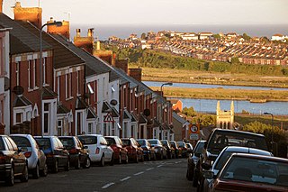
Barry is a town in the Vale of Glamorgan, Wales, on the north coast of the Bristol Channel approximately 9 miles (14 km) south-southwest of Cardiff. Barry is a seaside resort, with attractions including several beaches and the resurrected Barry Island Pleasure Park. According to Office for National Statistics 2016 estimate data, the population of Barry was 54,673.

<span class="mw-page-title-main">Trecastle</span> Village in Powys, Wales

Trecastle is a village in Powys, Wales, situated on the edge of the Brecon Beacons National Park (Welsh: Parc Cenedlaethol Bannau Brycheiniog) and in the community of Llywel. The village has a population of about 200.

<span class="mw-page-title-main">Dinas Powys</span> Human settlement in Wales

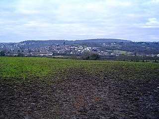
Dinas Powys is a small town and community in the Vale of Glamorgan, South Wales. Its name means "fort of the provincial place" and refers to the Iron Age hillfort which overlooks the village. Dinas Powys is 5.6 miles (9.0 km) south-west of the centre of Cardiff and is situated on the A4055 road from Cardiff to Barry, making it a popular dormitory village for city commuters. It neighbours the larger town of Penarth.

<span class="mw-page-title-main">Palmerstown, Vale of Glamorgan</span> District of Barry in Wales

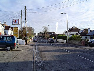
Palmerstown is a south-eastern suburb of Barry in the Vale of Glamorgan south-west of Dinas Powys and 7 miles south-west of Cardiff in Wales. It is immediately north of chemical and plastics industries such as Dow Chemicals, and Barry No.2 dock and the Atlantic Trading Estate lie south-east of No.2 dock. Its south end is separated from the A4055 Cardiff-Barry main road via Palmerston Road, (sic) a tee junction with the A4055 and access to the original part of Palmerstown's housing is via a narrow railway bridge over the Barry-Cardiff railway line and lies north-west of the former Biglis Junction which was a short distance from the so-called "Palmerston Bridge" which separates Palmerston Road from Dobbins Road.

<span class="mw-page-title-main">Colcot</span> District of Barry in Wales

Colcot is a northern district of Barry, Vale of Glamorgan, in the Dyfan ward of South Wales. Dyfan ward is situated in the north west of Barry and its most northern edge is on the green belt of the town. Port Road West runs through the ward and is the main route to Cardiff and Cardiff International Airport in Rhoose. Dyfan benefits from a sports centre and Buttrills recreation field and The Barry Hospital is located on Colcot Road. It also contains the Colcot Primary School, the Colcot Arms pub, the St David's Methodist Church, Coastlands Family Church, a fish and chip shop/Chinese takeaway, Barry Arts Centre and Merthyr Dyfan Cemetery.

<span class="mw-page-title-main">Kingdom of Ceredigion</span> Post-Roman kingdom in Wales

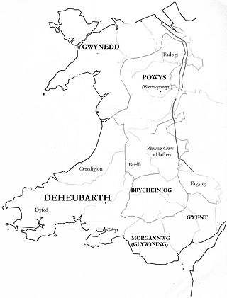
The Kingdom of Ceredigion was one of several Welsh kingdoms that emerged in post-Roman Britain in the mid-5th century. Cardigan Bay to the west and the surrounding hilly geography made it difficult for foreign invaders to conquer. Its area corresponded roughly to that of the county of Ceredigion. Ceredigion transparently means "the people of Ceredig." The kingdom as an independent entity ceased to exist around the year 872.

<span class="mw-page-title-main">The Bendricks</span>

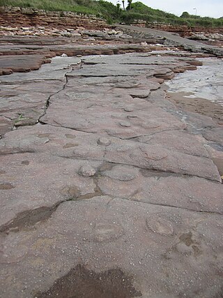
The Bendricks is a stretch of coastline and an important paleontological site in the Vale of Glamorgan in south Wales located along the northern coast of the Bristol Channel between Barry and Sully at 51°23′46″N3°14′50″W. It lies at the foreshore of the industrial port of Barry between the eastern breakwater of the Barry docks entrance on its western edge to Hayes Point on its eastern edge. This area of the coast is a Site of Special Scientific Interest.

<span class="mw-page-title-main">Barry Docks</span> Port in Wales

Barry Docks is a port facility in the town of Barry, Vale of Glamorgan, Wales, a few miles southwest of Cardiff on the north shore of the Bristol Channel. The docks were opened in 1889 by David Davies and John Cory as an alternative to the congested and expensive Cardiff Docks to ship coal carried by rail from the South Wales Coalfield. The principal engineer was John Wolfe Barry, assisted by Thomas Forster Brown and Henry Marc Brunel, son of the famous engineer Isambard Kingdom Brunel.

<span class="mw-page-title-main">Cambrian Archaeological Association</span> Welsh historical society

The Cambrian Archaeological Association was founded in 1846 to examine, preserve and illustrate the ancient monuments and remains of the history, language, manners, customs, arts and industries of Wales and the Welsh Marches and to educate the public in such matters. The association's activities include sponsoring lectures, field visits, and study tours; as well as publishing its journal, Archaeologia Cambrensis, and monographs. It also provides grants to support research and publications.

<i>Archaeologia Cambrensis</i> Historical scholarly journal (1846–)

Archaeologia Cambrensis is a Welsh archaeological and historical scholarly journal published annually by the Cambrian Archaeological Association. It contains historical essays, excavation reports, and book reviews, as well as society notes and accounts of field visits. The journal has included "much valuable material on the manuscripts, genealogy, heraldry, toponymy, folklore and literature of Wales".

<span class="mw-page-title-main">Cadoxton River</span> River in Wales

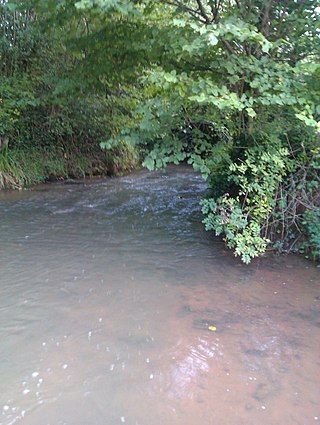
The Cadoxton River is a short river in the Vale of Glamorgan, South Wales and with a length of about 5 miles/8 kilometres it is one of Wales's shortest rivers.

The South Wales Senior League is a former football league in South Wales. The league consisted of two divisions, named Divisions One and Two. Division One was a feeder to the Welsh Football League Division Three, and therefore sat at levels 5 of the Welsh football pyramid.

Osborn Wyddel the Irishman, , was founder of the houses of Cors y gedol, Wynne of Ynys maengwyn, Wynne of Maes y neuadd, and other important families in Merionethshire.

<span class="mw-page-title-main">Pencoedtre</span> District of Barry in Wales

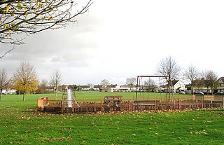
Pencoedtre or Pencoetre, also known as Pencoedtre Village, is a northeastern suburb of Barry in the Vale of Glamorgan, Wales. It borders Gibbonsdown to the southwest and Cadoxton to the south. It has developed from a small farming hamlet into an extensive housing estate in recent years. Pencoedtre Wood is one of the largest areas of woodland in the town, and is a Site of Special Scientific Interest. Pencoedtre Park is located between Pencoedtre and Gibbonsdown.

A bibliography of books related to the Vale of Glamorgan, south Wales.

<span class="mw-page-title-main">Stephen W. Williams</span> Architect and civil engineer (1837–1899)

Stephen W Williams or Stephen Williams (1837–1899) was a civil engineer and architect who worked mainly in Radnorshire and Breconshire, Wales. He was county surveyor of Radnorshire from 1864 to 1899. He had offices at Rhayader and lived at Penralley House, Rhayader, He became a noted authority on the archaeology of the Cistercian Monasteries in Wales and undertook excavations at Strata Florida Abbey in Ceredigion, Abbey Cwm Hir in Radnorshire and Strata Marcella near Welshpool in Montgomeryshire. He was appointed High Sheriff of Radnorshire in 1899.

<span class="mw-page-title-main">Parciau hill fort</span> Roman period hill fort on Anglesey

Parciau hill fort is a hill fort on the Welsh island of Anglesey. It stands on the summit of Bryn Ddiôl, whose name means "trackless hill".

References

  1. 1 2 Atlantic Trading Estate Particulars, Vale of Glamorgan Council
  2. 1 2 Davidson, Andrew (2002). The coastal archaeology of Wales. Council for British Archaeology. pp. 6, 59. ISBN   978-1-902771-27-4.
  3. Cambrian Archaeological Association (2007). Archaeologia Cambrensis. Cambrian Archaeological Association. p. 48.
  4. Knight, Jeremy (2014). South Wales: From the Romans to the Normans. Amberley Publishing Limited. pp. 15, 37. ISBN   978-1-4456-2543-0.
  5. 1 2 Moore, Donald (1985). Barry: The Centenary Book. Barry Centenary Book Committee. p. 45. ISBN   978-0-9509738-1-4.
  6. Official Report of the Standing Committees: Session. H.M. Stationery Office. 1971. p. 635.
  7. "In brief". South Wales Echo. 22 November 2011. Archived from the original on 21 September 2014. Retrieved 4 September 2014.
  8. "Blaze at factory". South Wales Echo. 5 April 2006. Archived from the original on 21 September 2014. Retrieved 4 September 2014.
  9. "Car fire suspicious". South Wales Echo. 21 February 2007. Archived from the original on 21 September 2014. Retrieved 4 September 2014.
  10. "Police treating blaze as arson". South Wales Echo. 26 September 2007. Archived from the original on 21 September 2014. Retrieved 4 September 2014.
  11. "Second Blaze Hits Town in 12 Hours; Director Hails Firefighters for Saving Recycle Business". South Wales Echo. 18 April 2008. Archived from the original on 21 September 2014. Retrieved 4 September 2014.
  12. "Men arrested at trading site". South Wales Echo. 1 July 2008. Archived from the original on 21 September 2014. Retrieved 4 September 2014.
  13. "Recycling centre plan". South Wales Echo. 6 January 2007. Archived from the original on 21 September 2014. Retrieved 4 September 2014.
  14. "Cooking oil to be recycled". South Wales Echo. 19 August 2011. Archived from the original on 21 September 2014. Retrieved 4 September 2014.
  15. "Wind Turbine Plan to Help Power Trading Estate in Barry". South Wales Echo. 6 May 2014. Archived from the original on 21 September 2014. Retrieved 4 September 2014.
  16. Lynch, Frances; Aldhouse-Green, Stephen; Davies, J. L. (2000). Prehistoric Wales. Sutton Publishing. p. 87. ISBN   978-0-7509-2165-7.
  17. 1 2 Archaeologia Cambrensis. Cambrian Archaeological Association. 2007. pp. 44, 138.
  18. Carver, Martin (2005). The Cross Goes North: Processes of Conversion in Northern Europe, AD 300-1300. Boydell Press. p. 172. ISBN   978-1-84383-125-9.
  19. Hamerow, Helena; Hinton, David A.; Crawford, Sally (2011). The Oxford Handbook of Anglo-Saxon Archaeology. Oxford University Press. p. 290. ISBN   978-0-19-921214-9.
  20. Edwards, Nancy; Lane, Alan (1992). The Early Church in Wales and the West: Recent Work in Early Christian Archaeology, History and Place Names. Oxbow. p. 97. ISBN   978-0-946897-37-7.

51°24′3″N3°14′41″W / 51.40083°N 3.24472°W / 51.40083; -3.24472