Cold Knap | |
|---|---|
District of Barry | |
 Cold Knap lake | |
| Coordinates: 51°23′14″N3°17′25″W / 51.38722°N 3.29028°W | |
| Country | United Kingdom |
| Region | Wales |
| County | Vale of Glamorgan |
| Town | Barry |
| Time zone | UTC+0 (GMT) |
Cold Knap is a district of Barry in South Wales.
Cold Knap | |
|---|---|
District of Barry | |
 Cold Knap lake | |
| Coordinates: 51°23′14″N3°17′25″W / 51.38722°N 3.29028°W | |
| Country | United Kingdom |
| Region | Wales |
| County | Vale of Glamorgan |
| Town | Barry |
| Time zone | UTC+0 (GMT) |
Cold Knap is a district of Barry in South Wales.
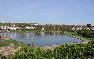
Cold Knap is a coastal pebble beach (with some sand at low tide), [1] approximately a mile west of the sandy beach at Barry Island, which attracts visitors during the summer months. It extends generally westwards towards Porthkerry from Cold Knap Point. [2] It was founded by the Romans who used it as a port, and the remains of a Roman building here are now a scheduled monument. [3]
Attractions include a lake shaped like a Welsh harp and the Richard Taylor Memorial Skatepark. [4] There was previously an outdoor swimming pool, but this has now been closed and filled in, and the area turned into a tourist trail. There was a campaign to have the lido rebuilt during 2014 but an enthusiastic online campaign (including a Facebook campaign group ("Rebuild the Knap Lido") has not been successful, despite a number of celebrity endorsements (including local BBC weatherman Derek Brockway). [5]
Cold Knap Lake is the title and subject of a poem by Gillian Clarke, which has been included in an English literature GCSE syllabus in England. Cold Knap Point is the site of a sewage pumping station serving Barry. [6] It was also the location of a case in English contract law - Chapelton v. Barry UDC [1940] 1 KB 532 - where a man's deckchair collapsed.
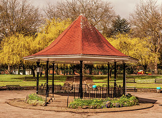
The park is listed at Grade II on the Cadw/ICOMOS Register of Parks and Gardens of Special Historic Interest in Wales. [7]

Caernarfon is a royal town, community and port in Gwynedd, Wales. It has a population of 9,852. It lies along the A487 road, on the eastern shore of the Menai Strait, opposite the island of Anglesey. The city of Bangor is 8.6 miles (13.8 km) to the north-east, while Snowdonia (Eryri) fringes Caernarfon to the east and south-east.

Victoria Park is a park in the London Borough of Tower Hamlets in East London, England.

Porthcawl ( ) is a town and community in the Bridgend County Borough of Wales. It is on the south coast of Wales, 25 miles (40 km) west of Cardiff and 19 miles (31 km) southeast of Swansea.

Colwyn Bay is a town, community and seaside resort in Conwy County Borough on the north coast of Wales overlooking the Irish Sea. It lies within the historic county of Denbighshire. Eight neighbouring communities are incorporated within its postal district. Established as its own separate parish in 1844 with just a small grouping of homes and farms where the community of Old Colwyn stands today, Colwyn Bay has expanded to become the second-largest community and business centre in the north of Wales as well as the 14th largest in the whole of Wales with the urban statistical area, including Old Colwyn, Rhos-on-Sea, and Mochdre and Penrhyn Bay, having a population of 34,284 at the 2011 census.

Barry Island is a district, peninsula and seaside resort, forming part of the town of Barry in the Vale of Glamorgan, South Wales. It is named after the 6th century Saint Baruc. Barry's stretch of coast, on the Bristol Channel, has the world's second highest tidal range of 15 metres (49 ft), second only to the Bay of Fundy in Nova Scotia, Atlantic Canada.

Swansea Bay is a bay on the southern coast of Wales. The River Neath, River Tawe, River Afan, River Kenfig and Clyne River flow into the bay. Swansea Bay and the upper reaches of the Bristol Channel experience a large tidal range. The shipping ports in Swansea Bay are Swansea Docks, Port Talbot Docks and Briton Ferry wharves.

Llanishen is a district and community in the north of Cardiff, Wales. Its population as of the 2011 census was 17,417.
Richard Taylor was a Welsh inline skating and freestyle skiing champion.

Barry is a town and community in the Vale of Glamorgan, Wales. It is on the north coast of the Bristol Channel approximately 9 miles (14 km) south-southwest of Cardiff. Barry is a seaside resort, with attractions including several beaches and the resurrected Barry Island Pleasure Park. According to Office for National Statistics 2021 estimate data, the population of Barry was 56,605.

Roath Park Cardiff, Wales, is one of Cardiff's most popular parks, owned by Cardiff County Council and managed by the Parks Section. It retains a classic Victorian atmosphere and has many facilities. The park has recently been awarded the prestigious Green Flag award to recognise its high quality and its importance to Cardiff. Roath Park has widely diverse environments across the park.

Aberavon Beach, also known as Aberavon Sands, is a three-mile (5 km) stretch of sandy beach on the north-eastern edge of Swansea Bay in Port Talbot, Wales. With its high breaker waves, it is popular with surfers. Aberavon Beach was awarded Blue Flag status in December 2007 and features in the Good Beach Guide published by the Marine Conservation Society.

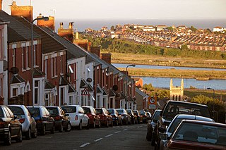
Romilly is a western district of Barry in the Vale of Glamorgan, South Wales, United Kingdom.
Penmon is a promontory, village and ecclesiastical parish on the eastern tip of the Isle of Anglesey in Wales, about 3 miles (4.8 km) east of the town of Beaumaris. It is in the community of Llangoed. The name comes from Welsh: pen and Môn, which is the Welsh word for Anglesey. It is the site of a historic monastery and associated 12th-century church. Walls near the well next to the church may be part of the oldest remaining Christian building in Wales. Penmon also has an award-winning beach and the Anglesey Coastal Path follows its shores. Quarries in Penmon have provided stone for many important buildings and structures, including Birmingham Town Hall and the two bridges that cross the Menai Strait. The area is popular with locals and visitors alike for its monuments, tranquillity, bracing air and fine views of Snowdonia to the south across the Menai Strait.

Taylors Beach is a suburb of the Port Stephens local government area in the Hunter Region of New South Wales, Australia. It is largely undeveloped except for some commercial and light industrial developments in the southern part of the suburb. The largest population centre is at Taylors Beach itself, in the western part of the suburb, adjacent to Tilligerry Creek and Port Stephens. At the 2021 census Taylors Beach had a population of 120.

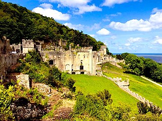
Gwrych Castle is a Grade I listed country house near Abergele in Conwy County Borough, Wales. On an ancient site, the current building was created by Lloyd Hesketh Bamford-Hesketh and his descendants over much of the 19th and early 20th centuries. The castle and its 236-acre estate are now owned by a charity, the Gwrych Castle Preservation Trust.

Llanidan is a community in the south of Anglesey, Wales which includes the village of Brynsiencyn. The parish is along the Menai Strait, about 4 miles north-east of Caernarfon. The parish church of St Nidan is near the A4080 road, a little to the east of Brynsiencyn. The ruins of an earlier parish church survive.

The golden age of lidos in the United Kingdom was in the 1930s, when outdoor swimming became popular, and 169 were built across the UK as recreational facilities by local councils. Many lidos closed when foreign holidays became less expensive, but those that remain have a dedicated following. The name Lido originated from the Lido di Venezia.

St Brides Major is a community on the western edge of the Vale of Glamorgan, South Wales. Its largest settlement is the village of St Brides Major, and also includes the villages of Ogmore-by-Sea and Southerndown, and the hamlets of Ogmore Village, Castle-upon-Alun, Heol-y-Mynydd, Norton and Pont-yr-Brown It is notable for coastal geology and scenery, limestone downlands and fossilised primitive mammals, sea cliffs and beaches, two Iron Age hillforts, three medieval castle sites,, two stepping stone river crossings and a clapper bridge. Three long distance paths cross the community. It is the western limit of the Vale of Glamorgan Heritage Coast, and has a visitor centre and tourist facilities.

Ynysangharad War Memorial Park is located in the town of Pontypridd, Wales. The area that now makes up the park was bought by the people of Pontypridd in 1919 after workers raised the money to establish the park. It was originally designed for those who lived in the surrounding area to have somewhere to relax from their work lives. The park is designated Grade II on the Cadw/ICOMOS Register of Parks and Gardens of Special Historic Interest in Wales.

The Vale of Glamorgan is a county borough in south-east Wales. It covers an area of 331 km2 (128 sq mi) and in 2021 the population was approximately 132,500.
51°23′14″N3°17′25″W / 51.38722°N 3.29028°W