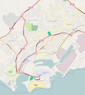
The Vale of Glamorgan, locally referred to as The Vale, is a county borough in the south-east of Wales. It borders Bridgend County Borough to the west, Cardiff to the east, Rhondda Cynon Taf to the north, and the Bristol Channel to the south. With an economy based largely on agriculture and chemicals, it is the southernmost unitary authority in Wales. Attractions include Barry Island Pleasure Park, the Barry Tourist Railway, Medieval wall paintings in St Cadoc's Church, Llancarfan, Porthkerry Park, St Donat's Castle, Cosmeston Lakes Country Park and Cosmeston Medieval Village. The largest town is Barry. Other towns include Penarth, Llantwit Major, and Cowbridge. There are many villages in the county borough.
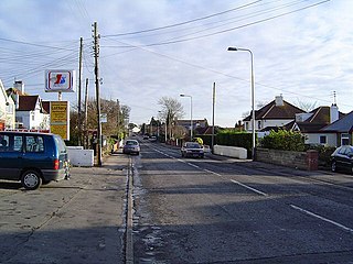
Sully is a village in the community of Sully and Lavernock, in the Vale of Glamorgan, Wales, lying on the northern coast of the Bristol Channel, midway between the towns of Penarth and Barry and 7 miles southwest of the Welsh capital city of Cardiff.
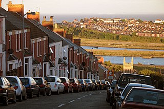
Barry is a town and community in the Vale of Glamorgan, Wales. It is on the north coast of the Bristol Channel approximately 9 miles (14 km) south-southwest of Cardiff. Barry is a seaside resort, with attractions including several beaches and the resurrected Barry Island Pleasure Park. According to Office for National Statistics 2021 estimate data, the population of Barry was 56,605.

The Vale of Glamorgan Line is a commuter railway line in Wales, running through the Vale of Glamorgan from Barry to Bridgend, via Rhoose and Llantwit Major.

Penarth railway station is the railway station serving the town of Penarth in the Vale of Glamorgan, South Wales. It is the terminus of Network Rail's Penarth branch running from Cogan Junction to Penarth station, 1 mile 12 chains from the junction and 2 miles 67 chains south of Cardiff Central station. The Penarth branch ran from Cogan Junction to Biglis Junction, a rail mileage of 5 miles 65 chains and was officially closed beyond Penarth after the last passenger train ran on Saturday 4 May 1968.
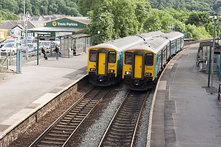
Cogan railway station is a railway station serving Cogan in the Vale of Glamorgan, Wales. It is on the Vale of Glamorgan Line 2+3⁄4 miles (4.4 km) south of Cardiff Central on the way to Barry Island and Bridgend.

Barry Island railway station is a railway station, 9+1⁄4 miles (14.9 km) south-west of Cardiff Central, serving Barry Island in South Wales. The station has been the terminus – and only remaining active station at the end of the Barry branch of the Cardiff Central to Barry Island line since the closure of Barry Pier station in 1976, the last passenger working through Barry Island tunnel to the Pier station being an enthusiasts' special in 1973. Previous to that year, only a few revenue-earning workings to meet up with the former P&A Campbell's paddle-steamer trips to Weston-super-Mare or other Somerset/Devon havens, were made following May 1964.

Barry railway station is one of three stations serving the town of Barry, Vale of Glamorgan in South Wales. This one, Barry Town, is preceded by Barry Docks and Cadoxton stations on the Barry Branch which runs from Cardiff Central to a fourth station at Barry Island, the terminus. Barry is also the junction at the start of the Vale of Glamorgan Line which serves Rhoose and Llantwit Major and terminates at Bridgend.
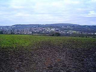
Dinas Powys is a small town and community in the Vale of Glamorgan, South Wales. Its name means "fort of the provincial place" and refers to the Iron Age hillfort which overlooks the village. Dinas Powys is 5.6 miles (9.0 km) south-west of the centre of Cardiff and is situated on the A4055 road from Cardiff to Barry, making it a popular dormitory village for city commuters. It neighbours the larger town of Penarth.

Cadoxton railway station is a railway station serving Cadoxton and Palmerstown near Barry, Vale of Glamorgan, South Wales. It is located on the Barry Branch 6½ miles (10 km) south of Cardiff Central. The line continues to the terminus of the Barry Branch at Barry Island but from Barry Junction the line also continues as the Vale of Glamorgan branch to Bridgend via Rhoose for Cardiff International Airport bus link and then Llantwit Major.

The Barry Railway Company was a railway and docks company in South Wales, first incorporated as the Barry Dock and Railway Company in 1884. It arose out of frustration among Rhondda coal owners at congestion and high charges at Cardiff Docks as well the monopoly held by the Taff Vale Railway in transporting coal from the Rhondda. In addition, the Taff Vale did not have the required capacity for the mineral traffic using the route, leading to lengthy delays in getting to Cardiff.
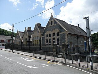
Cogan is a suburb of Penarth in the Vale of Glamorgan, Wales 2.5 miles (4 km) south of the centre of the Welsh capital city of Cardiff. Cogan contains one of the vale's four major leisure centres.

The A4055 is the main road link between Cardiff Bay and Barry.
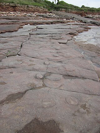
The Bendricks is a stretch of coastline and an important paleontological site in the Vale of Glamorgan in south Wales located along the northern coast of the Bristol Channel between Barry and Sully at 51°23′46″N3°14′50″W. It lies at the foreshore of the industrial port of Barry between the eastern breakwater of the Barry docks entrance on its western edge to Hayes Point on its eastern edge. This area of the coast is a Site of Special Scientific Interest.

Barry Docks is a port facility in the town of Barry, Vale of Glamorgan, Wales, a few miles southwest of Cardiff on the north shore of the Bristol Channel. The docks were opened in 1889 by David Davies and John Cory as an alternative to the congested and expensive Cardiff Docks to ship coal carried by rail from the South Wales Coalfield. The principal engineer was John Wolfe Barry, assisted by Thomas Forster Brown and Henry Marc Brunel, son of the famous engineer Isambard Kingdom Brunel.

Tonteg Halt refers to two railway stations serving the township of Tonteg in Rhondda Cynon Taf, Wales. They were located on the Llantrisant and Taff Vale Junction Railway and latterly on the Barry Railway under the Great Western Railway.
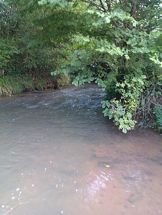
The Cadoxton River is a short river in the Vale of Glamorgan, South Wales and with a length of about 5 miles/8 kilometres it is one of Wales's shortest rivers.

Walnut Tree Viaduct was a railway viaduct located above the southern edge of the village of Taffs Well, South Wales. Originally built to carry the Barry Railway across a narrow gorge through which the River Taff, Taff Vale Railway and Cardiff Railway passed, it was deconstructed in 1969, leaving only two of the support columns visible from the A470 road.

Wenvoe Quarry is a quarry located on the eastern edge of the Vale of Glamorgan, south Wales, approximately 5 km southwest of Cardiff city centre. It is situated on Alps Quarry Road, in an area known as "The Alps", between Wenvoe, Culverhouse Cross and Caerau. The quarry is accessed from the A4050 road.

Wenvoe Tunnel is a disused tunnel on the defunct Barry Railway that runs under Culverhouse Cross in the Vale of Glamorgan in south Wales, on the western outskirts of Cardiff. It was opened in 1889 on a line used to carry coal to Barry Docks. The line also had a sparse passenger service and closed after March 1963.

