Bad Radkersburg

Last updated • 3 min readFrom Wikipedia, The Free Encyclopedia
Bad Radkersburg
Bad Radkersburg-Stadtmauer 7343.JPG
Town walls
AUT Bad Radkersburg COA.svg
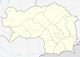
Austria Styria adm location map.svg
Red pog.svg
Bad Radkersburg
Location within Styria#Location within Austria
Austria adm location map.svg
Red pog.svg
Bad Radkersburg
Bad Radkersburg (Austria)
Coordinates: 46°41′23″N15°59′19″E / 46.68972°N 15.98861°E / 46.68972; 15.98861
Country Austria
State Styria
District Südoststeiermark
Government
   Mayor Josef Sommer (ÖVP)
Area
[1]
  Total29.94 km2 (11.56 sq mi)
Elevation
209 m (686 ft)
Population
 (2018-01-01) [2]
  Total3,156
  Density110/km2 (270/sq mi)
Time zone UTC+1 (CET)
  Summer (DST) UTC+2 (CEST)
Postal code
8490
Area code 03476
Vehicle registration RA
Website www.badradkersburg.org

Bad Radkersburg (German pronunciation: [ˈbaːtˈʁatkɐsbʊʁk] ; Slovene : Radgona; archaic Hungarian : Regede [3] ) is a spa town in the southeast of the Austrian state of Styria, in the district of Südoststeiermark.

Contents

Geography

Mur bridge Radkersburg-Murbrucke 9134.JPG
Mur bridge

In the south the town borders Slovenia on the Mur River. On the other side of the river lies its twin city Gornja Radgona (Oberradkersburg) in the Slovenian Styria region. Bad Radkersburg is a spa town featuring a thermal spring with a temperature of 80 °C (176 °F). This and the longest sunshine duration in Austria make it an attractive site for tourism with over 100,000 stays per year.

In the course of a Styrian administrative reform, the town merged with the neighbouring municipality of Radkersburg Umgebung with combined population of 3158 inhabitants, in effect from 1 January 2015.

Weather

Climate data for Bad Radkersburg 1971-2000
MonthJanFebMarAprMayJunJulAugSepOctNovDecYear
Mean daily maximum °C (°F)2.9
(37.2)
5.8
(42.4)
11.3
(52.3)
16.0
(60.8)
21.0
(69.8)
23.9
(75.0)
25.9
(78.6)
25.3
(77.5)
21.4
(70.5)
15.2
(59.4)
8.0
(46.4)
3.5
(38.3)
15.1
(59.2)
Daily mean °C (°F)−1.4
(29.5)
0.6
(33.1)
5.2
(41.4)
9.5
(49.1)
14.6
(58.3)
17.7
(63.9)
19.4
(66.9)
18.6
(65.5)
14.7
(58.5)
9.3
(48.7)
3.6
(38.5)
−0.3
(31.5)
9.3
(48.7)
Mean daily minimum °C (°F)−4.4
(24.1)
−3.2
(26.2)
0.6
(33.1)
4.3
(39.7)
9.1
(48.4)
12.4
(54.3)
14.0
(57.2)
13.6
(56.5)
10.2
(50.4)
5.5
(41.9)
0.6
(33.1)
−3.2
(26.2)
5.0
(41.0)
Average precipitation mm (inches)33.7
(1.33)
38.0
(1.50)
51.3
(2.02)
52.9
(2.08)
77.3
(3.04)
100.4
(3.95)
115.1
(4.53)
95.8
(3.77)
81.3
(3.20)
71.9
(2.83)
71.8
(2.83)
51.7
(2.04)
841.2
(33.12)
Average precipitation days (≥ 1.0 mm)5.35.25.97.99.610.49.68.87.56.97.57.091.6
Mean monthly sunshine hours 80.9143.5154.3186.1236.6226.6249.3235.1168.5121.666.760.91,930.1
Source: Zamg.ac.at [4]

History

It is not known when Radkersburg was first settled or where the first settlement, mentioned in an 1182 deed, was located. It is also not known when it fell under princely territorial rule. Most likely, Radkersburg originally did not belong to the Dukes of Styria, but possibly to an aristocrat named Radger to whom it had been given by the German king.

Radkersburg about 1830 010 Radkersburg - J.F.Kaiser Lithografirte Ansichten der Steiermark 1825.jpg
Radkersburg about 1830

A market is documented in a 1265/67 urbarium issued under King Ottokar II of Bohemia, who ruled Styria from 1261 to 1278, however, contemporary research suggests that the present-day town was founded by the Habsburg king Albert I of Germany, Duke of Styria, in the end of the 13th century. The appearance of the city today is apparently based on a precise plan, surrounded by a wall with towers. Radkersburg was first mentioned as a town in 1299.

Parish church Stadtpfarrkirche bad radkersburg.JPG
Parish church

Located near the border with the Kingdom of Hungary, it was affected by the armed conflict between King Matthias Corvinus and Emperor Frederick III in the late 15th century. During the Ottoman–Habsburg wars, extended fortifications were laid out according to plans designed by the Italian architect Domenico dell'Allio. Radkersburg was elevated to an Imperial fortress by resolution of the 1582 Diet of Augsburg.

Austrian Radkersburg Corner, 1926 map Radgonski kot.jpg
Austrian Radkersburg Corner, 1926 map

In the course of the 19th century language conflict, nationalist struggles in the ethnically mixed area arose between the predominantly German-speaking citizens and the Slovene-speaking peasant population down the Mur River. A garrison town of the Austro-Hungarian Army in World War I, it was occupied by troops of the newly emerged Kingdom of Serbs, Croats and Slovenes (Yugoslavia) on 1 December 1918. An armed revolt against the occupation forces, led by Johann Mickl, in order to affiliate the town with German-Austria failed. Nevertheless, by resolution of the 1919 Treaty of Saint-Germain, the area north of the Mur passed to the First Austrian Republic, while Oberradkersburg (Gornja Radgona) and the neighbouring municipality of Apače (Abstall), on the south bank, became part of Yugoslavia.

The nationalist conflicts lingered on, on both sides of the border. In World War II many members of the German minority greeted the Wehrmacht invasion of Yugoslavia in 1941 and joined the German combat units, while large parts of Radkersburg were devastated by armed conflicts. After the war, most of the remaining German-speaking population south of the Mur was forcibly expelled.

The Radkersburg bridge across the Mur was reopened on October 12, 1969, which led to a first rapprochement between Austria and Yugoslavia. In 1975 the town achieved spa status, another thermal spring was made accessible in 1978, soon followed by an extension to the bathing site. Since Slovenia joined the Schengen Area in 2007, border controls between Radkersburg and Gornja Radgona have been abolished.

Population

Historical population
YearPop.±%
18692,387    
18802,534+6.2%
18902,630+3.8%
19002,569−2.3%
19102,852+11.0%
19232,218−22.2%
19342,076−6.4%
19392,004−3.5%
19512,247+12.1%
19612,040−9.2%
19712,007−1.6%
19811,745−13.1%
19911,938+11.1%
20011,599−17.5%
20111,361−14.9%

Politics

Main square and town hall 2005.09.06 - 34 - Radkersburg - Mariensaule und Rathaus.jpg
Main square and town hall

Seats in the municipal council (Gemeinderat) as of 2010 (local elections):

Twin towns

Bad Radkersburg is twinned with:

Notable people

Related Research Articles

<span class="mw-page-title-main">History of Styria</span> Account of events in Styria

The history of Styria concerns the region roughly corresponding to the modern Austrian state of Styria and the Slovene region of Styria (Štajerska) from its settlement by Germans and Slavs in the Dark Ages until the present. This mountainous and scenic region, which became a centre for mountaineering in the 19th century, is often called the "Green March", because half of the area is covered with forests and one quarter with meadows, grasslands, vineyards and orchards. Styria is also rich in minerals, soft coal and iron, which has been mined at Erzberg since the time of the Romans. The Slovene Hills is a famous wine-producing district, stretching between Slovenia and Austria. Styria was for long the most densely populated and productive mountain region in Europe.

<span class="mw-page-title-main">Mur (river)</span> River in Central Europe

The Mur or Mura is a river in Central Europe rising in the Hohe Tauern national park of the Central Eastern Alps in Austria with its source at 1,898 m (6,227 ft) above sea level. It is a tributary of the Drava and subsequently the Danube.

<span class="mw-page-title-main">1920 Carinthian plebiscite</span> Referendum in Austria which determined its border with Yugoslavia

The Carinthian plebiscite was held on 10 October 1920 in the area in southern Carinthia predominantly settled by Carinthian Slovenes. It determined the final border between the Republic of Austria and the newly formed Kingdom of Serbs, Croats and Slovenes (Yugoslavia) after World War I. The predominantly Slovene-speaking plebiscite area voted to remain part of Austria with a 59% majority.

<span class="mw-page-title-main">Bruck an der Mur</span> Municipality in Styria, Austria

Bruck an der Mur is a city of some 15,970 people located in the district Bruck-Mürzzuschlag, in the Austrian state of Styria. It is located at the confluence of the rivers Mur and Mürz. Its manufacturing includes metal products and paper. Bruck is located on the Graz to Vienna main line, and is an important regional rail junction.

<span class="mw-page-title-main">Bleiburg</span> Place in Carinthia, Austria

Bleiburg is a small town in the south Austrian state of Carinthia (Koroška), south-east of Klagenfurt, in the district of Völkermarkt, some four kilometres from the border with Slovenia.
<span class="mw-page-title-main">Prekmurje</span> Traditional region of Slovenia

Prekmurje is a geographically, linguistically, culturally and ethnically defined region of Slovenia, settled by Slovenes and a Hungarian minority, lying between the Mur River in Slovenia and the Rába Valley in the westernmost part of Hungary. It maintains certain specific linguistic, cultural and religious features that differentiate it from other Slovenian traditional regions. It covers an area of 938 square kilometers (362 sq mi) and has a population of 78,000 people.

<span class="mw-page-title-main">Styria (Slovenia)</span> Traditional region of Slovenia

Styria, also known as Slovenian Styria or Lower Styria to differentiate it from Austrian Styria, is a traditional region in northeastern Slovenia, comprising the southern third of the former Duchy of Styria. The population of Styria in its historical boundaries amounts to around 705,000 inhabitants, or 34.5% of the population of Slovenia. The largest city is Maribor.
<span class="mw-page-title-main">Duchy of Carniola</span> Historical land, Habsburg crown land

The Duchy of Carniola was an imperial estate of the Holy Roman Empire, established under Habsburg rule on the territory of the former East Frankish March of Carniola in 1364. A hereditary land of the Habsburg monarchy, it became a constituent land of the Austrian Empire in 1804 and part of the Kingdom of Illyria until 1849. A separate crown land from 1849, it was incorporated into the Cisleithanian territories of Austria-Hungary from 1867 until the state's dissolution in 1918. Its capital was German: Laibach, today Ljubljana.

<span class="mw-page-title-main">Wildon</span> Municipality in Styria, Austria

Wildon is a small town located between Leibnitz and Graz in the Austrian country of Styria.

<span class="mw-page-title-main">Gornja Radgona</span> Town in Styria, Slovenia

Gornja Radgona is a town in Slovenia. It is the seat of the Municipality of Gornja Radgona. Once it was a defensive stronghold for today's regional centre and its twin city, Bad Radkersburg, on the other side of the Mura River in Austria. The towns were split in 1919, when the state of Styria was divided between Austria and Slovenia. They afterward developed separately, and Gornja Radgona grew into a new town centre.

<span class="mw-page-title-main">Feldbach, Styria</span> Municipality in Styria, Austria

Feldbach is a town in the southeast of the Austrian state of Styria, near the Slovenian and Hungarian border. It is located in the valley around the river Raab. With 13,421 inhabitants, Feldbach is the fifth largest town in Styria.

<span class="mw-page-title-main">Bad Sankt Leonhard im Lavanttal</span> Place in Carinthia, Austria

Bad Sankt Leonhard im Lavanttal is a spa town in the district of Wolfsberg in the Austrian state of Carinthia.
<span class="mw-page-title-main">Lavamünd</span> Place in Carinthia, Austria

Lavamünd is a market town in the district of Wolfsberg in the Austrian state of Carinthia.

<span class="mw-page-title-main">Duchy of Styria</span> State of the Holy Roman Empire (1180–1806) and crown land of Austria-Hungary (1806-1918)

The Duchy of Styria was a duchy located in modern-day southern Austria and northern Slovenia. It was a part of the Holy Roman Empire until its dissolution in 1806 and a Cisleithanian crown land of Austria-Hungary until its dissolution in 1918.

<span class="mw-page-title-main">Mureck</span> Municipality in Styria, Austria

Mureck is a municipality in the district of Südoststeiermark in the Austrian state of Styria. Administrative reforms in Styria led to the merging on 1 January 2015 of the formerly separate municipalities of Mureck, Gosdorf, and Eichfeld, which includes the villages of Hainsdorf-Brunnsee and Oberrakitsch. The new municipality is named Mureck.

<span class="mw-page-title-main">Slovene Lands</span> Areas where the Slovene language is spoken

The Slovene lands or Slovenian lands is the historical denomination for the territories in Central and Southern Europe where people primarily spoke Slovene. The Slovene lands were part of the Illyrian provinces, the Austrian Empire and Austria-Hungary. They encompassed Carniola, southern part of Carinthia, southern part of Styria, Istria, Gorizia and Gradisca, Trieste, and Prekmurje. Their territory more or less corresponds to modern Slovenia and the adjacent territories in Italy, Austria, Hungary, and Croatia, where autochthonous Slovene minorities live. The areas surrounding present-day Slovenia were never homogeneously ethnically Slovene.

<span class="mw-page-title-main">Gornja Radgona railway station</span>

Gornja Radgona railway station serves the municipality of Gornja Radgona, Slovenia. It was opened on 16 October 1890, as part of the extension of the Radkersburger Bahn from Bad Radkersburg, in present-day Austria, to Ljutomer, in present-day Slovenia.

<span class="mw-page-title-main">Marburg's Bloody Sunday</span> 1919 massacre in Maribor, Slovenia

Marburg's Bloody Sunday was a massacre that took place on Monday, 27 January 1919 in the city of Maribor in Slovenia. Soldiers from the army of the Kingdom of Serbs, Croats and Slovenes, under the command of Slovene officer Rudolf Maister, killed between 9 and 13 civilians of German ethnic origin, wounding a further 60, during a protest in a city centre square. Estimates of casualties differ between Slovene and Austrian sources.

The Austro-Slovene conflict in Carinthia was a military engagement that ensued in the aftermath of World War I between forces loyal to the State of Slovenes, Croats and Serbs and later the Kingdom of Serbs, Croats and Slovenes, and forces loyal to the Republic of German-Austria. The main theater of the conflict was the linguistically mixed region in southeastern Carinthia. The conflict was settled by the Treaty of Saint-Germain in 1919, which stipulated that the territorial dispute be resolved by a plebiscite.
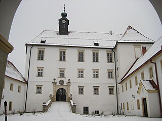
<span class="mw-page-title-main">Gornja Radgona Castle</span>

Gornja Radgona Castle is a castle in Gornja Radgona, Slovenia.

References

  1. "Dauersiedlungsraum der Gemeinden Politischen Bezirke und Bundesländer - Gebietsstand 1.1.2018". Statistics Austria. Retrieved 10 March 2019.
  2. "Einwohnerzahl 1.1.2018 nach Gemeinden mit Status, Gebietsstand 1.1.2018". Statistics Austria. Retrieved 9 March 2019.
  3. Divald, Kornél. 1931. Old Hungarian Art. London: Oxford University Press, p. 117.
  4. "Klimadaten von Österreich 1971 - 2000".