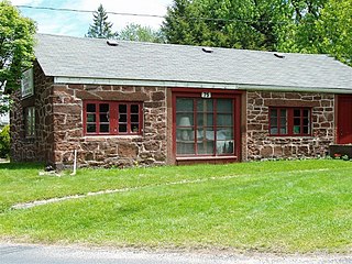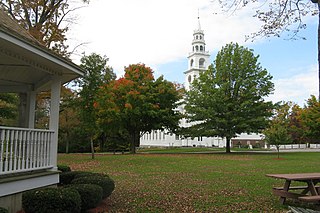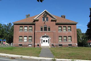
Orange Center Historic District is a historic district encompassing the historic civic, commercial, and industrial heart of Orange, Massachusetts in the United States. It was listed on the National Register of Historic Places in 1989.

The Dorchester-Milton Lower Mills Industrial District is a historic district on both sides of the Neponset River in the Dorchester area of Boston and in the town of Milton, Massachusetts. It encompasses an industrial factory complex, most of which was historically associated with the Walter Baker & Company, the first major maker of chocolate products in the United States. The industrial buildings of the district were built between about 1868 and 1947. They were listed as part of the district on the National Register of Historic Places in 1980, with a slight enlargement in 2001. The buildings have been adapted for mixed industrial/retail/residential use.

The East Blackstone Village Historic District is a historic district roughly along Elm Street at the junction with Summer Street in eastern Blackstone, Massachusetts. It encompasses a small 19th-century mill village center that developed along what was once a major roadway connecting Worcester with Providence, Rhode Island. The district was added to the National Register of Historic Places in 1995.

The Somersville Historic District encompasses the historic components of the mill village of Somersville in western Somers, Connecticut, United States. The district is centered on a mill complex on the Scantic River, which divides the district. The most significant years of development were between about 1835 and 1935, although the area has a history dating to the 1760s. The district was listed on the National Register of Historic Places in 1995. The Mill itself has since burned down and as of October 2018 is currently open field, although the canal structure remains in place.

The Russells Mills Village Historic District is a historic district on Russells Mills, Rock O' Dundee, Slades Corner, Horseneck and Fisher Roads in Dartmouth, Massachusetts. It encompasses an area that was an early industrial center, flourishing from the 18th century into the early 19th century. The district was added to the National Register of Historic Places in 1985.

Phillipston Center Historic District encompasses the historic village center of Phillipston, Massachusetts. The town was first settled in 1751 on land grants made in the 1730s, and was incorporated as a separate town in the 1770s. The surviving village center is not far from the location of the first settlement, which eventually came to include a tavern. After incorporation the center developed around what is now the junction of the Baldwinville, Petersham, and Templeton Roads, although this took time, possibly because of difficulties associated with the American Revolutionary War. As a result, the district has relatively few properties that date to the 18th century. All of these are modest vernacular residential structures. The town grew only modestly until 1830, after which time its population declined, not reaching the same level until 1980, 150 years later. As a result of the lack of growth, most of the properties in the district are Federal and Greek Revival in character. Many of the institutional buildings in the center date to the late 19th and early 20th centuries. The district was added to the National Register of Historic Places in 1999.

The Templeton Common Historic District encompasses the historic town center of Templeton, Massachusetts. Laid out in the 1750s, the area has been the focus of the town's civic and economic affairs since, and includes its finest assortment of 18th and early 19th-century architecture. The district was added to the National Register of Historic Places in 1983. The district was in 2010 named as one of the 1,000 places to visit in Massachusetts by the Great Places in Massachusetts Commission.

The Monument Square–Eagle Street Historic District is a historic district encompassing the civic heart of North Adams, Massachusetts. When it was originally designated in 1972, the district encompassed Monument Square – west of the intersection of Main Street and Church Street, and the location of a Civil War memorial – and the area around it. This designation included the North Adams Public Library, the First Baptist Church and First Congregational Church, and a block of shops Eagle Street. In 1988, the district's boundaries were increased to be roughly bounded by Holden, Center and Union Streets, the East Middle School, Summer Street, and Main Street. This expansion extended the district westward along Summer Street to include the US Post Office building and St. John's Church, and eastward to include Colgrove Park, the middle school, and St. Francis Catholic Church. An additional block of commercial buildings was also added on the north side of West Main Street, extending just west of Holden Street.

The Ware Millyard Historic District encompasses a 19th-century mill complex and industrial mill village in the town of Ware, Massachusetts. It is roughly bounded by South Street, the Ware River, Upper Dam Complex, Park Street, Otis Avenue and Church Street. The area includes surviving mill buildings, the oldest of which date to the 1840s, and a collection of tenement-style housing built for the millworkers, built between 1845 and the 1880s.

The Mill–Prospect Street Historic District in Hatfield, Massachusetts encompasses a historic landscape with over 300 years of industrial and agricultural history. It was listed on the National Register of Historic Places in 2002. The district runs along Prospect Street, a north-south road that roughly bisects Hatfield, from its southern end at Elm Street to a point north of its junction with Chestnut Street, and includes properties on adjacent roadways. The central focus of the district is the Mill River, which meanders from west to east across the district's middle. At the Prospect Street crossing is a cluster of former late 19th century industrial buildings, some of which comprise the Old Mill Site Historic District, listed in 1982.

The Chester Factory Village Historic District is a historic district encompassing the historic village of Chester Factories in Chester, Massachusetts. Chester was settled in the 1760s, and the factory village was a location where water power was harnessed at an early time for grist mills and sawmills. The village got its name from the Chester Glass Factory, which operated in the area through the War of 1812. It benefited from the construction of a turnpike leading to Chester Center in 1804, and was transformed by the arrival of the railroad around 1840. The village became an important provisioning stop for trains, and the village further benefited by the fact that the railroad bypassed Chester Center. The economic and civic life of the town gradually shifted, and Chester Factories is where the town hall and library were built. It was added to the National Register of Historic Places in 1989.

White River Junction Historic District is a historic district in the unincorporated village of White River Junction, within the town of Hartford, Vermont. It was first listed on the National Register of Historic Places in 1980, and its boundaries were increased in 2002 and 2019. It originally encompassed the central portion of the village's business district, and was then expanded to include a broader array of resources.

The Taftsville Historic District encompasses a historic 19th-century industrial village that is mostly in Woodstock, Vermont. Flanking the Ottauquechee River and extending up Happy Valley Road, the area developed around a metal tool factory established by members of the Taft family in 1793. Important elements from its early history include the Taftsville Store, built by the Taft family in 1840, and the Taftsville Covered Bridge, built in 1836. The district was listed on the National Register of Historic Places in 2001.

The Waterville Village Historic District encompasses most of the history 19th and early 20th-century village center of Waterville, Vermont. The village grew from beginnings late in the 18th century to serve as a modest civic, commercial, and residential hub for the rural community. It was added to the National Register of Historic Places in 2007.

The West Chesterfield Historic District is a historic district that encompasses the 19th century industrial and residential heritage of the village of West Chesterfield in the town of Chesterfield, Massachusetts. Centered at the junction of Main Road and Ireland Street, it was one of the town's main industrial sites for many years. The district was listed on the National Register of Historic Places in 2008.

The Bennington Village Historic District of Bennington, New Hampshire encompasses the 19th-century center of the village. Growth of the village followed a typical pattern for rural New Hampshire towns, based in this case around the growth in the early 19th century of the paper industry, which continues to be a significant economic force in the community. The district is centered on the junctions of Main, Center, and School Streets with Bible Hill Road and Francestown Road. The district was listed on the National Register of Historic Places in 2010.

The Lower Village District encompasses a historic industrial area down the Sugar River a short way from the historic center of Claremont, New Hampshire. The area was developed beginning in the 1830s by the Claremont Mill Company, and extends on either side of the river roughly from the Main Street crossing in the west to the junction of Main and Central Streets.

The Tilton Downtown Historic District encompasses a roughly one-block section of Main Street in the center of Tilton, New Hampshire. It extends from Central Street in the west to Bridge and School Streets in the east, including all of the buildings on the north side of this section, and a cluster of buildings on the south side near Bridge Street. The area has long been a commercial and industrial center for the town, although most of the buildings now date from the late 19th century onward, and include a fine array of Victorian architecture. The district was listed on the National Register of Historic Places in 1983.

The Quechee Historic Mill District encompasses the historic heart of the village of Quechee, Vermont, a well-preserved 19th-century mill village. Extending along Quechee Main Street between the Old Quechee Road and the Quechee-West Hartford Road, the village was settled in the 1760s, and has an industrial history extending into the 20th century. It was listed on the National Register of Historic Places in 1997.

The Waitsfield Village Historic District encompasses much of the main village center of Waitsfield, Vermont. Extending along Vermont Route 100 on either side of Bridge Street, it is a well-preserved example of a 19th-century village, with only a few sympathetic 20th-century additions. It was listed on the National Register of Historic Places in 1983.


