Dromineer is a small village and townland in County Tipperary, Ireland. It is on the shores of Lough Derg, 8 km north-west of Nenagh on the R495 road. It is also a civil parish in the historical barony of Ormond Lower. Historic documents describe the places as "Dromynnyre"; the earliest form of the name dating from 1302 was Dromynwyr.

Kinvara or Kinvarra is a sea port village in the southwest of County Galway, Ireland. It is located in the civil parish of Kinvarradoorus in the north of the barony of Kiltartan. Kinvarra is also an electoral division.

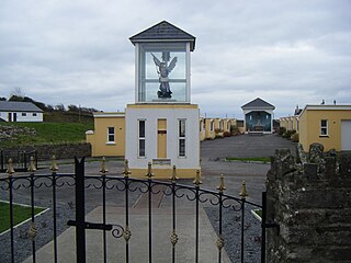
Ballyheigue, officially Ballyheige, is a coastal town and civil parish in County Kerry, Ireland. It is 18 km (11 mi) northwest of Tralee along the R551 road. It is a scenic locale which forms part of the Wild Atlantic Way and has several miles of beaches that connect to Banna Strand to the south, and Kerry Head to the north. Local events include the "Half on the Head" (Kerryhead) half marathon in June and an annual summer festival in July.

Glenamoy is a village in the civil parish of Kilcommon, Erris in the northern part of County Mayo in Ireland. The R314 road passes through Glenamoy.

Ballymacelligott is a civil parish in the north of County Kerry in Ireland. It is situated 7 kilometres (4.3 mi) east of Tralee in the historical barony of Trughanacmy.
Kilmihil is a village in the Barony of Clonderlaw, west County Clare, Ireland. It is also a civil parish and an ecclesiastical parish in the Roman Catholic Diocese of Killaloe. The area was officially classified as part of the West Clare Gaeltacht; an Irish-speaking community; until 1956.

Ballynacally is a village and townland situated 16.7 km (10.4 mi) southwest of Ennis, on the R473 coast road to Kilrush in the civil parish of Kilchreest, County Clare, Ireland. It lies near the bank of the River Shannon.

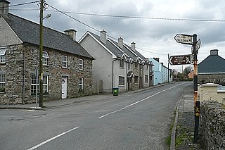
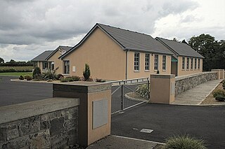
Tubber is a village in the north of County Clare, Ireland.
O'Callaghan's Mills, also O'Callaghansmills, is a village in County Clare, Ireland, and a Catholic parish by the same name. It takes its name from the O'Callaghan family who were large landowners in the area and a corn and grist mill built by John Coonan on the lands of Cornelius O'Callaghan in 1772.
Newtown is a town in County Tipperary, Ireland. It is located on the R494 regional road 7 km (4.3 mi) west of Nenagh. As of the 2016 census, the population was 309. It is in the barony of Owney and Arra. It is also part of the parish of Youghalarra in the Roman Catholic Diocese of Killaloe.

Danesfort is a rural townland and electoral division in County Kilkenny, Ireland, located approximately 6 km from Kilkenny City on the N10. The M9 motorway also passes through the townland. Danesfort is also the name of a civil parish in County Kilkenny.

Staplestown is a village and townland in north County Kildare, Ireland, located 40 kilometres west of Dublin. The village has a church, a school and is home to St Kevin's GAA. The local national (primary) school is Scoil Naomh Mhuire National School.

Ballinora or Ballynora is a small rural parish and townland near Cork city and Ballincollig in County Cork, Ireland. The townland, which lies in the civil parish of Kilnaglory, is home to several education facilities and sporting clubs. The village of Waterfall is nearby.

Kilmaley is a village in County Clare, Ireland, 8 kilometres (5 mi) west of Ennis. The name "Kilmaley" came from the Irish language "Cill Mhaile" which translates to Church of (Saint) Maley.

Ballyvolane is a townland and suburb of Cork on the north side of the city. The townland of Ballyvolane is in the civil parish of St. Anne's Shandon. It is within the Cork North-Central Dáil constituency.

Ballycommon is a parish and village in County Offaly, Ireland. It is located 10 km east of Tullamore.
Kilcommon, is a civil parish in the ancient barony of Ballinacor South in County Wicklow, Ireland. The parish is centered on the village of Tinahely. It is divided into 28 townlands
Dalystown is a village in Carrick, County Westmeath, Ireland. It is located in the south of the county on the N52 road, to the north of Tyrrellspass and Rochfortbridge.

Robinstown, in the townland of Balbradagh, is a village in County Meath, Ireland.

Ballyhar is a townland and electoral division in County Kerry, Ireland. Located in the historical barony of Magunihy and in the civil parish of Kilcredane, the townland of Ballyhar has an area of approximately 1.2 square kilometres (0.5 sq mi).