Banbury Rural District

Last updated

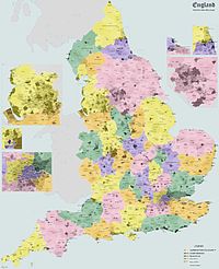
Administrative map of England in 1931 England Administrative 1931.jpg
Administrative map of England in 1931

Banbury was a rural district in Oxfordshire, England from 1894 to 1974. [1] It was formed under the Local Government Act 1894 from the bulk of the Banbury rural sanitary district, which had been divided among three counties. The Warwickshire part of the rural sanitary district (except for the Warwickshire part of the parish of Mollington, which joined Oxfordshire) formed the Farnborough Rural District, whilst the area in Northamptonshire formed the Middleton Cheney Rural District.

Contents

It covered the rural area north, west and south of Banbury. The district expanded in 1932 by taking in part of the disbanded Woodstock Rural District.

Bodicote House: Council's headquarters after 1952 Old Bodicote House.jpg
Bodicote House: Council's headquarters after 1952

Until 1952 the council was based in Banbury. [2] In 1952 the council acquired Bodicote House to be its headquarters, being a large eighteenth century house in the village of Bodicote, immediately south of Banbury. [3] [4] Following the council's abolition in 1974 the building became the main offices of its successor, Cherwell District Council.

The district was abolished in 1974 under the Local Government Act 1972, and now forms part of the Cherwell district of Oxfordshire.

See also

Related Research Articles

<span class="mw-page-title-main">Oxfordshire</span> County of England

Oxfordshire is a ceremonial county in South East England. The county is bordered by Northamptonshire and Warwickshire to the north, Buckinghamshire to the east, Berkshire to the south, and Wiltshire and Gloucestershire to the west. The city of Oxford is the largest settlement and county town.

<span class="mw-page-title-main">Cherwell (district)</span> Non-metropolitan district in England

Cherwell is a local government district in northern Oxfordshire, England. The district was created in 1974 and takes its name from the River Cherwell, which drains south through the region to flow into the River Thames at Oxford. Towns in Cherwell include Banbury and Bicester. Kidlington is a contender for largest village in England.

<span class="mw-page-title-main">Banbury (UK Parliament constituency)</span> Parliamentary constituency in the United Kingdom, 1801 onwards

Banbury is a constituency in Oxfordshire created in 1553 and represented in the House of Commons of the UK Parliament since 2015 by Victoria Prentis of the Conservative Party. She currently serves as Attorney General for England and Wales.

Aylesbury was a rural district in the administrative county of Buckinghamshire, England from 1894 to 1974. It was named after but did not include Aylesbury, which was a separate municipal borough.

<span class="mw-page-title-main">Buckingham Rural District</span>

Buckingham Rural District was a rural district in the administrative county of Buckinghamshire, England from 1894 to 1974, covering an area in the north-west of the county. It was named after but did not include the borough of Buckingham.

<span class="mw-page-title-main">Bodicote</span> Human settlement in England

Bodicote is a village and civil parish in North Oxfordshire, approximately 2 miles (3 km) south of the centre of Banbury. The 2011 Census recorded the parish's population as 2,126. The Church of England parish church of Saint John the Baptist is a Grade II* listed building, with the chancel arch dating back to the 13th century.

Bedford Rural District was a rural district in Bedfordshire, England from 1894 to 1974. It surrounded but did not include the Municipal Borough of Bedford and Kempston Urban District.

Farnborough was a rural district in Warwickshire, England from 1894 to 1932.

<span class="mw-page-title-main">Ely Rural District</span>

Ely Rural District was a rural district in England from 1894 to 1974. It was named after Ely, but did not include the city itself, instead covering the rural area to the west and north of it. It formed part of the administrative county of the Isle of Ely from 1894 to 1965, when this was merged into Cambridgeshire and Isle of Ely.

<span class="mw-page-title-main">Middleton Cheney Rural District</span>

Middleton Cheney was a rural district in Northamptonshire, England from 1894 to 1935.

Long Crendon was a rural district in the administrative county of Buckinghamshire, England from 1894 to 1934.

Abingdon was a rural district in the administrative county of Berkshire from 1894 to 1974.

<span class="mw-page-title-main">Calthorpe, Oxfordshire</span>

Calthorpe is an historic manor in Oxfordshire, now a ward in the town of Banbury, Oxfordshire. It contains the modern housing estates of Cherwell Heights and Calthorpe.

<span class="mw-page-title-main">Marston Sicca Rural District</span> Rural district in Gloucestershire between 1894 and 1931

Marston Sicca was, from 1894 to 1931, a rural district in the administrative county of Gloucestershire, England. The district formed part of a salient of Gloucestershire nearly surrounded by Warwickshire and Worcestershire. In 1931 the boundaries of the three counties were adjusted. The rural district was abolished and its area transferred to Warwickshire.

<span class="mw-page-title-main">Campden Rural District</span>

Campden was, from 1894 to 1935, a rural district in the administrative county of Gloucestershire, England. The district lay on the north-eastern boundary of Gloucestershire, and consisted of three separate areas nearly surrounded by the counties of Warwickshire and Worcestershire. The county and district boundaries were simplified in 1931 and the district was abolished in 1935.

Wolverton Urban District was a local government district in Buckinghamshire, England, from 1920 to 1974, covering the town of Wolverton and its environs, including the town of Stony Stratford. A district covering this area existed from 1894 to 1974, but was initially a rural district called Stratford and Wolverton Rural District. It was redesignated an urban district in 1919, briefly being called Stratford and Wolverton Urban District before being renamed Wolverton Urban District in 1920.

<span class="mw-page-title-main">History of Banbury</span> History of Banbury, England

Banbury is a circa 1,500-year-old market town and civil parish on the River Cherwell in the Cherwell District of Oxfordshire, England. It is 64 miles (103 km) northwest of London, 38 miles (61 km) southeast of Birmingham, 27 miles (43 km) south of Coventry and 21 miles (34 km) north northwest of the county town of Oxford.

The 2011 Cherwell District Council election took place on 5 May 2011 to elect members of Cherwell District Council in Oxfordshire, England. One third of the council was up for election and the Conservative Party stayed in overall control of the council.

Chipping Norton Rural District was a rural district in Oxfordshire, England from 1894 to 1974. It surrounded but did not include the town of Chipping Norton.

Witney Rural District was a rural district in Oxfordshire, England from 1894 to 1974. It surrounded but did not include the town of Witney.

References

  1. Banbury Rural District – Vision of Britain website
  2. "No. 39657". The London Gazette . 30 September 1952. p. 5155.
  3. Historic England. "Bodicote House, High Street, Bodicote (Grade II) (1248703)". National Heritage List for England . Retrieved 24 April 2023.
  4. "Banbury Rural District Council: Removal of Council Offices". Banbury Guardian. 27 November 1952. p. 4. Retrieved 24 April 2023. ...all departments of the Banbury Rural District Council (at present accommodated at 8 Horse Fair, Banbury, and at Castle Wharf, Banbury) will be transferred as from Monday the 1st December 1952 to Bodicote House...

52°02′N1°26′W / 52.03°N 1.43°W / 52.03; -1.43