Hook Norton

Last updated

Hook Norton
Hook norton brewery 1.jpg
Hook Norton brewery is one of Britain's last working Victorian tower breweries
Oxfordshire UK location map.svg
Red pog.svg
Hook Norton
Location within Oxfordshire
Area22.23 km2 (8.58 sq mi)
Population2,117 (2011 Census)
  Density 95/km2 (250/sq mi)
OS grid reference SP3533
Civil parish
  • Hook Norton
District
Shire county
Region
Country England
Sovereign state United Kingdom
Post town Banbury
Postcode district OX15
Dialling code 01608
Police Thames Valley
Fire Oxfordshire
Ambulance South Central
UK Parliament
Website Hook Norton
List of places
UK
England
Oxfordshire
52°00′N1°29′W / 52.00°N 1.48°W / 52.00; -1.48

Hook Norton is a village and civil parish in Oxfordshire, England. It lies 4+12 miles (7 km) northeast of Chipping Norton, close to the Cotswold Hills. The 2011 Census recorded the parish's population as 2,117. [1] The village is formed of four neighbourhoods: East End, Scotland End (in the west), Down End (in the centre) and Southrop (in the south).

Contents

Toponymy

In the Anglo-Saxon Chronicle in 917 the village is recorded as Hocneratun. The Domesday Book of 1086 records it as Hochenartone. A charter from 1130 records it as Hokenartona. An episcopal register entry from 1225 records it as Hokenartone. A record from 1267 records it as Hokenarton. The Taxatio Ecclesiastica of 1291 records it as Hoke Norton. [2] Other past spellings of the name include Hocceneretune (1050), Hogenarton (1216) and Okenardton (1263). [3] Hegnorton is recorded in a plea roll from 1430. [4] [5] The name is derived from Old English. Hocca may perhaps be the name of a person or tribe, although other interpretations are possible; ōra may refer to a hill slope and tūn is a settlement. [2] Today the village is colloquially known to its inhabitants as "Hooky" and sometimes as "The Hook".

History

The Anglo-Saxon Chronicle records that a Viking army from Northampton raided the Hook Norton area in 913. [6] The village had a parish church by 922. [7] The Domesday Book records that in 1086 Hook Norton had 76 villagers and two mills. [8] Leland noted c.1540 the existence of a deer park at Hook Norton which was owned by the king, Henry VIII. The park had previously belonged to a Chaucer and Charles Brandon, 1st Duke of Suffolk. [9] By the 1800s it was "an ancient park, long-disused and forgotten." [10]

Hook Norton had a clockmaker, Thomas Webb, [11] who maintained the turret clock at St. Giles' parish church, Wigginton from 1788 until 1834. [12] Webb was succeeded in his trade at Hook Norton by John Paine, who maintained the clock at Wigginton from 1835 until 1855. [13] In 1840 Paine built a new turret clock for St. George's parish church, Brailes, Warwickshire. [13]

The former Banbury and Cheltenham Direct Railway, part of the Great Western Railway, served Hook Norton with a railway station at East End. British Railways closed the station in 1951 and closed the railway to all traffic in 1964. [14] Tall stone pillars which supported two B&CDR viaducts can be seen in the valley to the south-east of the village. Near Hook Norton there were several ironstone quarries, evidence of which can still be seen. The Brymbo Ironworks, opened in 1899, had its own narrow gauge railway and was connected to the B&CDR at Council Hill Sidings, 34 mile (1.2 km) east of Hook Norton station. The Brymbo Ironworks closed in 1946 and was dismantled in 1948.

Hook Norton Brewery was founded in 1849 and is an important architectural example of a Victorian tower brewery, as well as containing a working Victorian steam engine. [15] [16] The brewery has a museum that includes a section on the history of the village. The village's 18th century hand-pumped fire engine, which was in use until 1896, is preserved in St. Peter's parish church. [7]

Churches

The present Church of England parish church of Saint Peter is of Norman origin but also has Early English, Decorated Gothic and Perpendicular Gothic features. The Norman font is 11th century and is unusual in featuring pagan signs of the Zodiac. St. Peter's contains a number of wall paintings including saints, angels and the Apostles Saint Peter and Saint Paul. [17] The church tower has a ring of eight bells, all cast in 1949 by John Taylor & Co of Loughborough. [18] St Peter's is now the mother church of the Benefice of Hook Norton with Great Rollright, Swerford and Wigginton. Hook Norton Baptist Church is among the oldest in Britain, having been founded 1640. [19] Its present building is Georgian, built in 1781. [17] Hook Norton also had a Methodist chapel, which was built in 1875. [17]

Amenities

Railway viaduct piers to the south-east of Hook Norton. (April 2006) Hook norton viaduct 1.jpg
Railway viaduct piers to the south-east of Hook Norton. (April 2006)

Hook Norton has a Church of England controlled primary school, [20] shop, a post office and general store, [21] a fire station [22] crewed by retained firefighters, a GPs' practice, [23] a dental practice, [24] veterinary surgery, [25] public library, [26] a memorial village hall, a Women's Institute [27] and a sports and social club. [28] Hook Norton Brewery is famous for brewing traditional real ale. Hook Norton hosts an annual music festival, Music at the Crossroads, that raises funds for many local charitable causes. Hook Norton has three public houses, all of which are controlled by Hook Norton Brewery:

Sport and leisure

Hook Norton F.C. plays in the Witney and District Division 2. [32] Hook Norton Cricket Club [33] plays in Oxfordshire Cricket Association Division One. [34] Hook Norton also has a tennis club, [35] a running club [36] and a Multi Use Games Area whose sports include netball. [28]

Related Research Articles

Blockley is a village, civil parish and ecclesiastical parish in the Cotswold district of Gloucestershire, England, about 3 miles (5 km) northwest of Moreton-in-Marsh. Until 1931 Blockley was an exclave of Worcestershire.

<span class="mw-page-title-main">Adderbury</span> Human settlement in England

Adderbury is a winding linear village and rural civil parish about 3 miles (5 km) south of Banbury in northern Oxfordshire, England. The settlement has five sections: the new Milton Road housing Development & West Adderbury towards the southwest; East Adderbury to the centre, both with a village green and a manor house; and the new housing Development on the Aynho Road; and the northeast, which is known as Twyford, named after a small outlying settlement by a forked section of the River Cherwell.

<span class="mw-page-title-main">Bloxham</span> Human settlement in England

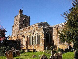
Bloxham is a village and civil parish in northern Oxfordshire several miles from the Cotswolds, about 3 miles (5 km) southwest of Banbury. It is on the edge of a valley and overlooked by Hobb Hill. The village is on the A361 road. The 2011 Census recorded the parish's population as 3,374.

<span class="mw-page-title-main">Thorpe Mandeville</span> Human settlement in England

Thorpe Mandeville is a village and civil parish in West Northamptonshire, England about 6 miles (10 km) northeast of Banbury in neighbouring Oxfordshire. The hamlet of Lower Thorpe is just north of the village.

<span class="mw-page-title-main">Steeple Aston</span> Human settlement in England

Steeple Aston is a village and civil parish on the edge of the Cherwell Valley, in the Cherwell District of Oxfordshire, England, about 12 miles (19 km) north of Oxford, 7 miles (11 km) west of Bicester, and 10 miles (16 km) south of Banbury. The 2011 Census recorded the parish population as 947. The village is 108 metres (354 ft) above sea level. The River Cherwell and Oxford Canal pass 1 mile (2 km) east of the village. The river forms part of the eastern boundary of the parish. The parish's southern boundary, 12 mile (800 m) south of the village, also forms part of Cherwell District's boundary with West Oxfordshire.

<span class="mw-page-title-main">Deddington</span> Human settlement in England

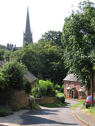
Deddington is a town and civil parish in Oxfordshire, England. The town lies 6 miles (10 km) south of Banbury. The parish includes two hamlets: Clifton and Hempton. The 2011 Census recorded the parish's population as 2,146. Deddington has a commercial centre including a market place, which hosts a popular monthly farmer’s market. It has been a market town probably since the 12th century. One of the Hundred Rolls of King Edward I from 1275–76 records Deddington as a borough. It has a deli, coffee shop, restaurant, three pubs and a town hall. Its football team is called Deddington Town FC.

<span class="mw-page-title-main">Lower Heyford</span> Human settlement in England

Lower Heyford is a village and civil parish beside the River Cherwell in Oxfordshire, about 6 miles (10 km) west of Bicester. The 2011 Census recorded the parish's population as 492.

<span class="mw-page-title-main">Bodicote</span> Human settlement in England

Bodicote is a village and civil parish in North Oxfordshire, approximately 2 miles (3 km) south of the centre of Banbury. The 2011 Census recorded the parish's population as 2,126. The Church of England parish church of Saint John the Baptist is a Grade II* listed building, with the chancel arch dating back to the 13th century.

<span class="mw-page-title-main">Hook Norton F.C.</span> Association football club in England

Hook Norton Football Club is a football club based in Hook Norton, near Banbury, Oxfordshire England. They are currently members of the Witney & District League Premier Division and play at the Bourne.

<span class="mw-page-title-main">Shipton-under-Wychwood</span> Human settlement in England

Shipton-under-Wychwood is a village and civil parish in the Evenlode valley about 4 miles (6.4 km) north of Burford, in the West Oxfordshire district, in the county of Oxfordshire, England. The village is one of three named after the ancient forest of Wychwood. The others are Milton-under-Wychwood immediately to the west of the village and Ascott-under-Wychwood about 1.5 miles (2.4 km) to the east. The 2011 Census recorded Shipton-under-Wychwood's parish population as 1,244.

<span class="mw-page-title-main">Great Bourton</span> Human settlement in England

Great Bourton is a village about 3 miles (5 km) north of Banbury in Oxfordshire, England. It is the largest settlement in the civil parish of Bourton. The 2011 Census recorded the parish's population as 614.

<span class="mw-page-title-main">Wardington</span> Human settlement in England

Wardington is a village and civil parish in Oxfordshire, about 4 miles (6.4 km) northeast of Banbury. The village consists of two parts: Wardington and Upper Wardington. The village is on a stream that rises in Upper Wardington and flows north to join the River Cherwell.

<span class="mw-page-title-main">Brailes</span> Human settlement in England

Brailes is a civil parish about 3 miles (5 km) east of Shipston-on-Stour in Warwickshire, England. It includes the two villages of Lower and Upper Brailes but is often referred to as one village as the two adjoin each other. The parish includes the village of Winderton about 1.5 miles (2.4 km) northeast of Brailes, and the deserted medieval village of Chelmscote about 3.5 miles (5.6 km) north of Brailes. The parish is bounded to the east by Ditchedge Lane and Beggars' Lane, which are a historic ridgeway that also forms part of the county boundary with Oxfordshire. The northeastern boundary is a minor road, part of which follows the course of a Roman road.

<span class="mw-page-title-main">Claydon, Oxfordshire</span> Human settlement in England

Claydon is a village and former civil parish, now in Claydon with Clattercot, in the Cherwell district, in Oxfordshire, England. The village is about 6 miles (10 km) north of Banbury and about 417 feet (127 m) above sea level on a hill of Early Jurassic Middle Lias clay.

<span class="mw-page-title-main">Drayton, Cherwell</span> Human settlement in England

Drayton is a village and civil parish in the valley of the Sor Brook in Oxfordshire, about 2 miles (3 km) northwest of Banbury. The 2011 Census recorded the parish's population as 242.

<span class="mw-page-title-main">Great Rollright</span> Human settlement in England

Great Rollright is a village and former civil parish, now in the parish of Rollright, in the West Oxfordshire district, in Oxfordshire, England, and about 2.5 miles (4 km) north of Chipping Norton.

<span class="mw-page-title-main">Swerford</span> Human settlement in England

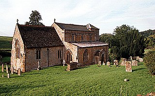
Swerford is a village and civil parish on the River Swere in the Cotswold Hills in Oxfordshire, England. It is about 4 miles (6.4 km) northeast of Chipping Norton. Swerford has two main neighbourhoods: Church End and East End. The area between them contains very few houses and is called Between Towns. The 2011 census recorded the parish's population as 132.

<span class="mw-page-title-main">Wigginton, Oxfordshire</span> Human settlement in England

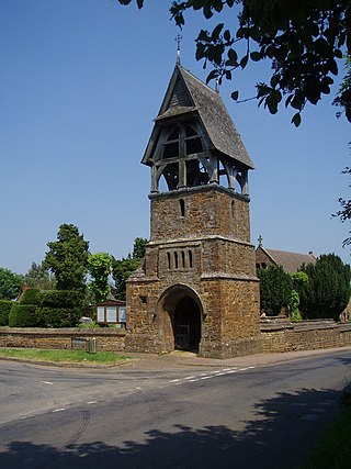
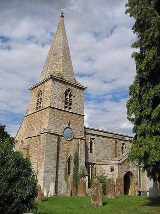
Wigginton is a village and civil parish about 6 miles (10 km) southwest of Banbury in Oxfordshire. The village is beside the River Swere, which forms the southern boundary of the parish. A Channel Four documentary, Hitler's British Girl, investigated the possibility that Unity Mitford gave birth to the son of Adolf Hitler in Hill View Cottage, Wigginton.

<span class="mw-page-title-main">Epwell</span> Human settlement in England

Epwell is a village and civil parish in the north of Oxfordshire about 6 miles (10 km) west of Banbury. The 2011 Census recorded the parish population's as 285. Epwell's toponym is believed to be derived from the Old English Eoppa's Well.

<span class="mw-page-title-main">Hook Norton railway station</span> Former railway station in Oxfordshire, England

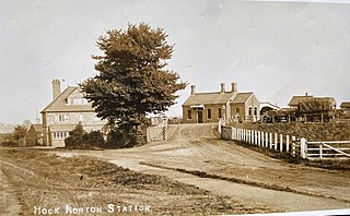
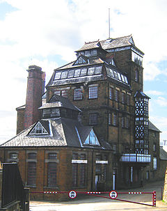
Hook Norton railway station served the village of Hook Norton in northern Oxfordshire, England.

References

  1. "Hook Norton Parish". nomis. Durham University . Retrieved 26 August 2020.
  2. 1 2 Ekwall 1960 , Hook Norton
  3. Land at Bourne Lane, Hook Norton, Oxfordshire: An Archaeological Assessment. CPM environmental planning and design. 2004. p. 5.[ clarification needed ]
  4. "'". Anglo American Legal Tradition.
  5. "CP 40 / 677". Plea Rolls of the Court of Common Pleas. National Archives. first entry, labelled "Staff", where the defendants are from Hognorton, Oxon
  6. Miller, Sean. "Timeline: 880–927". Anglo-Saxons.net. Retrieved 20 November 2011.
  7. 1 2 "St Peter's Parish Church history". St Peter's, Hook Norton. Archived from the original on 24 July 2011. Retrieved 20 November 2011.
  8. "Hook Norton in the Domesday Book" (PDF). Hook Norton Local History Group. Retrieved 26 August 2020.
  9. "The Itinerary of John Leland in or about the years 1535–1543". October 1907. p. 74 vol vii. Retrieved 20 December 2021.
  10. Shirley, Evelyn Philip (1867). Some Account of English Deer Parks. London: John Murray. p. 135.
  11. Beeson 1989, p. 149.
  12. Beeson 1989, p. 190.
  13. 1 2 Beeson 1989, p. 188.
  14. Photographs of former railway tunnel and cuttings at Hook Norton Archived 12 April 2009 at the Wayback Machine
  15. Hampson, Tim (2008). The Beer Book. London: Dorling Kindersley. p. 162. ISBN   978-1405333016.
  16. Hampson, Tim (2008). The Beer Book. London: Dorling Kindersley. p. 8. ISBN   978-1405333016.
  17. 1 2 3 Sherwood & Pevsner 1974 , p. 651
  18. Smith, Martin (28 June 2020). "Hook Norton, Oxfordshire, S Peter". Dove's Guide for Church Bell Ringers . Central Council for Church Bell Ringers . Retrieved 26 August 2020.
  19. "Our history". Hook Norton Baptist Church. Retrieved 20 November 2011.
  20. Hook Norton Church of England Primary School
  21. "Spar – Hook Norton". Spar. Retrieved 26 August 2020.
  22. "Hook Norton Fire Station". Oxfordshire County Council . Retrieved 26 August 2020.
  23. "Bloxham & Hook Norton Surgeries" . Retrieved 26 August 2020.
  24. "Lion House Dental Practice" . Retrieved 26 August 2020.
  25. "Hook Norton Veterinary Group" . Retrieved 20 November 2011.
  26. "Hook Norton Library". Oxfordshire County Council. Retrieved 26 August 2020.
  27. "Hook Norton". Oxfordshire Federation of Women's Institutes. Retrieved 26 August 2020.
  28. 1 2 "Hook Norton Sports and Social Club" . Retrieved 26 August 2020.
  29. "Gate Hangs High, Hook Norton". Hooky Norton Brewery. Retrieved 26 August 2020.
  30. "Pear Tree Inn, Hook Norton". Hook Norton Brewery. Retrieved 26 August 2020.
  31. "Sun Inn, Hook Norton". Hooky Norton Brewery. Retrieved 26 August 2020.
  32. "Hook Norton Football Club" . Retrieved 20 November 2011.
  33. "Hook Norton CC". play-cricket.com. 13 June 2002. Retrieved 20 November 2011.
  34. "Oxfordshire Cricket Association Division 1". Oxfordshire Cricket Association. Retrieved 4 July 2012.
  35. Hook Norton Tennis Club
  36. "Hook Norton Harriers" . Retrieved 26 August 2020.

Sources and further reading