
The regions of Ghana are the first level of subnational government administration within the Republic of Ghana. As of 2020, there are 16 regions, which are further divided for administrative purposes into 260 local metropolitan, municipal and district assemblies.

The Brong-Ahafo region was a region in central Ghana. Brong-Ahafo was bordered to the north by the Black Volta river and to the east by the Lake Volta, and to the south by the Ashanti, Eastern and Western regions. The capital of Brong-Ahafo is Sunyani. Brong-Ahafo was created on 14 April 1959 from the then Western Ashanti and named after the main ethnic groups, the Brong and Ahafo. In 2019, as a result of the 2018 Ghanaian new regions referendum, the region was divided into three, namely Bono, Bono East and Ahafo regions, and ceased to exist.
Tepa is the capital of Ahafo Ano North, a municipality in the Ashanti Region of Ghana.The old town of Tepa is known as Kelebim. Kelebim can be found in Tepa Ward 1 and the new town is also known as Restco. The major occupation of the people there is farming and trading

Nkoranza District is a former district that was located in Brong-Ahafo Region, Ghana. Originally created as an ordinary district assembly on 10 March 1989. However, on 1 November 2007, it was split off into two new districts: Nkoranza South District and Nkoranza North District. The district assembly was located in the southern part of Brong-Ahafo Region and had Nkoranza as its capital town.
Pru District is a former district that was located in Brong-Ahafo Region, Ghana. Originally it was formerly part of the then-larger Atebubu District on 10 March 1989, until the northern part was split off to create Pru District; thus the remaining part has been renamed as Atebubu-Amantin District, which it was elevated to municipal district assembly status on 15 March 2018 to become Atebubu-Amantin Municipal District. However on 15 March 2018, it was split off into two new districts: Pru East District and Pru West District. The district assembly was located in the east central part of Brong-Ahafo Region and had Yeji as its capital town.

Tain District is one of the twelve districts in Bono Region, Ghana. Originally it was formerly part of the then-larger Wenchi District on 10 March 1989; until the western part of the district was split off to create Tain District on 12 November 2003 ; thus the remaining part has been retained as Wenchi District. Later, the northern part of the district was split off to create Banda District on 28 June 2012; thus the remaining part has been retained as Tain District. The district assembly is located in the northeast part of Bono Region and has Nsawkaw as its capital town.
Jaman North District is one of the twelve districts in Bono Region, Ghana. Originally it was formerly part of the then-larger Jaman District on 10 March 1989, which was created from the former Berekum-Jaman District Council, until part of the district was split off to create Jaman North District on 12 November 2003 ; thus the remaining part has been renamed as Jaman South District; which it was elevated to municipal district assembly status on 1 November 2017 to become Jaman South Municipal District. The district assembly is located in the western part of Bono Region and has Sampa as its capital town.
Kintampo District is a former district that was located in Brong-Ahafo Region, Ghana. Originally created as an ordinary district assembly on 10 March 1989. However on 12 November 2003, it was split off into two new districts: Kintampo North District and Kintampo South District. The district assembly was located in the southern part of Brong-Ahafo Region and had Kintampo as its capital town.
Nkoranza is a town located in the mid-north of Ghana. It is the district capital of the Nkoranza District in the Bono East Region.
Dormaa East District is one of the twelve districts in Bono Region, Ghana. Originally it was formerly part of the then-larger Dormaa District on 10 March 1989; until the eastern part of the district was split off to create Dormaa East District on 29 February 2008; thus the remaining part has been retained as Dormaa District. The district assembly is located in the western part of Bono Region and has Wamfie as its capital town.
Asunafo North Municipal District is one of the six districts in Ahafo Region, Ghana. It was formerly part of the then-larger Asunafo District from 1988 until the southern part of the district was split off by a decree of president John Agyekum Kufuor on 12 November 2003 to become Asunafo South District. The remaining northern part was renamed as Asunafo North District which was later elevated to municipal status on 29 February 2008 to become Asunafo North Municipal District. The municipality is located in the western part of Ahafo Region and has Goaso as its capital town.
Berekum East Municipal District is one of the twelve districts in Bono Region, Ghana. Originally it was formerly part of the then-larger Berekum District on 10 March 1989, which was created from the former Berekum-Jaman District Council. It was later upgraded to municipal district assembly status and has been renamed as Berekum Municipal District on 29 February 2008; until the western part of the district was split off to create Berekum West District on 15 March 2018; thus the remaining part has been renamed as Berekum East Municipal District. The municipality is located in the western part of Bono Region and has Berekum as its capital town.
Seikwa is a town located in Tain District, in Bono region, Ghana. As of 2010, Seikwa had a population of 9,166, consisting of 4,149 males and 5,017 females. The town is served by the Nkoranman Senior Secondary School.
Nsawkaw is a town and the capital of Tain district of the Bono region of Ghana. The hometown of the native people of Nsoko was Hani Begho. It has a population of about 6,000.
Odumase is a small town and is the capital of Sunyani West district of the Bono Region of Ghana. The number of inhabitants is 16,542.

Banda Ahenkro is a town located in the west-northern of Bono region, Ghana, near the border of Ivory Coast. Its geography provided a home for numerous groups seeking shelter from across West Africa during the slave trade era. The original name of the settlement was Serminakuu meaning groups of 'grasses'. This name was changed to Banda, which is a corruption of 'Woanda' meaning 'they did not sleep'. Ancestors of Banda Ahenkro were allies of the Asante kingdom during wars and they provided a military force that virtually refused to sleep during at-war times. This is because they were predominantly Muslims and were found praying throughout the night. Later, 'woanda' was also corrupted by the Bono neighbours to become Banda. The settlement evolved to become the chief town or 'Ahenkro' within a collection of Nafana communities.

The Ahafo Region is a newly created region in Ghana with Goaso as its capital. The region has administrative and governmental legislature like all the ten already existing regions in Ghana. The region was carved out of the south-eastern part of the Brong Ahafo Region and was in fulfillment of a campaign promise made by New Patriotic Party. Prior to the 2016 Ghanaian general election, the then candidate Nana Akufo-Addo declared that when elected, he would explore the possibility of creating new regions out of some of the existing regions in Ghana in order to bring government closer to citizens.
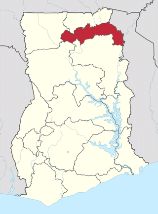
The North East Region is one of the sixteen regions of Ghana. It is located in the north of the country and was created in December 2018 after a referendum was voted upon to break it off of the Northern region. The region's capital is Nalerigu.
The Bono region is one of the 16 administrative regions of Ghana. It is as a result of the remainder of Brong-Ahafo region when Bono East region and Ahafo region were created. Sunyani, also known as the green city of Ghana, is the regional capital. Sunyani can pride itself as the cleanest capital city and a major conference destination.

The Bono East region of Ghana is a new region carved out of the Brong Ahafo region. The capital of the new region is Techiman. This creation of this new region was in fulfillment of a promise made by the New Patriotic Party prior to the 2016 Ghana general election. Upon winning the elections, the President, Nana Akuffo Addo created the Ministry of Regional Reorganization to oversee policy formulation and implementation. In all six new regions are to be created from the existing ten regions of Ghana. The other regions are Ahafo, Western North, Savannah, North East, and Oti regions.


