Location of Bangaram Atoll in Lakshadweep | |
Geography | |
---|---|
Location | Arabian Sea |
Coordinates | 10°57′N72°17′E / 10.95°N 72.29°E |
Type | Atoll |
Archipelago | Lakshadweep |
Adjacent to | Indian Ocean |
Total islands | 6 |
Major islands |
|
Area | 1.234 km2 (0.476 sq mi) [1] |
Length | 1.22 km (0.758 mi) |
Width | 0.7 km (0.43 mi) |
Coastline | 3.9 km (2.42 mi) |
Highest elevation | 1 m (3 ft) |
Administration | |
Territory | Union territory of Lakshadweep |
District | Lakshadweep |
Island group | Laccadive Islands |
Tehsils of India | Kavaratti |
Subdivisions of India | Agatti Island |
Largest settlement | Thinnakara(pop. 30) |
Demographics | |
Population | 40 (2014) |
Pop. density | 32/km2 (83/sq mi) |
Ethnic groups | Malayali, Mahls |
Additional information | |
Time zone | |
PIN | 68255x |
Telephone code | 04896 |
ISO code | IN-LD-06 [2] |
Official website | www |
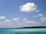
Bangaram is an atoll in the Union Territory of Lakshadweep, India.
The atoll has a roughly rectangular shape and is 8.1 km in length with a maximum width of 4.2 km and with a lagoon area of 36 km2 (14 sq mi). It is located over 352 km (219 mi) off Kannur, 382 km (237 mi) off Kozhikode, 400 km (250 mi) off Kochi, and 525 km (326 mi) from Kollam Port in the Indian Ocean.
Bangaram atoll is about 7 km (4.3 mi) northeast of the island of Agatti and 25 km (16 mi) to the southeast of Perumal Par, in the western Lakshadweep archipelago at 10°56′N72°17′E / 10.933°N 72.283°E . Bangaram atoll is connected to the reef of Agatti through a shallow submarine ridge. [3]
Bangaram Island, the main island in the atoll, has a small population of 10. Bangaram Island Resort was located on the east coast of this island. [7] Thinnakara, has a construction camp (~30) for the new resort being built on its west coast. [8]
The island belongs to the township of Agatti Island of Kavaratti Tehsil. [9]
The Bangaram Island Beach Resort opened to tourism in 1974, but the lack of commercial flights made access difficult. Tourism took off after the Agatti Aerodrome on the nearby Agatti island was commissioned and regular commercial flights from Kochi were established. [10] The resort had 60 cottages. Current alcohol regulations in Lakshadweep allow consumption of alcoholic drinks only on Bangaram Atoll.
The new Thinnakara is owned by locals from Agatti. It will offer numerous adventure activities, including scuba diving, snorkelling, deep sea fishing beside white sand beaches, a calm lagoon and a sparkling, clear coral reef. [11]
The Atoll is popular for its serene setting. Numerous species of tropical birds are found on the island. [12]
The Coral Sea Islands Territory is an external territory of Australia which comprises a group of small and mostly uninhabited tropical islands and reefs in the Coral Sea, north-east of Queensland, Australia. The only inhabited island is Willis Island. The territory covers 780,000 km2 (301,160 sq mi), most of which is ocean, extending east and south from the outer edge of the Great Barrier Reef and includes Heralds Beacon Island, Osprey Reef, the Willis Group and fifteen other reef/island groups. Cato Island is the highest point in the Territory.
An atoll is a ring-shaped island, including a coral rim that encircles a lagoon. There may be coral islands or cays on the rim. Atolls are located in warm tropical or subtropical parts of the oceans and seas where corals can grow. Most of the approximately 440 atolls in the world are in the Pacific Ocean.
The Laccadive or Cannanore Islands are one of the three island subgroups in the Union Territory of Lakshadweep, India. It is the central subgroup of the Lakshadweep, separated from the Amindivi Islands subgroup roughly by the 11th parallel north and from the atoll of Minicoy (Maliku)—far to the south—by the 9 Degree or Mamala Channel.
Kavaratti is the capital of the Union Territory of Lakshadweep in India. Kavaratti is a census town as well as the name of the atoll upon which the town stands. It is well known for its pristine white sand beaches and calm lagoons, which makes it a popular tourist destination. It is located 332 km (206 mi) west to the city of Kannur, 351 km (218 mi) west of the city of Kozhikode, and 404 km (251 mi) west of the city of Kochi.
Agatti Island is a 7.6 km long island, situated on a coral atoll called Agatti atoll in the Union Territory of Lakshadweep, India. It is 459 km (285 mi) west of the city of Kochi.
Lakshadweep, is a union territory of India. It is an archipelago of 36 islands in the Arabian sea, located 200 to 440 km off the Malabar Coast.
Amini is a census town in the Union Territory of Lakshadweep, India. It is also the name of the island where the town stands and of the atoll that contains that island. It lies 407 km (253 mi) west of the city of Kochi.
Bitra, also known as Bitrā Par, is a coral atoll belonging to the Amindivi Subgroup of islands of the Union Territory of Lakshadweep in India. It is 483 km (300 mi) west of the city of Kochi.
Kiltan or Kilthān Island is a coral island belonging to the Amindivi Subgroup of islands of the Union Territory of Lakshadweep in India. It is at a distance of 291 km away from Kannur, 303 km away from Kozhikode, and 394 km (245 mi) west of the city of Kochi. The nearest mainland body is Cannanore and the nearest port is Mangalore.
Kalpeni is an inhabited Atoll in the Union Territory of Lakshadweep, India. It has a distance of 287 km (178 mi) west of the city of Kochi.
Bassas de Pedro, also known as Manjappar or Pedro Bank, is a submerged bank or sunken atoll belonging to the Amindivi Subgroup of islands of the Union Territory of Lakshadweep, India, with a distance of 1,795 km (1,115 mi) south of the city of Delhi..
Cora Divh, also called Coradeeve or Little Bassas de Pedro Bank, is a submerged bank or sunken atoll belonging to the Amindivi Subgroup of islands of the Union Territory of Lakshadweep, India. It has a distance of 1,733 km (1,077 mi) south of the city of Delhi.
Kadmat Island, also known as Cardamom Island, is a coral island belonging to the Amindivi subgroup of islands of the Lakshadweep archipelago in India. Measuring 9.3 kilometres (5.8 mi) in length, the island has a lagoon with a width of 1.5 kilometres (0.93 mi) covering an area of 25 square kilometres (9.7 sq mi). The ecological feature of the island is of coral reef with seagrass, and marine turtles which nestle here. The Ministry of Environment and Forests (India) has notified the island as a marine protected area for ensuring conservation of the island's animal, plant, or other type of organism, and other resources.
Chetlat Island is a coral island belonging to the Amindivi Subgroup of islands of the Lakshadweep archipelago in India. It has a distance of 432 km (268 mi) west of the city of Kochi.
Cherbaniani Reef, also known as Beleapani Reef, is a coral atoll belonging to the Amindivi Subgroup of islands of the Union Territory of Lakshadweep, India. It has a distance of 1,880 km (1,170 mi) south of the city of Delhi.
Byramgore Reef, also known as Chereapani Reef, is a coral atoll belonging to the Amindivi Subgroup of islands of the Union Territory of Lakshadweep, India. It has a distance of 1,940 km (1,210 mi) south of the city of Delhi.
Suheli Par is a coral atoll in the Union Territory of Lakshadweep, India. It is an oval-shaped 17 km long atoll surrounded by a zone of rich marine fauna.
Pitti, also known as Pakshipitti, is an uninhabited coral islet in the Union Territory of Lakshadweep, India.
Perumal Par, also known as Peremul Par, is an uninhabited coral atoll belonging to the Amindivi Subgroup of islands of the Union Territory of Lakshadweep, India. It has a distance of 2,001 km (1,243 mi) south of the city of Delhi.
Lighthouse Reef is an atoll in the Caribbean Sea, the easternmost part of the Belize Barrier Reef and one of its three atolls, the other two being Turneffe Atoll and Glover's Reef. Lighthouse Reef is located about 80 kilometres (50 mi) southeast of Belize City. The atoll is of oblong shape, approximately 35 kilometres (22 mi) long from north to south, and about 8 kilometres (5.0 mi) wide. It forms a shallow sandy lagoon with an area of 120 square kilometres (46 sq mi) and a depth between 2 and 6 metres deep.
{{cite web}}
: CS1 maint: bot: original URL status unknown (link)