Barisha, Kolkata

Last updated

Barisha
Neighbourhood in Kolkata (Calcutta)
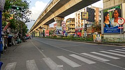
Kolkata location map EN.svg
Red pog.svg
Barisha
Location in Kolkata
Coordinates: 22°29′05″N88°18′49″E / 22.484847°N 88.313686°E / 22.484847; 88.313686 Coordinates: 22°29′05″N88°18′49″E / 22.484847°N 88.313686°E / 22.484847; 88.313686
CountryFlag of India.svg  India
State West Bengal
City Kolkata
District Kolkata [1] [2] [3]
Municipal Corporation Kolkata Municipal Corporation
KMC wards 123, 124, 125, 126
Time zone UTC+5:30 (IST)
PIN
700008,700063
Area code +91 33
Lok Sabha constituency Kolkata Dakshin
Vidhan Sabha constituency Behala Paschim and Behala Purba

Barisha is a residential and very old locality of Kolkata (Calcutta) in West Bengal, India. It is under Behala area and divided as Paschim Barisha and Purba Barisha.

Contents

Location

Barisha is situated in the southwest of Kolkata about 10 kilometres (6 mi) from the city centre Esplanade. The Barisha area is composed of Behala Chowrasta, Janakalyan, Silpara, Sakherbazar and Thakurpukur.

The area borders Behala towards north, Joka towards south, Sarsuna and Dakshin Behala toward West, and Haridevpur, Siriti, Tollygunge towards east.

See also

Related Research Articles

<span class="mw-page-title-main">South 24 Parganas</span> District of West Bengal in India

South 24 Parganas, or sometimes South Twenty Four Parganas and Dakshin 24 Parganas, is a district in the Indian state of West Bengal, headquartered in Alipore locality of Kolkata. It is the largest district of West Bengal by area and second largest by population. It is the sixth most populous district in India. On one side of the district there is the urban fringe of Kolkata, and on the other the remote riverine villages in the Sundarbans.

<span class="mw-page-title-main">Behala</span> Neighbourhood in Kolkata in West Bengal, India

Behala is a locality of South West Kolkata, in the Indian state of West Bengal. Behala is a part of Kolkata Municipal Corporation area. It is broadly spread across Ward Nos. 118, 119, 120, 121, 122, 123, 124, 125, 126, 127, 128, 129, 130, 131 and 132 of the Kolkata Municipal Corporation and is divided into two Vidhan Sabha constituencies: Behala Paschim and Behala Purba. Behala, Parnasree, Thakurpukur, Haridevpur and Sarsuna police stations serve this area under the South West Division of Kolkata Police also known as Behala Division.

<span class="mw-page-title-main">Parnasree Pally</span> Neighbourhood in Kolkata in West Bengal, India

Parnasree Pally is an upscale locality of Behala in southern Kolkata, India. It was included in the Kolkata Municipal Corporation in 1985. Translated to English the name means "beauty of the leaves". It was earlier known as Halderbagan. The name Parnasree was coined by Late Asoke Ratan Mazumder when he became the member of the Co Operative Society formed for the rehabilitation of Refugees during Partition of India in 1947.

<span class="mw-page-title-main">Kasba, Kolkata</span> Neighbourhood in Kolkata in West Bengal, India

Kasba is a upscale and standard locality of South Kolkata, in Kolkata District, West Bengal, India. It is situated in the southern part of the city encircled by the Sealdah South section of the Eastern Railways to the west, Dhakuria and Haltu to the south, the Eastern Metropolitan Bypass to the east and the locality of Tiljala to the north.

<span class="mw-page-title-main">Birati</span> Neighbourhood in North 24 Parganas, West Bengal, India

Birati is a locality in North Dumdum Municipality of North 24 Parganas district in the Indian state of West Bengal. It is close to Kolkata and also a part of the area covered by Kolkata Metropolitan Development Authority (KMDA).

<span class="mw-page-title-main">Sarsuna</span> Neighbourhood in Kolkata in West Bengal, India

Sarsuna is a neighborhood in South West Kolkata. It is a part of the greater Behala region and can be reached via Chowrasta or through Barisha. It is a predominantly Bengali neighborhood, though its fast becoming a cosmopolitan place. It is bordered by Barisha in the east and Shakuntala Park to the west.

<span class="mw-page-title-main">Civic administration of Kolkata</span>

The civic administration of Kolkata is executed by several government agencies, and consists of overlapping structural divisions. Kolkata's administrative agencies have areas of jurisdiction that do not coincide.

<span class="mw-page-title-main">Joka, Kolkata</span> Neighbourhood in Kolkata in West Bengal, India

Joka is a locality in South West Kolkata, India. It is a part of greater Behala region. This place is mostly known for Indian Institute of Management Calcutta and ESI-PGIMSR,ESIC Medical College and Hospital and in the current days joka is also famous for properties, high rising apartments, real estate businesses because joka is one of the newly developing places around the Kolkata.

Alipore Sadar subdivision is an administrative subdivision of the South 24 Parganas district in the Indian state of West Bengal.

<span class="mw-page-title-main">Garfa</span> Neighbourhood in Kolkata in West Bengal, India

Garfa is a southern neighborhood of Kolkata, India. This area is surrounded by Haltu, Nandi bagan, Jadavpur and Kalikapur. Starting as a refugee colony within Jadavpur, Garfa is now primarily a residential area within Kolkata.

Thakurpukur Maheshtala is a community development block that forms an administrative division in the Alipore Sadar subdivision of South 24 Parganas district in the Indian state of West Bengal.

Rajabagan is a neighbourhood located in the south-western part of Kolkata city, in the state of West Bengal, India. It is located on the eastern bank of Hooghly river and is situated between Metiabruz (east) and Badartala (west).

Ward No. 123, Kolkata Municipal Corporation is an administrative division of Kolkata Municipal Corporation in Borough No. 13, covering parts of Barisha neighbourhood in the Indian state of West Bengal.

Ward No. 124, Kolkata Municipal Corporation is an administrative division of Kolkata Municipal Corporation in Borough No. 16, covering parts of Barisha and Thakurpukur neighbourhoods in the Indian state of West Bengal.

Ward No. 125, Kolkata Municipal Corporation is an administrative division of Kolkata Municipal Corporation in Borough No. 16, covering parts of Paschim Barisha, Dakshin Behala Road and Thakurpukur neighbourhoods in the Indian state of West Bengal.

Ward No. 126, Kolkata Municipal Corporation is an administrative division of Kolkata Municipal Corporation in Borough No. 16(previously 14), covering parts of Sarsuna and Paschim Barisha neighbourhoods in the Indian state of West Bengal.

Survey Park is a neighbourhood within the Santoshpur area of East Kolkata in Kolkata in the Indian state of West Bengal.

<span class="mw-page-title-main">Thakurpukur</span> Neighbourhood in Kolkata in West Bengal, India

Thakurpukur is a region of South West Kolkata in Behala area of the Indian state of West Bengal. It is majorly a residential region. It has been rapidly developed in the last 20 years and what was a jungle before is now an urban agglomeration in Kolkata's South. Thakurpukur was also under the Barisha area of Sabarna Roy Choudhury's zamindari era.

<span class="mw-page-title-main">Haridevpur</span> Neighbourhood in Kolkata in West Bengal,India

Haridevpur is a region of South Kolkata of the state of West Bengal, India.

<span class="mw-page-title-main">Dakshin Behala</span> Neighbourhood in Kolkata in West Bengal, India

Dakshin Behala is a locality in South West kolkata in Behala area. It is under Kolkata Municipal Corporation and under Kolkata Police Jurisdiction.

References

  1. "South 24 Parganas district".
  2. "web.archieve.org" (PDF). Archived from the original (PDF) on 29 May 2013.
  3. "KMC Wards in South 24 Parganas".