
Victoria Island is a large island in the Canadian Arctic Archipelago that straddles the boundary between Nunavut and the Northwest Territories of Canada. It is the eighth largest island in the world, and at 217,291 km2 (83,897 sq mi) in area, it is Canada's second largest island. It is nearly double the size of Newfoundland (111,390 km2 [43,008 sq mi]), and is slightly larger than the island of Great Britain (209,331 km2 [80,823 sq mi]) but smaller than Honshu (225,800 km2 [87,182 sq mi]). It contains the world's largest island within an island within an island. The western third of the island belongs to the Inuvik Region in the Northwest Territories; the remainder is part of Nunavut's Kitikmeot Region.

The Arctic Archipelago, also known as the Canadian Arctic Archipelago, is a group of islands north of the Canadian mainland.

The island of Ummanz lies in the Baltic Sea, off the west coast of the island of Rügen, and belongs, like the latter, to the county of Vorpommern-Rügen in the German state of Mecklenburg-Western Pomerania.

The Outer Barrier, also known as the Long Island and New York City barrier islands, refers to the string of barrier islands that divide the lagoons south of Long Island, New York from the Atlantic Ocean. These islands include Coney Island, Long Beach Barrier Island, Island Park, Jones Beach Island, Fire Island and Westhampton Island. The outer barrier extends 75 miles (121 km) along the South Shore of Long Island, from the Rockaway Peninsula in New York City to the east end of Shinnecock Bay in Suffolk County.
Narboneta is a municipality in Cuenca, Castile-La Mancha, Spain. It has a population of 91.

Berveni is a commune of 3,331 inhabitants situated in Satu Mare County, Romania. It is composed of two villages, Berveni and Lucăceni (Újkálmánd).
Wiswell Inlet is a body of water in Nunavut's Qikiqtaaluk Region. It lies in eastern Frobisher Bay, forming a wedge into Baffin Island's Blunt Peninsula. There are several islands at the mouth of the inlet.
Bond Inlet is a body of water in Nunavut's Qikiqtaaluk Region. It lies in western Hudson Strait, forming a wedge into Baffin Island's Meta Incognita Peninsula and the western slopes of the Everett Mountains.
Wight Inlet is a body of water in Nunavut's Qikiqtaaluk Region. It lies in western Hudson Strait, forming a wedge into Baffin Island's Meta Incognita Peninsula and the western slopes of the Everett Mountains, is named after Sergeant James Edward Freeman Wight, RNWMP and RCMP #6296.

Balcom Inlet is a body of water in Nunavut's Qikiqtaaluk Region. It lies in western Hudson Strait, forming a wedge into Baffin Island's Meta Incognita Peninsula and the western slopes of the Everett Mountains.
Shaftesbury Inlet62°36′N069°16′W is a body of water in the Qikiqtaaluk Region of Nunavut, Canada. It lies in western Hudson Strait, forming a wedge into Baffin Island's Meta Incognita Peninsula. Kimmirut is to the northwest, while Barrier Inlet is to the southeast.
Elwin Inlet is a body of water in Nunavut's Qikiqtaaluk Region, in Canada. It lies on the eastern side of the mouth of Admiralty Inlet, forming a border to Sirmilik National Park. To the south lie Baillarge Bay and the hamlet of Arctic Bay.
Jackson Inlet is a body of water in Nunavut's Qikiqtaaluk Region. It lies east of Lancaster South and cuts into Baffin Island's Brodeur Peninsula.
Daspit Glacier is a glacier 6 nautical miles (11 km) long, flowing east-northeast along the south side of Mount Shelby to the head of Trail Inlet, on the east coast of Graham Land, Antarctica. It was discovered by members of the East Base of the United States Antarctic Service, 1939–41, and was originally named Fleming Glacier after Rev. W.L.S. Fleming. It was photographed from the air in 1947 by the Ronne Antarctic Research Expedition under Finn Ronne, and charted in 1948 by the Falkland Islands Dependencies Survey. It was renamed by Ronne for Captain Lawrence R. Daspit, U.S. Navy, who assisted in obtaining Navy support for the Ronne expedition, the original name being transferred to Fleming Glacier on the Rymill Coast.
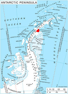
Weyerhaeuser Glacier is a large glacier flowing north into Mercator Ice Piedmont close west of Mobiloil Inlet, on the east coast of Antarctic Peninsula. This glacier lies in the area first explored from the air by Sir Hubert Wilkins in 1928 and Lincoln Ellsworth in 1935, but it was first clearly delineated in aerial photographs taken by the United States Antarctic Service (USAS) in 1940. The glacier was resighted in 1947 by the Ronne Antarctic Research Expedition (RARE) under Ronne. He named it for F. K. Weyerhaeuser, of the Weyerhaeuser Timber Co., who contributed lumber and insulating material to the expedition.
Mobiloil Inlet is an ice-filled inlet, nurtured by several northeast and east flowing glaciers, lying between the Rock Pile Peaks and Hollick-Kenyon Peninsula along the east coast of the Antarctic Peninsula. It was discovered by Sir Hubert Wilkins in a flight on December 20, 1928, and named by him after a product of the Vacuum Oil Company of Australia. Yates Spur, a prominent rock spur, projects from the south side of the inlet.
Fluke Ridge is a narrow rock ridge rising to about 300 metres (1,000 ft) in southern Aristotle Mountains, on the north side of Flask Glacier near the terminus, on Oscar II Coast, Graham Land, Antarctica. It was named by the UK Antarctic Place-Names Committee in 1987; it is one of several names in the area from Herman Melville's Moby-Dick which reflect a whaling theme.
Haydn Inlet is an ice-filled inlet indenting the west coast of Alexander Island, Antarctica, lying between Mozart Ice Piedmont and Handel Ice Piedmont. Schubert Inlet lies to the south and the Lassus Mountains are immediately north. Haydn Inlet is 27 nautical miles (50 km) long and 12 nautical miles (22 km) wide at the mouth, narrowing toward the head. It was first seen from the air and roughly mapped by the United States Antarctic Service, 1939–41. It was resighted from the air and photographed by the Ronne Antarctic Research Expedition, 1947–48, and remapped from these photos by D. Searle of the Falkland Islands Dependencies Survey in 1960. The inlet was named by the UK Antarctic Place-Names Committee for Joseph Haydn, the Austrian composer.
Mackellar Inlet is an inlet forming the northwestern head of Admiralty Bay, at King George Island in the South Shetland Islands. It was probably named by the Fourth French Antarctic Expedition under Jean-Baptiste Charcot, who charted Admiralty Bay in December 1909.


