
Victoria Island is a large island in the Canadian Arctic Archipelago that straddles the boundary between Nunavut and the Northwest Territories of Canada. It is the eighth largest island in the world, and at 217,291 km2 (83,897 sq mi) in area, it is Canada's second largest island. It is nearly double the size of Newfoundland (111,390 km2 [43,008 sq mi]), and is slightly larger than the island of Great Britain (209,331 km2 [80,823 sq mi]) but smaller than Honshu (225,800 km2 [87,182 sq mi]). It contains the world's largest island within an island within an island. The western third of the island belongs to the Inuvik Region in the Northwest Territories; the remainder is part of Nunavut's Kitikmeot Region.

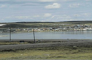
Pond Inlet is a small, predominantly Inuit community in the Qikiqtaaluk Region of Nunavut, Canada, and is located in northern Baffin Island. At the 2016 census the population was 1,617, an increase of 4.4% from the 2011 census Pond Inlet was named in 1818 by explorer John Ross for John Pond, an English astronomer. The mayor is Charlie Inuarak. Tununiq Sauniq Cooperative Limited, most often referred to simply as the Co-op, also operates a local hotel and other endeavours.
The Legislative Assembly of Nunavut, Canada, is located in Iqaluit, and is the territory's parliament.

The Kivalliq Region is an administrative region of Nunavut, Canada. It consists of the portion of the mainland to the west of Hudson Bay together with Southampton Island and Coats Island. The regional seat is Rankin Inlet. The population was 10,413 in the 2016 Census, an increase of 16.3% from the 2011 Census.
Baker Lake is a hamlet in the Kivalliq Region, in Nunavut on mainland Canada within Inuit Nunangat. Located 320 km (200 mi) inland from Hudson Bay, it is near the nation's geographical centre, and is notable for being the Canadian Arctic's sole inland community. The hamlet is located at the mouth of the Thelon River on the shore of Baker Lake. The community was given its English name in 1761 from Captain William Christopher who named it after Sir William Baker, the 11th Governor of the Hudson's Bay Company.
Bathurst Inlet is a deep inlet located along the northern coast of the Canadian mainland, at the east end of Coronation Gulf, into which the Burnside and Western rivers empty. The name, or its native equivalent Kingoak, is also used to identify the community of Bathurst Inlet located on the shore. Melville Sound opens into the eastern side of the inlet at Cape Croker, west of the Hurd Islands.

Bathurst Inlet,, is a small Inuit community located in Bathurst Inlet in the Kitikmeot Region of Nunavut, Canada. As of the 2016 census the population remained at zero.

The Keewatin Region was a region of the Northwest Territories, in use as an administrative and statistical division until the creation of Nunavut in 1999. The majority of Keewatin Region fell on the Nunavut side of the boundary and was reconstituted as Kivalliq Region within the new territory, while a strip on the region's west side remaining in the NWT was transferred to Fort Smith Region. Kivalliq continues to be referred to as "Keewatin Region, Nunavut" in some circumstances, such as by Statistics Canada.

Cape Fullerton is a cape and peninsula in the Kivalliq Region of Nunavut, Canada located on the northwest shores of Hudson Bay on Roes Welcome Sound and includes Fullerton Harbour. Today it is part of Ukkusiksalik National Park. Although Cape Fullerton was traditionally home to migrant Inuit people including the Aivilingmiut and the Qaernermiut, today the nearest permanently populated settlement is Chesterfield Inlet, roughly 100 kilometers to the southwest.
The locality Tavani (TA-vuh-nee) was a mining settlement and trading post in the Kivalliq Region of Nunavut, Canada. Sometimes known as Tavane, it is located on western Hudson Bay's Mistake Bay, 31.3 km (19.4 mi) south of the community of Whale Cove and 97 km (60 mi) east of Kaminak Lake.

Pitsiulartok or Pituilaktok, is a small, uninhabited island located at 63°15'N, 90°33'W in Hudson Bay, about 13 km from the community of Chesterfield Inlet, Nunavut, Canada. The narrow island is about 3.5 km in length and barely 1 km wide at its widest point. Traditionally it was a walrus-hunting ground for the local Inuit, and a landmark for southern whalers. It is part of a loose chain of small islands running along the coast, including Sakpik Island and Promise Island.
Alexandra Strait is a natural waterway in the Canadian territory of Nunavut. It separates King William Island to the east from Royal Geographical Society Island to the west. The strait, an arm of the Arctic Ocean, connects Victoria Strait to the north with Queen Maud Gulf to the south.
Ward Inlet is a body of water in Nunavut's Qikiqtaaluk Region. It lies in eastern Frobisher Bay, forming a wedge into Baffin Island, separating Becher Peninsula from Hall Peninsula. Augustus Island lies deep into the inlet.
Berlinguet Inlet is a body of water within the Qikiqtaaluk Region of Nunavut, Canada. It runs west-east at Admiralty Inlet's southern end, separated from Berlinguet Bay, which opens into the Gulf of Boothia, by a 1.5 km (0.93 mi) isthmus. Baffin Island's Brodeur Peninsula is to the north.
Milne Inlet is a body of water in Nunavut's Qikiqtaaluk Region. It flows in a southerly direction from Navy Board Inlet at the confluence of Eclipse Sound. Ragged Island is located at the inlet's opening, while Stephens Island is located further within. Baffinland had proposed in 2008 to build a harbour here. Then connecting the mine to Steensby Inlet, via a special cold-weather railway was planned in 2011. A few years later, after Baffinland's original environmental assessments had been approved, Baffinland announced that a fall in ore prices meant they could no longer justify the high capital cost of building the railway. Instead they proposed spending a smaller sum to construct a "tote road" that would allow ore to be trucked to Milne Inlet. They ended up building the road, and the harbour at Milne Inlet. The bulk carrier Federal Tiber departed from Milne Inlet on August 8, 2015, with the first shipment of ore from the mine.
Scott Inlet is a body of water in the Qikiqtaaluk Region of Nunavut, Canada. It is an arm of Baffin Bay. Scott Island lies in its middle. At its south end, it splits into Clark and Gibbs Fiords. The Inuit community of Clyde River is approximately 120 km (75 mi) to the southeast.
The Becher Peninsula is located on southern Baffin Island in the Canadian territory of Nunavut. It is a part of the larger Hall Peninsula. Becher Peninsula is bounded by Frobisher Bay to the west, and Ward Inlet to the east.

Apex is a small community in Iqaluit located on Baffin Island in Nunavut, Canada. It is about 5 km (3.1 mi) southeast of Iqaluit on a small peninsula separating Koojesse (Kuujussi) Inlet from Tarr Inlet. Historically Apex was the place where most Inuit lived when Iqaluit was a military site and off-limits to anyone not working at the base. The community is accessed by bridge or causeway, and bordered by a local creek (kuujuusi) and waterfall (kugluktuk). Located here are the women's shelter, a church, Nanook Elementary School, and a bed-and-breakfast, along with housing for about 60 families.
CICH-FM is a community radio station that broadcasts at 93.3 FM in Chesterfield Inlet, Nunavut, Canada.

Dundas Harbour is an abandoned settlement in Qikiqtaaluk, Nunavut, Canada. It is located on Devon Island at the eastern shore of the waterway also named Dundas Harbour. Baffin Bay's Croker Bay is immediately to the west.


