
Victoria Island is a large island in the Canadian Arctic Archipelago that straddles the boundary between Nunavut and the Northwest Territories of Canada. It is the eighth largest island in the world, and at 217,291 km2 (83,897 sq mi) in area, it is Canada's second largest island. It is nearly double the size of Newfoundland (111,390 km2 [43,008 sq mi]), and is slightly larger than the island of Great Britain (209,331 km2 [80,823 sq mi]) but smaller than Honshu (225,800 km2 [87,182 sq mi]). It contains the world's largest island within an island within an island. The western third of the island belongs to the Inuvik Region in the Northwest Territories; the remainder is part of Nunavut's Kitikmeot Region.

Pond Inlet is a small, predominantly Inuit community in the Qikiqtaaluk Region of Nunavut, Canada, and is located in northern Baffin Island. At the 2016 census the population was 1,617, an increase of 4.4% from the 2011 census Pond Inlet was named in 1818 by explorer John Ross for John Pond, an English astronomer. The mayor is Charlie Inuarak. Tununiq Sauniq Cooperative Limited, most often referred to simply as the Co-op, also operates a local hotel and other endeavours.
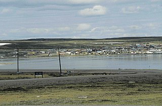
Rankin Inlet is an Inuit hamlet on Kudlulik Peninsula in Nunavut, Canada. Located on the northwestern Hudson Bay, between Chesterfield Inlet and Arviat, it is the regional centre for the Kivalliq Region.

The Kivalliq Region is an administrative region of Nunavut, Canada. It consists of the portion of the mainland to the west of Hudson Bay together with Southampton Island and Coats Island. The regional seat is Rankin Inlet. The population was 10,413 in the 2016 Census, an increase of 16.3% from the 2011 Census.

Kitikmeot Region is an administrative region of Nunavut, Canada. It consists of the southern and eastern parts of Victoria Island with the adjacent part of the mainland as far as the Boothia Peninsula, together with King William Island and the southern portion of Prince of Wales Island. The regional seat is Cambridge Bay.
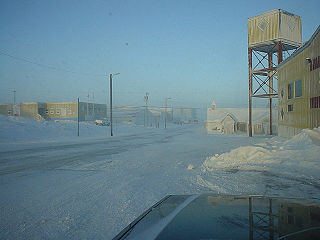
Baker Lake is a hamlet in the Kivalliq Region, in Nunavut on mainland Canada. Located 320 km (200 mi) inland from Hudson Bay, it is near the nation's geographical centre, and is notable for being the Canadian Arctic's sole inland community. The hamlet is located at the mouth of the Thelon River on the shore of Baker Lake. The community was given its English name in 1761 from Captain William Christopher who named it after Sir William Baker, the 11th Governor of the Hudson's Bay Company.

Brodeur Peninsula is an uninhabited headland on Baffin Island in the Qikiqtaaluk Region of Nunavut, Canada. It is located on the northwestern part of the island and is bounded by Prince Regent Inlet, Lancaster Sound, and Admiralty Inlet (Nunavut). The peninsula is connected to the rest of Baffin Island by a narrow isthmus.

The Parry Channel is a natural waterway through the central Canadian Arctic Archipelago. Its eastern two-thirds lies in the territory of Nunavut, while its western third lies in the Northwest Territories. It runs east to west, connecting Baffin Bay in the east with the Beaufort Sea in the west. Its eastern end is the only practical entrance to the northwest passage. Its western end would be a natural exit from the archipelago were it not filled with ice. The channel separates the Queen Elizabeth Islands to the north from the rest of Nunavut.
Elwin Inlet is a body of water in Nunavut's Qikiqtaaluk Region, in Canada. It lies on the eastern side of the mouth of Admiralty Inlet, forming a border to Sirmilik National Park. To the south lie Baillarge Bay and the hamlet of Arctic Bay.

Admiralty Inlet is a body of water in Nunavut's Qikiqtaaluk Region. It extends southerly from Lancaster Sound along the western shore of Baffin Island's Borden Peninsula. The hamlet of Arctic Bay is located on Uluksan Peninsula, a landform that juts into Admiralty Inlet south of Sirmilik National Park.

The Borden Peninsula is a peninsula on northern Baffin Island, in Nunavut, Canada. It lies south of Lancaster Sound. Northeastern Borden Peninsula is home to Sirmilik National Park.
Cape Liddon is an uninhabited headland on Devon Island in the Qikiqtaaluk Region of Nunavut, Canada. It is located on the southwestern coast of the island at Radstock Bay.
Hobhouse Inlet is a body of water in the Qikiqtaaluk Region of Nunavut, Canada. It lies off the southern coast of Devon Island. Like Stratton Inlet, Burnett Inlet, Powell Inlet, and Cuming Inlet, Hobhouse is situated between Maxwell Bay and Croker Bay, in the eastern high Arctic, north of Lancaster Sound and Barrow Strait.
Stratton Inlet is a body of water in the Qikiqtaaluk Region of Nunavut, Canada.
Powell Inlet is a body of water in the Qikiqtaaluk Region of Nunavut, Canada. It lies off the southern coast of Devon Island in the eastern high Arctic. Like Stratton Inlet, Burnett Inlet, Hobhouse Inlet, and Cuming Inlet, Powell Inlet is situated between Maxwell Bay and Croker Bay, north of Lancaster Sound and Barrow Strait.
Cuming Inlet is a body of water in the Qikiqtaaluk Region of Nunavut, Canada. It lies off the southern coast of Devon Island in the eastern high Arctic. Like Stratton Inlet, Burnett Inlet, Hobhouse Inlet, and Powell Inlet, Cuming Inlet is situated between Maxwell Bay and Croker Bay, north of Lancaster Sound and Barrow Strait.
Round Island is an uninhabited island in the Qikiqtaaluk Region of Nunavut, Canada. It is located across the mouth of Coutts Inlet in Baffin Bay off the northeastern coast of Baffin Island. Nova Zembla Island is 7.4 km (4.6 mi) to the northwest.
Dundas Harbour is an abandoned settlement in Qikiqtaaluk, Nunavut, Canada. It is located on Devon Island at the eastern shore of the waterway also named Dundas Harbour. Baffin Bay's Croker Bay is immediately to the west.
The Pork Peninsula is a cape located in Kivalliq Region, Nunavut, Canada. It is located on Hudson Bay, 30.1 km (18.7 mi) from the Inuit hamlet of Whale Cove, and 43.5 km (27.0 mi) from Rankin Inlet. The peninsula separates Corbett Inlet and Pistol Bay. Igloo Point is the eastern extremity of the peninsula.
Within Nunavut, Smooth Island may refer to one of islands.


