Batestown, Illinois

Last updated

Batestown
USA Illinois location map.svg
Red pog.svg
Batestown
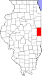
Location of Batestown within Illinois
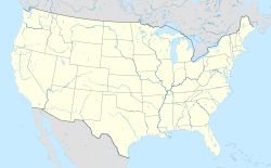
Usa edcp location map.svg
Red pog.svg
Batestown
Batestown (the United States)
Coordinates: 40°07′12″N87°41′47″W / 40.12000°N 87.69639°W / 40.12000; -87.69639
CountryUnited States
StateIllinois
County Vermilion
Township Danville
Elevation
650 ft (200 m)
Time zone UTC-6 (CST)
 • Summer (DST) UTC-5 (CDT)
Area code 217

Batestown is an unincorporated community in Danville Township, Vermilion County, Illinois. It is west of Danville, Illinois. [1]
Contents

History

Batestown was a suburb of Danville in the early 20th century. [2] As of 1906, it had a black Baptist church led by the Reverend Dabney Jones. [2] As of 1911, United Doctors operated the Decatur Institute in Batestown. [3]

Lulu O'Dell ran a tavern in Batestown with her son in the 1940s. [4]

Geography

Batestown is located at 40°07′12″N87°41′47″W / 40.12000°N 87.69639°W / 40.12000; -87.69639 .

See also

References

  1. ↑ Meadows, Jim (February 27, 2023). "Marron seeks state funding for Savoy, Rantoul & Danville infrastructure projects". IPM Newsroom. Retrieved April 13, 2025.
  2. 1 2 "For the Batestown Church". The Champaign Daily Gazette. September 26, 1906. Retrieved April 13, 2025– via Newspapers.com.
  3. ↑ "Batestown Woman Followed Relatives". Herald and Review. Decatur, Illinois. May 25, 1911. Retrieved April 13, 2025– via Newspapers.com.
  4. ↑ "Man Kille When Auto Hits Train". The Tuscola Journal. April 16, 1942. Retrieved April 13, 2025– via Newspapers.com.