Prudhoe is a town and civil parish in the south of Northumberland, England. It is 11 miles (18 km) west of Newcastle upon Tyne and situated on a steep, north-facing hill on the south bank of the River Tyne. Prudhoe had a population of 11,675 at the 2011 census, making it the second largest town in the Tyne Valley after Hexham.

Hexham is a market town and civil parish in Northumberland, England, on the south bank of the River Tyne, formed by the confluence of the North Tyne and the South Tyne at Warden nearby, and close to Hadrian's Wall. Hexham was the administrative centre for the Tynedale district from 1974 to 2009. In 2011, it had a population of 13,097.

Haltwhistle is a market town and civil parish in Northumberland, England, 23 miles east of Carlisle and 37 miles west of Newcastle upon Tyne. It had a population of 3,811 at the 2011 Census.
Langley or Langley-on-Tyne is a small village in Northumberland, England, located to the west of Hexham.

Stocksfield is a small village situated close to the River Tyne, about 14 miles (23 km) west of Newcastle upon Tyne in the southern part of Northumberland, England. There are several smaller communities within the parish of Stocksfield, including Branch End, New Ridley, Broomley, Hindley and the Painshawfield Estate. Other villages in Stocksfield's postal district include Bywell, Newton, Mickley, and Hedley on the Hill.

Haydon Bridge is a village in Northumberland, England, which had a population of 2,184 in the 2011 census. Its most distinctive features are the two bridges crossing the River South Tyne: the picturesque original bridge after which the village was named and a modern bridge which used to carry the A69 road. A bypass was completed in 2009 and the A69 now bypasses the village to the south.

Bellingham is a village and civil parish in Northumberland, to the north-west of Newcastle upon Tyne and is situated on the Hareshaw Burn at its confluence with the River North Tyne. In 2011 the parish had a population of 1334.

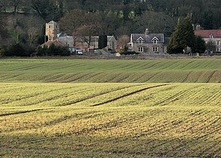
Wylam is a village and civil parish in the county of Northumberland, England. It is located about 10 miles (16 km) west of Newcastle upon Tyne.

Acomb is a village in the south of Northumberland, England. The population at the 2001 Census was 1,184 increasing to 1,268 at the 2011 Census. It is situated to the north of Hexham, not far from the junction of the A69 road and A6079 road. The name is Anglo-Saxon Old English acum, 'at the oak trees'. The traditional pronunciation of the name is "Yeckam".

Bardon Mill is a small village in Northumberland, within the vicinity of the ancient Hadrian's Wall. It is located around 10+1⁄2 miles from Hexham, 26+1⁄2 mi (43 km) from Carlisle, and 32 mi (51 km) from Newcastle upon Tyne.

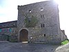
Bywell is a village and civil parish in Northumberland, England. It is situated on the north bank of the River Tyne opposite Stocksfield, between Hexham and Newcastle. The parish has a population of around 380 and Newton to the north is now its most populous settlement.
Ovingham is a village and civil parish in the Tyne Valley of south Northumberland, England. It lies on the River Tyne 10 miles (16 km) east of Hexham with neighbours Prudhoe, Ovington, Wylam and Stocksfield.

Riding Mill is a village near Hexham in Northumberland, England. It is part of the civil parish of Broomhaugh and Riding. It is served by Riding Mill railway station and by a frequent bus service on the route from Hexham to Newcastle.
This is a list of the high sheriffs of the English county of Northumberland. The high sheriff is the oldest secular office under the Crown. Formerly the High Sheriff was the principal law enforcement officer in the county but over the centuries most of the responsibilities associated with the post have been transferred elsewhere or are now defunct, so that its functions are now largely ceremonial. The High Sheriff changes every March.

Carham or Carham on Tweed is a village in Northumberland, England. The village lies on the south side of the River Tweed about 3 miles (5 km) west of Coldstream. According to the United Kingdom Census 2011, it is the place in England with greatest proportion of Scottish-born people, at approximately 33%.
Thockrington is a village and former civil parish, now in the parish of Bavington, in Northumberland, England. The village lies about 10 miles (16 km) north of Hexham. In 1951 the parish had a population of 18.

Corsenside is one of the largest parishes in Northumberland, however the area is mainly a vast expanse of rolling hills and farmland, with three tiny villages: West Woodburn, East Woodburn and Ridsdale with about 600 inhabitants in total. The area runs alongside the A68 road about 17 miles (27 km) north of Corbridge. The A68 roughly follows the route of the old Roman 'Dere Street'. There are many historic points of interest in this area including the remains of the Roman Camp of Habitancum, Bell Knowe an Iron Age burial site, and the remains of Ridsdale Iron Works, which had its heyday in the Industrial Revolution.
Warden is a village in Northumberland, England about 2 miles (3 km) west of Hexham.

Lambley, formerly known as Harper Town, is a village and former civil parish, now in the parish of Coanwood, in Northumberland, England about four miles southwest of Haltwhistle. The village lies adjacent to the River South Tyne. In 1951 the parish had a population of 298. The place name Lambley refers to the "pasture of lambs". Lambley used to be the site of a small convent of Benedictine Nuns, founded by Adam de Tindale and Heloise, his wife, in the 12th century. The Scots led by William Wallace devastated it in 1296 [Rowland gives 1297]. However it was restored and one William Tynedale was ordained priest to the nunnery in about 1508 – most likely not William Tyndale, the reformer, as once believed but another man of the same name. At the time of the suppression of religious houses by Henry VIII, the nunnery contained six inmates. Nothing now remains but the bell from the nunnery, which hangs in the church, and a few carved stones. The village lies in the Midgeholme Coalfield and there are reserves of good-quality coal remaining.

Newton is a village and former civil parish, now the parish of Bywell, in Northumberland, England. It is situated close to the A69 road, 3 miles (5 km) north of Stocksfield and 13 miles (21 km) west of Newcastle upon Tyne. In 1951 the parish had a population of 78. Bywell parish has a population of around 450 and Newton is its most populous settlement. Newton, Newton Hall and Stelling were three separate civil parishes from 1866 to 1 April 1955, when they were merged into the existing Bywell civil parish.