Bemaraha Formation

Last updated
Bemaraha Formation
Stratigraphic range: Early Bajocian-Early Bathonian
~170–168  Ma
O
S
D
C
P
T
J
K
Pg
N
Type Geological formation
Unit of Morondava Basin
Underlies Sakaraha Formation
Overlies Isalo III Formation
Lithology
Primary Lime mudstone
Other Grainstone, limestone
Location
Coordinates 19°12′S45°00′E / 19.2°S 45.0°E / -19.2; 45.0
Approximate paleocoordinates 24°54′S21°48′E / 24.9°S 21.8°E / -24.9; 21.8
Region Morondava District, Menabe
CountryFlag of Madagascar.svg  Madagascar
Extent~300 km (190 mi)
Type section
Named for Tsingy de Bemaraha National Park
Madagascar physical map.svg
Blue pog.svg
Blue pog.svg
Outcrops of the formation in Madagascar

The Bemaraha Formation is a Middle Jurassic (early Bajocian to early Bathonian) geological formation of the Morondava Basin of Madagascar. The lime mudstones, grainstones and limestones of the formation were deposited in lagoonal and reefal environments. Fossils of groups of invertebrates and theropod and sauropod tracks have been found in the formation. [1] The Sahalaly River tracksite yielded a single trackway belonging to a quadrupedal dinosaur, possibly a sauropod. [2] Sauropod tracks are rare, making up as little as 1 percent of the present sample. The best-preserved tracks are assigned to the ichnogenus Kayentapus . [3]

Contents

Description

The limestones of the Bemaraha Formation have been interpreted as a coastal barrier/lagoon complex of Middle Jurassic age (Bajocian, about 170 Ma). At that time, Madagascar had already separated from Africa, but was still attached to India and Antarctica. Since Antarctica was connected to southern Africa, a land bridge really existed between Madagascar and all major southern hemisphere landmasses. Faunal exchanges were possible and endemism was probably very low. Madagascar was to become an island only some 80-90 million years later, during the Late Cretaceous. During Bajocian times, a narrow seaway stretched between eastern Africa and western Madagascar, much in the same position as today's Mozambique Channel. Along the shores of western Madagascar, coral reefs separated wide lagoons from the open sea. The remnants of this reef/lagoon complex is what today, after the coastline shifted several tens of kilometers westward, is seen in the limestones of the Bemaraha Formation. [4]

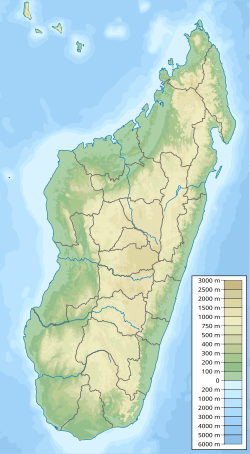
The Bemaraha limestones stretches over an area of roughly 300 kilometres (190 mi), [5] and are best exposed in the area between the towns of Bekopaka and Antsalova, in the northern half of the Morondava Basin. The outcropping limestones can roughly be divided into a western and an eastern belt with different facies. [4]

In the western belt, the formation mainly consists of massive limestones with metre-scale bedding or no recognizable bedding at all. Oolites and fossils of reefal organisms (mainly corals) are common in places. This region is affected by the spectacular karst features known as "tsingy" and for this reason most of the area is part of the Tsingy de Bemaraha National Park, included in the UNESCO World Heritage Sites list. The facies in the eastern belt is made up mainly of fine-grained and well-bedded limestones with the average thickness of the individual beds being a few tens of centimeters. Beds are often laminated and invertebrate fossils (gastropods, bivalves, brachiopods, echinoids and isolated coral fragments) are common in some beds, while others are devoid of fossils. [4]

In the south-western Majunga Basin, interbedded limestones and mudstones (shales and marls) above the Aalenian Sandstone were attributed to a Bajocian carbonate platform formed by the Bemaraha Formation. The carbonate platform at the Manambolo and Tsiribihina River gorges, which cut through the Bemaraha plateau, are likewise assigned to the Early Bajocian. At the eastern margin of the Bemaraha Plateau, the carbonate succession directly rests on Isalo sandstones. Farther south at Besabora (along National Road RN35), limestones with the foraminifera Mesoendothyra croatica and Protopeneroplis striata support a Middle Jurassic (Bajocian to Early Bathonian) age. [6]

See also

Related Research Articles

<span class="mw-page-title-main">Morrison Formation</span> Rock formation in the western United States

The Morrison Formation is a distinctive sequence of Upper Jurassic sedimentary rock found in the western United States which has been the most fertile source of dinosaur fossils in North America. It is composed of mudstone, sandstone, siltstone, and limestone and is light gray, greenish gray, or red. Most of the fossils occur in the green siltstone beds and lower sandstones, relics of the rivers and floodplains of the Jurassic period.

<span class="mw-page-title-main">High Atlas</span> Mountain range in central Morocco

The High Atlas, also called the Grand Atlas, is a mountain range in central Morocco, North Africa, the highest part of the Atlas Mountains.

<i>Lapparentosaurus</i> Extinct genus of dinosaurs

Lapparentosaurus is a genus of sauropod dinosaur from the Middle Jurassic. Its fossils were found in Madagascar. The type species is L. madagascariensis.

<i>Razanandrongobe</i> Genus of fossil reptiles related to crocodilians

Razanandrongobe is a genus of carnivorous ziphosuchian crocodyliform from the Middle Jurassic of Madagascar. It contains the type and only species Razanandrongobe sakalavae, named in 2004 by Simone Maganuco and colleagues based on isolated bones found in 2003. The remains, which included a fragment of maxilla and teeth, originated from the Bathonian-aged Sakaraha Formation of Mahajanga, Madagascar. While they clearly belonged to a member of the Archosauria, Maganuco and colleagues refrained from assigning the genus to a specific group because the fragmentary remains resembled lineages among both the theropod dinosaurs and crocodylomorphs.

The Isalo III Formation is a geological formation in Madagascar, off the eastern coast of Africa. It dates back to the Middle Jurassic. The use of the term "Isalo III" is somewhat controversial as the two prior units Isalo I and II are Triassic cross-bedded sandstone units that form a continuous depositional sequence, while the "Isalo III" sandstones are not part of the same depositional sequence, and were deposited considerably later. and are perhaps better treated as part of several separate formations. It is traditionally divided into two subunits the lower, Bajocian aged Isalo IIIa unit also known as the Beronono Formation and the upper, Bathonian aged Isalo IIIb unit also known as the Sakaraha Formation or Sakahara Formation. The Sakaraha Formation consists of sandstones, marls and carbonates and represents a coastal plain environment, and is laterally equivalent to the predominantly carbonate Bemaraha Formation, which represents a coastal barrier lagoon complex. The formation is found in the northwest and in the southeast of the country and has provided a variety of fossils.

<span class="mw-page-title-main">Purgatoire River track site</span> Dinosaur track site in Colorado, USA

The Purgatoire River track site, also called the Picketwire Canyonlands tracksite, is one of the largest dinosaur tracksites in North America. The site is located on public land of the Comanche National Grassland, along the Purgatoire ("Picketwire") River south of La Junta in Otero County, Colorado.

<span class="mw-page-title-main">Aganane Formation</span> Geologic formation in Azilal Province, central Morocco

The Aganane Formation is a Pliensbachian geologic formation in the Azilal, Béni-Mellal, Ouarzazate, Tinerhir and Errachidia provinces, central Morocco, being the remnant of a local massive Carbonate platform, and known mostly for its rich tracksites including footprints of thyreophoran, sauropod and theropod dinosaurs. This formation has been dated to the Pliensbachian stage of the Lower Jurassic, thanks to the find of the ammonite Arieticeras cf. algovianum, indicator of Middle Domerian in the upper zone, and lower delimitation by the foraminifers Mayncina termieri and Orbitopsella praecursor. The dinosaur tracksites are all located a few metres below the Pliensbachian-Toarcian limit, being coeval and connected with the lowermost layers of the continental Azilal Formation. The Aganane Formation was also coeval with the Jbel Taguendouft Formation and the Tamadout 1 Formation, all developed along a local "platform-furrow" in the Middle Atlas Mountains, that act as a barrier controlling the western border of the Jurassic Atlas Gulf. The nearshore sections, including both carbonate platforms and close to sea terrestrial facies where located on an isolated internal domain thanks to the control of the barrier, allowing the Aganane Formation to develop on a hot and humid climate, where a local algal marsh had intermittent progradations, intercalated with a layer of terrigenous continental origin. The ichnosites were developed in tidal flats and coastal deposits suitable to sea flooding.

The Kurek Formation is a late Oxfordian geologic formation of the Kugitang Svita in Turkmenistan and Uzbekistan. Fossil sauropod tracks have been reported from the formation.

Tetrapodium is an ichnogenus of fossil footprints found in the Etjo Sandstone and Omingonde Formations of Namibia. The Etjo Sandstone fossils were initially identified as rounded, featureless depressions presumed to have been made by a quadrupedal animal, but more recent examination in 2016 could not identify such tracks and concluded they are most likely non-biogenic features of the rock surface.

<span class="mw-page-title-main">Etjo Sandstone</span>

The Etjo Sandstone is an Early Jurassic geologic formation in northern Namibia. The formation overlies the Omingonde Formation in the Waterberg Basin and the Doros and Gai-As Formations in the Huab Basin and has a total thickness of 140 metres (460 ft). Fossil theropod tracks of Prosauropoda indet., Theropoda indet., Tetrapodium elmenhorsti, Saurichnium anserinum, S. damarense, S. parallelum and S. tetractis have been reported from the formation, deposited in an aeolian environment.

<span class="mw-page-title-main">Geology of Madagascar</span>

The geology of Madagascar comprises a variety of rocks of Precambrian age which make up the larger part of the east and centre of the island. They are intruded by basalts and rhyolites of Mesozoic to Cenozoic age. In contrast, the western part of the island is formed from sedimentary rocks of Carboniferous to Quaternary age. Archean rocks occur from the northeast portion of the island down to the south in the Ranotsara shear zone. Rocks in the northern portion of Madagascar are greenstone belts, from the Archean or Paleoproterozoic age.

<span class="mw-page-title-main">Duntulm Formation</span>

The Duntulm Formation is a sedimentary geologic formation deposited in the Inner Hebrides, Scotland. The formation was previously known as the 'Lower Ostrea Beds', and dates to the Bathonian stage of the Middle Jurassic. The formation is noted for its highly fossiliferous oyster beds, which compose of the species Praeexogyra hebridica. The sedimentary sequence also forms part of the Great Estuarine Group.

<span class="mw-page-title-main">Kilmaluag Formation</span> Geologic formation in Scotland

The Kilmaluag Formation is a Middle Jurassic geologic formation in Scotland. It was formerly known as the Ostracod Limestone for preserving an abundance of fossil freshwater/low salinity ostracods. Gastropods, bivalves, trace fossil burrows, and vertebrate fossil remains have also been recorded from the formation. Vertebrate fossils include fish, crocodylomorphs, mammals, small reptiles, amphibians, theropod and sauropod dinosaurs and pterosaurs.

The Moskvoretskaya Formation is a Middle Jurassic geologic formation in the European part of Russia. It consists of continental claystones, siltstones and sandstones deposited in karstified segments of underlying Middle Carboniferous limestone, that would have formed underground aquifers.

The Kandreho Formation is an Early Jurassic geological formation of the Mahajanga Basin of Madagascar. The marly limestones of the formation were deposited in a subtidal lagoonal environment. The formation overlies the Bouleiceras and Spiriferina beds of the early Toarcian and has been correlated to the Marrat Formation of Saudi Arabia. Fossils of the marine crocodylian Andrianavoay as well as bivalves and the ammonite Nejdia have been found in the formation. The name Kandreho Formation was proposed by Geiger in 2004.

<span class="mw-page-title-main">Rotzo Formation</span> Jurassic geological formation in Italy

The Rotzo Formation is a geological formation in Italy, dating to roughly between 192 and 186 million years ago and covering the Pliensbachian stage of the Jurassic Period in the Mesozoic Era. Has been traditionally classified as a Sinemurian-Pliensbachian Formation, but a large and detailed dataset of isotopic 13C and 87Sr/86Sr data, estimated the Rotzo Formation to span only over the Early Pliensbachian, bracketed between the Jamesoni-Davoei biozones, marked in the Loppio Oolitic Limestone–Rotzo Fm contact by a carbon isotope excursion onset similar to the Sinemu-Pliens boundary event, while the other sequences fit with the a warm phase that lasts until the Davoei biozone. The Rotzo Formation represented the Carbonate Platform, being located over the Trento Platform and surrounded by the Massone Oolite, the Fanes Piccola Encrinite, the Lombadian Basin Medolo Group and Belluno Basin Soverzene Formation, and finally towards the south, deep water deposits of the Adriatic Basin. The also Pliensbachian Aganane Formation of Morocco represents a regional equivalent, both in deposition and faunal content.

<span class="mw-page-title-main">Budoš Limestone</span> Geological formation in Montenegro

The Budoš Limestone is a geological formation in Montenegro, dating to 180 million years ago, and covering the Toarcian stage of the Jurassic Period. It has been considered an important setting in Balkan paleontology, as it represents a unique terrestrial setting with abundant plant material, one of the few know from the Toarcian of Europe. It is the regional equivalent to the Toarcian units of Spain such as the Turmiel Formation, units like the Azilal Formation of Morocco and others from the Mediterranean such as the Posidonia Beds of Greece and the Marne di Monte Serrone of Italy. In the Adriatic section, this unit is an equivalent of the Calcare di Sogno of north Italy, as well represents almost the same type of ecosystem recovered in the older (Pliensbachian) Rotzo Formation of the Venetian region, know also for its rich floral record.

<span class="mw-page-title-main">Azilal Formation</span>

The Azilal Formation, also known as Toundoute Continental Series and Wazzant Formation, is a geological unit in the Azilal, Béni-Mellal, Ouarzazate, Tinerhir and Errachidia provinces of the High Atlas of Morocco, that cover the Latest Pliensbachian to Middle Aalenian stages of the Jurassic Period. It is a terrestrial deposit which overlies marine dolomites of equivalent age to the Rotzo Formation of Italy, mostly part of the Aganane Formation. Dinosaur remains, such the sauropod Tazoudasaurus and the basal ceratosaur Berberosaurus are known from the unit, along with several undescribed genera. The Units inside the group have been considered individual on the past, being a division of the so-called "Couches rouges", and subdivided by a supposed geological scale. The strata of the group extends towards the Central High Atlas, covering different anticlines, and topographic accidents along the range of the Mountains. Although new studies have suggested that the strata is coeval in age, and should be referred to as a unique unit. The formation is best assigned to an alluvial environment occasionally interrupted by shallow marine incursions and marks a dramatic decrease of the carbonate productivity under increasing terrigenous sedimentation. The Azilal Formation consists mainly of claystones rich in continental plant debris and laminated microbial facies. The toarcian High Atlas is divided in 5 units: the continental layers with paralic deposits belong to the Azilal, along the shoreface layers of the Tagoudite Formation and Tafraout Formation, both connected with the offshore Ait Athmane Formation and the deeper shelf deposits of the Agoudim 1 Formation.

References

  1. Tsiandro tracksite at Fossilworks.org
  2. Wagensommer et al., 2010, p.127
  3. Wagensommer et al., 2012, p.124
  4. 1 2 3 D'Orazi Porchetti et al., 2010, p.8
  5. Wagensommer et al., 2012, p.111
  6. Geiger & Schweigert, 2005, p.5

Bibliography