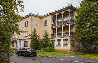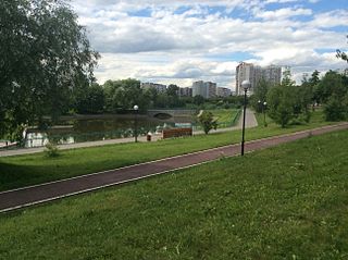
Zapadnoye Degunino District is an administrative district (raion) of Northern Administrative Okrug, and one of the 125 raions of Moscow, Russia. The area of the district is 7.5266 square kilometers (2.9060 sq mi). In 1997 the Businovo District was merged into the district.

Altufyevsky District is an administrative district (raion) of North-Eastern Administrative Okrug, and one of the 125 raions of Moscow, Russia.

Losinoostrovsky District is an administrative district (raion) of North-Eastern Administrative Okrug, and one of the 125 raions of Moscow, Russia. It is 14 km north of the Moscow city center, located just inside the Moscow Ring Road, with Moscow Oblast to the north, Severnoye Medvedkovo District to the west, Babushkinsky District to the south, and Yarosloavsky District to the east. The area of the district is 5.54 square kilometers (2.14 sq mi). Population: 72,100. Although its name coincides with Losiny Ostrov National Park, the district does not even border the park. Its name in fact refers to Losinoostrovskaya railway station, in turn named after the park.

Marfino District is an administrative district (raion) of North-Eastern Administrative Okrug, and one of the 125 raions of Moscow, Russia. It is 8 km north of Moscow city center; to the east is Moscow's Central Botanical Gardens and the Ostankino Park. To the west is Butyrsky District. The area of the district is 2.7 square kilometers (1.0 sq mi). Population: 34,500

Severnoye Medvedkovo District is an administrative district (raion) of North-Eastern Administrative Okrug, and one of the 125 raions of Moscow, Russia.

Sviblovo District is an administrative district (raion) of North-Eastern Administrative Okrug, and one of the 125 raions of Moscow, Russia. The area of the district is 4.41 square kilometers (1.70 sq mi). Moscow Botanical Garden is located in Sviblovo.

Yaroslavsky District, Moscow is an administrative district (raion) of North-Eastern Administrative Okrug, and one of the 125 raions of Moscow, Russia. The area of the district is 7.99 square kilometers (3.08 sq mi). The district is situated on both sides of a major highway, Yaroslavskoye shosse, east from Yaroslavsky railway, and is named after both. The Moscow State Construction University is located in this district at 26 Yaroslavsky Highway.

Pokrovskoye-Streshnevo District is an administrative district (raion) of North-Western Administrative Okrug, and one of the 125 raions of Moscow, Russia.

Ivanovskoye District is an administrative district (raion) of Eastern Administrative Okrug, and one of the 125 raions of Moscow, Russia.

Novogireyevo District is an administrative district (raion) of Eastern Administrative Okrug, and one of the 125 raions of Moscow, Russia. The area of the district is 4.45 square kilometers (1.72 sq mi).

Perovo District is an administrative district (raion) of Eastern Administrative Okrug, and one of the 125 raions of Moscow, Russia.

Vostochny District, Moscow is an administrative district (raion) of Eastern Administrative Okrug, and one of the 125 raions of Moscow, Russia.

Fili-Davydkovo District is an administrative district (raion) of Western Administrative Okrug, and one of the 125 raions of Moscow, Russia.

Novo-Peredelkino District is an administrative district (raion) of Western Administrative Okrug, and one of the 125 raions of Moscow, Russia.

Ochakovo-Matveevskoe is an administrative district (raion) of Western Administrative Okrug, and one of the 125 raions of Moscow, Russia. The area of the district is 17.5436 square kilometers (6.7736 sq mi). Population: 124,580.

Chertanovo Tsentralnoye District is an administrative district (raion) of Southern Administrative Okrug, and one of the 125 raions of Moscow, Russia.

Chertanovo Yuzhnoye District is an administrative district (raion) of Southern Administrative Okrug, and one of the 125 raions of Moscow, Russia.

Moskvorechye-Saburovo District is an administrative district (raion) of Southern Administrative Okrug, and one of the 125 raions of Moscow, Russia. The area of the district is 9.30 square kilometers (3.59 sq mi).

Zyablikovo District is an administrative district (raion) of Southern Administrative Okrug, and one of the 125 raions of Moscow, Russia. The area of the district is 4.379 square kilometers (1.691 sq mi). Population: 131,297.

Ryazansky District, Moscow is an administrative district (raion) of South-Eastern Administrative Okrug, and one of the 125 raions of Moscow, Russia. The area of the district is 6.485 square kilometers (2.504 sq mi).


