Yuzhnoye Butovo District

Last updated
Yuzhnoye Butovo District
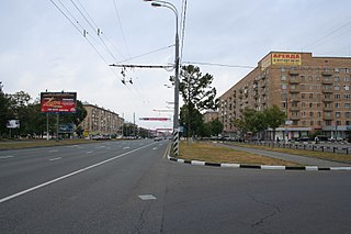
Iuzhnoe Butovo (61).JPG
Street scene, Yuzhnoye Butovo District
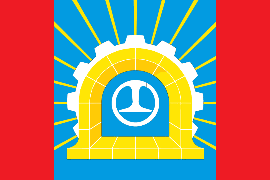
Flag of Butovo South (municipality in Moscow).png
Flag
Coat of Arms of Butovo South (municipality in Moscow).png
Coat of arms
Location of Yuzhnoye Butovo District on the map of Moscow
Coordinates: 55°31′22.62″N37°33′2.09″E / 55.5229500°N 37.5505806°E / 55.5229500; 37.5505806
Country Russia
Federal subject Moscow
Area
[1]
  Total27 km2 (10 sq mi)
Population
  Estimate 
(2018) [2]
207,967
Time zone UTC+3 (MSK Blue pencil.svg [3] )
OKTMO ID45909000
Website http://ubutovo.mos.ru/

Yuzhnoye Butovo District (Southern Butovo, Russian : Ю́жное Бу́тово) is the biggest residential district in South-Western Administrative Okrug of Moscow, Russia. The district's history dates back to 1612, and it is named after a Don Cossack Butov. The area of the district is 27 square kilometres (10 sq mi) [1] . The population (July 2016) was 207,903.

Russian language East Slavic language

Russian is an East Slavic language, which is official in the Russian Federation, Belarus, Kazakhstan and Kyrgyzstan, as well as being widely used throughout Eastern Europe, the Baltic states, the Caucasus and Central Asia. It was the de facto language of the Soviet Union until its dissolution on 25 December 1991. Although, nowadays, nearly three decades after the breakup of the Soviet Union, Russian is used in official capacity or in public life in all the post-Soviet nation-states, as well as in Israel and Mongolia, the rise of state-specific varieties of this language tends to be strongly denied in Russia, in line with the Russian World ideology.

South-Western Administrative Okrug Administrative okrug of Moscow in Russia

South-Western Administrative Okrug, or Yugo-Zapadny Administrative Okrug, is one of the twelve high-level territorial divisions of the federal city of Moscow, Russia. As of the 2010 Census, its population was 1,362,751, up from 1,179,211 recorded during the 2002 Census.

Moscow Capital city of Russia

Moscow is the capital and most populous city of Russia, with 13.2 million residents within the city limits, 17 million within the urban area and 20 million within the metropolitan area. Moscow is one of Russia's federal cities.

Contents

Butovo memorial

Situated approximately 27 km south-east of Moscow, Butovo is the site of the Butovo firing range, a mass grave dating from the "Great Purge" of the 1930s. In excess of 20,000 people were shot and buried there from August 1937 to October 1938 . It has become a shrine to Joseph Stalin's victims and has an Orthodox church on the grounds.

Butovo firing range cemetery

The Butovo Firing Range or Butovo Shooting Range, is a former private estate near the village of Drozhzhino in the Yuzhnoye Butovo District south of Moscow that was seized by the Soviets after the 1917 revolution and thereafter used by secret police as an agricultural colony, shooting range, and from 1938 to 1953, as a site for executions and mass graves of persons deemed "enemies of the people." The exact number of victims executed remains unknown, as only fragmentary data has been declassified by NKVD's successor services. However, between 1937 and 1938, the height of Josef Stalin's Great Terror, 20,761 prisoners were transported to the site and executed, typically by gunshot to the back of the head. Notable victims included Béla Kun, Gustav Klutsis, Seraphim Chichagov, as well as over 1000 members of the Russian Orthodox clergy. The Russian Orthodox Church took over the ownership of the lot in 1995 and erected a large Russian Revival memorial church. The mass grave may be visited daily.

A mass grave is a grave containing multiple human corpses, which may or may not be identified prior to burial. The United Nations has defined a criminal mass grave as a burial site containing three or more victims of execution. Mass graves are usually created after a large number of people die or are killed, and there is a desire to bury the corpses quickly for sanitation concerns. Although mass graves can be used during major conflicts such as war and crime, in modern times they may be used after a famine, epidemic, or natural disaster. In disasters, mass graves are used for infection and disease control. In such cases, there is often a breakdown of the social infrastructure that would enable proper identification and disposal of individual bodies.

Great Purge Soviet campaign of political repression, imprisonment, and execution

The Great Purge or the Great Terror was a campaign of political repression in the Soviet Union which occurred from 1936 to 1938. It involved a large-scale purge of the Communist Party and government officials, repression of wealthy landlords and the Red Army leadership, widespread police surveillance, suspicion of saboteurs, counter-revolutionaries, imprisonment, and arbitrary executions. In Russian historiography, the period of the most intense purge, 1937–1938, is called Yezhovshchina, after Nikolai Yezhov, the head of the Soviet secret police, the NKVD, who was executed a year after the purge. Modern historical studies estimate the total number of deaths due to Stalinist repression in 1937–38 to be between 681,692-1,200,000.

Related Research Articles

Shcherbinka Town in Moscow, Russia

Shcherbinka is a town, formerly in Moscow Oblast, Russia, and since July 1, 2012 a part of the federal city of Moscow, Russia. It is located 37 kilometers (23 mi) south of the center of Moscow. Population: 32,450 (2010 Census); 28,043 (2002 Census); 28,011 (1989 Census).

Begovoy District District in Moscow, Russia

Begovoy District is an administrative district (raion) of Northern Administrative Okrug, and one of the 125 raions of Moscow, Russia. The area of the district is 4.18 square kilometers (1.61 sq mi). Population: 37,900

Beskudnikovsky District District in Moscow, Russia

Beskudnikovsky District is an administrative district (raion) of Northern Administrative Okrug, and one of the 125 raions of Moscow, Russia. The district is about 12 km north of Central Moscow, and has an area of 3.27 square kilometers (1.26 sq mi). Population: 64,000

Severnoye Tushino District District in Moscow, Russia

Severnoye Tushino District or Northern Tushino is an administrative district (raion) of North-Western Administrative Okrug, and one of the 125 raions of Moscow, Russia. In the district there are Alyoshkinsky forest and Severnoye Tushino park.

Yuzhnoye Tushino District District in Moscow, Russia

Yuzhnoye Tushino District is an administrative district (raion) of North-Western Administrative Okrug, and one of the 125 raions of Moscow, Russia.
Metrogorodok District District in Moscow, Russia

Metrogorodok District is the northernmost administrative district (raion) of Eastern Administrative Okrug, and one of the 125 raions of Moscow, Russia. The district has a size of 27.57 square kilometers (10.64 sq mi).

Severnoye Izmaylovo District District in Moscow, Russia

Severnoye Izmaylovo District is one if 16 districts in the administrative district (raion) of Eastern Administrative Okrug, and one of the 125 raions of Moscow, Russia. It is bounded on the north by Shchelkovo Highway, on the south by Sirenevyy Boulevard, and on the east by the Moscow Ring Road (MKAD). The area of the district is 4 square kilometers (1.5 sq mi). Population: 85741 ;
Troparyovo-Nikulino District District in Moscow, Russia

Troparyovo-Nikulino District is an administrative district (raion) at the southern edge of Western Administrative Okrug, and one of the 125 raions of Moscow, Russia. The western border is the Moscow Ring Road, and the southern border is Leninsky Prospekt. The area of the district is 11.26 square kilometers (4.35 sq mi). Population: 119,000

Chertanovo Yuzhnoye District District in Moscow, Russia

Chertanovo Yuzhnoye District is an administrative district (raion) of Southern Administrative Okrug, and one of the 125 raions of Moscow, Russia.
Nekrasovka District District in Moscow, Russia

Nekrasovka District is an administrative district (raion) of South-Eastern Administrative Okrug, and one of the 125 raions of Moscow, Russia. The area of the district is 11.475 square kilometers (4.431 sq mi). Population: 68,539

Nizhegorodsky District, Moscow District in Moscow, Russia

Nizhegorodsky District is an administrative district (raion) of South-Eastern Administrative Okrug, and one of the 125 raions of Moscow, Russia. The area of the district is 7.574 square kilometers (2.924 sq mi). Population: 32,000.

Ryazansky District, Moscow District in Moscow, Russia

Ryazansky District, Moscow is an administrative district (raion) of South-Eastern Administrative Okrug, and one of the 125 raions of Moscow, Russia. The area of the district is 6.485 square kilometers (2.504 sq mi).

Vykhino-Zhulebino District District in Moscow, Russia

Vykhino-Zhulebino District is an administrative district (raion) of South-Eastern Administrative Okrug, one of the 125 raions of Moscow, Russia. The area of the district is 14.77 square kilometers (5.70 sq mi). Population: 219,600.

Konkovo District District in Moscow, Russia

Konkovo District is an administrative district (raion) of South-Western Administrative Okrug, and one of the 125 raions of Moscow, Russia. The area of the district is 7.179 square kilometers (2.772 sq mi). Population: 97,847 .It is located in the south of the city, along the orange metro line.

Kotlovka District District in Moscow, Russia

Kotlovka District is an administrative district (raion) of South-Western Administrative Okrug, and one of the 125 raions of Moscow, Russia. The area of the district is 3.865 square kilometers (1.492 sq mi). Population: 54,200.
Lomonosovsky District, Moscow District in Moscow, Russia

Lomonosovsky District, Moscow is an administrative district (raion) of South-Western Administrative Okrug, and one of the 125 raions of Moscow, Russia. The area of the district is 3.34 square kilometers (1.29 sq mi). Population: 85,000 . Population - 81,851. Established at 1995. Named after Mikhail Vasilyevich Lomonosov.

Severnoye Butovo District District in Moscow, Russia

Severnoye Butovo District is an administrative district (raion) of South-Western Administrative Okrug, and one of the 125 raions of Moscow, Russia. The area of the district is 9.271 square kilometers (3.580 sq mi). Population: 73,357.

Bulvar Admirala Ushakova Moscow Metro station

Bulvar Admirala Ushakova is a station on the Butovskaya Line of the Moscow Metro system in Moscow, Russia. It was opened on 27 December 2003 along with four other stations. The station is located in Yuzhnoye Butovo District, between two other stations of the same line, Ulitsa Skobelevskaya and Ulitsa Gorchakova. The station, which name literally means Admiral Ushakov Boulevard, was named after the nearby street, and the street was named after the 18th-century Russian naval commander Fyodor Ushakov.

Ulitsa Gorchakova Moscow Metro station

Ulitsa Gorchakova is a station on the Butovskaya Line of the Moscow Metro system in Moscow, Russia. It was opened on 27 December 2003 along with four other stations. The station is located in Yuzhnoye Butovo District, between two other stations of the same line, Bulvar Admirala Ushakova and Buninskaya Alleya.

References

  1. 1 2 "General Information" (in Russian). Yuzhnoye Butovo District. Retrieved April 12, 2018.
  2. "26. Численность постоянного населения Российской Федерации по муниципальным образованиям на 1 января 2018 года". Federal State Statistics Service. Retrieved 23 January 2019.
  3. "Об исчислении времени". Официальный интернет-портал правовой информации (in Russian). 3 June 2011. Retrieved 19 January 2019.

Coordinates: 55°32′46″N37°32′39″E / 55.54611°N 37.54417°E / 55.54611; 37.54417

Geographic coordinate system Coordinate system

A geographic coordinate system is a coordinate system that enables every location on Earth to be specified by a set of numbers, letters or symbols. The coordinates are often chosen such that one of the numbers represents a vertical position and two or three of the numbers represent a horizontal position; alternatively, a geographic position may be expressed in a combined three-dimensional Cartesian vector. A common choice of coordinates is latitude, longitude and elevation. To specify a location on a plane requires a map projection.