Marfino District

Last updated
Marfino District
MoscowTVtower-2009-view13.jpg
Views from the observation deck of the Ostankino Tower, Marfino District
Flag of Marfino (municipality in Moscow).png
Flag
Coat of Arms of Marfino (municipality in Moscow).png
Coat of arms
Location of Marfino District on the map of Moscow
Coordinates: 55°49′49″N37°35′34″E / 55.83028°N 37.59278°E / 55.83028; 37.59278
Country Russia
Federal subject Moscow
Area
[1]
  Total2.7 km2 (1.0 sq mi)
Population
  Estimate 
(2018) [2]
35,196
Time zone UTC+3 (MSK Blue pencil.svg [3] )
OKTMO ID45356000
Website http://marfino.mos.ru/

Marfino District (Russian : Марфино райо́н) is an administrative district (raion) of North-Eastern Administrative Okrug, and one of the 125 raions of Moscow, Russia. [4] It is 8 km north of Moscow city center; to the east is Moscow's Central Botanical Gardens and the Ostankino Park. To the west is Butyrsky District. The area of the district is 2.7 square kilometers (1.0 sq mi). Population: 34,500 (2017 est.) [1]

Russian language East Slavic language

Russian is an East Slavic language, which is official in the Russian Federation, Belarus, Kazakhstan and Kyrgyzstan, as well as being widely used throughout Eastern Europe, the Baltic states, the Caucasus and Central Asia. It was the de facto language of the Soviet Union until its dissolution on 25 December 1991. Although nearly three decades have passed since the breakup of the Soviet Union, Russian is used in official capacity or in public life in all the post-Soviet nation-states, as well as in Israel and Mongolia.

A raion is a type of administrative unit of several post-Soviet states. The term is from the French "rayon", which is both a type of a subnational entity and a division of a city, and is commonly translated in English as "district".

North-Eastern Administrative Okrug, or Severo-Vostochny Administrative Okrug, is one of the twelve high-level territorial divisions of the federal city of Moscow, Russia. As of the 2010 Census, its population was 1,359,508, up from 1,240,062 recorded during the 2002 Census.

Contents

See also

Related Research Articles

Altufyevsky District District in Moscow, Russia

Altufyevsky District is an administrative district (raion) of North-Eastern Administrative Okrug, and one of the 125 raions of Moscow, Russia.

Butyrsky District District in Moscow, Russia

Butyrsky District is an administrative district (raion) of North-Eastern Administrative Okrug, and one of the 125 raions of Moscow, Russia. It is 6 km north of the Moscow city center, located just outside the third ring road, with Timiryazevsky District to the west and Marfino District and Maryina roshcha District to the east. The area of the district is 5.04 square kilometers (1.95 sq mi). Population: 68,700.

Losinoostrovsky District District in Moscow, Russia

Losinoostrovsky District is an administrative district (raion) of North-Eastern Administrative Okrug, and one of the 125 raions of Moscow, Russia. It is 14 km north of the Moscow city center, located just inside the Moscow Ring Road, with Moscow Oblast to the north, Severnoye Medvedkovo District to the west, Babushkinsky District to the south, and Yarosloavsky District to the east. The area of the district is 5.54 square kilometers (2.14 sq mi). Population: 72,100. Although its name coincides with Losiny Ostrov National Park, the district does not even border the park. Its name in fact refers to Losinoostrovskaya railway station, in turn named after the park.

Ostankinsky District District in Moscow, Russia

Ostankinsky District , also called simply Ostankino, is an administrative district (raion) of North-Eastern Administrative Okrug, and one of the 125 raions of Moscow, Russia. VDNH exhibition center and Ostankino Tower, the tallest structure in Europe, are located in Ostankinsky. The district is served by Moscow Monorail. Ostankinsky district is named after Ostankino village that existed on its site before urbanization.

Severnoye Medvedkovo District District in Moscow, Russia

Severnoye Medvedkovo District is an administrative district (raion) of North-Eastern Administrative Okrug, and one of the 125 raions of Moscow, Russia.

Sviblovo District District in Moscow, Russia

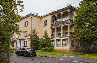
Sviblovo District is an administrative district (raion) of North-Eastern Administrative Okrug, and one of the 125 raions of Moscow, Russia. The area of the district is 4.41 square kilometers (1.70 sq mi).

Yaroslavsky District, Moscow District in Moscow, Russia

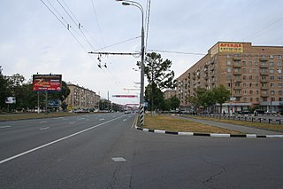
Yaroslavsky District, Moscow is an administrative district (raion) of North-Eastern Administrative Okrug, and one of the 125 raions of Moscow, Russia. The area of the district is 7.99 square kilometers (3.08 sq mi). The district is situated on both sides of a major highway, Yaroslavskoye shosse, east from Yaroslavsky railway, and is named after both. The Moscow State Construction University is located in this district at 26 Yaroslavsky Highway.

Pokrovskoye-Streshnevo District District in Moscow, Russia

Pokrovskoye-Streshnevo District is an administrative district (raion) of North-Western Administrative Okrug, and one of the 125 raions of Moscow, Russia.

Yuzhnoye Tushino District District in Moscow, Russia

Yuzhnoye Tushino District is an administrative district (raion) of North-Western Administrative Okrug, and one of the 125 raions of Moscow, Russia.

Ivanovskoye District District in Moscow, Russia

Ivanovskoye District is an administrative district (raion) of Eastern Administrative Okrug, and one of the 125 raions of Moscow, Russia.

Perovo District District in Moscow, Russia

Perovo District is an administrative district (raion) of Eastern Administrative Okrug, and one of the 125 raions of Moscow, Russia.

Vostochny District, Moscow District in Moscow, Russia

Vostochny District, Moscow is an administrative district (raion) of Eastern Administrative Okrug, and one of the 125 raions of Moscow, Russia.

Fili-Davydkovo District District in Moscow, Russia

Fili-Davydkovo District is an administrative district (raion) of Western Administrative Okrug, and one of the 125 raions of Moscow, Russia.

Novo-Peredelkino District District in Moscow, Russia

Novo-Peredelkino District is an administrative district (raion) of Western Administrative Okrug, and one of the 125 raions of Moscow, Russia.

Chertanovo Tsentralnoye District District in Moscow, Russia

Chertanovo Tsentralnoye District is an administrative district (raion) of Southern Administrative Okrug, and one of the 125 raions of Moscow, Russia.

Chertanovo Yuzhnoye District District in Moscow, Russia

Chertanovo Yuzhnoye District is an administrative district (raion) of Southern Administrative Okrug, and one of the 125 raions of Moscow, Russia.

Moskvorechye-Saburovo District District in Moscow, Russia

Moskvorechye-Saburovo District is an administrative district (raion) of Southern Administrative Okrug, and one of the 125 raions of Moscow, Russia. The area of the district is 9.30 square kilometers (3.59 sq mi).

Vykhino-Zhulebino District District in Moscow, Russia

Vykhino-Zhulebino District is an administrative district (raion) of South-Eastern Administrative Okrug, one of the 125 raions of Moscow, Russia. The area of the district is 14.77 square kilometers (5.70 sq mi). Population: 219,600.

Lomonosovsky District, Moscow District in Moscow, Russia

Lomonosovsky District, Moscow is an administrative district (raion) of South-Western Administrative Okrug, and one of the 125 raions of Moscow, Russia. The area of the district is 3.34 square kilometers (1.29 sq mi). Population: 85,000 . Population - 81,851. Established at 1995. Named after Mikhail Vasilyevich Lomonosov.

Tyoply Stan District District in Moscow, Russia

Tyoply Stan District is an administrative district (raion) of South-Western Administrative Okrug, and one of the 125 raions of Moscow, Russia. The area of the district is 7.5 square kilometers (2.9 sq mi).

References

Notes

  1. 1 2 "General Information" (in Russian). Marfino District. Retrieved February 5, 2018.
  2. "26. Численность постоянного населения Российской Федерации по муниципальным образованиям на 1 января 2018 года". Federal State Statistics Service. Retrieved 23 January 2019.
  3. "Об исчислении времени". Официальный интернет-портал правовой информации (in Russian). 3 June 2011. Retrieved 19 January 2019.
  4. Государственный комитет Российской Федерации по статистике. Комитет Российской Федерации по стандартизации, метрологии и сертификации. №ОК 019-95 1 января 1997 г. «Общероссийский классификатор объектов административно-территориального деления. Код 45», в ред. изменения №278/2015 от 1 января 2016 г.. (State Statistics Committee of the Russian Federation. Committee of the Russian Federation on Standardization, Metrology, and Certification. #OK 019-95 January 1, 1997 Russian Classification of Objects of Administrative Division . Code 45, as amended by the Amendment #278/2015 of January 1, 2016. ).

Sources

Coordinates: 55°49′49″N37°35′34″E / 55.83028°N 37.59278°E / 55.83028; 37.59278

Geographic coordinate system Coordinate system

A geographic coordinate system is a coordinate system that enables every location on Earth to be specified by a set of numbers, letters or symbols. The coordinates are often chosen such that one of the numbers represents a vertical position and two or three of the numbers represent a horizontal position; alternatively, a geographic position may be expressed in a combined three-dimensional Cartesian vector. A common choice of coordinates is latitude, longitude and elevation. To specify a location on a plane requires a map projection.