Voykovsky District

Last updated
Voykovsky District

Войковский район
Moscow Metropolis Mall.jpg
A shopping center in Voykovsky District
Flag of Voikovsky (municipality in Moscow).png
Flag
Coat of Arms of Voikovsky (municipality in Moscow).png
Coat of arms
Location of Voykovsky District in Moscow (pre-2012 map)
Coordinates: 55°49′N37°30′E / 55.817°N 37.500°E / 55.817; 37.500 Coordinates: 55°49′N37°30′E / 55.817°N 37.500°E / 55.817; 37.500
Country Russia
Federal subject federal city of Moscow [1]
Area
[2]
  Total6.6 km2 (2.5 sq mi)
Population
  Total64,933
  Estimate 
(2018) [4]
70,192 (+8.1%)
  Density9,800/km2 (25,000/sq mi)
Municipal structure
   Municipally incorporated asVoykovsky Municipal Okrug [5]
Time zone UTC+3 (MSK Blue pencil.svg [6] )
OKTMO ID45336000
Website http://voykovsky.mos.ru
Population of Voykovsky District
2010 Census 64,933 [3]
2002 Census 67,470 [7]

Voykovsky District (Russian : Во́йковский райо́н) is an administrative district (raion), one of the sixteen in Northern Administrative Okrug of the federal city of Moscow, Russia. [1] It is located 10 km northwest of the Moscow city center. The area of the district is 6.6 square kilometres (2.5 sq mi) [2] As of the 2010 Census, the total population of the district was 64,933. [3]

Russian language East Slavic language

Russian is an East Slavic language, which is official in the Russian Federation, Belarus, Kazakhstan and Kyrgyzstan, as well as being widely used throughout Eastern Europe, the Baltic states, the Caucasus and Central Asia. It was the de facto language of the Soviet Union until its dissolution on 25 December 1991. Although nearly three decades have passed since the breakup of the Soviet Union, Russian is used in official capacity or in public life in all the post-Soviet nation-states, as well as in Israel and Mongolia.

A raion is a type of administrative unit of several post-Soviet states. The term is from the French "rayon", which is both a type of a subnational entity and a division of a city, and is commonly translated in English as "district".

Administrative divisions of Moscow

The federal city of Moscow, Russia is divided into twelve administrative okrugs, which are in turn subdivided into districts (raions). The city does not have a downtown area; the urban core is scattered across the city. Prominent business areas include Tverskoy, Arbat, and Presnensky Districts. Central Administrative Okrug as a whole has a large concentration of businesses. The city hall and major administration buildings are located in Tverskoy District. Western Administrative Okrug is home to Moscow State University, Sparrow Hills and Mosfilm Studios, while North-Eastern hosts Ostankino Tower and VDNKh Exhibition Park. The total population of the Federal City of Moscow was 11,503,501 inhabitants at the Russian Census (2010).

Contents

Municipal status

As a municipal division, it is incorporated as Voykovsky Municipal Okrug. [5]

History

The territory of the present area "Voikovsky" was inhabited by people in ancient times, as evidenced by archaeological excavations in 1932-34. However, multi-storey construction began only under Soviet rule. The main highway of the district is the Leningrad Highway which has a long history. The former Petrograd Highway in 1924 became Leningrad and is the main thoroughfare on the way to St. Petersburg. In the 15th-17th centuries through the village of Nakhinskoe, later Nikolskoe, there was a large trade road to Tver, along it there were trade people, numerous convoys with goods, drove cattle. No wonder the old adage read: "The City of Tver - the door to Moscow". In the 18th century, when Peter I moved the capital to St. Petersburg, the road connected the two largest cities of Russia.

The metro station "Voykovskaya" got its name from the settlement Voikovets located in this part of Moscow at the plant named after. Behind the second lobby of the "Voykovskaya" metro station in 1970, the "Warsaw" cinema was built with a large concert hall for 1200 seats, which at the moment does not work, and the room is rented to a restaurant.

The present appearance of the Voykovsky district began to form in the 1930s, when together with the Khimki Reservoir, the first multi-storey residential buildings, appeared on its territory. After 1945, mass housing and industrial construction began, new neighborhoods appeared (for example, the micro district "Lebed" that was famous in the 1970s). Now the reconstruction of a dilapidated housing stock and vast territories of industrial enterprises is in full swing in the region, objects of social and cultural life are being built. On the territory of the district there will be a section of the Fourth Ring Road with a network of large interchanges and flyovers, as well as a high-speed track for the Leningrad highway.

Related Research Articles

Khovrino District District in federal city of Moscow, Russia

Khovrino District is an administrative district (raion), one of the sixteen in Northern Administrative Okrug of the federal city of Moscow, Russia. It is located along the Likhoborka River. The area is 5.727 square kilometres (2.211 sq mi) As of the 2010 Census, the total population of the district was 80,792.

Orekhovo-Borisovo Yuzhnoye District District in Federal city of Moscow, Russia

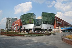
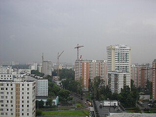
Orekhovo-Borisovo Yuzhnoye District is a territorial division in Southern Administrative Okrug, one of the 125 in the federal city of Moscow, Russia. It is located in the south of the federal city. The area of the district is 7.197 square kilometers (2.779 sq mi). As of the 2010 Census, the total population of the district was 145,588.

Sokol District District in federal city of Moscow, Russia

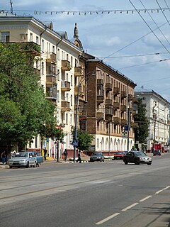
Sokol District is an administrative district (raion), one of the sixteen in Northern Administrative Okrug of the federal city of Moscow, Russia. The area of the district is 3.05 square kilometres (1.18 sq mi) As of the 2010 Census, the total population of the district was 57,133.

Eastern Administrative Okrug Administrative okrug of Moscow in Russia

Eastern Administrative Okrug, or Vostochny Administrative Okrug, is one of the twelve high-level territorial divisions of the federal city of Moscow, Russia. As of the 2010 Census, its population was 1,452,759, up from 1,394,497 recorded during the 2002 Census.

Dmitrovsky District, Moscow District in federal city of Moscow, Russia

Dmitrovsky District is an administrative district (raion), one of the sixteen in Northern Administrative Okrug of the federal city of Moscow, Russia. The area of the district is 6.8397 square kilometres (2.6408 sq mi). As of the 2010 Census, the total population of the district was 87,779.

Levoberezhny District, Moscow District in federal city of Moscow, Russia

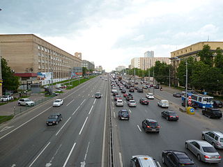
Levoberezhny District is an administrative district (raion), one of the sixteen in Northern Administrative Okrug of the federal city of Moscow, Russia. The area of the district is 8 square kilometres (3.1 sq mi). As of the 2010 Census, the total population of the district was 51,457.

Molzhaninovsky District District in federal city of Moscow, Russia

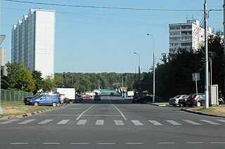
Molzhaninovsky District is an administrative district (raion), one of the sixteen in Northern Administrative Okrug of the federal city of Moscow, Russia. The area of the district is 16.65 square kilometres (6.43 sq mi)As of the 2010 Census, the total population of the district was 3,521.

Alexeyevsky District, Moscow District in Federal city of Moscow, Russia

Alexeyevsky District is a territorial division in North-Eastern Administrative Okrug, one of the 125 in the federal city of Moscow, Russia. It is located in the northeast of the federal city. The area of the district is 5.2931 square kilometers (2.0437 sq mi). As of the 2010 Census, the total population of the district was 78,421.

Lianozovo District District in federal city of Moscow, Russia

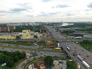
Lianozovo District is an administrative district (raion), one of the seventeen in North-Eastern Administrative Okrug of the federal city of Moscow, Russia. It is located 15 km north of Moscow city center, on the south side of the Moscow Ring Road ('MKAD'). It borders with Moscow Oblast in the north, Bibirevo District in the east, Altufyevsky District in the south, and with Dmitrovsky District in the west. The area is 6.6 square kilometres (2.5 sq mi). As of the 2010 Census, the total population of the district was 79,582.

Rostokino District District in federal city of Moscow, Russia

Rostokino District is an administrative district (raion), one of the seventeen in North-Eastern Administrative Okrug of the federal city of Moscow, Russia. It is located on both banks of the Yauza River and borders with Yaroslavsky District in the northeast, Sviblovo District in the northwest, and Ostankinsky District in the south. As of the 2010 Census, the total population of the district was 37,505.

Yuzhnoye Medvedkovo District District in Federal city of Moscow, Russia

Yuzhnoye Medvedkovo District is a territorial division in North-Eastern Administrative Okrug, one of the 125 in the federal city of Moscow, Russia. It is located in the north of the federal city. The area of the district is 3.875 square kilometers (1.496 sq mi). As of the 2010 Census, the total population of the district was 81,986.

Vostochnoye Izmaylovo District District in federal city of Moscow, Russia

Vostochnoye Izmaylovo District is an administrative district (raion), one of the sixteen in Eastern Administrative Okrug of the federal city of Moscow, Russia. The area is 3.84 square kilometres (1.48 sq mi). As of the 2010 Census, its population was 76,312, up from 75,450 recorded during the 2002 Census.

Krylatskoye District District in Federal city of Moscow, Russia

Krylatskoye District is a territorial division in Western Administrative Okrug, one of the 125 in the federal city of Moscow, Russia. It is located in the west of the federal city. The area of the district is 12.0446 square kilometers (4.6504 sq mi). As of the 2010 Census, the total population of the district was 78,509.

Mozhaysky District, Moscow District in Federal city of Moscow, Russia

Mozhaysky District is a territorial division in Western Administrative Okrug, one of the 125 in the federal city of Moscow, Russia. It is located in the west of the federal city. The area of the district is 17.526 square kilometers (6.767 sq mi). As of the 2010 Census, the total population of the district was 132,373. Mozhaysky District takes its name after Mozhayskoe Highway, the district's major road, which in turn was named after the old Mozhayskaya road which lead to Mozhaysk town, located 110 kilometers to the west of Moscow, which was protecting west approach routes to Moscow since 13th century.

Biryulyovo Vostochnoye District District in Federal city of Moscow, Russia

Biryulyovo Vostochnoye District is a territorial division in Southern Administrative Okrug, one of the 125 in the federal city of Moscow, Russia. It is located in the south of the federal city. The area of the district is 14.772 square kilometers (5.704 sq mi). As of the 2010 Census, the total population of the district was 145,100.

Biryulyovo Zapadnoye District District in Federal city of Moscow, Russia

Biryulyovo Zapadnoye District is a territorial division in Southern Administrative Okrug, one of the 125 in the federal city of Moscow, Russia. It is located in the south of the federal city. The area of the district is 8.5064 square kilometers (3.2843 sq mi). As of the 2010 Census, the total population of the district was 85,726.

Chertanovo Severnoye District District in Federal city of Moscow, Russia

Chertanovo Severnoye District is a territorial division in Southern Administrative Okrug, one of the 125 in the federal city of Moscow, Russia. It is located in the south of the federal city. The area of the district is 5.4015 square kilometers (2.0855 sq mi). As of the 2010 Census, the total population of the district was 111,875.

Pechatniki District District in federal city of Moscow, Russia

Pechatniki District is an administrative district (raion), one of the twelve in South-Eastern Administrative Okrug of the federal city of Moscow, Russia. As of the 2010 Census, the total population of the district was 83,403.

Obruchevsky District District in federal city of Moscow, Russia

Obruchevsky District is an administrative district (raion), one of the twelve in South-Western Administrative Okrug of the federal city of Moscow, Russia. As of the 2010 Census, the total population of the district was 78,619.

Zyuzino District District in federal city of Moscow, Russia

Zyuzino District is an administrative district (raion), one of the twelve in South-Western Administrative Okrug of the federal city of Moscow, Russia. As of the 2010 Census, the total population of the district was 123,003.

References

Notes

  1. 1 2 Law #13-47
  2. 1 2 "General Information" (in Russian). Voykovsky District. Retrieved February 5, 2018.
  3. 1 2 3 Russian Federal State Statistics Service (2011). "Всероссийская перепись населения 2010 года. Том 1" [2010 All-Russian Population Census, vol. 1]. Всероссийская перепись населения 2010 года [2010 All-Russia Population Census] (in Russian). Federal State Statistics Service.
  4. "26. Численность постоянного населения Российской Федерации по муниципальным образованиям на 1 января 2018 года". Federal State Statistics Service. Retrieved 23 January 2019.
  5. 1 2 Law #59
  6. "Об исчислении времени". Официальный интернет-портал правовой информации (in Russian). 3 June 2011. Retrieved 19 January 2019.
  7. Russian Federal State Statistics Service (21 May 2004). "Численность населения России, субъектов Российской Федерации в составе федеральных округов, районов, городских поселений, сельских населённых пунктов – районных центров и сельских населённых пунктов с населением 3 тысячи и более человек" [Population of Russia, Its Federal Districts, Federal Subjects, Districts, Urban Localities, Rural Localities—Administrative Centers, and Rural Localities with Population of Over 3,000](XLS). Всероссийская перепись населения 2002 года [All-Russia Population Census of 2002] (in Russian).

Sources