Bibogobogo

Last updated

Bibogobogo, also known as Bibokoboko in Kibembe, is a village in the middle plateaus of the Mutambala Sector in the Fizi Territory in the South Kivu Province of the Democratic Republic of the Congo (DRC). It is situated in the forested mountains and middle plateaus, overlooking Baraka in the south-west, near Kisombe and Bibokoboko II villages. [1] [2] [3] Bibogobogo shares the borders with Uvira Territory in the North, the Mwenga Territory and Shabunda Territory in the West, the Kalemie Territory in the South, and Lake Tanganyika in the East. Geologically, the regional soil is composed of metals, including sodium, potassium, calcium, magnesium, iron, aluminium and mercury, making it suitable for gold plating, mercury pollution, pollution index and agriculture. [4]

Contents

Despite being rich in forest biodiversity, the region is in a state of poverty and insecurity which hampers any attempt at sustainable development. The ongoing ethnic conflict in the region continues to affect communities identified as Babembe, Bafuliiru, Babwari, Babuyu, Banyindu, Balega (Warega), Bamushi, and Banyamulenge. [5] [6]

History

The area was conventionally inhabited by the Bembe people, a Bantu ethnic group that inhabits the shores of Lake Tanganyika and Fizi Territory. However, the region also contains several other ethnic groups closely intertwined with the Bembe people, including Babwari, Nyindu, Buyu, Lega and Fuliru. [7] [8]

In the mid-20th-century, in the Belgian Congo, migrants (Banyarwanda) from Rwanda dispersed in the area in search of greener pastures. [9] [10] Incidentally, the area sheltered another inflow of immigrants from Burundi during the Great Calamity in 1972 and during the displacement of Burundians in 1976–1977. [11] [12]

In September 1996, In the early stages of the First Congo War, confronted with growing insecurity in the territories of Fizi, Uvira and Mwenga as a result of the insurgency of the Tutsi/Banyamulenge armed units, the Forces Armées Zaïroises (FAZ) carried out several operations against the various armed groups and militias operating in the North and South Kivu Province. During these campaigns, the FAZ committed multiple acts of violence against Banyamulenge populations. According to the Working Group on Enforced or Involuntary Disappearances (WGEID), the Banyamulenge population of Bibogobogo village was subjected to a mass manumilatari arrest by FAZ soldiers. Consequently, over 700 people were taken to Baraka prison where men, women and children were parked in separate sheds. The victims were accused of being in contact with Banyamulenge/Tutsi-infiltrated armed units. [13] [14]

The current issue of insecurity

Following nearly three decades of violence, Bibogobogo still suffered significant problems of insecurity. [15] The combination of persistent armed conflict, massive population displacement, non-existent infrastructure, and widespread deterioration of productive assets has significantly affected food security in Bibogobogo. Furthermore, in both the northern and southern sectors of the village, recurring warfare and ethnic tensions further intensify the prevailing sense of insecurity. [16] [17]

The recent clashes in Bibogobogo pit the Twiganeho-Makanika militia, composed predominantly of Banyamulenge combatants, against the Mai-Mai Mutetezi, primarily consisting of Babembe fighters. The commanding figure of the Twigwaneho-Makanika faction is Colonel Michel Rukundo Makanika, an army deserter who, along with a contingent of Banyamulenge soldiers, established themselves as an insurgent group, fiercely defending the interests of the Banyamulenge people in the rugged Fizi highlands of South Kivu. Additionally, the Mai-Mai of Ebuela Mtetezi comprises Bembe commanders who previously commanded their own factions. In February 2010, a minimum of five instances of armed attacks were reported along the route from Baraka to Bibogobogo. These attacks involved operatives from both the Mai-Mai rebel group and the Banyamulenge rebel group. The armed assaults resurfaced in June 2020, causing the distressing displacement of approximately 1,500 families of internally displaced persons (IDPs) from Fizi, leaving them in an extremely precarious predicament. [18] [19] [20] [21]

2021 Incident

On October 15, 2021, Mai-Mai Mutetezi and Mai-Mai Biloze Bishambuke attacked Twiganeho-Makanika, who shelled their strongholds from the villages of Mugorore, Mugono, Bivumu, and Bibogobogo in the vast expanse of Fizi Territory. The Mai-Mai Mutetezi and the Bilozi Bishambuke captured 40 Twiganeho, as well as looting the village, absconding with a substantial herd of a hundred bovines, and ruthlessly claiming the lives of the locals. [22] [23] [24] In addition, Mai-Mai Biloze Bishambuke and Mai-Mai Mutetezi claim to have attacked the villages of Bibogobogo to stifle the ambition of the Ngumino/Twigwaneho to extend their strongholds to other entities in the middle plateaus and the coast during the deployment of the FARDC (Forces Armées de la République Démocratique du Congo). However, the Twiganeho militiamen deny these allegations, instead asserting that the Mai-Mai attacks are motivated by a sinister agenda of "ethnic cleansing." [25] Contrary to this claim, Dieudonne Kasereka, the spokesperson for the army in South Kivu Province, maintains that these are not acts of "ethnic cleansing," but rather confrontations between the Twiganeho and Mai-Mai combatants. [26]

Kasereka stated:

"It is the armed groups of the Mai-Mai Biloze Bishambuke against the Twigwaneho who are fighting in the Maguga village near Bibokoboko. These armed groups began their hostilities since the morning of this Wednesday. We learn that some villages have been burned on both sides, on the Biloze side and on the Twigwaneho side. The FARDC strongly condemn this action. We have dispatched the soldiers who are on their way to try to track down these outlaws who continue to sow desolation among the population". [26]

Since November 2021, armed groups have intensified attacks in Bibokoboko village. As a result, more than a thousand displaced people fled to Baraka in November 2021. However, the displaced returned to their environment in late December 2021 after establishing a temporary base for the United Nations Organization Stabilization Mission in the Democratic Republic of the Congo (MONUSCO) in the region. [27] [28] [29]

See also

Related Research Articles

<span class="mw-page-title-main">South Kivu</span> Province of the Democratic Republic of the Congo

South Kivu is one of 26 provinces of the Democratic Republic of the Congo (DRC). Its capital is Bukavu.

<span class="mw-page-title-main">Minembwe</span> Village in South Kivu, Democratic Republic of the Congo

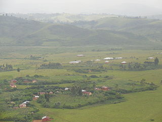
Minembwe is a cluster of several villages located in the highlands of the Lulenge, within the Fizi Territory of South Kivu Province in the Democratic Republic of the Congo (DRC). It is situated at an altitude of about 2,500 meters above sea level, in a hilly and mountainous region covered with forests, which provides fertile land for agriculture. It is approximately 150 kilometers south of Bukavu, the capital city of South Kivu. The region is also home to various streams and rivers that flow into Lake Tanganyika, the second-deepest lake in the world.

<span class="mw-page-title-main">Runingo</span> Grouping in South Kivu, Democratic Republic of the Congo

Runingo, commonly known as Runingu, is one of the groupements (groupings) that constitutes the Bafuliiru Chiefdom in the Uvira Territory of the South Kivu Province in the eastern part of the Democratic Republic of the Congo (DRC). It is situated near the border with Burundi, along National Highway 5, to the north of Butaho.

<span class="mw-page-title-main">Bunyakiri</span> Town in Democratic Republic of the Congo

Bunyakiri is a town located in the high plateau of Kalehe Territory in the South Kivu Province in the eastern region of the Democratic Republic of the Congo (DRC). Bunyakiri is nearby the Bulehe and Mulamba villages. It is mainly inhabited by Tembo, Havu, Twa and Hunde ethnic groups.

<span class="mw-page-title-main">Uvira Territory</span> Territory in South Kivu, DR Congo

Uvira Territory is a territory in South Kivu, Democratic Republic of the Congo. It is bordered by Walungu Territory to the north, Mwenga Territory to the west, Fizi Territory to the south, and Burundi and Lake Tanganyika to the east. Its capital is Uvira.

<span class="mw-page-title-main">Baraka, Democratic Republic of the Congo</span> Town in South Kivu, Democratic Republic of the Congo

Baraka, also known as Bala'a, is the main city and metropolitan center of the Fizi Territory located in the South Kivu Province in the eastern region of the Democratic Republic of the Congo (DRC). Baraka is bordered by the Lweba River to the north, the Mutambala River to the south, Lake Tanganyika to the east, and the Lu'e River, Efuma Mountain, and Makundu Mountain to the west.

<span class="mw-page-title-main">National Coalition of the People for the Sovereignty of Congo</span> Congolese rebel coalition in South Kivu

The National Coalition of the People for the Sovereignty of Congo, and also known as the Alliance of Article 64, is an armed rebel coalition in the east of the Democratic Republic of the Congo. The group is a coalition of around 12 different Mai-Mai groups in and around South Kivu province. It was formed on 30 June 2017, symbolically Congolese Independence Day.

The 2020 Democratic Republic of the Congo attacks were a series of attacks which took place in 2020. The attacks were mostly carried out by the Allied Democratic Forces (ADF), a radical Islamist rebel group and the Cooperative for the Development of Congo (CODECO), an agricultural and religious group made up of ethnic Lendu people. The attacks left at least 1,316 people dead and 132 injured.

The Kipupu massacre occurred on 16 July 2020 in the South Kivu village of Kipupu in the Mwenga Territory in the eastern Democratic Republic of the Congo. Gunmen belonging to the Ngumino and Twiganeho militias of the Banyamulenge community attacked the village and reportedly killed 220 people according to provincial lawmakers, while independent analysts state only 18 people were killed.

The 2017 CNPSC offensive was a military offensive launched by rebels of the National Coalition of the People for the Sovereignty of Congo (CNPSC) on 30 June 2017 against security forces of the Democratic Republic of the Congo and MONUSCO. The goal of the offensive was to capture major settlements, mainly in South Kivu province in order to raise support for a popular uprising against then-president Joseph Kabila, who the coalition had deemed as an illegitimate president.

Attacks were carried out by various armed groups in the Democratic Republic of the Congo in 2021 and 2022. The attacks have killed 629 and injured 321. At least 82 perpetrators were also killed and one injured in these attacks.

Lemera is one of the groupements (groupings) within the Bafuliiru Chiefdom, located in the Uvira Territory of the South Kivu Province in the eastern part of the Democratic Republic of the Congo (DRC). It is situated in the northwestern part of the Uvira Territory, approximately 60 kilometers north of Bukavu and 90 kilometers southwest of the border with Rwanda and Burundi. Lemera is in close proximity to several villages, including Kasheke, Nyambasha, Luzira, Lukayo, Kajuju, Lushasha, and Ihusi.

<span class="mw-page-title-main">Lulenge</span> Sector in the DRC

Lulenge is one of the four sectors of Fizi Territory of the South Kivu Province in the eastern region of the Democratic Republic of the Congo (DRC). It is situated near the Kiloba and Makena villages, at an altitude of 943 meters. Its capital is Kilembwe. Lulenge is bordered to the north by the Itombwe sector and Mwenga Territory. In the east, it is bordered by Lake Tanganyika and the Mutambala sector. In the south, it is bordered by the N’gangya sector, and in the west by Shabunda Territory.

<span class="mw-page-title-main">Katogota</span> Village in the DRC

Katogota is a village located in the Itara-Luvungi grouping within the Bafuliiru Chiefdom in Uvira Territory of the South Kivu Province in the Democratic Republic of the Congo (DRC). Situated approximately 60 km south of Bukavu, Katogota is in close proximity to the Kamonyi and Rusagara villages, near the border regions of Rwanda and Burundi.

<span class="mw-page-title-main">Mutambala</span> Sector in the DRC

Mutambala is a sector that constitutes one of the four sectors in the Fizi Territory of the South Kivu Province in the eastern part of the Democratic Republic of the Congo. Mutambala is situated near Lake Tanganyika, in the west by the Lulenge sector, in the north by the Tangani'a sector, and in the south by the Ngandja sector. It has a surface area of 777 km 2. The sector consists of five groupings (groupements), including the Basimukindja groupings, the Batombwe groupings, and the Babwari groupings.

<span class="mw-page-title-main">Kilungutwe village</span> Village in South Kivu, Democratic Republic of the Congo

Kilungutwe is a small village in the Luindi Chiefdom, located in the valley of the Kilungutwe River in the Mwenga Territory of the South Kivu Province. Situated in the eastern part of the Democratic Republic of the Congo (DRC), Kilungutwe is positioned nearby neighboring villages of Kirukungutu and Chowe. The region is a melting pot for many ethnic groups, boasting a diverse ethnocultural landscape. It is also a point of confluence for numerous ethnic groups, including the Lega, Nyindu, Shi, Fuliiru, Holoholo, Bwari, Vira, Hunde, Nyanga, Bembe, and Amba people.

The Makobola massacre occurred from December 30, 1998, to January 2, 1999, in the small village of Makobola, located approximately 15 kilometers south of Uvira, on the border between Fizi Territory and Uvira Territory in the South Kivu Province of the Democratic Republic of the Congo (DRC). The Rally for Congolese Democracy, a predominantly Tutsi Rwandan-backed armed group led by Ernest Wamba dia Wamba, killed over 800 civilians, largely belonging to the Babembe community.

Kidote, also known as Kidoti, is a small village situated in the middle plateaux of Lemera, within the Bafuliiru Chiefdom of the Uvira Territory in the South Kivu Province in the eastern region of the Democratic Republic of the Congo (DRC). It also serves as a camp for Congolese Internally Displaced People (IDPs) from various regions of Bwegera.

<span class="mw-page-title-main">Kitchanga</span> Place in North Kivu, DR Congo

Kitchanga, also known as Kitshanga, is a town and a camp for Congolese Internally Displaced People (IDPs) in the Rutshuru Territory of North Kivu Province in the eastern region of the Democratic Republic of the Congo (DRC). Kitchanga is located 119 kilometers north of Goma and 10 kilometers north of Burungu. It also lies near Kizimba and Budey villages.

References

  1. "Carte topographique Bibogobogo, altitude, relief". Cartes topographiques (in French). Retrieved 2023-04-29.
  2. "Sud-Kivu : 16 morts à Bibogobogo lors des combats entre l'armée et les miliciens Maï-Maï (FARDC)". Radio Okapi (in French). 2022-02-16. Retrieved 2023-04-29.
  3. "Sud-Kivu : les communautés de Mutambala et de Baraka appelées à la cohésion". Radio Okapi (in French). 2022-03-08. Retrieved 2023-04-29.
  4. Munyaas, Wa Nyasa (August 16, 2016). Territoire de Fizi-Kalembelembe: Défis et développement (in French). Boulogne-Billancourt, Paris, France: Editions Persée. ISBN   9782823110906.
  5. "RDC : après l'offensive de l'armée dans les hauts plateaux, les miliciens du colonel déserteur Makanika signalés dans les moyens plateaux de Fizi". Actualite.cd (in French). 2021-10-08. Retrieved 2023-04-29.
  6. "Sud-Kivu : les communautés de Mutambala et de Baraka appelées à la cohésion". Radio Okapi (in French). 2022-03-08. Retrieved 2023-04-29.
  7. Cosma, Wilungula B.; Vellut, Jean-Luc (1997). "Fizi 1967-1986: le maquis Kabila" (PDF) (in French). Tervuren, Belgium: Institut Africain CEDAF. Retrieved 2023-04-29.
  8. Moeller, Alfred (1936). "Les grandes lignes des migrations des Bantus de la province orientale du Congo belge" (PDF) (in French). Brussels, Belgium: G. van Campenhout. Retrieved 2023-04-29.
  9. Kapapi, John (March 28, 2019). Lies of the Tutsi in Eastern Congo/Zaire: A Case Study: South Kivu (Pre-Colonial to 2018). Bloomington, Indiana. ISBN   9781796022896.{{cite book}}: CS1 maint: location missing publisher (link)
  10. Muchukiwa, Bosco. Enjeux des conflits ethniques dans les hauts plateaux d'Itombwe au Sud - Kivu (Zaïre) (in French). Tervuren, Belgium: Institut Africain CEDAF. pp. 6–7.
  11. Kapapi, John (March 28, 2019). Lies of the Tutsi in Eastern Congo/Zaire: A Case Study: South Kivu (Pre-Colonial to 2018). Bloomington, Indiana. pp. 62–63. ISBN   9781796022896.{{cite book}}: CS1 maint: location missing publisher (link)
  12. Christensen, Hanne (1985). Refugees and Pioneers: History and Field Study of a Burundian Settlement in Tanzania. University of Illinois at Urbana-Champaign. p. 75.
  13. "Report of the Mapping Exercise documenting the most serious violations of human rights and international humanitarian law committed within the territory of the Democratic Republic of the Congo between March 1993 and June 2003" (PDF). August 2010. p. 163. Retrieved 2023-04-29.
  14. "Report of the Mapping Exercise documenting the most serious violations of human rights and international humanitarian law committed within the territory of the Democratic Republic of the Congo between March 1993 and June 2003" (PDF). August 2010. pp. 83–84.
  15. "RDC : après l'offensive de l'armée dans les hauts plateaux, les miliciens du colonel déserteur Makanika signalés dans les moyens plateaux de Fizi". Actualite.cd (in French). 2021-10-08. Retrieved 2023-04-29.
  16. Etahoben, Chief Bisong (2022-06-04). "2 IDPs Die In DR Congo Bibokoboko Village Attack". HumAngle. Retrieved 2023-04-30.
  17. PrunelleRDC, La (2021-10-30). "Baraka : les déplacés de Bibokoboko décident de rentrer chez-eux". La PrunelleRDC (in French). Retrieved 2023-04-30.
  18. Fides, Agenzia. "AFRICA/DR CONGO - Appeal to save the life of a human rights activist threatened with death - Agenzia Fides". www.fides.org. Retrieved 2023-04-30.
  19. "Sud-Kivu : 5 agressions armées en un mois sur la route Baraka – Bibokoboko à Fizi". Radio Okapi (in French). 2014-02-20. Retrieved 2023-04-30.
  20. "Sud-Kivu : près de 1500 familles des déplacés de Fizi en situation difficile, la société civile sollicite l'aide du gouvernement et des humanitaires". Actualite.cd (in French). 2020-06-08. Retrieved 2023-04-30.
  21. Verweijen, Judith; Twaibu, Juvénal; Ribakare, Moïse; Bulambo, Paul; Kasongo, Freddy M. (April 2021). "Mayhem in the mountains: How violent conflict on the Hauts Plateaux of South Kivu escalated" (PDF). White Rose Research Online. p. 26. Retrieved 2023-04-30.
  22. "RDC-Fizi : une cinquantaine d'otages des miliciens Mai-Mai libérés sont arrivés à Baraka". Actualite.cd (in French). 2021-10-25. Retrieved 2023-04-30.
  23. "RDC-Baraka : les autorités ont des difficultés à gérer les déplacés fuyant les affrontements armés dans les moyens plateaux de Fizi, "certains ne veulent pas cohabiter"". Actualite.cd (in French). 2021-10-21. Retrieved 2023-04-30.
  24. "RDC : afflux des déplacés à Baraka fuyant des affrontements armés dans les hauts et moyens plateaux de Fizi". Actualite.cd (in French). 2021-10-16. Retrieved 2023-04-30.
  25. "Sud-Kivu : des villages de Bibokoboko occupés par des Maï-Maï Biloze Bishambuke et Yakutumba". Radio Okapi (in French). 2021-10-15. Retrieved 2023-04-30.
  26. 1 2 "RDC : trois morts et des villages incendiés lors des attaques des miliciens dans les moyens plateaux de Fizi". Actualite.cd (in French). 2021-10-14. Retrieved 2023-04-30.
  27. "Sud-Kivu : près de 7 000 déplacés internes recensés à Baraka et ses environs". Radio Okapi (in French). 2021-10-20. Retrieved 2023-04-30.
  28. "Sud-Kivu : 2 000 déplacés internes de Mushimbakye regagnent leur village". Radio Okapi (in French). 2021-11-03. Retrieved 2023-04-30.
  29. "Sud-Kivu : 300 déplacés internes hébergés à Lusenda, retournent à Bibokoboko". Radio Okapi (in French). 2021-11-05. Retrieved 2023-04-30.