Total population | |
---|---|
615,000 [1] | |
Languages | |
Kifuliiru, Kiswahili, French, and English | |
Religion | |
Christianity, Fuliiru Religion, Islam, and Irreligious | |
Related ethnic groups | |
Vira, Nyindu, Bashi, Lega, Bembe, Holoholo, Nyanga, and Amba |
Person | Mufuliiru |
---|---|
People | Bafuliiru |
Language | Kifuliiru |
Country | Bufuliiru |
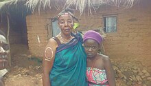
The Fuliiru people are a Bantu ethnic group predominantly inhabiting the east-central highlands of the Democratic Republic of the Congo (DRC). [2] [3] [4] They reside in the South Kivu Province, situated south of Lake Kivu and to the north and northwest of Uvira Territory, along the Ruzizi Plain near the border with Rwanda and Burundi, where a contingent of Fuliiru also resides. [5] [4] [6] According to the 2009 census, their population estimate exceeded 250,000, [2] while a 1999 estimate of Kifuliiru-language speakers placed the number at 300,000. [4] The Fuliiru are renowned for their skilled craftsmanship, particularly in the production of pottery and basketry. Their handcrafted baskets are highly coveted for their intricate designs and exceptional quality, and are frequently employed for storage, decoration, and even as musical instruments. [7]
The Fuliiru, like many other communities in the eastern part of the DRC, face ongoing challenges related to access to basic needs such as clean water, healthcare, and education. Parenthetically, they face issues related to land disputes, political marginalization, and human rights abuses. The Fuliiru women and girls are particularly vulnerable to sexual and gender-based violence amplified by the region's persistent armed conflicts, which have resulted in the prevalence of a pervasive culture of impunity. [8] [9] [10] [11]
At the onset of Belgian colonization, the establishment of chieftaincies was the primary method of governance, reflecting the decentralized nature of the colonial policy. These chieftaincies were established with due respect to the customs and traditions of each area, particularly based on three principal criteria defined and established by the Belgian colonial administration as essential conditions for the establishment of any chieftaincy. This was done to prevent lawlessness and to avoid violating the ancestral realities that had existed for millennia. Belgian colonial administration's criteria for establishing chieftaincies varied based on the region and the ethnic group in question. The establishment of chieftaincies was often accompanied by the appointment of a local chief (chefs de groupement) or a traditional ruler who was then tasked with maintaining law and order in the area, as well as ensuring the well-being of the local population. However, the establishment of chieftains was controversial, particularly in areas where multiple ethnic groups co-exist. There were instances where the colonial administration had to navigate complex power dynamics and determine which ethnic group or faction should hold the position of chief. This led to tensions between different ethnic groups and, in some cases, even armed conflict. Each ethnic group, however small, was assigned a chiefdom or a sector, if not, a grouping (groupement). The administrative territories were thus constituted within the limits of the chiefdom. The aim was to regroup "ethnic units" in their own geographical entities, but this led to such fragmentation that Orientale Province, which included the present-day Haut-Congo Province and the former Kivu, comprised up to 2,500 chiefdoms and groups. This approach by the Belgian colonial administration was based on the principle of indirect rule, which aimed to maintain control over the local population through traditional rulers. This system was viewed as a means of preserving the existing social and political structures of the colonized societies while ensuring their loyalty to the colonial authorities. However, this approach had some negative consequences. The proliferation of chiefdoms and groups created administrative difficulties for the colonial administration, making it challenging to maintain control over such a vast and diverse territory. Additionally, the creation of numerous chiefdoms and groups resulted in the fragmentation of ethnic groups, further exacerbating existing inter-ethnic tensions and conflicts. [12] [13] [14]
The Bembe and Buyu were both grouped in the Fizi Territory, which was further subdivided into five sectors, including Itombwe, Lulenge, Mutambala, Ndandja, and Tangani'a. Conversely, the Bafuliru Chiefdom borders Rwanda and Burundi through the Ruzizi Plain in the Uvira Territory. The sandy soil of the plain is suitable for growing crops such as groundnuts and cotton, with Luvungi, Lubarika, and Luberizi being particularly noteworthy areas for such cultivation. The Fuliiru collectivity is situated in two distinct types of plateaus: the Middle Plateau and the High Plateau. The Middle Plateau spans between Luvungi and Mulenge, with the altitude gradually increasing from 100 m to 1800 meters. This plateau comprises several groupements and villages, including Namutiri, Ndolera, Bulaga, Langala, Bushokw, Bushuju, Butole, Lemera, Bwesho, Katala, Mulenge, and others. It is also a favorable environment for growing cassava, coffee, banana, beans and maize. The High Plateau, on the other hand, form a watershed between the tributaries of the Ulindi and the Elila rivers, as well as the torrents that flow into the Ruzizi River and Lake Tanganyika. The High Plateaus are characterized by a rugged landscape with steep slopes and elevations ranging from 1800 to 2700 meters. The main villages located on the High Plateaus include Kagongo, Kishusha, Mulobela, and Kashekezi. These villages are known for their cool climate and are suitable for the cultivation of crops such as Irish potatoes and beans. This plateau is mostly used for grazing cattle and is less populated compared to the Middle Plateau. [15] [16]
Bafuliiru Chiefdom is subdivided in groupements (groupings) governed by customary chiefs (chefs de groupement) who are appointed by the paramount chief. Groupements are subdivided in localités (villages) which are also ruled by customary chiefs. The "chefferie" (chiefdom) of Bafuliru, the second and last chefferie in the Uvira Territory, is composed of five groupements: Runingu, Itara-Luvungi, Lemera, Muhungu and Kigoma. Each groupements are composed of a certain number of villages. [17]
The Muhungu groupement consists of the following villages:
The Kigoma groupement consists of the following villages:
The Runingu groupement consists of the following villages:
The Itara-Luvungi groupement consists of the following villages:
The Lemera groupement consists of the following villages:
Alternatively, Bafuliiru are not a homogeneous people; it is an amalgamation of people with diverse backgrounds, a kind of multicultural state, each with distinct origins. To be considered Mufuliiru one must be born into one of the thirty-seven progenitor families (clans) of the ethnic group.
The Fuliiru people are made up of about 37 clans: [18]
The origin of the Fuliiru people, like that of many ethnic groups in the Great Lakes region of Africa, is complex and multifaceted, shaped by migration, colonization, and conflict. The Fuliiru are believed to have originated from the Bantu-speaking people who migrated from West-Central Africa as part of the Bantu migration to Central, Eastern and Southern Africa. Most, however, are descended from Bantu groups that had settled in Southeast Africa after the initial expansion from Nigeria/Cameroon and settled in the eastern region of the Democratic Republic of Congo (DRC) in the 16th century. By the mid-1700s, the Bafuliru people had established a significant presence in the region surrounding Lake Tanganyika, specifically in the mountainous hinterland of South Kivu along the Ulindi River. [19] [20]
The Fuliiru have a unique history as one of the only highland Bantu groups to have formed a single, relatively small state that was highly centralized, [21] [5] founded by Kahambalingishi. [19] [22] According to oral tradition, the epicenter of the Fuliiru people's migratory dispersion in the middle Lwalaba Basin is located at the mouth of the Ulindi River. Bishikwabo Chubaka, a Shi historian, has written that after migrating from Lwindi around the Ulindi River in the mountainous hinterland, the Fuliiru and Vira people occupied Uvira. [20]
The preeminent genesis of the Bafuliiru Chiefdom, prior to its transformation into a political entity in the Belgian Congo, remains a subject of debate. Various hypotheses and conjectures have been proposed to explain its emergence.
According to Alfred Moeller de Laddersous, a colonial administrator who conducted extensive research on the Bantu communities residing in the eastern parts of the Belgian Congo, noted that the Bahamba dynasty embarked on a journey from the Lwindi directions, ultimately settling in the present-day Uvira Territory. Over time, the Bahamba dynasty changes their eponym from Bahamba (Wahamba) to Bafuliiru as a badge of their new identity. Moeller de Laddersous presents the Bahamba as a clan to which the founder of the customary "Bafuliro" Chiefdom belongs. [23] René Loons, a Belgian colonial administrator, classified the "Bafulero" as a region rather than an ethnic group and identified main factions within it: Bahamba, Batumba, Banakatanda, Balemera, among others. Loons further notes that these factions were organized into distinct traditional chiefdoms, but that the Bahamba faction dominated the others and held the management of the extended "Bafulero" customary chiefdom. According to Loons, the Bahamba clan was led by their chief Kikanwe to the present-day Uvira Territory. [19] [24] Kingwengwe Mupe, a Fuliiru historian and political analyst, argues that the Bahamba clan drove out (and possibly dethroned) the Balemera clan to occupy Uvira. According to Mupe's account, the Balemera clan can be traced back as the indigenous people who first inhabited the region. It is believed that the Bafuliiru Chiefdom, which had its stronghold in Lemera, a town situated in close proximity to the towns of Kasheke and Nyambasha, was the very heartland of their ancestral domain. Mupe's assertion thus hints at a deep-rooted history of the land, which speaks of the clan's enduring presence and cultural heritage. Despite this, there is some inconsistency in historical accounts, while some sources uphold the claim that the Bahamba clan played an instrumental role in founding the chiefdom, other narratives indicate that they supplanted the Balemera clan to establish their hegemony and royal lineage in the Bafuliiru Chiefdom. The latter account alludes to a process of usurpation and consolidation of power by the Bahamba clan. The co-existence of these contradictory accounts presents a complex picture of the historical evolution of the Bafuliiru Chiefdom, which demands a careful evaluation of the available sources to arrive at a plausible understanding of its past. [25] [26] [27]
While Loons attributes the chiefdom's founding to Kahambalingishi, a purported descendant of either Kikanwe or Namboko, other historians, such as Bishikwabo Chubaka, offer dissenting opinions. Chubaka postulates that Mulemera, the father and progenitor of the Bahamba dynasty, was the true architect of the chiefdom's rise to power. Chubaka believes that the Bafuliiru Chiefdom owes its inception to Mulemera, the progenitor of the Bahamba dynasty, who Chubaka contends was the true architect of the chiefdom's establishment. Chubaka's account posits that Mulemera played an instrumental role in the region's political development and was responsible for the consolidation of power. Chubaka also challenges the prevailing narratives that ascribe the chiefdom's founding to Kahambalingishi, whose lineage may have been less directly linked to the Bahamba dynasty. According to Chubaka, Kahambalingishi may have been a later ruler who inherited the chiefdom from Mulemera. This perspective is supported by Kingwengwe-Mupe, whose scholarship bolsters Chubaka's theory. Both historians draw on local accounts that lend credence to the idea that the Balemera clan were the original founders of the Bafuliiru Chiefdom. [19] [20] [28] [29]
In the late 1800s, various groups established themselves in Bafuliiru's lands in search of more arable soil. Led by Chief Ngabwe, the Barundi arrived from Burundi and assertively requested land from the Bavira, which they acquired between the Kiliba and Kawezi Rivers in exchange for ivory. As the tides of colonialism encroached across the region, it sparked wars of expansion on both sides. The Mwami of the Bafuliiru tenaciously claimed jurisdiction over certain villages in the Ruzizi Plain, while the Mwami of the Plain sought to establish his own authority. In the absence of a resolution, both chiefdoms resorted to warfare to vie for dominance. [30] [31]
After Chief Ngabwe consolidated his authority, Chief Kinyoni, a sub-chief under Burundian King Mwezi Gisabo from the Banyakarama Dynasty, established his own presence along the Ruzizi River's right bank. With swift prowess, he conquered southern villages like Kigoma, Mulenge, Kihanga, and Kalengera, expanding his dominion. He then launched a northward offensive, seizing Kiringye, Kabwiba, and Kigwena, nearly half of the Bafuliiru Chiefdom. [32] [30] [33] Facing significant territorial setbacks, the Bafuliiru Chiefdom rebuffed to capitulate and shoved forward to defend Bwesho. Led by the renowned leader Katangaza—a respected and influential figure from Bwesho—they rallied their forces and readied themselves to face the ineluctable advance of Chief Kinyoni and his dexterous warrior, Rubisha. Following their advent in Bwesho, Rubisha and his army encountered fierce resistance from Bafuliiru's army, resulting in Kinyoni being callously wounded and succumbed to a spear attack, including his son Rubwatara. His troops were subsequently expelled from every village they had captured. However, Kinyoni's troops managed to retreat to Luvungi, where they received support from Belgian colonists, who provided them with much-needed resources and supplies. This assistance allowed Kinyoni's troops to regroup and prepare for another attempt to conquer the Bafuliiru Chiefdom under the guidance of Katangaza. Despite the setback, the Bafuliiru troops pursued the retreating army and eventually expelled them from Kiringye. [34] [35] [30]
During the period of European penetration, the Banyarwanda, now commonly referred to as "Banyamulenge", emerged as a significant group in the region. The term "Banyarwanda" includes Hutus, Tutsis, and Twa people from Rwanda, who share the same common language and cultural heritage. In traditional Rwandan society, a feudal system existed in which Hutus were expected to leave their land available for Tutsis to graze their cows. This arrangement was enforced through a system of clientelism, where Tutsis loaned their cows to Hutus, who in turn were required to lend their land. Wealth was measured by the number of cows one possessed, and the richest Tutsis had the largest herds. At the top of this social hierarchy was the king, known as the " Mwami ", who was believed to possess divine powers and symbolized national unity. The king surrounded himself with Tutsi warlords and Hutu advisers who oversaw the distribution of land. Over time, the Tutsis established a system of serfdom that further marginalized the Hutu people. The Belgian colonial administration formalized and solidified this social system, ultimately leading to its being perceived as an ethnic divide between Hutus and Tutsis. [36] [37]
Between 1935 and 1955, the colonial power of Belgium in the Belgian Congo, which had guardianship over Ruanda-Urundi, officially encouraged and facilitated the immigration of Rwandans to Kivu. The Rwandans who migrated to Itombwe and Uvira during this time were predominantly Tutsis, and were favored by Belgian colonists due to their perceived superiority over the Hutus. [38] [39] [40]
Unusually in contacts with the Tutsi pastoralists from Banyarwanda group, the Fuliiru were neither conquered nor assimilated by them, but instead engaged in trade and occasional cattle raiding, leading to a deep and long-lasting social interaction that particularly impacted the Fuliiru people. The Banyarwanda later acquired Mulenge and Upper Sange from the Bafuliiru, and many of them settled in remote areas, including Kalamba, the Ruzizi Plain, and the Mulenge hills, before spreading to other parts of southern Kivu. The Belgian colonial administration, through the Mission d'immigration des Banyarwanda (MIB), facilitated the immigration of Rwandans to other parts of the Belgian Congo. Between 10,000 of Rwandan families were established in various regions of Belgian Congo, including the current Masisi Territory, the Bwito Chiefdom in the Rutshuru Territory, the Buzi-Ziralo grouping (groupement) in the Kalehe Territory, and Moba in Katanga. Other eastern regions such as Baraka and Marungu were also prepared to welcome the immigrants. This immigration policy was officially supported by the Belgian colonial government, which aimed to promote economic development and expand its control over the region. However, the influx of Rwandans led to tensions and conflicts with the local population, contributing to the ongoing ethnic tensions in the region. [41] [42] [43] [44]
Another factor that fostered this immigration of Rwandans was the recruitment of labor. Between the 1920s and 1950s, the colonial authorities in Belgian Congo actively recruited labor for large mining companies such as the Union Minière du Haut-Katanga and Kivu, particularly in Kalima and Kamituga. Many of these workers were Rwandan and were hired under contract, but they did not renounce their nationality or property, which remained in Rwanda. This immigration of Rwandans was also facilitated by the establishment of a chiefdom for the Banyarwanda after the arrival of numerous laborers brought by missionaries from neighboring Rwanda. [45] [46] [47]
Monsignor Faustin Ngabu, who was the president of the Episcopate of Congo and the bishop of the Diocese of Goma, acknowledged this historical event in his Easter pastoral letter of April 11, 1998 (French: Lettre Pastorale du 11 avril 1998).
In the letter, he stated: [48]
"With us, the main tribes or socio-political communities are called, I quote in alphabetical order: Bahavu, Bahunde, Banande, Banyanga, Barega, Bashi, Batembo. The Banyarwanda (Hutus and Tutsis), at least those who were, those who no longer want this title and those who still identify with this term, will want to understand that, in their case, the notion of "tribe" that they give themselves when they declare themselves Hutu and Tutsi cannot be understood in the same sense as that of the other communities mentioned above. Indeed, unlike that of the Hutus and Tutsis, the Havu, Hunde, Nande, Nyanga and Tembo communities each have their "Mwami" and their "Balu" or "Vakama", who are respectively their heads of state and leading executives in the precolonial context. These communities have their traditional values which are based on their languages, their territories, their customs and their own family, matrimonial, cultural, economic, political and religious organizations. For the case of Hutus and Tutsis, after 23 years already spent in this diocese, I am not able to say the same; how does each of these two Hutu and Tutsi groups constitute a tribe? It is up to them to understand it and convince others of it."
Since the 1960s, the cohabitation between the Banyarwanda and their Congolese neighbors has been plagued by problems, resulting in serious social tensions and violence. The escalation of these tensions and violence has led to lethal conflict of a social, cultural, economic, and security nature. Human rights organizations estimate that as of May 1996, the total number of deaths from the conflict stands around 70,000. [49]
The tension within Bafuliiru communities originates from the circumstance where Rwandan refugees, placed by the Belgian colonial administration and the United Nations in the eastern region of the Democratic Republic of the Congo, failed to uphold their designated status upon their arrival. Instead, they profess to be a newly established ethnic group known as "Banyamulenge" (literally 'those who live in Mulenge') through an entirely fabricated ethnogenesis. This emerging identity allowed them to lay claim to land and resources in the area, setting off conflicts with Fuliiru, who consider Mulenge as their ancestral homeland. [50] Following the nation's independence, the Banyarwanda, both Tutsi and Hutu, striven to establish recognition of their rights as "indigenous", vouching they possessed two "chefferies" (traditional chiefdoms) unrecognized by other ethnic groups. The Tutsi contended that their migration to the Congo Basin coincided with that of their Fuliiru, Vira, Bembe, and Lega counterparts, antedating the establishment of the Congo Free State, and consequently, should be entitled to equivalent ethnic rights as other communities. [51] In 1976, Faustin Tabazi Rugama, a Munyamulenge writer, attempted to legitimize the notion of a tribe called "Banyamulenge" that presumably held sway in Mulenge prior to the Berlin Conference. This "historical and scientific" apologia was unlikely intended to equate the "Banyamulenge" pseudo-tribe with the indigenous Congolese ethnic groups. Under the pressure of Gisaro Muhoza, a Rwandan university administrator and revered as the creator of the term "Banyamulenge", Rugama used the term in his thesis. [52] According to René Lemarchand, Banyamulenge constitute a "Rwandan-origin" community that established themselves in the Kivu region and were not known by this name during the colonial period. Using "Banyamulenge" as an ethnic identify, they campaigned for Congolese citizenship along with land possessed by indigenous Fuliiru populace. [39] [50]
In the early stages of the First and Second Congo Wars, a large contingent of Banyamulenge traversed into Bafuliiru communities to provide support to the Tutsi members of the Alliance of Democratic Forces for the Liberation of Congo (AFDLC). This influx of Banyamulenge played a pivotal role in enabling the AFDLC to seize control of the region from local chiefs and civilians who were uprooted from their ancestral lands against their will. The conflict was marked by brutal violence against the civilian population. On October 6, 1996, Banyamulenge rebels launched an assault on Lemera, a town situated in the north-western region of the Uvira Territory in South Kivu Province, resulting in the loss of several dozen lives. A total of 37 individuals, including two medical personnel, lost their lives in a hospital massacre. The armed assailants also pillaged the Lemera Hospital, the largest hospital in the region, located approximately 85 kilometers north of Uvira. [53] [54] [55]
In October 1998, a large number of people were brutally killed and displaced in Uvira, including the former Mulenge post chief, Ladislas Matalambu, who met his demise on October 1, 1998, at 7:30 p.m. Additionally, Alexis Deyidedi, the former administrative secretary of the Bafuliiru Chiefdom, was assassinated on October 2, 1998, at 11 p.m. The AFDL troops forced many Bafuliiru, Babembe, Warega, and Bavira individuals to flee and take refuge in neighboring countries such as Burundi, Tanzania, Uganda, Kenya, Zambia, and Mozambique. The displacement caused a ripple effect of the humanitarian crisis, with many facing severe challenges, including inadequate food and water supplies, inadequate medical facilities, and substandard living conditions. [56] [57] [58]
On May 14, 2000, the Rassemblement Congolais pour la Démocratie (RCD), a rebel group comprising mainly Banyamulenge child soldiers, perpetrated a massacre in the village of Katogota. The victims, numbering 375 in total, were primarily from the Bafuliiru community and were brutally murdered in cold blood. Some were mercilessly gunned down, while others suffered the grisly fate of having their throats slashed, and their bodies were thrown into the Ruzizi River to dispose of the evidence. The rebels also set fire to their homes, leaving many others to burn to death. The horrors of the Katogota massacre caused many to flee their homes, including up to 3,500 Congolese, mainly from the Bafuliiru and Babembe communities, who sought refuge in Burundi on June 10, 2004, to escape ongoing ethnic persecution. [59] [60] [61] [62]
The ongoing violence in the Bafuliiru communities has been exacerbated by political instability, resource scarcity, and deep-seated mistrust between the various groups. The situation is further complicated by the involvement of different armed groups, including militias and rebel factions, who compete for control over the region's resources and strategic locations. The proliferation of weapons and the absence of effective governance has allowed these groups to act with impunity, perpetrating horrific acts of violence against civilians and engaging in illicit activities, including the illegal exploitation of mineral resources. The impact of the conflict on the local population has been devastating, with many families displaced from their homes, and their livelihoods destroyed. The absence of adequate humanitarian assistance has only exacerbated the already dire situation, with many facing severe challenges, including food and water insecurity, inadequate medical care, and substandard living conditions. [63] [64] [65] [66]
In June 2014, 35 Fuliiru were killed in an attack on the town of Mutarule. The attack was believed to be ethnically motivated. The massacres were carried out mainly by Barundi and Banyamulenge rebel groups in a determined, planned, systematic and methodical manner, and were inspired by ethnic hatred. [67]
In January 2019, Twigwaneho and Ngumino, a Banyamulenge rebel groups, reportedly torched homes and property belonging to the Bafuliiru in the village of Babengwa. [68]
Between February 2019 and 2020, a large number of Bafuliiru were killed and displaced, leading them to the Bijombo camp in the South Kivu Province. Despite efforts to prioritize and act on serious cases in the immediate aftermath of the ethnic violence, there have been few prosecutions and fewer convictions, as well as a near total lack of investigations of those who organized and financed the violence. [69] [70]
The Fuliiru speak the Fuliiru language, a Bantu language. The Furiiru are connected to the Vira in a Furiiru-Vira culture cluster. [71] Both groups are interlacustrine, living between the African Great Lakes. Kifuliiru is the most widely spoken language in Uvira. It is estimated that Fuliiru has 60% lexical similarity with Kinyarwanda; 63% with Kirundi, and 80% with Shi language. More than half of the Uvira population are able to understand it. Many Fuliiru people also speak French, English, Lingala, Portuguese, Tshiluba, and Swahili. [72]
Music is part and parcel of the Bafuliiru culture. Bafuliiru music is characterized by a variety of traditional instruments such as the ngoma (drum), xylophone, and flute, which are used to create complex rhythms and melodies. The melodic strains of traditional instrument permeate the air, accompanied by the hypnotic rhythm of indigenous dance, which envelops the senses with its entrancing cadence. [73] The ngoma, in particular, is an essential instrument in Bafuliru music, and it is often played during various social and religious events. Bafuliru music also incorporates a form of call-and-response singing, where one group of singers will lead with a phrase, and another group will respond with a harmonized phrase. This technique creates a rich and layered sound that is both engaging and captivating. The themes of Bafuliru music often center around daily life, social issues, and cultural practices, such as marriage and initiation ceremonies. They also have songs that praise their leaders and ancestors, and these are often performed during political rallies and other communal events. [74] [75] [76] [77] [78] [79]
The Bafuliiru economy is almost exclusively agriculturally based, although they also own and raise cattle for milk and meat; [80] their homelands in the South Kivu Province are some of the most intensively farmed areas of the country. More than 90% of the population makes its livelihood by producing food crops or through industrial work involving the processing of crops. Agriculture contributes more than 19.04% of the nation's GDP. [81] The most fertile agricultural areas in the country are the mountain regions forming the Congo-Nile watershed and the central plateau, where two crops can normally be harvested each year. Principal food crops include cassava, corn, rice, plantains, and, to a lesser extent, bananas, beans, and peanuts. Principal export crops include coffee, cocoa, and palm oil. Many Bafuliiru people have ventured into business and politics. One of the notable figures in the Congolese government, Justin Bitakwira, is a member of the Bafuliiru community, having served as a former government Minister.
As per the oral tradition of Bafuliiru, cassava originated from Lwindi Chiefdom and was brought by the community during their exodus. Today, cassava remains a vital food source for the Bafuliiru population, particularly those residing in the Ruzizi Plain and the Bafuliiru Chiefdom as a whole. For Bafuliiru, owning a cassava field is considered a treasure trove, and it holds immense value for the community. Apart from its roots, cassava leaves are also edible, and its stems are used for wood. Cassava's significance goes beyond its nutritional value and practical applications. It plays a critical role in the administration of the community, serving as a source of tax revenue. 80% of all taxes collected come from cassava alone. This tax collection system enables tax collectors to fill the state coffers at both the community and zone levels, which, in turn, are used to support the local markets of the Bafuliiru Chiefdom. [82] [83]
The banana tree is a versatile crop that thrives in almost all areas of the Bafuliiru Chiefdom. It holds a significant role in the community's customs and traditions, particularly in marriage ceremonies. In Fuliiru lore, it is believed that one cannot undertake any strenuous activities without a banana. Specifically, during a wedding ceremony or at the end of mourning, a person intending to marry must present a pitcher of banana juice, known as "I mbindi ya mavuyoKudeterakwo" in Kifuliiru, which means "the jug of juice that enables you to speak." The jug of banana juice must be presented to the assembly, or the speaker cannot deliver a valuable message. Bafuliiru also make Kasigisi, an alcoholic drink made from bananas and sorghum, which is preserved for special occasions, as it can be used for both practical and cultural purposes. [84] [85] [86] [87]
The banana tree also holds ritual significance in the Bafuliiru Chiefdom during childbirth. It is believed that the umbilical cord of certain children is buried near the banana plantation, marking its importance as a symbol of fertility and growth. [87]
Rice grown in the Bufuliiru Chiefdom belongs to the genus Oryza and Ozyresatira species. Its different varieties are IR5, L9, and IRON 282. Rice is more of an income source than food for the Bafuliiru at the CEP Kabwe, Kaliri, and at the Community Development Center (CDC) base in Kiringye. For the Bafuliiru, rice is a cultural export. Consequently, it is not consumed much, although it is produced adequately. [88] [89] [90]
Beans are a prominent crop in the Bafuliiru Chiefdom, cultivated in the central region of Lemera, [91] stretching from Rubanga [91] to Mulenge. [92] The crop thrives in the temperate climate of high altitudes. Although beans are also exported like rice, they are sold at a lower price because Bafuliiru are not accustomed to consuming them as a staple food. To accompany a bean meal, it is customary to have cassava mbundu on the side. [93] The beans produced in the Bafuliiru Chiefdom are marketed in Bukavu and Uvira, while a significant quantity is exported to neighboring countries such as Burundi and Rwanda. [94] [95]
Despite being a major crop, both beans and rice are not consumed widely among the Bafuliiru Chiefdom. They serve as secondary food, with cassava being the staple food. This is due to the fact that cassava is more versatile, with its leaves and stems also being edible and useful for other purposes, such as wood. [94]
Corn is a extensively cultivated crop throughout the Bafuliiru Chiefdom. It is primarily grown in the Ruzizi Plain, particularly in Luvungi, and in the Hauts Plateaux, where it serves as the staple food. [96] [97] [98] Although many inhabitants of the Hauts Plateaux consume it, some Bafuliiru agriculturalists don't prefer corn. This could be because it is less versatile compared to other crops like cassava, which has multiple uses beyond consumption. Corn has a long history in the Bafuliiru Chiefdom, dating back to their migration from Lwindi Chiefdom. The crop has since become a fundamental component of their traditional cuisine and customs. For instance, roasted corn is often served during important community gatherings and celebrations. Incidentally, corn is also used as an offering in traditional rituals to the ancestors. [94] [98]
Peanuts are predominantly cultivated in the Bafuliru Chiefdom's Luvungi and Lubarika regions, but they can also be found in Lemera and Rubanga. Groundnuts from Bafuliiru are local delicacy and also exported to neighboring countries such as Rwanda and Burundi, providing a valuable source of income for local farmers. In addition, peanuts are also used in various traditional dishes, such as a sauce for cassava mbundu or as an ingredient in a stew. [94] Peanut farming in the Bafuliru Chiefdom is often a labor-intensive process that involves a considerable amount of manual labor, such as digging and weeding. Parenthetically, Bafuliiru also incorporated peanuts into their cultural practices, using them as offerings during traditional ceremonies and rituals. [94]
Two species of coffee exist in the Bafuliiru Chiefdom are Coffea arabica and Coffea canephora . The arabica species is the most common in the chiefdom. It is a culture of exporting coffee to Burundi. [94]
Traditional Fuliiru houses are huts made from wood, reeds, and straw and are shaped like beehives. High hedges serve as fences. In recent years, modern houses have been built with modern materials. [94]
Fuliiru crafts include pottery, woodwork, jewelry, metal work, and basket weaving. [99] [100]
The main priorities of women are childbearing, childcare, and housework. However, in many rural areas, women also work in agriculture through planting because their fertility is believed to be transferred to the seeds. Women are never seen holding high, respected positions, and men handle most of the production of goods.
Today, the preponderance of Bafuliiru living in the Democratic Republic of the Congo practice Christianity. [101] Nonetheless, many traditional beliefs and customs continue to be an important part of their cultural identity. [101] In their traditional beliefs, the Bafuliiru believe in a Supreme Being and a distant Creator God known as Rurema, who is considered to be the creator of everything on Earth. Rurema is seen as an invisible and elusive presence in the sky, and on earth, he is represented by priests who are considered to be mediators between the people and the divine. Among the Bafuliiru, the most important priests who represent Rurema are Mushabo, Budisi, and Mugajalugulu. These priests play a crucial role in the community, as they are believed to have the ability to communicate with Rurema and provide guidance to the people. They are consulted on various matters, including spiritual, social, and cultural issues, and their opinions are highly honoured. The Bafuliiru people also present offerings and sacrifices to the priests, which are believed to help them connect with Rurema and receive his blessings. [94] [102]
In the past, Fuliiru wore skirts of cloth made from tree bark, and cloaks made of animal hides. These have long been replaced by Western-style clothing. However, handmade beaded necklaces and bracelets are still worn. The woven fabrics, adorned with intricate patterns of vivid hues have honed their craft over generations.
South Kivu is one of 26 provinces of the Democratic Republic of the Congo (DRC). Its capital is Bukavu.
Banyamulenge is a community from the Democratic Republic of the Congo's South Kivu province. The Banyamulenge are culturally and socially distinct from the Tutsi of South Kivu, with most speaking Kinyamulenge, a mix of Kinyarwanda, Kirundi, Ha language, and Swahili. Banyamulenge are often discriminated against in the DRC due to their Tutsi phenotype, similar to that of people living in the Horn of Africa, their insubordination towards colonial rule, their role in Mobutu's war against and victory over the Simba Rebellion, which was supported by the majority of other tribes in South Kivu, their role during the First Congo War and subsequent regional conflicts (Rally for Congolese Democracy–Goma, Movement for the Liberation of the Congo, National Congress for the Defence of the People, and more importantly for the fact that two of the most influential presidents of their country declared them as enemy of the State both in 1996 and 1998.
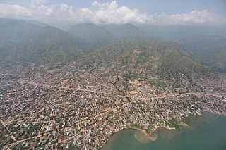
Uvira is a city strategically located in the South Kivu Province of the eastern region of the Democratic Republic of the Congo (DRC). It is situated between Lake Tanganyika and the Mitumba Mountains, spanning approximately 16 square kilometers.
Minembwe is a cluster of several villages located in the highlands of the Lulenge, within the Fizi Territory of South Kivu Province in the Democratic Republic of the Congo (DRC). It is situated at an altitude of about 2,500 meters above sea level, in a hilly and mountainous region covered with forests, which provides fertile land for agriculture. It lies approximately 150 kilometers southward of Bukavu. The region is interspersed with myriad streams and rivers that flow towards Lake Tanganyika, the second-deepest lake in the world.
Mulenge is a village encircled by hills in the Bafuliiru Chiefdom, located in the Uvira Territory of South Kivu Province, Democratic Republic of the Congo (DRC). It is situated on the high plateaus of the Itombwe massif, overlooking the locality of Uvira. The area has conventionally been inhabited by various ethnic groups, including the remnants of the autochthonous population of African Pygmies, as well as Bantu ethnic groups such as the Mbuti, Fuliiru, and Nyindu. The region boasts high agricultural productivity, with two harvests typically achievable each year.
Runingo, commonly known as Runingu, is one of the groupements (groupings) that constitutes the Bafuliiru Chiefdom in the Uvira Territory of the South Kivu Province in the eastern part of the Democratic Republic of the Congo (DRC). It is situated near the border with Burundi, along National Highway 5, to the north of Butaho.
Uvira Territory is a territory in South Kivu, Democratic Republic of the Congo. It is bordered by Walungu Territory to the north, Mwenga Territory to the west, Fizi Territory to the south, and Burundi and Lake Tanganyika to the east. Its capital is Uvira.
Luvungi, also known as Itara-Luvungi, is one of the groupements (groupings) within the Bafuliiru Chiefdom in the Uvira Territory of the South Kivu Province in the eastern Democratic Republic of the Congo (DRC). Situated on the Ruzizi Plain, it lies at the borders of Uvira Territory and Walungu Territory, in close proximity to the frontiers of Rwanda and Burundi. Luvungi is home to a population of approximately 85,000 individuals, predominantly consisting of Fuliru agriculturalists who play a vital role in the local community. There's also has a small population of Vira, Bembe, Lega, Shi, Burundians and Banyamulenge. Its economy is founded mainly on subsistence agriculture and the artisanal mining of cassiterite, an ore of tin.
Lemera is one of the groupements (groupings) within the Bafuliiru Chiefdom, located in the Uvira Territory of the South Kivu Province in the eastern part of the Democratic Republic of the Congo (DRC). It is situated in the northwestern part of the Uvira Territory, approximately 60 kilometers north of Bukavu and 90 kilometers southwest of the border with Rwanda and Burundi. Lemera is in close proximity to several villages, including Kasheke, Nyambasha, Luzira, Lukayo, Kajuju, Lushasha, and Ihusi.
Lulenge constitutes one of the four sectors within the Fizi Territory of South Kivu Province, situated in the eastern region of the Democratic Republic of the Congo (DRC). Geographically positioned adjacent to the Kiloba and Makena villages at an elevation of 943 meters, the sector's administrative center is Kilembwe. Lulenge is delineated to the north by the Itombwe sector and Mwenga Territory, to the east by Lake Tanganyika and the Mutambala sector, to the south by the N'gangya sector, and to the west by Shabunda Territory.
Sange is a village located in the Bafuliiru Chiefdom in the Uvira Territory of the South Kivu Province, Democratic Republic of the Congo. It is situated 24 km from the Burundian border, at 1,021 meters altitude.
Katogota is a village located in the Itara-Luvungi grouping within the Bafuliiru Chiefdom in Uvira Territory of the South Kivu Province in the Democratic Republic of the Congo (DRC). Situated approximately 60 km south of Bukavu, Katogota is in close proximity to the Kamonyi and Rusagara villages, near the border regions of Rwanda and Burundi.
Kamanyola is one of the groupements (groupings) within the Ngweshe Chiefdom of the Walungu Territory. It is located in the Ruzizi Plain in the South Kivu Province of the Democratic Republic of the Congo (DRC), sharing a border with Rwanda and Burundi. Kamanyola stands at a height of 901 meters and is closely situated to the suburb of Mwaro and the village of Mubombo.
Bwegera is a village in the Bafuliiru Chiefdom in the Uvira Territory of South Kivu Province, Democratic Republic of the Congo. Bwegera has an elevation of 952 meters and is situated in the vicinity of the Kakamba and Nyaruhuhuma villages. The region It's crossed by Lake Tanganyika, providing a vital source of water and transportation for the local inhabitants. Bwegera is rich in building materials such as rubble, sand, and baked bricks, making it an ideal location for construction and development. The region also encompasses a vast rural area where agriculture, animal breeding, and fishing are the primary means of livelihood.
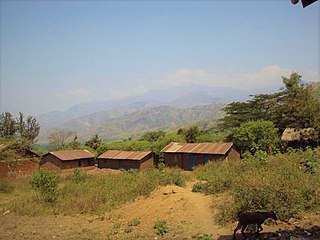
Lubarika is a village situated in the hills and high plateaus of Bafuliiru Chiefdom in Uvira Territory, located in the South Kivu Province in the eastern part of the Democratic Republic of Congo (DRC). It sits at an elevation of 969 meters above sea level and is near the villages of Murunga and Nyakagobe II. Lubarika is a predominantly agricultural region with large hectares used for subsistence agriculture. Agriculture is practiced by an extensive segment of the population. The products grown are mainly intended for domestic consumption and commercialization. Moreover, fishing is carried out artisanally in Lake Tanganyika by the local population.
Mutambala is a sector that constitutes one of the four sectors in the Fizi Territory of the South Kivu Province in the eastern part of the Democratic Republic of the Congo. Mutambala is situated near Lake Tanganyika, in the west by the Lulenge sector, in the north by the Tangani'a sector, and in the south by the Ngandja sector. It has a surface area of 777 km 2. The sector consists of five groupings (groupements), including the Basimukindja groupings, the Batombwe groupings, and the Babwari groupings.
The Ruzizi Plain is a valley situated between the Mitumba mountain chain and the Ruzizi River. It serves as a natural border, separating the Democratic Republic of the Congo (DRC) from Burundi and Rwanda on the other side. The Ruzizi Plain is an integral part of the larger Western Rift Valley, which stretches across several African countries. It is traversed by the Ruzizi River, which flows from Lake Kivu through the plain and into Lake Tanganyika. It covers an area of 175,000 hectares divided between Burundi, Rwanda and the DRC. In Burundi, the plain extends to the northern sector of Imbo. It is bounded by parallels 2°36′ and 3°26′ south latitude and by meridians 29°00′ and 29°26 east longitude—an area of 1025 km2. The Congolese side is bounded to the north by the plain of Bugarama (Rwanda), to the east by the plain of Imbo (Burundi), to the West by the chain of Mitumba and to the South by Lake Tanganyika. The region covers thus about 80,000 hectares with 80 kilometers in length.
Kidote, also known as Kidoti, is a small village situated in the middle plateaux of Lemera, within the Bafuliiru Chiefdom of the Uvira Territory in the South Kivu Province in the eastern region of the Democratic Republic of the Congo (DRC). It also serves as a camp for Congolese Internally Displaced People (IDPs) from various regions of Bwegera.
Kiringye is a village situated in the Lemera groupement within the Bafuliiru Chiefdom, which is part of Uvira Territory in the South Kivu Province in the eastern region of the Democratic Republic of the Congo (DRC). The village is located at an elevation of 928 meters and is in close proximity to the localities of Luburule and Karenzu.
The Bafuliiru Chiefdom, also spelled as Chefferie des Bafulero, is a chiefdom located in the Democratic Republic of the Congo (DRC). It is situated in the Uvira Territory, which is part of the South Kivu Province in eastern DRC.
{{cite book}}
: CS1 maint: location missing publisher (link){{cite book}}
: CS1 maint: others (link){{cite book}}
: CS1 maint: location missing publisher (link){{cite book}}
: CS1 maint: location (link) CS1 maint: location missing publisher (link){{cite book}}
: CS1 maint: location missing publisher (link){{cite book}}
: CS1 maint: others (link)