Big Kangaroo

Last updated
Big Kangaroo
Big Kangaroo on Kangaroo Ridge.jpg
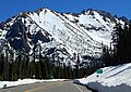
Big Kangaroo seen from Wallaby Peak
Highest point
Elevation 8,280 ft (2,520 m) [1]
Prominence 1,000 ft (300 m) [1]
Coordinates 48°31′09″N120°37′03″W / 48.519243°N 120.6175°W / 48.519243; -120.6175
Geography
USA Washington relief location map.jpg
Red triangle with thick white border.svg
Big Kangaroo
Location in Washington
Location Okanogan County, Washington
Parent range Cascade Range
Topo map USGS Silver Star Mountain
Geology
Age of rock 45 million years old
Type of rock (Rapakivi texture) granite
Climbing
First ascent brothers Helmy and Fred Beckey, Walt Varney, June 21, 1942 [2]

Big Kangaroo is an 8,280+ ft (2,520+ m) granitic mountain located in Okanogan County, Washington. The mountain is part of the Methow Mountains in the Cascade Range. Big Kangaroo is the high point of Kangaroo Ridge which is about two miles east and within view of Washington Pass. Its nearest higher peak is Snagtooth Ridge, 1.7 mi (2.7 km) to the northeast. [1] Precipitation runoff from the peak drains into Early Winters Creek which is a tributary of the Methow River.

Contents

Climate

Big Kangaroo is located in the marine west coast climate zone of western North America. [2] Most weather fronts originate in the Pacific Ocean, and travel northeast toward the Cascade Mountains. As fronts approach the North Cascades, they are forced upward by the peaks of the Cascade Range, causing them to drop their moisture in the form of rain or snowfall onto the Cascades. As a result, the west side of the North Cascades experiences high precipitation, especially during the winter months in the form of snowfall. [2] During winter months, weather is usually cloudy, but, due to high pressure systems over the Pacific Ocean that intensify during summer months, there is often little or no cloud cover during the summer. [2] Because of maritime influence, snow tends to be wet and heavy, resulting in high avalanche danger. [2]

Geology

The North Cascades features some of the most rugged topography in the Cascade Range with craggy peaks, ridges, and deep glacial valleys. Geological events occurring many years ago created the diverse topography and drastic elevation changes over the Cascade Range leading to the various climate differences. These climate differences lead to vegetation variety defining the ecoregions in this area.

The history of the formation of the Cascade Mountains dates back millions of years ago to the late Eocene Epoch. [3] With the North American Plate overriding the Pacific Plate, episodes of volcanic igneous activity persisted. [3] In addition, small fragments of the oceanic and continental lithosphere called terranes created the North Cascades about 50 million years ago. [3]

During the Pleistocene period dating back over two million years ago, glaciation advancing and retreating repeatedly scoured the landscape leaving deposits of rock debris. [3] The U-shaped cross section of the river valleys is a result of recent glaciation. Uplift and faulting in combination with glaciation have been the dominant processes which have created the tall peaks and deep valleys of the North Cascades area.

See also

Related Research Articles

<span class="mw-page-title-main">Silver Star Mountain (Okanogan County, Washington)</span> Mountain in Washington, United States

Silver Star Mountain is an 8,876-foot (2,705-metre) mountain located in Okanogan County, Washington. The mountain is part of the Methow Mountains, a subset of the Cascade Range. Silver Star is the dominant feature in the Washington Pass area and visible from the North Cascades Highway. It was first climbed by Lage Wernstedt in 1926.

<span class="mw-page-title-main">Golden Horn (Washington)</span> Mountain in Washington (state), United States

Golden Horn is an 8,366-foot (2,550-metre) mountain summit located in Okanogan County in Washington state. It is part of the Okanogan Range which is a sub-range of the North Cascades Range. Golden Horn is situated north of Methow Pass at headwaters of the Methow River, on land administered by the Okanogan–Wenatchee National Forest. It ranks as the 95th-highest summit in Washington. The nearest higher peak is Tower Mountain, 1.67 miles (2.69 km) to the southeast. The first ascent of Golden Horn was made by Fred Beckey, Keith Rankin, and Charles Welsh on September 18, 1946.

<span class="mw-page-title-main">Mount Hardy (Washington)</span> Mountain in Washington (state), United States

Mount Hardy is an 8,080+ ft mountain summit located on the common border of Okanogan County with Skagit County in Washington state. It is part of the Okanogan Range which is a sub-range of the North Cascades Range. Mount Hardy is situated west of Methow Pass, at headwaters of the Methow River, on land administered by the Okanogan–Wenatchee National Forest. The nearest higher peak is Golden Horn, 1.75 miles (2.82 km) to the northeast. Mount Hardy can be seen from the North Cascades Highway which traverses below the southwestern base of the mountain. This mountain's name was officially adopted in 1973 by the United States Board on Geographic Names.

<span class="mw-page-title-main">Hinkhouse Peak</span> Mountain in Washington, United States of America

Hinkhouse Peak is a 7,560-foot-elevation (2,300-meter) mountain summit located on the shared border of Okanogan County and Chelan County in Washington state. It is part of the Okanogan Range which is a sub-range of the North Cascades Range. Hinkhouse Peak is situated on land administered by the Okanogan–Wenatchee National Forest. The nearest higher neighbor is Liberty Bell Mountain, 1.52 miles (2.45 km) to the south. Hinkhouse Peak is situated north of Washington Pass, at the east end of a high ridge which connects to Cutthroat Peak. A high ridge extending northeast connects it to Constitution Crags. Most precipitation runoff from the peak drains into Early Winters Creek which is a tributary of the Methow River, but the south slope drains into a tributary of the Chelan River. Topographic relief is significant as it rises nearly 3,200 feet above Early Winters Creek in approximately one mile.

<span class="mw-page-title-main">Snagtooth Ridge</span>

Snagtooth Ridge is a jagged granitic ridge located in Okanogan County of Washington state. It is part of the Methow Mountains which is a sub-range of the North Cascades. Snagtooth Ridge is situated between Silver Star Mountain and Kangaroo Ridge on land administered by the Okanogan–Wenatchee National Forest.

<span class="mw-page-title-main">Vasiliki Ridge</span>

Vasiliki Ridge is a three-mile-long ridge located in Okanogan County of Washington state. It is part of the Methow Mountains which is a sub-range of the North Cascades. Vasiliki Ridge is situated north of Silver Star Mountain on land administered by the Okanogan–Wenatchee National Forest. The name Vasiliki was recommended by climber Fred Beckey who made the first ascent in 1952. Vasiliki Ridge can be seen from Washington Pass and from the North Cascades Highway.

<span class="mw-page-title-main">Delancy Ridge</span> Ridge in Washington, US

Delancy Ridge is a four-mile-long ridge located in Okanogan County of Washington state. It is part of the Okanogan Range which is a sub-range of the North Cascades. Delancy Ridge is situated east of The Needles on land administered by the Okanogan–Wenatchee National Forest. Delancy Ridge can be seen from Washington Pass and from the North Cascades Highway which follows the length of its southern base. Precipitation runoff from the north side of the ridge drains into the Methow River, whereas the south side drains into Early Winters Creek which is a tributary of the Methow River.

<span class="mw-page-title-main">Stiletto Peak</span> Summit in North America

Stiletto Peak is a 7,660 ft summit located in the Methow Mountains, a sub-range of the North Cascades in Washington state. It is situated in the Stephen Mather Wilderness on a ridge which also has Switchblade Peak and Jackknife Peak to its east. Stiletto Peak is also located on the boundary of North Cascades National Park, 2.24 miles (3.60 km) due north of Hock Mountain. Precipitation runoff on the north side of the mountain drains into Bridge Creek via Copper Creek, whereas the south side of the mountain drains into the East Fork Bridge Creek.

<span class="mw-page-title-main">Blue Lake Peak</span> Mountain in Washington (state), United States

Blue Lake Peak is the unofficial name of a 7,800+ ft summit in the North Cascades Range in the U.S. state of Washington. It is located in the Okanogan–Wenatchee National Forest on the shared border of Okanogan County and Chelan County. It is situated south of Early Winters Spires, Liberty Bell Mountain, and Washington Pass. Blue Lake is set below its west slope, and Stiletto Peak is to its south. Blue Lake Peak can be seen from the North Cascades Highway at the Blue Lake Trailhead. Precipitation runoff from Blue Lake Peak drains into tributaries of the Chelan River and Methow River.

<span class="mw-page-title-main">Holliway Mountain</span> Mountain in Washington (state), United States

Holliway Mountain is an 8000+ ft granite summit located in Okanogan County in Washington state. It is part of the Okanogan Range which is a sub-range of the North Cascades Range. Holliway Mountain is situated near the headwaters of the Methow River on land administered by the Okanogan–Wenatchee National Forest. The nearest higher peak is Golden Horn, 0.91 miles (1.46 km) to the south. Azurite Peak is located three miles to the north-northwest.

<span class="mw-page-title-main">Molar Tooth (Washington)</span> Mountain in Washington (state), United States

Molar Tooth is a 7,547-foot-elevation (2,300-meter) granite summit located on the shared border of Okanogan County and Skagit County, in Washington state. The mountain is part of the Okanagan Range which is a subset of the Cascade Range. Set in the Okanogan–Wenatchee National Forest, Molar Tooth is situated south of Cutthroat Pass, and 0.57 miles (0.92 km) north of Cutthroat Peak, which is also its nearest higher peak. The easiest climbing route is class 4 scrambling, but solid rock provides class 5 technical routes as well. Precipitation runoff from the east side of Molar Tooth drains into tributaries of the Methow River, whereas runoff from the west side drains into tributaries of the Skagit River.

<span class="mw-page-title-main">Constitution Crags</span> Mountain in Washington (state), United States

Constitution Crags is a 6,978-foot-elevation summit located in Okanogan County of Washington state. It is part of the Okanogan Range which is a sub-range of the North Cascades. Constitution Crags is situated west of Silver Star Mountain on land administered by the Okanogan–Wenatchee National Forest. The nearest higher neighbor is Hinkhouse Peak, 0.62 mile to the southwest. Washington Pass is located over a mile south of Constitution Crags, and the North Cascades Highway traverses below the east face of Constitution Crags. Like many North Cascade peaks, Constitution Crags is more notable for its large, steep rise above local terrain than for its absolute elevation. Precipitation runoff from the peak drains into Early Winters Creek which is a tributary of the Methow River.

<span class="mw-page-title-main">Copper Benchmark</span> Mountain in Washington (state), United States

Copper Benchmark, also known as Copper Point, is a mountain summit located in the Methow Mountains, a sub-range of the North Cascades, on the shared border between Okanogan County and Chelan County in Washington state. Copper Benchmark is situated on the crest of the Cascade Range between Kangaroo Pass and Copper Pass. It was used as a triangulation station for early surveying. It is protected by the Lake Chelan-Sawtooth Wilderness within the Okanogan–Wenatchee National Forest. Copper Benchmark has a subsidiary peak, Pica Peak (elevation 7,565 feet, which is 0.52 miles northwest of the summit. The nearest higher peak is Wallaby Peak, 0.9 miles to the northeast. Precipitation runoff on the north side of the mountain drains into the Methow River via Early Winters Creek, whereas the other sides of the mountain drain into tributaries of the Chelan River.

<span class="mw-page-title-main">Wallaby Peak</span> Mountain in Washington (state), United States

Wallaby Peak is a 7,995-foot (2,437-metre) mountain summit located on the boundary line of the Lake Chelan-Sawtooth Wilderness, in Okanogan County, Washington. The mountain is part of the Methow Mountains, which are a subset of the Cascade Range. Wallaby Peak is situated on Kangaroo Ridge which is approximately two miles east and within view of Washington Pass. The nearest higher peak is Big Kangaroo, 0.86 mi (1.38 km) to the north. Precipitation runoff from the peak drains into Early Winters Creek, Cedar Creek, and North Fork Twisp River, all of which are tributaries of the Methow River.

<span class="mw-page-title-main">Half Moon (Washington)</span> Mountain in Washington (state), United States

Half Moon is a 7,960+ ft summit located in Okanogan–Wenatchee National Forest, in Okanogan County, of Washington state. The mountain is part of the Methow Mountains, which are a subset of the Cascade Range. Half Moon is situated on Kangaroo Ridge which is approximately two miles east and within view of the North Cascades Highway at Washington Pass. Its nearest higher peak is Wallaby Peak, 0.23 mi (0.37 km) to the south. Precipitation runoff from the peak drains into Early Winters Creek, and Cedar Creek, both of which are tributaries of the Methow River.

<span class="mw-page-title-main">Switchback Peak</span> Mountain in Washington (state), United States

Switchback Peak is an 8,321-foot (2,536-metre) mountain summit located in the Methow Mountains, a subset of the North Cascades in Washington state. It is the eighth-highest peak in the Methow Mountains, and ranks 95th in the state of Washington. Switchback Peak is set on Sawtooth Ridge, on land managed by the Okanogan-Wenatchee National Forest. Other peaks of Sawtooth Ridge include Oval Peak, Star Peak, Hoodoo Peak, Courtney Peak, Mount Bigelow, and Martin Peak, which is the nearest higher neighbor, 0.96 miles (1.54 km) to the north.

<span class="mw-page-title-main">Pica Peak</span> Mountain in Washington (state), United States

Pica Peak is a 7,565-foot (2,306-metre) summit located in the Methow Mountains, a subset of the North Cascades, on the shared border between Okanogan County and Chelan County in Washington state. Pica Peak is situated 1.7 mi (2.7 km) southeast of Washington Pass, within the Okanogan-Wenatchee National Forest. The nearest higher neighbor is Copper Benchmark, 0.58 miles (0.93 km) to the southeast, and Blue Lake Peak is set 0.93 miles (1.50 km) to the west-northwest. Although modest in prominence, relief is significant as the peak rises 2,000 feet above Early Winters Basin in only 0.5 mi (1 km). Precipitation runoff on the north side of the mountain drains to the Methow River via Early Winters Creek, whereas the south side of the mountain drains into tributaries of the Stehekin River.

<span class="mw-page-title-main">Sherman Peak</span> Mountain in Washington (state), United States

Sherman Peak is an 8,204-foot (2,501-metre) mountain summit located in western Okanogan County in Washington state. It is part of the Okanogan Range which is a subset of the North Cascades. This remote mountain is on Isabella Ridge, 10.5 mi (16.9 km) north-northeast of Mazama, on land administered by the Okanogan–Wenatchee National Forest. The nearest higher neighbor is Big Craggy Peak, 2 miles (3.2 km) to the north. Precipitation runoff from Sherman drains into tributaries of the Methow River.

<span class="mw-page-title-main">Hock Mountain</span> Mountain in Washington (state), United States

Hock Mountain is a 7,750-foot-elevation summit located in the Methow Mountains, a subset of the North Cascades in Washington state. It is situated on the triple-shared boundary of North Cascades National Park, Lake Chelan-Sawtooth Wilderness, and Lake Chelan National Recreation Area, as well as the shared border between Chelan County and Okanogan County. Additionally, it lies one mile southwest of Twisp Mountain, and 2.24 miles (3.60 km) due south of Stiletto Peak, the nearest higher neighbor. The north face is steep, granitic rock, but the west slope is more moderate, allowing a scramble ascent. Precipitation runoff from the north and west sides of Hock drains to the Stehekin River via Bridge Creek, whereas the south and east sides of the mountain drain into the South Fork Twisp River.

<span class="mw-page-title-main">Mother Lode (Methow Mountains)</span> Mountain in Washington (state), United States

Mother Lode is a 7,905-foot-elevation (2,409-meter) mountain summit located in the North Cascades, in Okanogan County, Washington. It is situated in the Lake Chelan-Sawtooth Wilderness, on land managed by Okanogan–Wenatchee National Forest. The mountain is part of the Methow Mountains, which are a subset of the Cascade Range, and the peak is approximately two miles east of the crest of the range. Mother Lode is set approximately six miles south of Washington Pass, and the nearest higher neighbor is Gilbert Mountain, three miles to the northeast. Topographic relief is significant as the north aspect rises 3,500 feet above the South Fork Twisp River in one mile. The peak was climbed in 1983 by Rick La Belle and Glen Sterr via the north ridge, and the northeast ridge was climbed in 1985 by Carl and Gordon Skoog. Precipitation runoff from the peak drains into tributaries of Twisp River, which in turn is a tributary of the Methow River.

References

  1. 1 2 3 "Big Kangaroo, Washington". Peakbagger.com.
  2. 1 2 3 4 5 Beckey, Fred W. (2009). Cascade Alpine Guide: climbing and high routes, Vol. 3, Rainy Pass to Fraser River (3rd ed.). Mountaineers Books. p. 302. ISBN   978-1-59485-136-0.
  3. 1 2 3 4 Kruckeberg, Arthur (1991). The Natural History of Puget Sound Country. University of Washington Press.