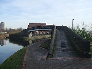
Birchills Junction

Last updated

Birchills Junction
Birchills Junction.jpg
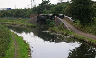
Birchills Junction with the Walsall Canal passing through the bridge to the right.
Specifications
StatusOpen
Navigation authority Canal & River Trust
History
Date completed1798
Date closed1799
Date restored1841
Birchills Junction in context
BSicon uDOCKf.svg
Anglesey Basin
BSicon uFABZgl+l.svg
BSicon gCONTfq.svg
Ogley Junction, Lichfield Canal
BSicon gKMW.svg
BSicon uSTR.svg
Cannock Extension Canal
BSicon uSTR.svg
BSicon uSTR+l.svg
BSicon uSTRq.svg
BSicon uFABZgr+r.svg
Catshill Junction
BSicon uSTRl.svg
BSicon uFABZgr+r.svg
BSicon uSTRl.svg
BSicon uSTR+r.svg
Pelsall Junction
BSicon uSTR.svg
BSicon uKMW.svg
Daw End Branch
BSicon uFABZgl+l.svg
BSicon uSTR+r.svg
BSicon uENDE.svg
Birchills Junction (left)
BSicon uSTR+l.svg
BSicon uSTRr.svg
BSicon uLOCKSu.svg
BSicon uLOCKSu.svg
Walsall and Rushall Locks
BSicon uSTR.svg
BSicon uKMW.svg
BSicon uKMW.svg
Walsall and Rushall Canals
BSicon uSTR.svg
BSicon uFABZgl+l.svg
BSicon uSTR+r.svg
BSicon uSTR.svg
Tame Valley Junction
BSicon uSTR.svg
BSicon uSTR.svg
BSicon uFABZgl+l.svg
BSicon uSTRr.svg
Rushall Junction
BSicon uKMW.svg
BSicon uSTR.svg
BSicon uSTR.svg
Wyrley and Essington Canal
BSicon uSTR.svg
BSicon uKMW.svg
BSicon uKMW.svg
Walsall and Tame Valley Canals
BSicon uSTR.svg
BSicon uSTR.svg
BSicon uCONTf.svg
To Salford Junction
BSicon uSTR.svg
BSicon uCONTf.svg
To Ryder's Green Junction
BSicon uFABZqlr.svg
BSicon uSTR+r.svg
Horseley Fields Junction
BSicon uSTRl.svg
BSicon uSTRq.svg
BSicon uCONTfq.svg
BCN Main Line

Birchills Junction (grid reference SK002000 ) is the canal junction at the northern limit of what is now called the Walsall Canal where it meets the Wyrley and Essington Canal main line, near Walsall, West Midlands, England. It opened in 1798, but lasted for little more than a year, until it was re-opened in 1841 when a connecting link was built to the Birmingham Canal Navigations' southern route to Walsall.

Contents

History

The Wyrley and Essington Canal was authorised by an Act of Parliament in 1792, as a way of delivering coal from the Wyrley and Essington coal fields to the towns of Wolverhampton to the west and Walsall to the east. The main line was to run from the coal fields down to Sneyd Junction, and continue westwards to reach the Birmingham Canal Navigations at Horseley Fields Junction, near Wolverhampton. A branch would run from Sneyd Junction eastwards to Birchills. Before construction work was complete, the company obtained a second Act in 1794, which authorised a line from near Birchills to Brownhills, passing through Bloxwich and Pelsall. From Brownhills it would drop through 30 locks on its route past Lichfield to reach Huddlesford Junction. This was on a route authorised by the Coventry Canal Act, but built by the Birmingham and Fazeley Canal, as part of a deal to ensure that that canal was part of a larger network and would therefore be profitable. The Wyrley and Essington main line was now considered to be the route from Horseley Fields to Birchills Junction via Sneyd Junction, and on to Huddlesford Junction. The route which climbed Wyrley Bank to the coal mines was now a branch, as was the final short section of the route between Birchills Junction and the basin where the original branch terminated. [1]

To the south of the junction, another canal had been built in stages. Leaving the Birmingham Canal Navigations main line at Pudding Green Junction, the first part had been built by the Wednesbury Canal and opened in 1769. The next section had been built under powers contained in the Birmingham and Fazeley Canal Act, and ran from Riders Green Junction to Broadwaters, a coal mining complex near Moxley. This opened in 1786. [2] Plans for a link from Broadwaters to Walsall were proposed in 1793, but the route was not built until 1799. [3] The Wyrley and Essington main line opened on 8 May 1797, and their northern branch to Walsall opened the following year. The southern route from Broadwaters opened in June 1799, and after that date, the northern branch was barely used. John Farley visited the area in 1809, and reported that the northern branch was dammed off, and had been dry for some time. Although a Mr. Willoughby attempted to get the branch reopened in 1818, no further action took place, [4] until after the merger of the Wyrley and Essington Canal and the Birmingham Canal Navigations. A short connecting link was then built in 1841, with eight locks, to join the southern and northern branches and create a through route. The junction became operational again in 1841, and the canal to the south of it is now normally considered to be part of the Walsall Canal. [2]

Location

From the junction, the Wyrley and Essington Canal to the west is level for its entire 8 miles (13 km) to Horseley Fields Junction, where it joins the Birmingham Canal Navigations main line. In the other direction, it passes under Green Lane Bridge, which carries the A34 road over the canal, and is level for 9.3 miles (15.0 km) to Chasewater Reservoir. [5] Ogley Junction, from where the former main line to Huddleford ran, is just over 1 mile (1.6 km) from the end, but the route was abandoned in 1954. However, it may be reopened as the Lichfield Canal, for a restoration group have been working on it for some years. [6] The towpath on the Wyrley and Essington Canal is on the southern bank, and it crosses the start of the Walsall Canal. Immediately afterwards, Stephenson Avenue Bridge crosses, and the canal then passes over an aqueduct, which once passed over a railway line but is now dismantled. The top lock of the eight Walsall Locks, which lower the level by 65 feet (20 m), is reached after 0.4 miles (0.64 km). At the bottom of the flight is Walsall Junction, where the Walsall Canal continues straight ahead and the short Walsall Town Arm turns to the east. [7]

See also

Bibliography

Related Research Articles

<span class="mw-page-title-main">Birmingham and Fazeley Canal</span> Canal in the United Kingdom

The Birmingham and Fazeley Canal is a canal of the Birmingham Canal Navigations in the West Midlands of England. Its purpose was to provide a link between the Coventry Canal and Birmingham and thereby connect Birmingham to London via the Oxford Canal.
<span class="mw-page-title-main">Wyrley and Essington Canal</span> Narrow canal in the Midlands, England

The Wyrley and Essington Canal, known locally as "the Curly Wyrley", is a canal in the English Midlands. As built it ran from Wolverhampton to Huddlesford Junction near Lichfield, with a number of branches: some parts are currently derelict. Pending planned restoration to Huddlesford, the navigable mainline now terminates at Ogley Junction near Brownhills. In 2008 it was designated a Local Nature Reserve.
<span class="mw-page-title-main">Birmingham Canal Navigations</span>

Birmingham Canal Navigations (BCN) is a network of canals connecting Birmingham, Wolverhampton, and the eastern part of the Black Country. The BCN is connected to the rest of the English canal system at several junctions. It was owned and operated by the Birmingham Canal Navigations Company from 1767 to 1948.

<span class="mw-page-title-main">Bentley Canal</span>

The Bentley Canal is an abandoned canal that was part of the Birmingham Canal Navigations. A very short section still exists where it joins the Wyrley and Essington Canal in Wolverhampton. From there it headed generally southeast through Willenhall and Walsall and connected with the Anson Branch and thus the Walsall Canal. The main line opened in 1843, with the Neachell Hall Branch following two years later. The branch closed in 1953 and the main line in the early 1960s.

<span class="mw-page-title-main">Lichfield Canal</span> English canal under restoration

The Lichfield Canal, as it is now known, was historically a part of the Wyrley and Essington Canal, being the section of that canal from Ogley Junction at Brownhills on the northern Birmingham Canal Navigations to Huddlesford Junction, east of Lichfield, on the Coventry Canal, a length of 7 miles (11.3 km). The branch was abandoned in 1955, along with several other branches of the Wyrley and Essington, and much of it was filled in.

<span class="mw-page-title-main">Aston Junction</span>

Aston Junction is the name of the canal junction where the Digbeth Branch Canal terminates and meets the Birmingham and Fazeley Canal near to Aston, Birmingham, England.
<span class="mw-page-title-main">Anson Branch</span>

The Anson Branch is a short canal in the West Midlands, England. It runs for just over one mile from its junction with the Walsall Canal near Forster's bridge. It forms part of the Birmingham Canal Navigations.

<span class="mw-page-title-main">Water levels of the Birmingham Canal Navigations</span>

The Birmingham Canal Navigations (BCN), a network of narrow canals in the industrial midlands of England, is built on various water levels. The three longest are the Wolverhampton, Birmingham, and Walsall levels. Locks allow boats to move from one level to another.

<span class="mw-page-title-main">Walsall Canal</span>

The Walsall Canal is a narrow canal, seven miles (11 km) long, forming part of the Birmingham Canal Navigations, and passing around the western side of Walsall, West Midlands, England.

<span class="mw-page-title-main">Tipton Green and Toll End Canals</span>

The Tipton Green Branch and Toll End Branch were narrow canals comprising part of the Birmingham Canal Navigations near Tipton, West Midlands, England. These canals no longer exist.
<span class="mw-page-title-main">Rushall Junction</span> Canal junction

Rushall Junction is the southern limit of the Rushall Canal where it meets the Tame Valley Canal in the West Midlands, England. It opened in 1847, when the Rushall Canal was built to create connections between the Birmingham Canal Navigations system and the Wyrley and Essington Canal, following the amalgamation of the two companies in 1840.

<span class="mw-page-title-main">Tame Valley Junction</span> Canal junction

Tame Valley Junction, also known as Doe Bank Junction, is a canal junction at the western limit of the Tame Valley Canal where it meets the Walsall Canal, south of Walsall, in the West Midlands, England.

<span class="mw-page-title-main">Horseley Fields Junction</span>

Horseley Fields Junction is a canal junction at the western limit of the Wyrley and Essington Canal where it meets the BCN Main Line, at Horseley Fields east of Wolverhampton, in the West Midlands, England.

<span class="mw-page-title-main">Huddlesford Junction</span> Canal junction in Staffordshire, England

Huddlesford Junction is a canal junction at the original north-eastern limit of the Wyrley and Essington Canal where it met the Coventry Canal, near Lichfield, in Staffordshire, England.
<span class="mw-page-title-main">Ogley Junction</span> Canal junction in the English Midlands

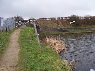
Ogley Junction, on the Staffordshire county border near Brownhills, West Midlands, England, is a historic canal junction on the Wyrley and Essington Canal where the Anglesey Branch left the main line.

<span class="mw-page-title-main">Catshill Junction</span>

Catshill Junction is a canal junction at the northern limit of the Daw End Branch Canal where it meets the Wyrley and Essington Canal main line, near Brownhills, in West Midlands, England.

<span class="mw-page-title-main">Pelsall Junction</span> Canal junction in England

Pelsall Junction is a canal junction at the southern limit of the Cannock Extension Canal where it meets the Wyrley and Essington Canal main line, near Pelsall, West Midlands, England.

<span class="mw-page-title-main">Rumer Hill Junction</span>

Rumer Hill Junction was a canal junction on the Cannock Extension Canal where the Churchbridge Branch left to join the Hatherton Canal. The junction, along with the northern section of the canal was abandoned in 1963. The Churchbridge Branch and Rumer Hill Junction were subsequently obliterated by opencast mining.

<span class="mw-page-title-main">Spon Lane Junction</span>

Spon Lane Junction is the original junction of the Wednesbury Canal and the Birmingham Canal, near Oldbury in the West Midlands, England.

<span class="mw-page-title-main">Bradley Branch</span>

The Bradley Branch or Bradley Locks Branch was a short canal of the Birmingham Canal Navigations in the West Midlands, England. Completed in 1849, it included nine locks, and had a number of basins which enabled it to service local collieries and industrial sites. The locks were unusual, as they had a single gate at both ends, rather than double gates at the bottom end. The route closed in the 1950s, and the top seven locks were covered over and landscaped.

References

  1. Hadfield 1985 , pp. 94–96
  2. 1 2 Shill 2002 , p. 21
  3. Hadfield 1985 , p. 85
  4. Hadfield 1985 , p. 96
  5. Cumberlidge 2009 , pp. 76, 81
  6. Nicholson 2006 , pp. 43–45
  7. Nicholson 2006 , p. 50

Coordinates: 52°35′55″N1°59′52″W / 52.5987°N 1.9979°W / 52.5987; -1.9979