Bloomingdale Township, Illinois

Last updated

Bloomingdale Township
Map highlighting Bloomingdale Township, DuPage County, Illinois.svg
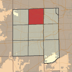
Location in DuPage County
Map of Illinois highlighting DuPage County.svg
DuPage County's location in Illinois
Coordinates: 41°56′40″N88°05′20″W / 41.94444°N 88.08889°W / 41.94444; -88.08889
Country Flag of the United States (23px).png  United States
State Flag of Illinois.svg Illinois
County DuPage
SettledNovember 6, 1849
Government
  SupervisorMichael D. Hovde, Jr.
Area
  Total
35.38 sq mi (91.6 km2)
  Land34.17 sq mi (88.5 km2)
  Water1.21 sq mi (3.1 km2)  3.41%
Elevation
[1]
781 ft (238 m)
Population
 (2020)
  Total
111,875
  Density3,274/sq mi (1,264/km2)
Time zone UTC-6 (CST)
  Summer (DST) UTC-5 (CDT)
ZIP codes
60101, 60103, 60108, 60137, 60133, 60139, 60143, 60148, 60157, 60172, 60185, 60188, 60190
FIPS code 17-043-06600
Website Bloomingdale Township

Bloomingdale Township is one of nine townships in DuPage County, Illinois, United States. As of the 2020 census, its population was 111,875 and it contained 42,488 housing units. [2]

Contents

Geography

According to the 2021 census gazetteer files, Bloomingdale Township has a total area of 35.38 square miles (91.63 km2), of which 34.17 square miles (88.50 km2) (96.59%) is land and 1.21 square miles (3.13 km2) (3.41%) is water. [3]

Cities, towns, and villages

Unincorporated communities

(This list is based on USGS data and may include former settlements.)

Natural features

Landmarks

Bloomingdale Township contains several preserves and recreational areas managed by the Forest Preserve District of DuPage County:

Transportation

Major highways

Airports and heliports

Cemeteries

The township contains seven cemeteries: Bloomingdale, Cloverdale, Freinenigreit, Old Ontarioville, St. Andrew Ukrainian Orthodox, St. Isidore’s, and St. Luke’s Lutheran.

Demographics

As of the 2020 census, [2] there were 111,875 people, 40,428 households, and 28,278 families residing in the township. The population density was 3,161.92 inhabitants per square mile (1,220.82/km2). There were 42,488 housing units at an average density of 1,200.84 per square mile (463.65/km2). The racial makeup of the township was 57.87% White, 5.33% African American, 0.79% Native American, 16.15% Asian, 0.06% Pacific Islander, 9.84% from other races, and 9.97% from two or more races. Hispanic or Latino of any race were 21.26% of the population.

There were 40,428 households, of which 32.0% had children under 18, 54.9% were married couples, 11.3% had a female householder with no spouse present, and 30.1% were non-families. 24.4% of households consisted of individuals, and 9.6% had someone living alone who was 65 or older. The average household size was 2.73 and the average family size was 3.30.

The median household income was $81,010, and the median family income was $95,914. The per capita income was $36,952. About 6.1% of families and 8.6% of the population were below the poverty line, including 14.2% of those under age 18 and 5.1% of those 65 or over.

Historical population
CensusPop.Note
1960 14,924
1970 36,654145.6%
1980 79,571117.1%
1990 96,05020.7%
2000 111,70916.3%
2010 111,8990.2%
2020 111,8750.0%
U.S. Decennial Census [4]

Political districts

See also

References

  1. "Bloomingdale Township, DuPage County, Illinois". Geographic Names Information System . United States Geological Survey, United States Department of the Interior.
  2. 1 2 "Explore Census Data". data.census.gov. Retrieved January 22, 2023.
  3. "Gazetteer Files". Census.gov. United States Census Bureau. Retrieved January 22, 2023.
  4. "Census of Population and Housing". Census.gov. Retrieved June 4, 2016.