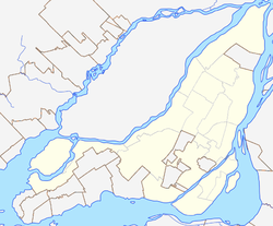
Victoriaville is a town in south-central Quebec, Canada, on the Nicolet River. Victoriaville is the seat of Arthabaska Regional County Municipality and a part of the Centre-du-Québec (Bois-Francs) region. It is formed by the 1993 merger of Arthabaska, Saint-Victoire-d'Arthabaska and Victoriaville, the name of the last being used for the merged town.
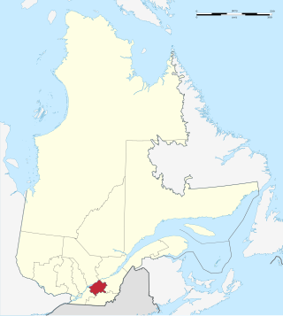
Centre-du-Québec is a region of Quebec, Canada. The main centres are Drummondville, Victoriaville, and Bécancour. It has a land area of 6,930.05 square kilometres (2,675.71 sq mi) and a 2016 Census population of 242,399 inhabitants.

The Orange Line is the longest and first-planned of the four subway lines of the Montreal Metro in Montreal, Quebec, Canada. It formed part of the initial network, and was extended from 1980 to 1986. On April 28, 2007, three new stations in Laval opened making it the second line to leave Montreal Island.
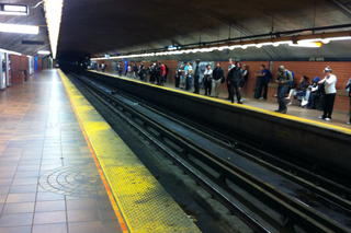
Côte-Vertu station is a Montreal Metro station in the borough of Saint-Laurent in Montreal, Quebec, Canada. It is operated by the Société de transport de Montréal (STM) and serves the Orange Line. It opened on November 3, 1986 and has been the western terminus of the Orange Line since that date, having taken over from Du Collège station.

Cartierville Airport was an airport in Saint-Laurent, Quebec, now a borough of Montreal. The airport was decommissioned in 1988 and turned into the Bois-Franc neighbourhood. It was located next to Route 117 and the terminal buildings were accessed via Boul. Henri-Bourassa, near the present Bois-Franc Train Station on the Deux Montagnes Commuter Rail Line.
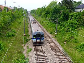
Deux-Montagnes or Two Mountains Line was an electrified commuter rail line in Greater Montreal, Quebec, Canada. It was owned by Exo, the organization that operates public transport services across this region.

Du Ruisseau station is a future Réseau express métropolitain (REM) station in Montreal, Quebec, Canada, expected to open for REM service by the end of 2024. It was formerly a commuter rail station on the Deux-Montagnes line until Exo ended service in 2020.

Bois-Franc station is a future Réseau express métropolitain (REM) interchange station in the Bois-Franc neighbourhood of Montreal, Quebec, Canada. REM service is expected to begin at the station in the fourth quarter of 2024.

Ahuntsic-Cartierville is a borough (arrondissement) of the city of Montreal, Quebec, Canada. The borough was created following the 2002 municipal reorganization of Montreal. It comprises two main neighbourhoods, Ahuntsic, a former village annexed to Montreal in 1910 and Cartierville, a town annexed to Montreal in 1916.

Leaside Aerodrome was an airport in the Town of Leaside, Ontario. It opened in 1917 as a Royal Flying Corps airfield during the First World War.

Saint-Laurent is a borough of the city of Montreal, Canada, located in the northern part of the island. Although it is no longer an independent city, it is still commonly known as Ville Saint-Laurent or by its initials, VSL.

Autoroute 13, is a freeway in the urban region of Montreal, Quebec, Canada. Its southern end is at the junction of A-20 on the Island of Montreal near Pierre Elliott Trudeau International Airport. Its northern terminus is at the junction of A-640 near Boisbriand. The road traverses Laval. A-13 is mostly six-laned and tolls were removed.

Autoroute 19, also known as Autoroute Papineau, is an autoroute in Quebec. It crosses the Rivière des Prairies via the Papineau-Leblanc Bridge, connecting the borough of Ahuntsic-Cartierville in Montreal and the Duvernay neighbourhood in Laval.

Route 335 is a north-south regional route located on the north shore of the St. Lawrence River. from Montreal It serves the administrative regions of Montreal, Laval, Laurentides, and Lanaudière. It is the only secondary road whose route crosses the Island of Montreal. Between Autoroute 440 in Laval and Côte-Saint-Louis Road in Terrebonne, Route 335 is located in the right-of-way of the future Autoroute 19.

Bois-de-Boulogne station is a commuter rail station operated by Exo in Montreal, Quebec, Canada. It is served by the Saint-Jérôme line.
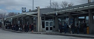
Henri Bourassa Boulevard is a major east–west street located in Montreal, Quebec, Canada. Located in the north of the island of Montreal, it runs parallel to Gouin Boulevard. Spanning 29 kilometres in length, it links the borough of Rivière-des-Prairies–Pointe-aux-Trembles in the east to a junction with Autoroute 13 and Alfred Nobel Boulevard in Saint-Laurent in the west. West of here, the street continues into the West Island as Hymus Boulevard, a main thoroughfare in Dorval, Pointe-Claire, and Kirkland.

Ruisseau-De Montigny Nature Park is a large nature park in the Rivière-des-Prairies neighbourhood of the Rivière-des-Prairies–Pointe-aux-Trembles borough of Montreal, Quebec, Canada.

The Réseau express métropolitain is a light metro rapid transit system in Greater Montreal, Quebec, Canada. It consists of five stations and connects Downtown Montreal with the suburb of Brossard. Extensions to the western Montreal suburbs and Montréal–Trudeau International Airport are under construction and will open in stages between 2024 and 2027. A portion of the route was taken over from the Exo commuter rail Deux-Montagnes line and is being converted to light metro standards.
Bois-Franc or Bois-Francs can refer to the following places, all in Quebec, Canada:


