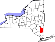
Putnam County is a county located in the U.S. state of New York. As of the 2020 census, the population was 97,668. The county seat is Carmel, located within one of six towns comprising the county. The county is part of the Hudson Valley region of the state.

Ancram is a town in Columbia County, New York, United States. The population was 1,440 at the 2020 census, down from 1,573 at the 2010 census. The town was named after Ancram, Scotland.

Gallatin is a town in Columbia County, New York, United States. The population at 2020 was 1,628, down from 1,668 at the 2010 census. Gallatin is on the southern border of Columbia County and located 100 miles (160 km) north of New York City.

Milan is a town in Dutchess County, New York, United States. The town is in the northern part of the county and is very rural. As of the 2020 census it had a population of 2,245, slightly down from 2,370 in 2010. Milan is located approximately 90 miles (140 km) north of New York City, 60 miles (97 km) south of Albany, and 150 miles (240 km) west of Boston. It is bordered by Rhinebeck and Red Hook to the west, Pine Plains to the east, Stanford to the southeast, Clinton to the south, and Gallatin to the north by Columbia County. The only major route in the town is the historic Taconic State Parkway, though NY 199 serves as the main local thoroughfare.

North East is a town in Dutchess County, New York, United States. The population was 3,031 at the 2020 census. The town is in the northeastern corner of the county. U.S. Route 44 crosses the town.

Wappinger is a town in Dutchess County, New York, United States. The town is located in the Hudson River Valley region, on the eastern bank of the Hudson River. The population was 28,216 at the 2020 census. The name is derived from the Wappinger Native Americans who inhabited the area. Wappinger comprises three-fourths of the incorporated village of Wappingers Falls, several unincorporated hamlets such as Chelsea, Diddell, Hughsonville, Middlebush, Myers Corners, New Hackensack, and Swartwoutville, and a number of neighborhoods.

Southeast is a town in Putnam County, New York, United States, so named for its location in the southeastern corner of the county. The population was 18,058 at the 2020 census. The town as a whole is informally referred to as Brewster, the town's principal settlement; the latter is also an incorporated village within the town's borders. Interstate 84, Interstate 684, U.S. Route 202, US Route 6, and NY 22 are the primary routes through the town.

Pine Plains is a town in Dutchess County, New York, United States. The population was 2,218 at the 2020 census.

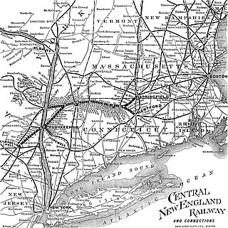
The Central New England Railway was a railroad from Hartford, Connecticut, and Springfield, Massachusetts, west across northern Connecticut and across the Hudson River on the Poughkeepsie Bridge to Maybrook, New York. It was part of the Poughkeepsie Bridge Route, an alliance between railroads for a passenger route from Washington to Boston, and was acquired by the New York, New Haven & Hartford Railroad in 1904. The New Haven ran the CNE as a separate company until finally merging it in 1927. The vast majority of the system was abandoned by the 1930s and 1940s. Surviving portions of the Central New England Railway are operated by the Central New England Railroad and the Housatonic Railroad.
The Poughkeepsie and Eastern Railway was the first railroad to run east from Poughkeepsie, New York, and was taken over by the New York, New Haven and Hartford Railroad and assigned to the Central New England Railway in 1907.

Wassaic is a hamlet and census-designated place in the town of Amenia, Dutchess County, New York, United States. As of the 2020 census, its population is 210. Located in southeastern New York in the valley of the Ten Mile River, Wassaic is bordered to the east and west by mountain ranges.
Taconic State Park is located in Columbia and Dutchess County, New York abutting Massachusetts and Connecticut within the Taconic Mountains. The state park is located off New York State Route 344 south of Interstate 90 and 110 miles (180 km) north of New York City. It features camping, hiking, bicycling, hunting, cross county skiing and other recreational opportunities.

New York State Route 82 (NY 82) is a state highway in the eastern Hudson Valley of New York in the United States. It begins at an junction with NY 52 northeast of the village of Fishkill, bends eastward towards Millbrook, and then returns westward to end at a junction with U.S. Route 9, NY 9H, and NY 23 at Bell Pond, near Claverack. NY 82 meets the Taconic State Parkway twice; it is the only state highway that has more than one exit with the parkway. The road spans two counties: Dutchess and Columbia.

Verbank is a hamlet in the town of Union Vale in Dutchess County, New York, United States. Verbank is served by a post office with the ZIP code of 12585; the ZCTA for ZIP Code 12585 had a population of 956 at the 2000 census.

Brace Mountain is the peak of a ridge in the southern Taconic Mountains, near the tripoint of the U.S. states of New York, Connecticut and Massachusetts. Its 2,311-foot (704 m) main summit is located in New York; it is the highest point in that state's Dutchess County.

Chelsea is a hamlet of the Town of Wappinger in Dutchess County, New York, United States. It is located on the Hudson River in the southwestern corner of the town. It takes the ZIP Code 12512 and is in the 845 telephone area code, and has its own fire district.
Mount Pleasant is a populated place in the town of Shandaken in Ulster County, New York, United States. Mount Pleasant is located along New York State Route 28 within Catskill State Park, to the south of Phoenicia and to the north of Boiceville. The community is located at 42°02′54″N74°17′21″W.

The Boston Corners station was a former New York Central Railroad station that served the residents of Ancram, New York.

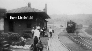
East Litchfield is an unincorporated village in the town of Litchfield, Litchfield County, Connecticut, United States.
Bangall is a hamlet in Dutchess County, New York, United States. The community is 6.2 miles (10.0 km) north of Millbrook. Bangall has a post office with ZIP code 12506, which opened on August 8, 1851.


