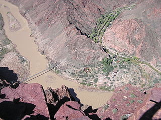
The South Kaibab Trail is a hiking trail in Grand Canyon National Park, located in the U.S. state of Arizona. Unlike the Bright Angel Trail which also begins at the south rim of the Grand Canyon and leads to the Colorado River, the South Kaibab Trail follows a ridge out to Skeleton Point allowing for 360-degree views of the canyon.

The Bright Angel Trail is a hiking trail located in Grand Canyon National Park in the U.S. state of Arizona.
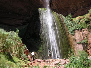
The North Kaibab Trail is a hiking trail in the North Rim side of the Grand Canyon, in Grand Canyon National Park, located in the U.S. state of Arizona.

The Hermit Trail is a hiking trail in Grand Canyon National Park, located in the U.S. state of Arizona. This trail provides access to a historic area of Grand Canyon and offers a more challenging route to the Colorado River for more experienced canyon hikers.

The Tonto Trail is a hiking trail on the South Rim of the Grand Canyon in Grand Canyon National Park, located in the U.S. state of Arizona.

The River Trail is a hiking trail in Grand Canyon National Park, located in the U.S. state of Arizona. This trail connects the end of the Bright Angel Trail with Phantom Ranch and the South Kaibab Trail.
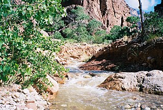
The Clear Creek Trail is a hiking trail below the North Rim, from lower Bright Angel Canyon into lower Clear Creek Canyon of the Grand Canyon National Park, located in the U.S. state of Arizona.

The Plateau Point Trail is a hiking and pack trail located on the South Rim of the Grand Canyon National Park, located in the U.S. state of Arizona.
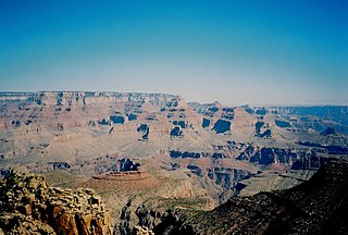
The Grandview Trail is a hiking trail located on the South Rim of the Grand Canyon National Park, located in the U.S. state of Arizona.It was built in 1893 by miners and is noted for its cobblestone and cribbing sections.
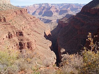
The Dripping Springs Trail is a hiking trail on the South Rim of the Grand Canyon National Park, located in the U.S. state of Arizona.

The Tanner Trail is a hiking trail located on the South Rim of the Grand Canyon National Park, located in the U.S. state of Arizona. The trailhead is located at Lipan Point, a prominent lookout located to the east of the Grand Canyon Village, and the trail ends at the Colorado River at Tanner Rapids.

The South Bass Trail is a hiking trail located on the South Rim of the Grand Canyon National Park, located in the U.S. state of Arizona.

Havasu Creek is a stream in the U.S. state of Arizona associated with the Havasupai people. It is a tributary to the Colorado River, which it enters in the Grand Canyon.
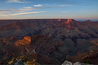
Newton Butte, in the Grand Canyon, Arizona, United States is a prominence below the South Rim, northwest of Grandview Point, and north on a ridgeline from Shoshone Point which is one mile east of Yaki Point, East Rim Drive. Shoshone Point and Yaki are both on access roads from East Rim Drive, with Yaki being the more advantageous to different viewing directions.

Isis Temple, in the Grand Canyon, Arizona, USA, is a prominence below the North Rim, and adjacent to Granite Gorge. The prominence lies north of the north bank of the west-flowing Colorado River and is just north of Granite Gorge. The Trinity Creek and canyon flow due-south at its west border; its north, and northeast border/flank is formed by Phantom Creek and canyon, a west tributary of Bright Angel Creek; the creeks intersect about 3 mi southeast, and 1 mi north of Granite Gorge. The Isis Temple prominence, is only ~202 ft lower than Grand Canyon Village, the main public center on Grand Canyon’s South Rim.

Angels Gate is a 6,761-foot (2,061 m)-elevation summit located in the Grand Canyon, in Coconino County of Arizona, United States. It is situated seven miles (11 km) due north of the Grandview Point overlook on the canyon's South Rim, three miles (4.8 km) west of Vishnu Temple, and three point five miles (5.6 km) southeast of Zoroaster Temple. Topographic relief is significant as it rises over 4,200 feet (1,300 m) above the Colorado River in three miles. Angels Gate is the place in Paiute mythology where the gods would return to earth by descending from the shadow world above. George Wharton James applied the "Angel Gate" name to this geographical feature in his book, In & Around the Grand Canyon, in 1900. This feature's name was officially adopted in 1906 by the U.S. Board on Geographic Names. Angels Gate has four peaks composed of Coconino Sandstone. The main highest summit and three spires are known as "Snoopy and his Doghouse" for a resemblance to Snoopy, and the first ascent was made April 1972 by Chuck Graf and Dave Ganci. According to the Köppen climate classification system, Angels Gate is located in a cold semi-arid climate zone.

Whites Butte is a 4,860-foot (1,480 m) prominence adjacent the course of the Colorado River near the beginning of the Western Grand Canyon,. The butte lies at the terminus of Travertine Canyon, the adjacent canyon west of Hermit Canyon. The Boucher Trail which begins at Upper Hermit Canyon, courses the east base of Whites Butte to reach the Tonto Trail-(west), on the Tonto Platform, south side of the Colorado River.

O'Neill Butte is a 6,071-foot (1,850 m)-elevation summit located in the Grand Canyon, in Coconino County of northern Arizona, United States. It is situated 2.5 miles (4.0 km) east-northeast of Grand Canyon Village, one mile (1.6 km) northeast of Mather Point, and one mile immediately northwest of Yaki Point. Cedar Ridge connects O'Neill Butte with Yaki Point on the South Rim. Topographic relief is significant as O'Neill Butte rises 3,600 feet (1,100 m) above the Colorado River in two miles (3.2 km). Access to this prominence is via the South Kaibab Trail which traverses the east slope of the peak. According to the Köppen climate classification system, O'Neill Butte is located in a cold semi-arid climate zone.

Topaz Canyon is a linear, narrow canyon in western Grand Canyon, below the South Rim. It lies in a region of four canyons, and a fifth smaller canyon, all trending mostly northeasterly towards the west-flowing Colorado River, in western Grand Canyon National Park. The name of Topaz Canyon was named by the Board of Geographical Names for precious stones of the region. Topaz Canyon is the southeast border of the linear, and major, forested-landform, Diana Temple; .
The northeast terminus of Topaz Canyon intersects with the outfall of Boucher Canyon and the tract of the Tonto Trail. The Boucher Trail starting in Hermit Canyon,, ends at the termini of both Topaz and Boucher Canyons.


