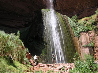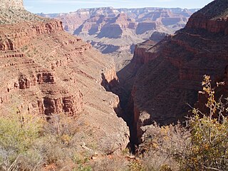
The Grand Canyon of the Yellowstone is the first large canyon on the Yellowstone River downstream from Yellowstone Falls in Yellowstone National Park in Wyoming. The canyon is approximately 24 miles (39 km) long, between 800 and 1,200 ft deep and from .25 to .75 mi wide.

Yellowstone Falls consist of two major waterfalls on the Yellowstone River, within Yellowstone National Park, Wyoming, United States. As the Yellowstone river flows north from Yellowstone Lake, it leaves the Hayden Valley and plunges first over Upper Yellowstone Falls and then a quarter mile downstream over Lower Yellowstone Falls, at which point it then enters the Grand Canyon of the Yellowstone, which is up to 1,000 feet deep.

The Arizona National Scenic Trail is a National Scenic Trail from Mexico to Utah that traverses the whole north–south length of the U.S. state of Arizona. The trail begins at the Coronado National Memorial near the US–Mexico border and moves north through parts of the Huachuca, Santa Rita, and Rincon Mountains. The trail continues through the Santa Catalina north of Tucson and the Mazatzal Mountains before ascending the Mogollon Rim north of Payson, eventually leading to the higher elevations of Northern Arizona and the San Francisco Peaks. The trail then continues across the Coconino Plateau and in and out of the Grand Canyon. The Arizona Trail terminates near the Arizona-Utah border in the Kaibab Plateau region. The 800-mile (1,300 km) long Arizona Trail was completed on December 16, 2011. The trail is designed as a primitive trail for hiking, equestrians, mountain biking, and even cross country skiing, showcasing the wide variety of mountain ranges and ecosystems of Arizona.

The North Kaibab Trail is a hiking trail in the North Rim side of the Grand Canyon, in Grand Canyon National Park, located in the U.S. state of Arizona.

The Cape Final Trail is a hiking trail on the North Rim of the Grand Canyon National Park, located in the U.S. state of Arizona.

The Bill Hall Trail is a hiking trail in Grand Canyon National Park, located in the U.S. state of Arizona.

The Bright Angel Point Trail is a hiking trail located on the North Rim of the Grand Canyon National Park, located in the U.S. state of Arizona.

The Plateau Point Trail is a hiking and pack trail located on the South Rim of the Grand Canyon National Park, located in the U.S. state of Arizona.

The Dripping Springs Trail is a hiking trail on the South Rim of the Grand Canyon National Park, located in the U.S. state of Arizona.

The Cape Royal Trail is a hiking trail on the North Rim of the Grand Canyon National Park, located in the U.S. state of Arizona.

The North Bass Trail is a hiking trail located on the North Rim of the Grand Canyon, in Grand Canyon National Park, located in the U.S. state of Arizona.

The South Bass Trail is a hiking trail located on the South Rim of the Grand Canyon National Park, located in the U.S. state of Arizona.

The Uinkaret volcanic field is an area of monogenetic volcanoes in northwestern Arizona, United States, located on the north rim of the Grand Canyon.
The Thunder River Trail is a hiking trail on the North Rim of the Grand Canyon National Park, located in the U.S. state of Arizona.

The Nankoweap Trail is an unmaintained hiking trail on the North Rim of the Grand Canyon National Park, located in the U.S. state of Arizona. The Nankoweap trail descends 6,040 feet in 14 miles from the Saddle Mountain trailhead to Nankoweap Creek and on to the Colorado River. It is considered to be the hardest of the trails into the Canyon. Hikers have to carry and cache water as there is none in the 11 miles between the trailhead and Nankoweap Creek.

The Royal Arch Route is a hiking trail on the South Rim of the Grand Canyon National Park, located in the U.S. state of Arizona.

The Escalante Route is a hiking trail on the South Rim of the Grand Canyon National Park, located in the U.S. state of Arizona. It starts near the Tanner Rapids on the Colorado River and follows the river. It also passes by Escalante Creek and ends near the Hance Rapids. It falls into the lowest maintenance category ("route") of the Grand Canyon trails which means it is essentially unmaintained. There is a 30-feet cliff located near the Hance Rapids, popularly known as the Papago Wall, which needs to be climbed. The National Park Service advises to bring a rope for backpacks. There are several other easy, yet avoidable climbing opportunities in 75 Mile Canyon, some of which have been marked by cairns.

The Tuckup Trail is a 100-mile-long (160 km) hiking trail on the North Rim of the Grand Canyon, in Grand Canyon National Park, located in the U.S. state of Arizona.

The Cliff Spring Trail is a 1-mile (1.6 km) hiking trail located on the North Rim of the Grand Canyon National Park, located in the U.S. state of Arizona.

Toroweap Overlook is a viewpoint within the Grand Canyon National Park in Arizona, United States. It is located in a remote area on the North Rim of the Grand Canyon, 55 miles (89 km) west of the North Rim Headquarters. The overlook is the only viewpoint in the National Park from where the Colorado River can be seen vertically below. The overlook stands 3,000 feet (910 m) above the river.


