Bradford Regional Airport

Last updated
Bradford Regional Airport
BFD logo.png
Summary
Airport typePublic
OwnerBradford Regional Airport Authority
OperatorBradford Regional Airport Authority
Serves Bradford, Pennsylvania
Location McKean County, Pennsylvania, U.S.
Elevation  AMSL 2,143 ft / 653 m
Coordinates 41°48′11″N078°38′24″W / 41.80306°N 78.64000°W / 41.80306; -78.64000
Website BradfordAirport.net
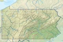
Map
USA Pennsylvania relief location map.svg
Airplane silhouette.svg
BFD
Usa edcp relief location map.png
Airplane silhouette.svg
BFD
Runways
Direction LengthSurface
ftm
14/326,3071,922Asphalt
5/234,4991,371Asphalt
Statistics
Aircraft operations (2019)2,987
Based aircraft (2022)15

Bradford Regional Airport( IATA : BFD [2] , ICAO : KBFD, FAA LID : BFD) is 11 miles south of Bradford, in Lafayette Township, McKean County, Pennsylvania. [1] It has scheduled airline service subsidized by the Essential Air Service program.

Contents

The airport is owned by the Bradford Regional Airport Authority [1] and serves Pennsylvania and western New York including Olean, NY. It is surrounded by the oil field which makes up a large part of local economy. Bradford is the home of Zippo lighters and Case knives; there is an armory at the airport for the National Guard.

The National Plan of Integrated Airport Systems for 2021–2025 categorized it as a non-primary commercial service airport (between 2,500 and 10,000 enplanements per year). [3]

Former airline service

Its first scheduled airline flights were United Airlines Douglas DC-3s in 1948. In 1953 United's DC-3 flew New York Newark Airport - Philadelphia - Bradford - Youngstown - Akron/Canton - Cleveland - Toledo - Chicago Midway Airport - Moline, IL - Cedar Rapids - Omaha - Lincoln, NE. [4] United left in 1954.

In 1953 Allegheny Airlines DC-3s stopped at Bradford on a multi-stop route between Buffalo, NY and Pittsburgh. [5] In 1971 Allegheny Convair 580s flew nonstop to Erie, Harrisburg, Jamestown, NY, New York Newark Airport, Pittsburgh and Washington National Airport and direct to Detroit. [6] Allegheny introduced McDonnell Douglas DC-9-30s and flew one-stop in 1976 from Chicago O'Hare Airport via Erie and from New York LaGuardia Airport via Elmira while continuing to fly nonstop Convair 580s from Buffalo and Pittsburgh. [7] Allegheny remained until 1979 when Allegheny Commuter took over, with nonstop Beechcrafts from Buffalo and nonstop Short 330s from Pittsburgh. [8] Allegheny Commuter service continued for a number of years for Allegheny successor USAir. [9] In 1994 Allegheny Commuter successor USAir Express was operating nonstop code sharing BAe Jetstream 31s to Pittsburgh. [10] USAir changed its name to US Airways with US Airways Express Beechcraft 1900Cs being flown nonstop to Pittsburgh in 1999. [11]

Facilities

The airport covers 1,015 acres (411 ha) at an elevation of 2,143 feet (653 m). It has two asphalt runways: 14/32 is 6,307 by 150 feet (1,922 x 46 m) and 5/23 is 4,499 by 100 feet (1,371 x 30 m). [1]

In the year ending January 31, 2019, the airport had 2,987 aircraft operations, an average of 8 per day: 80% commercial, 14% general aviation, 4% air taxi and 2% military. In April 2022, there were 15 aircraft based at this airport: all 15 single-engine. [1]

Airline and destinations

Southern Airways Express currently provides BFD with daily commercial flights to Pittsburgh International Airport and Washington Dulles International Airport. There are two daily departures to each destination.

Scheduled passenger flights:

AirlinesDestinationsRefs
Southern Airways Express Pittsburgh, Washington–Dulles [12]

Statistics

Top domestic destinations: February 2021 – January 2022 [13]
RankCityAirport name & IATA codePassengers
1 Pittsburgh, PA Pittsburgh International Airport 2,270
2 Washington, D.C. Dulles International Airport 1,020
Passenger boardings (enplanements) by year, as per the FAA [14]
Year2008 [15] 2009 [16] 2010 [17] 2011 [18] 2012 [19] 2013 [20] 2014 [21] 2015 [22] 2016 [23] 2017 [24] 2018 [25]
Enplanements4,8982,5932,9622,9082,3102,2952,0193,4912,6233,8974,191
ChangeIncrease2.svg57.80%Decrease2.svg47.06%Increase2.svg14.23%Decrease2.svg1.82%Decrease2.svg20.56%Decrease2.svg0.65%Decrease2.svg12.03%Increase2.svg72.91%Decrease2.svg24.86%Increase2.svg48.57%Increase2.svg7.54%
Airline Colgan Air dba United Express Gulfstream International Airlines dba Continental Connection Gulfstream International Airlines dba Continental Connection Gulfstream International Airlines dba United Express Silver Airways dba United Express Silver Airways dba United Express Silver Airways dba United Express Sun Air Express Southern Airways Express Southern Airways Express Southern Airways Express
Destination(s) Jamestown
Washington-Dulles
Jamestown
Cleveland
Jamestown
Cleveland
Jamestown
Cleveland
Jamestown
Cleveland
Jamestown
Cleveland
Jamestown
Cleveland
Pittsburgh Pittsburgh Pittsburgh Pittsburgh

Accidents and Incidents

DateFlight NumberInformation
December 24, 1968AL0736 Allegheny Airlines Flight 736 crashed on approach to Bradford. 20 of the 47 passengers and crew on board are killed. [26]
January 6, 1969AL0737 Allegheny Airlines Flight 737 crashed on approach to Bradford. 11 of the 28 passengers and crew on board are killed. [27]

See also

Related Research Articles

<span class="mw-page-title-main">Augusta State Airport</span> Airport

Augusta State Airport is a public use airport located one nautical mile (2 km) west of the central business district of the state capital of Augusta, a city in Kennebec County, Maine, United States. The airport is owned by the state of Maine, but managed and operated by the city of Augusta. It is served by one commercial airline, with scheduled passenger service subsidized by the Essential Air Service program.

<span class="mw-page-title-main">Hancock County–Bar Harbor Airport</span> Public use airport in Trenton, Maine

Hancock County–Bar Harbor Airport is a county-owned, public-use airport located in Trenton, Maine, eight nautical miles northwest of the central business district of Bar Harbor, a city in Hancock County, Maine, United States. It serves the residents of Hancock County with commercial and charter aviation services. During the summer months, the airport becomes one of Maine's busiest, with significant private jet operations bringing visitors to the numerous summer colonies in the county, which includes Mount Desert Island. Scheduled passenger airline service is subsidized by the Essential Air Service program.

<span class="mw-page-title-main">Del Norte County Airport</span> Municipal airport serving Crescent City, California, United States

Del Norte County Regional Airport is a public airport three miles northwest of Crescent City, in Del Norte County, California, United States. It has one airline flight per day to and from Oakland under the Essential Air Service program. The National Plan of Integrated Airport Systems for 2011–2015 categorized it as a primary commercial service airport.

<span class="mw-page-title-main">Central Wyoming Regional Airport</span> Airport

Central Wyoming Regional Airport, formerly Riverton Regional Airport, is three miles northwest of Riverton, in Fremont County, Wyoming; it also serves nearby Lander, Wyoming. It is used for general aviation and sees one passenger airline. Service was subsidized by the Essential Air Service program until October 2006, when Great Lakes Airlines began providing subsidy-free service. Key Lime Air operating as the Denver Air Connection began serving the airport with regional jet aircraft on July 1, 2016.

<span class="mw-page-title-main">Lebanon Municipal Airport (New Hampshire)</span> Public-use airport in Lebanon, New Hampshire, United States

Lebanon Municipal Airport is a city-owned, public-use airport located three nautical miles (6 km) west of the central business district of Lebanon, a city in Grafton County, New Hampshire, United States. Also known as Lebanon Airport, it is the northernmost commercial airport in New Hampshire, near the Vermont border, off Interstate 89 just south of the junction with Interstate 91. Other nearby towns include Hanover, New Hampshire and White River Junction, Vermont. The area is also the home of Dartmouth College and the Dartmouth–Hitchcock Medical Center.

<span class="mw-page-title-main">Barkley Regional Airport</span> Airport

Barkley Regional Airport is an American domestic airport in West Paducah, Kentucky, 14 miles west of Paducah in McCracken County. It is used for general aviation and sees one airline, subsidized by the Essential Air Service program.
<span class="mw-page-title-main">Greenville Mid-Delta Airport</span> Airport

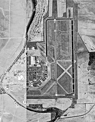
Greenville Mid-Delta Airport, operating as Mid Delta Regional Airport until 2011, is a public use airport in unincorporated Washington County, Mississippi, United States. It is located five nautical miles northeast of the central business district of Greenville, the city that owns the airport. It is served by one commercial airline, Contour Airlines, which is subsidized by the Essential Air Service program. Formerly, the facility was known as Greenville Air Force Base.

<span class="mw-page-title-main">Altoona–Blair County Airport</span> Airport in Martinsburg, Pennsylvania

Altoona–Blair County Airport is in Martinsburg, Pennsylvania, 14 miles south of Altoona, in Blair County, Pennsylvania. It is owned by the Blair County Airport Authority. The airport has a few airline flights, subsidized by the Essential Air Service program.

<span class="mw-page-title-main">Middle Georgia Regional Airport</span> Airport in between Macon and Warner Robins, Georgia

Middle Georgia Regional Airport is a city-owned, public-use airport located nine nautical miles south of the central business district of Macon, a city in Bibb County, Georgia, United States. It is mostly used for general aviation, but is also served by one commercial airline.

<span class="mw-page-title-main">Raleigh County Memorial Airport</span> Airport in West Virginia

Raleigh County Memorial Airport is three miles east of Beckley, in Raleigh County, West Virginia, United States. It is owned by the Raleigh County Airport Authority. The airport is used for general aviation and sees one scheduled passenger airline, subsidized by the Essential Air Service program.

<span class="mw-page-title-main">North Central West Virginia Airport</span> Airport in West Virginia, United States

North Central West Virginia Airport is a public/military airport a mile northeast of Bridgeport and six miles east of Clarksburg, in Harrison County, West Virginia, United States. It is owned and operated by the Benedum Airport Authority, serving Harrison and Marion County, and was formerly Benedum Airport and Harrison-Marion Regional Airport. The airport sees two airlines, with some passenger service subsidized by the Essential Air Service program.

Greenbrier Valley Airport is three miles north of Lewisburg in Greenbrier County, West Virginia. Contour Airlines schedules airline flights, subsidized by the Essential Air Service program, to Charlotte Douglas International Airport. Federal Aviation Administration records say the airport had 10,902 passenger boardings (enplanements) in calendar year 2021 and 10,048 in 2022. The National Plan of Integrated Airport Systems for 2023–2027 called it a primary commercial service airport based on enplanements in 2021.
<span class="mw-page-title-main">Morgantown Municipal Airport</span> Airport

Morgantown Municipal Airport is three miles east of Morgantown, in Monongalia County, West Virginia. It is also known as Walter L. Bill Hart Field. It sees one passenger airline, Southern Airways Express, subsidized by the Essential Air Service program.

<span class="mw-page-title-main">Mid-Ohio Valley Regional Airport</span> Airport in West Virginia, U.S.

Mid-Ohio Valley Regional Airport is seven miles northeast of Parkersburg, in Wood County, West Virginia. It is owned by the Wood County Airport Authority and is also known as Wood County Airport or Gill Robb Wilson Field. It serves the Mid-Ohio Valley area which includes the Ohio cities of Marietta and Belpre and the West Virginia cities of Williamstown, Parkersburg and Vienna. It has scheduled passenger service subsidized by the Essential Air Service program.

Venango Regional Airport, also known as Chess Lamberton Field, is a public airport in western Pennsylvania, 2 miles (3 km) southwest of Franklin and about 10 miles (16 km) southwest of Oil City. Both cities are in Venango County, which operates the airport. The airport had limited airline service, which was subsidized by the Essential Air Service program until October 2019.

<span class="mw-page-title-main">Williamsport Regional Airport</span> Commercial airport in Williamsport, Pennsylvania

Williamsport Regional Airport serves Williamsport, Pennsylvania, and the surrounding area with a population of roughly 200,000. The airport processes approximately 40,000 passengers annually and has served north central Pennsylvania since 1929.
DuBois Regional Airport, formerly DuBois–Jefferson County Airport, is in Jefferson County, Pennsylvania, eight miles northwest of DuBois, a city in Clearfield County. The airport is in Washington Township. It is owned and operated by the Clearfield-Jefferson Counties Regional Airport Authority, based at the airport. It has scheduled service on one airline, Southern Airways Express, subsidized by the Essential Air Service program.

<span class="mw-page-title-main">Johnstown–Cambria County Airport</span> Airport

John Murtha Johnstown–Cambria County Airport is a civil-military airport three miles (5 km) northeast of Johnstown, in Cambria County, Pennsylvania. It is owned by Johnstown–Cambria County Airport Authority and is named after the late Congressman John Murtha. It sees one airline, subsidized by the Essential Air Service.

<span class="mw-page-title-main">Chautauqua County-Jamestown Airport</span> Airport in Chautauqua County, New York

Chautauqua County/Jamestown Airport at Robert H. Jackson Field is a county-owned, public-use airport located three nautical miles (6 km) north of the central business district of Jamestown, in Chautauqua County, New York, United States. It is mostly used for general aviation.
<span class="mw-page-title-main">Adak Airport</span> Runway and terminal for aircraft on the Aleutian island

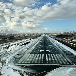
Adak Airport is a state-owned public-use airport located west of Adak, on Adak Island in the Aleutian Islands in the U.S. state of Alaska. The airport is the farthest western airfield with scheduled passenger air service in the entire United States at 176.64W.

References

  1. 1 2 3 4 5 FAA Airport Form 5010 for BFD PDF . Federal Aviation Administration. effective April 21, 2022.
  2. "IATA Airport Code Search (BFD: Bradford)". International Air Transport Association . Retrieved June 5, 2014.
  3. "2011–2015 NPIAS Report, Appendix A" (PDF). National Plan of Integrated Airport Systems. Federal Aviation Administration. October 4, 2010. Archived from the original (PDF, 2.03 MB) on 2012-09-27.
  4. http://www.timetableimages.com, Jan. 4, 1953 United timetable
  5. http://www.timetableimages.com, April 26, 1953 Allegheny timetable
  6. http://www.departedflights.com, March 1, 1971 Allegheny timetable
  7. Feb. 1, 1976 Official Airline Guide
  8. http://www.departedflights.com, Nov. 15, 1979 Official Airline Guide
  9. http://www.departedflights.com, April 9, 1988 USAir & Allegheny Commuter route maps
  10. Sept. 15, 1994 OAG Desktop Flight Guide
  11. http://www.departedflights.com, June 1, 1999 Official Airline Guide
  12. "Routes" . Retrieved 5 April 2017.
  13. "RITA - BTS - Transtats".
  14. "Passenger Boarding (Enplanement) and All-Cargo Data for U.S. Airports – Airports". www.faa.gov. Retrieved 2020-05-26.
  15. "2008 Primary, Non-primary Commercial Service, and General Aviation Airports with Enplanements (by State)" (PDF, 1.0 MB). CY 2008 Passenger Boarding and All-Cargo Data. Federal Aviation Administration. December 18, 2009.
  16. "2009 Primary, Non-primary Commercial Service, and General Aviation Airports (by State)" (PDF, 891 KB). CY 2009 Passenger Boarding and All-Cargo Data]. Federal Aviation Administration. November 23, 2010.
  17. "2010 Primary, Non-primary Commercial Service, and General Aviation Airports (by State)" (PDF, 189 KB). CY 2010 Passenger Boarding and All-Cargo Data]. Federal Aviation Administration. October 4, 2011.
  18. "2011 Enplanements at Primary, Non-primary Commercial Service, and General Aviation Airports (by State)" (PDF). CY 2011 Passenger Boarding and All-Cargo Data]. Federal Aviation Administration. October 9, 2012.
  19. "2012 Enplanements at All Airports (Primary, Non-primary Commercial Service, and General Aviation) by State and Airport" (PDF). CY 2012 Passenger Boarding and All-Cargo Data]. Federal Aviation Administration. October 31, 2013.
  20. "All Airports with CY 2013 Enplanements" (PDF). Archived (PDF) from the original on 2014-10-20. Retrieved May 25, 2020.
  21. "Calendar Year 2014 Enplanements by State" (PDF). Archived (PDF) from the original on 2015-07-01.
  22. "Calendar Year 2015 Enplanements by State" (PDF). Archived (PDF) from the original on 2016-09-27.
  23. "Calendar Year 2016 Final Revenue Enplanements at All Airports" (PDF).
  24. "Calendar Year 2017 Final Revenue Enplanements at All Airports" (PDF). Archived (PDF) from the original on 2018-10-17.
  25. "Calendar Year 2016 Final Revenue Enplanements at All Airports" (PDF). Archived (PDF) from the original on 2019-10-17.
  26. "NTSB Identification: DCA69A0007". National Transportation Safety Board. December 24, 1968.
  27. "NTSB Identification: DCA69A0011". National Transportation Safety Board. January 6, 1969.

Other sources