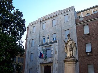
Bagnaria is a comune (municipality) in the Province of Pavia in the Italian region Lombardy, located about 70 km south of Milan and about 40 km south of Pavia. As of 31 December 2004, it had a population of 640 and an area of 16.6 km².

Borgarello is a comune (municipality) in the Province of Pavia in the Italian region Lombardy, located about 25 km south of Milan and about 6 km north of Pavia. As of 31 December 2004, it had a population of 2,188 and an area of 4.8 km².

Borgo Priolo is a comune (municipality) in the Province of Pavia in the Italian region Lombardy, located about 60 km south of Milan and about 25 km south of Pavia. As of 31 December 2004, it had a population of 1,399 and an area of 29.0 km².

Borgoratto Mormorolo is a comune (municipality) in the Province of Pavia in the Italian region Lombardy, located about 60 km south of Milan and about 30 km south of Pavia. As of 31 December 2004, it had a population of 415 and an area of 16.0 km².

Calvignano is a comune (municipality) in the Province of Pavia in the Italian region Lombardy, located about 50 km south of Milan and about 20 km south of Pavia. As of 31 December 2004, it had a population of 112 and an area of 6.9 km².

Corvino San Quirico is a comune (municipality) in the Province of Pavia in the Italian region Lombardy, located about 50 km south of Milan and about 20 km south of Pavia. As of 31 December 2004, it had a population of 1,084 and an area of 4.4 km².

Cura Carpignano is a comune (municipality) in the Province of Pavia in the Italian region Lombardy, located about 30 km south of Milan and about 9 km northeast of Pavia.

Fortunago is a comune (municipality) in the Province of Pavia in the Italian region Lombardy, located about 91 km south of Milan and about 42 km south of Pavia. As of 31 December 2004, it had a population of 407 and an area of 18.0 km².

Mornico Losana is a comune (municipality) in the Province of Pavia in the Italian region Lombardy, located about 50 km south of Milan and about 20 km south of Pavia. As of 31 December 2004, it had a population of 727 and an area of 8.2 km².

Oliva Gessi is a comune (municipality) in the Province of Pavia in the Italian region Lombardy, located about 50 km south of Milan and about 20 km south of Pavia. As of 31 December 2004, it had a population of 196 and an area of 3.9 km².

Pancarana is a comune (municipality) in the province of Pavia in the Italian region Lombardy, located about 45 km south of Milan and about 14 km southwest of Pavia, in the Oltrepò Pavese.

Robecco Pavese is a comune (municipality) in the Province of Pavia in the Italian region Lombardy, located in the Oltrepò Pavese about 45 km south of Milan and about 15 km south of Pavia.

Santa Margherita di Staffora is a comune (municipality) in the Province of Pavia in the Italian region Lombardy, located about 80 km south of Milan and about 50 km south of Pavia. As of 31 December 2004, it had a population of 589 and an area of 36.7 km².

Torricella Verzate is a comune (municipality) in the Province of Pavia in the Italian region Lombardy, located about 50 km south of Milan and about 20 km south of Pavia. As of December 31, 2004, it had a population of 829 and an area of 3.6 km².

Val di Nizza is a comune (municipality) in the Province of Pavia in the Italian region Lombardy, located about 60 km south of Milan and about 35 km south of Pavia. As of 31 December 2004, it had a population of 701 and an area of 29.5 km².

Valle Salimbene is a comune (municipality) in the Province of Pavia in the Italian region Lombardy, located about 35 km south of Milan and about 7 km southeast of Pavia. As of 31 December 2004, it had a population of 1,368 and an area of 7.1 km².

Valverde is a comune (municipality) in the Province of Pavia in the Italian region Lombardy, located about 70 km south of Milan and about 35 km south of Pavia. As of 31 December 2004, it had a population of 333 and an area of 14.8 km².

Vellezzo Bellini is a comune (municipality) in the Province of Pavia in the Italian region Lombardy, located about 25 km south of Milan and about 10 km northwest of Pavia. As of 31 December 2004, it had a population of 2,565 and an area of 7.9 km².

Verrua Po is a comune (municipality) in the Province of Pavia in the Italian region Lombardy, located about 45 km south of Milan and about 11 km south of Pavia.

Zavattarello is a comune (municipality) in the Province of Pavia in the Italian region Lombardy, located about 70 km south of Milan and about 35 km south of Pavia.


