Candia Lomellina

Last updated
Candia Lomellina
Comune
Comune di Candia Lomellina
Italy provincial location map 2015.svg
Red pog.svg
Candia Lomellina
Location of Candia Lomellina in Italy
Coordinates: 45°11′N8°36′E / 45.183°N 8.600°E / 45.183; 8.600 Coordinates: 45°11′N8°36′E / 45.183°N 8.600°E / 45.183; 8.600
Country Italy
Region Lombardy
Province Province of Pavia (PV)
Frazioni Terrasa
Area
  Total 27.8 km2 (10.7 sq mi)
Population (Dec. 2004)
  Total 1,639
  Density 59/km2 (150/sq mi)
Demonym(s) Candiesi
Time zone CET (UTC+1)
  Summer (DST) CEST (UTC+2)
Postal code27031
Dialing code 0384
Website Official website

Candia Lomellina is a comune (municipality) in the Province of Pavia in the Italian region Lombardy, located about 50 kilometres (31 mi) southwest of Milan and about 45 kilometres (28 mi) west of Pavia. As of 31 December 2004, it had a population of 1,639 and an area of 27.8 square kilometres (10.7 sq mi). [1]

<i>Comune</i> third-level administrative divisions of the Italian Republic

The comune is a basic administrative division in Italy, roughly equivalent to a township or municipality.
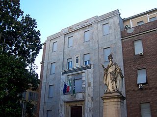
Province of Pavia Province of Italy

The province of Pavia is a province in the region of Lombardy in northern Italy; its capital is Pavia. As of 2015, the province has a population of 548,722 inhabitants and an area of 2,968.64 square kilometres (1,146.20 sq mi); the town of Pavia has a population of 72,205.

Italy republic in Southern Europe

Italy, officially the Italian Republic, is a country in Southern and Western Europe. Located in the middle of the Mediterranean Sea, Italy shares open land borders with France, Switzerland, Austria, Slovenia and the enclaved microstates San Marino and Vatican City. Italy covers an area of 301,340 km2 (116,350 sq mi) and has a largely temperate seasonal and Mediterranean climate. With around 61 million inhabitants, it is the fourth-most populous EU member state and the most populous country in Southern Europe.

Contents

The municipality of Candia Lomellina contains the frazione (subdivision) Terrasa.

"Frazione" is the Italian name given in administrative law to a type of territorial subdivision of a comune; for other administrative divisions, see municipio, circoscrizione, quartiere. It is cognate to the English word fraction, but in practice is roughly equivalent to "parishes" or "wards" in other countries.

Candia Lomellina borders the following municipalities: Breme, Casale Monferrato, Cozzo, Frassineto Po, Langosco, Motta de' Conti, Valle Lomellina.

Breme Comune in Lombardy, Italy

Breme is a comune (municipality) in the Province of Pavia in the Italian region Lombardy, located about 60 kilometres (37 mi) southwest of Milan and about 40 kilometres (25 mi) west of Pavia. As of 31 December 2004, it had a population of 889 and an area of 19.2 square kilometres (7.4 sq mi).

Casale Monferrato Comune in Piedmont, Italy

Casale Monferrato is a town in the Piedmont region in Italy, in the province of Alessandria. It is situated about 60 km (37 mi) east of Turin on the right bank of the Po, where the river runs at the foot of the Montferrat hills. Beyond the river lies the vast plain of the Po valley.

Cozzo Comune in Lombardy, Italy

Cozzo is a comune (municipality) in the Province of Pavia in the Italian region Lombardy, located about 50 km southwest of Milan and about 40 km west of Pavia. As of 31 December 2004, it had a population of 421 and an area of 17.4 km².

Demographic evolution

Candia Lomellina

Notable Persons of Candia Lomellina

Antipope Alexander V Catholic cardinal and antipope

Peter of Candia or Peter Phillarges as Alexander V was a nominal pope elected during the Western Schism (1378–1417). He reigned briefly from June 26, 1409, to his death in 1410 and is officially regarded by the Roman Catholic Church as an antipope.

Giovanni Reale Italian philosopher

Giovanni Reale was an Italian historian of philosophy.

Related Research Articles

Motta de Conti Comune in Piedmont, Italy

Motta de' Conti is a comune (municipality) in the Province of Vercelli in the Italian region Piedmont, located about 70 kilometres (43 mi) east of Turin and about 15 kilometres (9 mi) southeast of Vercelli. As of 31 December 2004, it had a population of 851 and an area of 11.8 square kilometres (4.6 sq mi).

Frassineto Po Comune in Piedmont, Italy

Frassineto Po is a comune (municipality) in the Province of Alessandria in the Italian region Piedmont, located about 70 kilometres (43 mi) east of Turin and about 25 kilometres (16 mi) north of Alessandria. As of 31 December 2004, it had a population of 1,462 and an area of 29.2 square kilometres (11.3 sq mi).

Borgo San Siro Comune in Lombardy, Italy

Borgo San Siro is a comune (municipality) in the Province of Pavia in the Italian region Lombardy, located about 25 kilometres (16 mi) southwest of Milan and about 12 kilometres (7 mi) northwest of Pavia, in the western Lomellina.

Castello dAgogna Comune in Lombardy, Italy

Castello d'Agogna is a small town and comune (municipality) in the Province of Pavia in the Italian region Lombardy, located about 45 km southwest of Milan and about 35 km west of Pavia. It is crossed by the Agogna river.

Castelnovetto Comune in Lombardy, Italy

Castelnovetto is a comune (municipality) in the Province of Pavia in the Italian region Lombardy, located about 50 km southwest of Milan and about 45 km west of Pavia. As of 31 December 2004, it had a population of 640 and an area of 18.5 km².

Ceretto Lomellina Comune in Lombardy, Italy

Ceretto Lomellina is a comune (municipality) in the Province of Pavia in the Italian region Lombardy, located about 45 km southwest of Milan and about 40 km west of Pavia. As of 31 December 2004, it had a population of 228 and an area of 7.4 km².

Cergnago Comune in Lombardy, Italy

Cergnago is a comune (municipality) in the Province of Pavia in the Italian region Lombardy, located about 45 km southwest of Milan and about 30 km west of Pavia. As of 31 December 2004, it had a population of 769 and an area of 13.6 km².

Langosco Comune in Lombardy, Italy

Langosco is a comune (municipality) in the Province of Pavia in the Italian region Lombardy, located about 50 kilometres (31 mi) southwest of Milan and about 45 kilometres (28 mi) west of Pavia. As of 31 December 2004, it had a population of 467 and an area of 15.7 square kilometres (6.1 sq mi).

Mezzana Rabattone Comune in Lombardy, Italy

Mezzana Rabattone is a comune (municipality) in the Province of Pavia in the Italian region Lombardy, located about 40 kilometres (25 mi) south of Milan and about 13 kilometres (8 mi) southwest of Pavia.

Nicorvo Comune in Lombardy, Italy

Nicorvo is a comune (municipality) in the Province of Pavia in the Italian region Lombardy, located about 45 km southwest of Milan and about 40 km northwest of Pavia. It is in the northern Lomellina, near the left bank of the Agogna river. Economy is based on agriculture, and especially on rice growing.

Ottobiano Comune in Lombardy, Italy

Ottobiano is a comune (municipality) in the Province of Pavia in the Italian region Lombardy, located about 45 km (28 mi) southwest of Milan and about 25 km (16 mi) west of Pavia. As of 31 December 2004, it had a population of 1,168 and an area of 24.5 km2 (9.5 sq mi).

San Giorgio di Lomellina Comune in Lombardy, Italy

San Giorgio di Lomellina is a comune (municipality) in the Province of Pavia in the Italian region Lombardy, located about 45 km southwest of Milan and about 30 km west of Pavia. As of 31 December 2004, it had a population of 1,196 and an area of 25.9 km².

SantAngelo Lomellina Comune in Lombardy, Italy

Sant'Angelo Lomellina is a comune (municipality) in the Province of Pavia in the Italian region Lombardy, located about 45 km southwest of Milan and about 35 km west of Pavia. As of 31 December 2004, it had a population of 821 and an area of 10.4 km².

Sartirana Lomellina Comune in Lombardy, Italy

Sartirana Lomellina is a comune (municipality) in the Province of Pavia in the Italian region Lombardy, located about 60 km southwest of Milan and about 40 km west of Pavia. As of 31 December 2004, it had a population of 1,837 and an area of 29.5 km².

Semiana Comune in Lombardy, Italy

Semiana is a comune (municipality) in the Province of Pavia in the Italian region Lombardy, located about 50 km southwest of Milan and about 35 km west of Pavia. As of 31 December 2004, it had a population of 256 and an area of 9.9 km².

Tromello Comune in Lombardy, Italy

Tromello is a comune (municipality) in the Province of Pavia in the Italian region Lombardy, located about 35 km southwest of Milan and about 25 km west of Pavia. As of 31 December 2004, it had a population of 3,561 and an area of 35.2 km².

Valle Lomellina Comune in Lombardy, Italy

Valle Lomellina is a comune (municipality) in the Province of Pavia in the Italian region Lombardy, located about 50 km southwest of Milan and about 40 km west of Pavia. As of 31 December 2004, it had a population of 2,224 and an area of 27.1 km².

Velezzo Lomellina Comune in Lombardy, Italy

Velezzo Lomellina is a comune (municipality) in the Province of Pavia in the Italian region Lombardy, located about 50 km southwest of Milan and about 35 km west of Pavia. As of 31 December 2004, it had a population of 113 and an area of 8.6 km².

References

  1. All demographics and other statistics: Italian statistical institute Istat.