Battuda | |
---|---|
Comune | |
Comune di Battuda | |
Coordinates: 45°16′N9°5′E / 45.267°N 9.083°E Coordinates: 45°16′N9°5′E / 45.267°N 9.083°E | |
Country | Italy |
Region | Lombardy |
Province | Pavia (PV) |
Government | |
• Mayor | Luigi Santagostini |
Area | |
• Total | 7.14 km2 (2.76 sq mi) |
Elevation | 98 m (322 ft) |
Population (28 February 2017) [1] | |
• Total | 656 |
• Density | 92/km2 (240/sq mi) |
Demonym(s) | Battudini |
Time zone | CET (UTC+1) |
• Summer (DST) | CEST (UTC+2) |
Postal code | 27020 |
Dialing code | 0382 |
Website | Official website |
Battuda is a comune (municipality) in the Province of Pavia in the Italian region Lombardy, located about 25 km southwest of Milan and about 11 km northwest of Pavia.
The comune is a basic administrative division in Italy, roughly equivalent to a township or municipality.
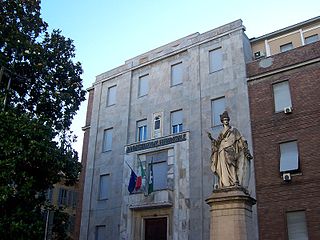
The province of Pavia is a province in the region of Lombardy in northern Italy; its capital is Pavia. As of 2015, the province has a population of 548,722 inhabitants and an area of 2,968.64 square kilometres (1,146.20 sq mi); the town of Pavia has a population of 72,205.
Italy, officially the Italian Republic, is a country in Southern and Western Europe. Located in the middle of the Mediterranean Sea, Italy shares open land borders with France, Switzerland, Austria, Slovenia and the enclaved microstates San Marino and Vatican City. Italy covers an area of 301,340 km2 (116,350 sq mi) and has a largely temperate seasonal and Mediterranean climate. With around 61 million inhabitants, it is the fourth-most populous EU member state and the most populous country in Southern Europe.
Battuda borders the following municipalities: Marcignago, Rognano, Trivolzio, Trovo, Vellezzo Bellini.
Marcignago is a comune (municipality) in the Province of Pavia in the Italian region Lombardy, located about 25 km southwest of Milan and about 9 km northwest of Pavia. As of 31 December 2004, it had a population of 2,155 and an area of 10.1 km².
Rognano is a comune (municipality) in the Province of Pavia in the Italian region Lombardy, located about 20 km (12 mi) southwest of Milan and about 12 km (7.5 mi) northwest of Pavia. As of 31 December 2004, it had a population of 308 and an area of 9.2 km2 (3.6 sq mi).
Trivolzio is a comune (municipality) in the Province of Pavia in the Italian region Lombardy, located about 25 km southwest of Milan and about 12 km northwest of Pavia. As of 31 December 2004, it had a population of 1,333 and an area of 3.9 km².
Borgarello is a comune (municipality) in the Province of Pavia in the Italian region Lombardy, located about 25 km south of Milan and about 6 km north of Pavia. As of 31 December 2004, it had a population of 2,188 and an area of 4.8 km².
Ceranova is a comune (municipality) in the Province of Pavia in the Italian region Lombardy, located about 25 km south of Milan and about 11 km northeast of Pavia.
Copiano is a comune (municipality) in the Province of Pavia in the Italian region Lombardy, located about 30 km southeast of Milan and about 13 km east of Pavia.
Filighera is a comune (municipality) in the Province of Pavia in the Italian region Lombardy, located about 35 km southeast of Milan and about 13 km east of Pavia.
Linarolo is a comune (municipality) in the Province of Pavia in the Italian region Lombardy, located about 35 km south of Milan and about 9 km east of Pavia. As of 31 December 2004, it had a population of 2,200 and an area of 12.3 km².
Magherno is a comune (municipality) in the Province of Pavia in the Italian region Lombardy, located about 30 km southeast of Milan and about 15 km east of Pavia.
Oliva Gessi is a comune (municipality) in the Province of Pavia in the Italian region Lombardy, located about 50 km south of Milan and about 20 km south of Pavia. As of 31 December 2004, it had a population of 196 and an area of 3.9 km².
Pancarana is a comune (municipality) in the province of Pavia in the Italian region Lombardy, located about 45 km south of Milan and about 14 km southwest of Pavia, in the Oltrepò Pavese.
Pieve Albignola is a comune (municipality) in the Province of Pavia in the Italian region Lombardy, located about 45 km southwest of Milan and about 20 km southwest of Pavia.
Portalbera is a comune (municipality) in the Province of Pavia in the Italian region Lombardy, located about 40 km southeast of Milan and about 15 km southeast of Pavia. As of 31 December 2004, it had a population of 1,434 and an area of 4.7 km².
Sommo is a comune (municipality) in the province of Pavia in the Italian region Lombardy, about 40 km south of Milan and about 8 km southwest of Pavia, on the eastern border of Lomellina traditional region.
Torre d'Isola is a comune (municipality) in the Province of Pavia in the Italian region Lombardy, located about 30 km south of Milan and about 6 km northwest of Pavia. As of 30 June 2008, it had a population of 2,276 and an area of 16.3 km².
Torrevecchia Pia is a comune (municipality) in the Province of Pavia in the Italian region Lombardy, located about 25 km southeast of Milan and about 15 km northeast of Pavia.
Valeggio is a comune (municipality) in the Province of Pavia in the Italian region Lombardy, located about 40 km southwest of Milan and about 25 km west of Pavia.
Valle Salimbene is a comune (municipality) in the Province of Pavia in the Italian region Lombardy, located about 35 km south of Milan and about 7 km southeast of Pavia. As of 31 December 2004, it had a population of 1,368 and an area of 7.1 km².
Velezzo Lomellina is a comune (municipality) in the Province of Pavia in the Italian region Lombardy, located about 50 km southwest of Milan and about 35 km west of Pavia. As of 31 December 2004, it had a population of 113 and an area of 8.6 km².
Vellezzo Bellini is a comune (municipality) in the Province of Pavia in the Italian region Lombardy, located about 25 km south of Milan and about 10 km northwest of Pavia. As of 31 December 2004, it had a population of 2,565 and an area of 7.9 km².
This article on a location in the Province of Pavia is a stub. You can help Wikipedia by expanding it. |