Cornale

Last updated
Cornale
Comune
Comune di Cornale
CornalePanorama1.jpg
Italy provincial location map 2015.svg
Red pog.svg
Cornale
Location of Cornale in Italy
Coordinates: 45°3′N8°55′E / 45.050°N 8.917°E / 45.050; 8.917 Coordinates: 45°3′N8°55′E / 45.050°N 8.917°E / 45.050; 8.917
Country Italy
Region Lombardy
Province Province of Pavia (PV)
Area
  Total 1.7 km2 (0.7 sq mi)
Population (Dec. 2004)
  Total 732
  Density 430/km2 (1,100/sq mi)
Time zone CET (UTC+1)
  Summer (DST) CEST (UTC+2)
Postal code27050
Dialing code 0383

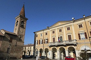
Cornale is a comune (municipality) in the Province of Pavia in the Italian region Lombardy, located about 50 km southwest of Milan and about 25 km southwest of Pavia. As of 31 December 2004, it had a population of 732 and an area of 1.7 km². [1]

<i>Comune</i> third-level administrative divisions of the Italian Republic

The comune is a basic administrative division in Italy, roughly equivalent to a township or municipality.

Province of Pavia Province of Italy

The province of Pavia is a province in the region of Lombardy in northern Italy; its capital is Pavia. As of 2015, the province has a population of 548,722 inhabitants and an area of 2,968.64 square kilometres (1,146.20 sq mi); the town of Pavia has a population of 72,205.

Italy republic in Southern Europe

Italy, officially the Italian Republic, is a country in Southern and Western Europe. Located in the middle of the Mediterranean Sea, Italy shares open land borders with France, Switzerland, Austria, Slovenia and the enclaved microstates San Marino and Vatican City. Italy covers an area of 301,340 km2 (116,350 sq mi) and has a largely temperate seasonal and Mediterranean climate. With around 61 million inhabitants, it is the fourth-most populous EU member state and the most populous country in Southern Europe.

Cornale borders the following municipalities: Bastida de' Dossi, Casei Gerola, Isola Sant'Antonio, Mezzana Bigli.

Bastida de Dossi Comune in Lombardy, Italy

Bastida de' Dossi is a comune (municipality) in the Province of Pavia in the Italian region Lombardy, located about 60 kilometres (37 mi) southwest of Milan and about 25 kilometres (16 mi) southwest of Pavia. It is situated in the Oltrepò Pavese plain and the municipal territory also include a part of Lomellina.

Casei Gerola Comune in Lombardy, Italy

Casei Gerola is a comune (municipality) in the Province of Pavia in the Italian region Lombardy, located about 60 kilometres (37 mi) southwest of Milan and about 25 kilometres (16 mi) southwest of Pavia.

Isola SantAntonio Comune in Piedmont, Italy

Isola Sant'Antonio is a comune (municipality) in the Province of Alessandria in the Italian region Piedmont, located about 90 kilometres (56 mi) east of Turin and about 20 kilometres (12 mi) northeast of Alessandria.

Demographic evolution

Cornale

Related Research Articles

Battuda Comune in Lombardy, Italy

Battuda is a comune (municipality) in the Province of Pavia in the Italian region Lombardy, located about 25 km southwest of Milan and about 11 km northwest of Pavia.

Ferrera Erbognone Comune in Lombardy, Italy

Ferrera Erbognone is a comune (municipality) in the Province of Pavia in the Italian region Lombardy, located about 45 km southwest of Milan and about 25 km southwest of Pavia. It is included in the lower Lomellina historical region, on the banks of the Erbognone stream, an affluent of the Agogna.

Frascarolo Comune in Lombardy, Italy

Frascarolo is a comune (municipality) in the Province of Pavia in the Italian region Lombardy, located about 60 km southwest of Milan and about 40 km southwest of Pavia. As of 31 December 2004, it had a population of 1,277 and an area of 23.4 km².

Galliavola Comune in Lombardy, Italy

Galliavola is a comune (municipality) in the Province of Pavia in the Italian region Lombardy, located about 50 km southwest of Milan and about 30 km southwest of Pavia. As of 31 December 2004, it had a population of 230 and an area of 8.5 km².

Gambarana Comune in Lombardy, Italy

Gambarana is a comune (municipality) in the Province of Pavia in the Italian region Lombardy, located about 60 km southwest of Milan and about 35 km southwest of Pavia. As of 31 December 2004, it had a population of 267 and an area of 12.0 km².

Marcignago Comune in Lombardy, Italy

Marcignago is a comune (municipality) in the Province of Pavia in the Italian region Lombardy, located about 25 km southwest of Milan and about 9 km northwest of Pavia. As of 31 December 2004, it had a population of 2,155 and an area of 10.1 km².

Mede, Lombardy Comune in Lombardy, Italy

Mede is a comune (municipality) in the Province of Pavia in the Italian region Lombardy, located about 50 km southwest of Milan and about 35 km southwest of Pavia. As of 31 December 2004, it had a population of 6,993 and an area of 33.4 km2.

Mezzana Bigli Comune in Lombardy, Italy

Mezzana Bigli is a comune (municipality) in the Province of Pavia in the Italian region Lombardy, located about 50 km southwest of Milan and about 25 km southwest of Pavia in the Lomellina traditional region, near the left bank of the Po River and its confluence with the Agogna.

Pieve Albignola Comune in Lombardy, Italy

Pieve Albignola is a comune (municipality) in the Province of Pavia in the Italian region Lombardy, located about 45 km southwest of Milan and about 20 km southwest of Pavia.

Pizzale Comune in Lombardy, Italy

Pizzale is a comune (municipality) in the Province of Pavia in the Italian region Lombardy, located about 50 km south of Milan and about 20 km southwest of Pavia.

Scaldasole Comune in Lombardy, Italy

Scaldasole is a comune (municipality) in the Province of Pavia in the Italian region Lombardy, located about 45 km southwest of Milan and about 20 km southwest of Pavia. As of 31 December 2004, it had a population of 902 and an area of 11.6 km².

Sommo Comune in Lombardy, Italy

Sommo is a comune (municipality) in the province of Pavia in the Italian region Lombardy, about 40 km south of Milan and about 8 km southwest of Pavia, on the eastern border of Lomellina traditional region.

Suardi Comune in Lombardy, Italy

Suardi is a comune (municipality) in the Province of Pavia in the Italian region Lombardy, located about 60 km southwest of Milan and about 35 km southwest of Pavia. As of 31 December 2004, it had a population of 692 and an area of 9.8 km².

Torre Beretti e Castellaro Comune in Lombardy, Italy

Torre Beretti e Castellaro is a comune (municipality) in the Province of Pavia in the Italian region Lombardy, located about 60 km southwest of Milan and about 40 km southwest of Pavia. As of 31 December 2004, it had a population of 604 and an area of 17.5 km².

Valeggio, Lombardy Comune in Lombardy, Italy

Valeggio is a comune (municipality) in the Province of Pavia in the Italian region Lombardy, located about 40 km southwest of Milan and about 25 km west of Pavia.

Velezzo Lomellina Comune in Lombardy, Italy

Velezzo Lomellina is a comune (municipality) in the Province of Pavia in the Italian region Lombardy, located about 50 km southwest of Milan and about 35 km west of Pavia. As of 31 December 2004, it had a population of 113 and an area of 8.6 km².

Villa Biscossi Comune in Lombardy, Italy

Villa Biscossi is a comune (municipality) in the Province of Pavia in the Italian region Lombardy, located about 50 km southwest of Milan and about 30 km southwest of Pavia. As of 31 December 2004, it had a population of 74 and an area of 5.0 km².

Villanova dArdenghi Comune in Lombardy, Italy

Villanova d'Ardenghi is a comune (municipality) in the Province of Pavia in the Italian region Lombardy, located about 35 km southwest of Milan and about 9 km west of Pavia. As of 31 December 2004, it had a population of 711 and an area of 6.8 km².

References

  1. All demographics and other statistics: Italian statistical institute Istat.