Ottobiano

Last updated
Ottobiano
Comune
Comune di Ottobiano
Italy provincial location map 2015.svg
Red pog.svg
Ottobiano
Location of Ottobiano in Italy
Coordinates: 45°9′N8°50′E / 45.150°N 8.833°E / 45.150; 8.833 Coordinates: 45°9′N8°50′E / 45.150°N 8.833°E / 45.150; 8.833
Country Italy
Region Lombardy
Province Province of Pavia (PV)
Area
  Total 24.5 km2 (9.5 sq mi)
Population (Dec. 2004)
  Total 1,168
  Density 48/km2 (120/sq mi)
Time zone CET (UTC+1)
  Summer (DST) CEST (UTC+2)
Postal code27030
Dialing code 0384

Ottobiano is a comune (municipality) in the Province of Pavia in the Italian region Lombardy, located about 45 km southwest of Milan and about 25 km west of Pavia. As of 31 December 2004, it had a population of 1,168 and an area of 24.5 km². [1]

<i>Comune</i> third-level administrative divisions of the Italian Republic

The comune is a basic administrative division in Italy, roughly equivalent to a township or municipality.
Province of Pavia Province of Italy

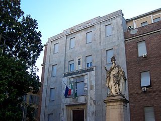
The province of Pavia is a province in the region of Lombardy in northern Italy; its capital is Pavia. As of 2015, the province has a population of 548,722 inhabitants and an area of 2,968.64 square kilometres (1,146.20 sq mi); the town of Pavia has a population of 72,205.

Italy republic in Southern Europe

Italy, officially the Italian Republic, is a European country consisting of a peninsula delimited by the Italian Alps and sorrounded by several islands. Located in the middle of the Mediterranean sea and traversed along its lenght by the Apennines, Italy has a largely temperate seasonal climate. The country covers an area of 301,340 km2 (116,350 sq mi) and shares open land borders with France, Slovenia, Austria, Switzerland and the enclaved microstates of Vatican City and San Marino. Italy has a territorial exclave in Switzerland (Campione) and a maritime exclave in the Tunisian sea (Lampedusa). With around 60 million inhabitants, Italy is the fourth-most populous member state of the European Union.

Contents

Ottobiano borders the following municipalities: Ferrera Erbognone, Lomello, San Giorgio di Lomellina, Tromello, Valeggio.

Ferrera Erbognone Comune in Lombardy, Italy

Ferrera Erbognone is a comune (municipality) in the Province of Pavia in the Italian region Lombardy, located about 45 km southwest of Milan and about 25 km southwest of Pavia. It is included in the lower Lomellina historical region, on the banks of the Erbognone stream, an affluent of the Agogna.

Lomello Comune in Lombardy, Italy

Lomello is a comune (municipality) in the Province of Pavia in the Italian region Lombardy, located about 50 km southwest of Milan and about 30 km west of Pavia, on the right bank of the Agogna. It gives its name to the surrounding area, the Lomellina. Lomello borders the following municipalities: Ferrera Erbognone, Galliavola, Mede, Ottobiano, San Giorgio di Lomellina, Semiana, Velezzo Lomellina, Villa Biscossi.

San Giorgio di Lomellina Comune in Lombardy, Italy

San Giorgio di Lomellina is a comune (municipality) in the Province of Pavia in the Italian region Lombardy, located about 45 km southwest of Milan and about 30 km west of Pavia. As of 31 December 2004, it had a population of 1,196 and an area of 25.9 km².

Demographic evolution

Ottobiano

Notable people

Victorio Codovilla was an Italian/Argentine socialist and later communist politician. He was a member of the Italian Socialist Party and held leadership posts in the Communist Party of Argentina and the Comintern.

Related Research Articles

Borgarello Comune in Lombardy, Italy

Borgarello is a comune (municipality) in the Province of Pavia in the Italian region Lombardy, located about 25 km south of Milan and about 6 km north of Pavia. As of 31 December 2004, it had a population of 2,188 and an area of 4.8 km².

Castelletto di Branduzzo Comune in Lombardy, Italy

Castelletto di Branduzzo is a comune (municipality) in the Province of Pavia in the Italian region Lombardy, located about 45 km (28 mi) south of Milan and about 14 km (8.7 mi) southwest of Pavia.

Cervesina Comune in Lombardy, Italy

Cervesina is a comune (municipality) in the Province of Pavia in the Italian region Lombardy, located about 45 kilometres (28 mi) south of Milan and about 15 kilometres (9 mi) southwest of Pavia. As of 31 December 2004, it had a population of 1,186 and an area of 12.5 square kilometres (4.8 sq mi).

Galliavola Comune in Lombardy, Italy

Galliavola is a comune (municipality) in the Province of Pavia in the Italian region Lombardy, located about 50 km southwest of Milan and about 30 km southwest of Pavia. As of 31 December 2004, it had a population of 230 and an area of 8.5 km².

Gambolò Comune in Lombardy, Italy

Gambolò is a comune (municipality) in the Province of Pavia in the Italian region Lombardy, located about 35 kilometres southwest of Milan and about 25 km (16 mi) northwest of Pavia.

Garlasco Comune in Lombardy, Italy

Garlasco is a comune (municipality) in the Province of Pavia in the Italian region Lombardy, located about 35 kilometres (22 mi) southwest of Milan and about 20 kilometres (12 mi) west of Pavia. As of 31 December 2004, it had a population of 9,343 and an area of 39.0 square kilometres (15.1 sq mi).

Marcignago Comune in Lombardy, Italy

Marcignago is a comune (municipality) in the Province of Pavia in the Italian region Lombardy, located about 25 km southwest of Milan and about 9 km northwest of Pavia. As of 31 December 2004, it had a population of 2,155 and an area of 10.1 km².

Montù Beccaria Comune in Lombardy, Italy

Montù Beccaria is a comune (municipality) in the Province of Pavia in the Italian region Lombardy, located about 50 km (31 mi) south of Milan and about 20 km (12 mi) southeast of Pavia. As of 31 December 2004, it had a population of 1,736 and an area of 15.6 km2 (6 sq mi).

Pizzale Comune in Lombardy, Italy

Pizzale is a comune (municipality) in the Province of Pavia in the Italian region Lombardy, located about 50 km south of Milan and about 20 km southwest of Pavia.

Ponte Nizza Comune in Lombardy, Italy

Ponte Nizza is a comune (municipality) in the Province of Pavia in the Italian region Lombardy, located about 70 km south of Milan and about 35 km south of Pavia.

Rognano Comune in Lombardy, Italy

Rognano is a comune (municipality) in the Province of Pavia in the Italian region Lombardy, located about 20 km (12 mi) southwest of Milan and about 12 km (7.5 mi) northwest of Pavia. As of 31 December 2004, it had a population of 308 and an area of 9.2 km2 (3.6 sq mi).

Torrazza Coste Comune in Lombardy, Italy

Torrazza Coste is a comune (municipality) in the Province of Pavia in the Italian region Lombardy, located about 50 km (31 mi) south of Milan and about 25 km (16 mi) southwest of Pavia. As of 31 December 2004, it had a population of 1,516 and an area of 16.1 km2 (6 sq mi).

Trovo Comune in Lombardy, Italy

Trovo is a comune (municipality) in the Province of Pavia in the Italian region of Lombardy, about 25 km (16 mi) southwest of Milan and 14 km (8.7 mi) northwest of Pavia.

Val di Nizza Comune in Lombardy, Italy

Val di Nizza is a comune (municipality) in the Province of Pavia in the Italian region Lombardy, located about 60 km south of Milan and about 35 km south of Pavia. As of 31 December 2004, it had a population of 701 and an area of 29.5 km².

Valeggio, Lombardy Comune in Lombardy, Italy

Valeggio is a comune (municipality) in the Province of Pavia in the Italian region Lombardy, located about 40 km southwest of Milan and about 25 km west of Pavia.

Vellezzo Bellini Comune in Lombardy, Italy

Vellezzo Bellini is a comune (municipality) in the Province of Pavia in the Italian region Lombardy, located about 25 km south of Milan and about 10 km northwest of Pavia. As of 31 December 2004, it had a population of 2,565 and an area of 7.9 km².

Verretto Comune in Lombardy, Italy

Verretto is a comune (municipality) in the Province of Pavia in the Italian region Lombardy, located about 45 km south of Milan and about 15 km south of Pavia.

Pavia di Udine Comune in Friuli-Venezia Giulia, Italy

Pavia di Udine is a comune (municipality) in the Province of Udine in the Italian region Friuli-Venezia Giulia, located about 60 kilometres (37 mi) northwest of Trieste and about 9 kilometres (6 mi) southeast of Udine.

References

  1. All demographics and other statistics: Italian statistical institute Istat.