Valle Salimbene

Last updated
Valle Salimbene
Comune
Comune di Valle Salimbene
Italy provincial location map 2015.svg
Red pog.svg
Valle Salimbene
Location of Valle Salimbene in Italy
Coordinates: 45°10′N9°14′E / 45.167°N 9.233°E / 45.167; 9.233 Coordinates: 45°10′N9°14′E / 45.167°N 9.233°E / 45.167; 9.233
Country Italy
Region Lombardy
Province Province of Pavia (PV)
Area
  Total 7.1 km2 (2.7 sq mi)
Population (Dec. 2004)
  Total 1,368
  Density 190/km2 (500/sq mi)
Time zone CET (UTC+1)
  Summer (DST) CEST (UTC+2)
Postal code27010
Dialing code 0382

Valle Salimbene is a comune (municipality) in the Province of Pavia in the Italian region Lombardy, located about 35 km south of Milan and about 7 km southeast of Pavia. As of 31 December 2004, it had a population of 1,368 and an area of 7.1 km². [1]

<i>Comune</i> third-level administrative divisions of the Italian Republic

The comune is a basic administrative division in Italy, roughly equivalent to a township or municipality.
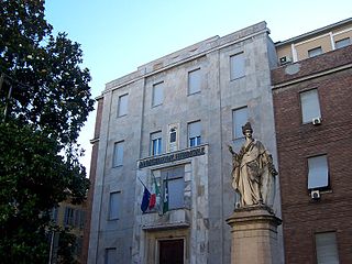
Province of Pavia Province of Italy

The province of Pavia is a province in the region of Lombardy in northern Italy; its capital is Pavia. As of 2015, the province has a population of 548,722 inhabitants and an area of 2,968.64 square kilometres (1,146.20 sq mi); the town of Pavia has a population of 72,205.

Italy republic in Southern Europe

Italy, officially the Italian Republic, is a country in Southern Europe. Located in the middle of the Mediterranean Sea, Italy shares open land borders with France, Switzerland, Austria, Slovenia and the enclaved microstates San Marino and Vatican City. Italy covers an area of 301,340 km2 (116,350 sq mi) and has a largely temperate seasonal and Mediterranean climate. With around 61 million inhabitants, it is the fourth-most populous EU member state and the most populous country in Southern Europe.

Valle Salimbene borders the following municipalities: Albuzzano, Cura Carpignano, Linarolo, Pavia, Travacò Siccomario.

Albuzzano Comune in Lombardy, Italy

Albuzzano is a comune (municipality) in the Province of Pavia in the Italian region of Lombardy, located about 30 km south of Milan and about 9 km east of Pavia. As of 31 December 2004, it had a population of 2,500 and an area of 15.3 km².

Cura Carpignano Comune in Lombardy, Italy

Cura Carpignano is a comune (municipality) in the Province of Pavia in the Italian region Lombardy, located about 30 km south of Milan and about 9 km northeast of Pavia.

Linarolo Comune in Lombardy, Italy

Linarolo is a comune (municipality) in the Province of Pavia in the Italian region Lombardy, located about 35 km south of Milan and about 9 km east of Pavia. As of 31 December 2004, it had a population of 2,200 and an area of 12.3 km².

Demographic evolution

Valle Salimbene

Related Research Articles

Breme Comune in Lombardy, Italy

Breme is a comune (municipality) in the Province of Pavia in the Italian region Lombardy, located about 60 kilometres (37 mi) southwest of Milan and about 40 kilometres (25 mi) west of Pavia. As of 31 December 2004, it had a population of 889 and an area of 19.2 square kilometres (7.4 sq mi).

Candia Lomellina Comune in Lombardy, Italy

Candia Lomellina is a comune (municipality) in the Province of Pavia in the Italian region Lombardy, located about 50 kilometres (31 mi) southwest of Milan and about 45 kilometres (28 mi) west of Pavia. As of 31 December 2004, it had a population of 1,639 and an area of 27.8 square kilometres (10.7 sq mi).

Carbonara al Ticino Comune in Lombardy, Italy

Carbonara al Ticino is a comune (municipality) in the Province of Pavia in the Italian region Lombardy, located about 35 km south of Milan and about 7 km southwest of Pavia.

Ceretto Lomellina Comune in Lombardy, Italy

Ceretto Lomellina is a comune (municipality) in the Province of Pavia in the Italian region Lombardy, located about 45 km southwest of Milan and about 40 km west of Pavia. As of 31 December 2004, it had a population of 228 and an area of 7.4 km².

Cozzo Comune in Lombardy, Italy

Cozzo is a comune (municipality) in the Province of Pavia in the Italian region Lombardy, located about 50 km southwest of Milan and about 40 km west of Pavia. As of 31 December 2004, it had a population of 421 and an area of 17.4 km².

Lirio Comune in Lombardy, Italy

Lirio is a comune (municipality) in the Province of Pavia in the Italian region Lombardy, located about 50 km south of Milan and about 20 km southeast of Pavia. As of 31 December 2004, it had a population of 153 and an area of 1.7 km².

Portalbera Comune in Lombardy, Italy

Portalbera is a comune (municipality) in the Province of Pavia in the Italian region Lombardy, located about 40 km southeast of Milan and about 15 km southeast of Pavia. As of 31 December 2004, it had a population of 1,434 and an area of 4.7 km².

Rea, Lombardy Comune in Lombardy, Italy

Rea is a comune (municipality) in the Province of Pavia in the Italian region Lombardy, located about 40 km south of Milan and about 7 km south of Pavia. As of 31 December 2004, it had a population of 462 and an area of 3.0 km².

Retorbido Comune in Lombardy, Italy

Retorbido is a comune (municipality) in the Province of Pavia in the Italian region Lombardy, located about 60 km south of Milan and about 30 km southwest of Pavia. As of 31 December 2004, it had a population of 1,242 and an area of 11.7 km².

Rognano Comune in Lombardy, Italy

Rognano is a comune (municipality) in the Province of Pavia in the Italian region Lombardy, located about 20 km (12 mi) southwest of Milan and about 12 km (7.5 mi) northwest of Pavia. As of 31 December 2004, it had a population of 308 and an area of 9.2 km2 (3.6 sq mi).

Santa Margherita di Staffora Comune in Lombardy, Italy

Santa Margherita di Staffora is a comune (municipality) in the Province of Pavia in the Italian region Lombardy, located about 80 km south of Milan and about 50 km south of Pavia. As of 31 December 2004, it had a population of 589 and an area of 36.7 km².

Sartirana Lomellina Comune in Lombardy, Italy

Sartirana Lomellina is a comune (municipality) in the Province of Pavia in the Italian region Lombardy, located about 60 km southwest of Milan and about 40 km west of Pavia. As of 31 December 2004, it had a population of 1,837 and an area of 29.5 km².

Semiana Comune in Lombardy, Italy

Semiana is a comune (municipality) in the Province of Pavia in the Italian region Lombardy, located about 50 km southwest of Milan and about 35 km west of Pavia. As of 31 December 2004, it had a population of 256 and an area of 9.9 km².

Travacò Siccomario Comune in Lombardy, Italy

Travacò Siccomario is a comune (municipality) in the Province of Pavia in the Italian region Lombardy, located about 35 km south of Milan and about 4 km southeast of Pavia, near the concluence of the Po and Ticino rivers.

Trovo Comune in Lombardy, Italy

Trovo is a comune (municipality) in the Province of Pavia in the Italian region of Lombardy, about 25 km (16 mi) southwest of Milan and 14 km (8.7 mi) northwest of Pavia.

Valle Lomellina Comune in Lombardy, Italy

Valle Lomellina is a comune (municipality) in the Province of Pavia in the Italian region Lombardy, located about 50 km southwest of Milan and about 40 km west of Pavia. As of 31 December 2004, it had a population of 2,224 and an area of 27.1 km².

Velezzo Lomellina Comune in Lombardy, Italy

Velezzo Lomellina is a comune (municipality) in the Province of Pavia in the Italian region Lombardy, located about 50 km southwest of Milan and about 35 km west of Pavia. As of 31 December 2004, it had a population of 113 and an area of 8.6 km².

Vellezzo Bellini Comune in Lombardy, Italy

Vellezzo Bellini is a comune (municipality) in the Province of Pavia in the Italian region Lombardy, located about 25 km south of Milan and about 10 km northwest of Pavia. As of 31 December 2004, it had a population of 2,565 and an area of 7.9 km².

References

  1. All demographics and other statistics: Italian statistical institute Istat.