Ceretto Lomellina

Last updated
Ceretto Lomellina
Comune
Comune di Ceretto Lomellina
Italy provincial location map 2015.svg
Red pog.svg
Ceretto Lomellina
Location of Ceretto Lomellina in Italy
Coordinates: 45°15′N8°40′E / 45.250°N 8.667°E / 45.250; 8.667 Coordinates: 45°15′N8°40′E / 45.250°N 8.667°E / 45.250; 8.667
Country Italy
Region Lombardy
Province Province of Pavia (PV)
Area
  Total 7.4 km2 (2.9 sq mi)
Population (Dec. 2004)
  Total 228
  Density 31/km2 (80/sq mi)
Time zone CET (UTC+1)
  Summer (DST) CEST (UTC+2)
Postal code27030
Dialing code 0384

Ceretto Lomellina is a comune (municipality) in the Province of Pavia in the Italian region Lombardy, located about 45 km southwest of Milan and about 40 km west of Pavia. As of 31 December 2004, it had a population of 228 and an area of 7.4 km². [1]

<i>Comune</i> third-level administrative divisions of the Italian Republic

The comune is a basic administrative division in Italy, roughly equivalent to a township or municipality.
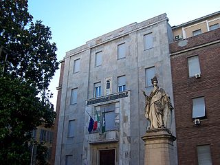
Province of Pavia Province of Italy

The province of Pavia is a province in the region of Lombardy in northern Italy; its capital is Pavia. As of 2015, the province has a population of 548,722 inhabitants and an area of 2,968.64 square kilometres (1,146.20 sq mi); the town of Pavia has a population of 72,205.

Italy republic in Southern Europe

Italy, officially the Italian Republic, is a country in Southern and Western Europe. Located in the middle of the Mediterranean Sea, Italy shares open land borders with France, Switzerland, Austria, Slovenia and the enclaved microstates San Marino and Vatican City. Italy covers an area of 301,340 km2 (116,350 sq mi) and has a largely temperate seasonal and Mediterranean climate. With around 61 million inhabitants, it is the fourth-most populous EU member state and the most populous country in Southern Europe.

Ceretto Lomellina borders the following municipalities: Castello d'Agogna, Castelnovetto, Mortara, Nicorvo, Sant'Angelo Lomellina.

Castello dAgogna Comune in Lombardy, Italy

Castello d'Agogna is a small town and comune (municipality) in the Province of Pavia in the Italian region Lombardy, located about 45 km southwest of Milan and about 35 km west of Pavia. It is crossed by the Agogna river.

Castelnovetto Comune in Lombardy, Italy

Castelnovetto is a comune (municipality) in the Province of Pavia in the Italian region Lombardy, located about 50 km southwest of Milan and about 45 km west of Pavia. As of 31 December 2004, it had a population of 640 and an area of 18.5 km².

Mortara, Lombardy Comune in Lombardy, Italy

Mortara is a town and comune in the region of Lombardy, Italy. It lies between the Agogna and Terdoppio rivers, in the historical district known as Lomellina, a rice-growing agricultural center. It received the honorary title of city with a royal decree in 1706.

Demographic evolution

Ceretto Lomellina

Related Research Articles

Candia Lomellina Comune in Lombardy, Italy

Candia Lomellina is a comune (municipality) in the Province of Pavia in the Italian region Lombardy, located about 50 kilometres (31 mi) southwest of Milan and about 45 kilometres (28 mi) west of Pavia. As of 31 December 2004, it had a population of 1,639 and an area of 27.8 square kilometres (10.7 sq mi).

Carbonara al Ticino Comune in Lombardy, Italy

Carbonara al Ticino is a comune (municipality) in the Province of Pavia in the Italian region Lombardy, located about 35 km south of Milan and about 7 km southwest of Pavia.

Cassolnovo Comune in Lombardy, Italy

Cassolnovo is a comune (municipality) in the Province of Pavia in the Italian region Lombardy, located about 30 km southwest of Milan and about 35 km northwest of Pavia. As of 31 December 2004, it had a population of 6,203 and an area of 32.0 km².

Cergnago Comune in Lombardy, Italy

Cergnago is a comune (municipality) in the Province of Pavia in the Italian region Lombardy, located about 45 km southwest of Milan and about 30 km west of Pavia. As of 31 December 2004, it had a population of 769 and an area of 13.6 km².

Cozzo Comune in Lombardy, Italy

Cozzo is a comune (municipality) in the Province of Pavia in the Italian region Lombardy, located about 50 km southwest of Milan and about 40 km west of Pavia. As of 31 December 2004, it had a population of 421 and an area of 17.4 km².

Ferrera Erbognone Comune in Lombardy, Italy

Ferrera Erbognone is a comune (municipality) in the Province of Pavia in the Italian region Lombardy, located about 45 km southwest of Milan and about 25 km southwest of Pavia. It is included in the lower Lomellina historical region, on the banks of the Erbognone stream, an affluent of the Agogna.

Mezzana Bigli Comune in Lombardy, Italy

Mezzana Bigli is a comune (municipality) in the Province of Pavia in the Italian region Lombardy, located about 50 km southwest of Milan and about 25 km southwest of Pavia in the Lomellina traditional region, near the left bank of the Po River and its confluence with the Agogna.

Nicorvo Comune in Lombardy, Italy

Nicorvo is a comune (municipality) in the Province of Pavia in the Italian region Lombardy, located about 45 km southwest of Milan and about 40 km northwest of Pavia. It is in the northern Lomellina, near the left bank of the Agogna river. Economy is based on agriculture, and especially on rice growing.

San Giorgio di Lomellina Comune in Lombardy, Italy

San Giorgio di Lomellina is a comune (municipality) in the Province of Pavia in the Italian region Lombardy, located about 45 km southwest of Milan and about 30 km west of Pavia. As of 31 December 2004, it had a population of 1,196 and an area of 25.9 km².

SantAngelo Lomellina Comune in Lombardy, Italy

Sant'Angelo Lomellina is a comune (municipality) in the Province of Pavia in the Italian region Lombardy, located about 45 km southwest of Milan and about 35 km west of Pavia. As of 31 December 2004, it had a population of 821 and an area of 10.4 km².

Sartirana Lomellina Comune in Lombardy, Italy

Sartirana Lomellina is a comune (municipality) in the Province of Pavia in the Italian region Lombardy, located about 60 km southwest of Milan and about 40 km west of Pavia. As of 31 December 2004, it had a population of 1,837 and an area of 29.5 km².

Semiana Comune in Lombardy, Italy

Semiana is a comune (municipality) in the Province of Pavia in the Italian region Lombardy, located about 50 km southwest of Milan and about 35 km west of Pavia. As of 31 December 2004, it had a population of 256 and an area of 9.9 km².

Sommo Comune in Lombardy, Italy

Sommo is a comune (municipality) in the province of Pavia in the Italian region Lombardy, about 40 km south of Milan and about 8 km southwest of Pavia, on the eastern border of Lomellina traditional region.

Torre Beretti e Castellaro Comune in Lombardy, Italy

Torre Beretti e Castellaro is a comune (municipality) in the Province of Pavia in the Italian region Lombardy, located about 60 km southwest of Milan and about 40 km southwest of Pavia. As of 31 December 2004, it had a population of 604 and an area of 17.5 km².

Tromello Comune in Lombardy, Italy

Tromello is a comune (municipality) in the Province of Pavia in the Italian region Lombardy, located about 35 km southwest of Milan and about 25 km west of Pavia. As of 31 December 2004, it had a population of 3,561 and an area of 35.2 km².

Valle Lomellina Comune in Lombardy, Italy

Valle Lomellina is a comune (municipality) in the Province of Pavia in the Italian region Lombardy, located about 50 km southwest of Milan and about 40 km west of Pavia. As of 31 December 2004, it had a population of 2,224 and an area of 27.1 km².

Velezzo Lomellina Comune in Lombardy, Italy

Velezzo Lomellina is a comune (municipality) in the Province of Pavia in the Italian region Lombardy, located about 50 km southwest of Milan and about 35 km west of Pavia. As of 31 December 2004, it had a population of 113 and an area of 8.6 km².

Zinasco Comune in Lombardy, Italy

Zinasco is a comune (municipality) in the Province of Pavia in the Italian region Lombardy, located about 40 km south of Milan and about 10 km southwest of Pavia in the Lomellina. It is formed by two villages, Zinasco Vecchio, known from the 12th century, and Zinasco Nuovo. It became part of the Savoy-Piedmont in 1713.

References

  1. All demographics and other statistics: Italian statistical institute Istat.