Redavalle

Last updated
Redavalle
Comune
Comune di Redavalle
Redavalle-Stemma.gif
Coat of arms
Italy provincial location map 2015.svg
Red pog.svg
Redavalle
Location of Redavalle in Italy
Coordinates: 45°2′N9°11′E / 45.033°N 9.183°E / 45.033; 9.183 Coordinates: 45°2′N9°11′E / 45.033°N 9.183°E / 45.033; 9.183
Country Italy
Region Lombardy
Province Pavia (PV)
Frazioni Calcababbio, Casa Ramati
Area
  Total 5.47 km2 (2.11 sq mi)
Elevation 85 m (279 ft)
Population (Dec. 2004) [1]
  Total 1,028
  Density 190/km2 (490/sq mi)
Time zone CET (UTC+1)
  Summer (DST) CEST (UTC+2)
Postal code27050
Dialing code 0385

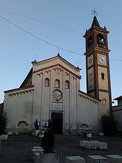
Redavalle is a comune (municipality) in the Province of Pavia in the Italian region Lombardy, located about 50 km south of Milan and about 15 km south of Pavia.

<i>Comune</i> third-level administrative divisions of the Italian Republic

The comune is a basic administrative division in Italy, roughly equivalent to a township or municipality.
Province of Pavia Province of Italy

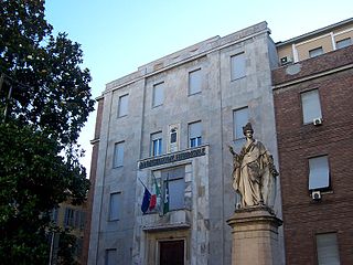
The province of Pavia is a province in the region of Lombardy in northern Italy; its capital is Pavia. As of 2015, the province has a population of 548,722 inhabitants and an area of 2,968.64 square kilometres (1,146.20 sq mi); the town of Pavia has a population of 72,205.

Italy republic in Southern Europe

Italy, officially the Italian Republic, is a European country consisting of a peninsula delimited by the Italian Alps and surrounded by several islands. Located in the middle of the Mediterranean sea and traversed along its length by the Apennines, Italy has a largely temperate seasonal climate. The country covers an area of 301,340 km2 (116,350 sq mi) and shares open land borders with France, Slovenia, Austria, Switzerland and the enclaved microstates of Vatican City and San Marino. Italy has a territorial exclave in Switzerland (Campione) and a maritime exclave in the Tunisian sea (Lampedusa). With around 60 million inhabitants, Italy is the fourth-most populous member state of the European Union.

Contents

Redavalle borders the following municipalities: Barbianello, Broni, Pietra de' Giorgi, Santa Giuletta.

Barbianello Comune in Lombardy, Italy

Barbianello is a comune (municipality) in the Province of Pavia in the Italian region Lombardy, located about 45 km south of Milan and about 14 km southeast of Pavia.

Broni Comune in Lombardy, Italy

Broni is a comune (municipality) in the Province of Pavia in the Italian region Lombardy, located about 45 km south of Milan and about 15 km southeast of Pavia. As of 31 December 2004, it had a population of 9,279 and an area of 20.9 km².

Pietra de Giorgi Comune in Lombardy, Italy

Pietra de' Giorgi is a comune (municipality) in the Province of Pavia in the Italian region Lombardy, located about 45 km south of Milan and about 15 km southeast of Pavia. As of 31 December 2004, it had a population of 857 and an area of 11.0 km².

History

A Roman centre called Cameliomagus, Comillomagus or Camillomagus existed in the area. In the Middle Ages a settlement known as San Martino di Strada (St. Martin on the Road) replaced it, which was acquired by the commune of Pavia in 1164. It had a castle which was set on fire during the war against Frederick Barbarossa. San Martino's population gradually moved to Ridavalle, part of the fief of Broni.

Demographic evolution

Redavalle

Twin towns

Related Research Articles

Albaredo Arnaboldi Comune in Lombardy, Italy

Albaredo Arnaboldi is a comune (municipality) in the Province of Pavia in the Italian region Lombardy, located about 40 km south of Milan and about 12 km southeast of Pavia. As of 31 December 2004, it had a population of 200 and an area of 9.2 km².

Borgarello Comune in Lombardy, Italy

Borgarello is a comune (municipality) in the Province of Pavia in the Italian region Lombardy, located about 25 km south of Milan and about 6 km north of Pavia. As of 31 December 2004, it had a population of 2,188 and an area of 4.8 km².

Calvignano Comune in Lombardy, Italy

Calvignano is a comune (municipality) in the Province of Pavia in the Italian region Lombardy, located about 50 km south of Milan and about 20 km south of Pavia. As of 31 December 2004, it had a population of 112 and an area of 6.9 km².

Campospinoso Comune in Lombardy, Italy

Campospinoso is a comune (municipality) in the Province of Pavia in the Italian region Lombardy, located about 50 km south of Milan and about 12 km southeast of Pavia. As of 31 December 2004, it had a population of 800 and an area of 3.7 km².

Canneto Pavese Comune in Lombardy, Italy

Canneto Pavese is a comune (municipality) in the Province of Pavia in the Italian region of Lombardy, located about 45 km south of Milan and about 20 km southeast of Pavia. As of 31 December 2004, it had a population of 1,428 and an area of 5.8 km².

Casatisma Comune in Lombardy, Italy

Casatisma is a comune (municipality) in the Province of Pavia in the Italian region Lombardy, located about 45 km south of Milan and about 15 km south of Pavia.

Cava Manara Comune in Lombardy, Italy

Cava Manara is a comune (municipality) in the province of Pavia in the Italian region Lombardy, located about 35 km south of Milan and about 7 km southwest of Pavia, not far from the confluence of the Ticino and the Po rivers.

Cigognola Comune in Lombardy, Italy

Cigognola is a comune (municipality) in the Province of Pavia in the Italian region Lombardy, located about 50 km south of Milan and about 20 km southeast of Pavia. As of 31 December 2004, it had a population of 1,386 and an area of 8.0 km².

Corvino San Quirico Comune in Lombardy, Italy

Corvino San Quirico is a comune (municipality) in the Province of Pavia in the Italian region Lombardy, located about 50 km south of Milan and about 20 km south of Pavia. As of 31 December 2004, it had a population of 1,084 and an area of 4.4 km².

Linarolo Comune in Lombardy, Italy

Linarolo is a comune (municipality) in the Province of Pavia in the Italian region Lombardy, located about 35 km south of Milan and about 9 km east of Pavia. As of 31 December 2004, it had a population of 2,200 and an area of 12.3 km².

Montù Beccaria Comune in Lombardy, Italy

Montù Beccaria is a comune (municipality) in the Province of Pavia in the Italian region Lombardy, located about 50 km (31 mi) south of Milan and about 20 km (12 mi) southeast of Pavia. As of 31 December 2004, it had a population of 1,736 and an area of 15.6 km2 (6 sq mi).

San Cipriano Po Comune in Lombardy, Italy

San Cipriano Po is a comune (municipality) in the Province of Pavia in the Italian region Lombardy, located about 40 km south of Milan and about 12 km southeast of Pavia. As of 31 December 2004, it had a population of 435 and an area of 8.7 km².

San Martino Siccomario Comune in Lombardy, Italy

San Martino Siccomario is a comune in the Province of Pavia in the Italian region Lombardy, located about 35 km south of Milan and about 4 km southwest of Pavia. It is now effectively part of Pavia metropolitan area.

Torre dIsola Comune in Lombardy, Italy

Torre d'Isola is a comune (municipality) in the Province of Pavia in the Italian region Lombardy, located about 30 km south of Milan and about 6 km northwest of Pavia. As of 30 June 2008, it had a population of 2,276 and an area of 16.3 km².

Torricella Verzate Comune in Lombardy, Italy

Torricella Verzate is a comune (municipality) in the Province of Pavia in the Italian region Lombardy, located about 50 km south of Milan and about 20 km south of Pavia. As of December 31, 2004, it had a population of 829 and an area of 3.6 km².

Travacò Siccomario Comune in Lombardy, Italy

Travacò Siccomario is a comune (municipality) in the Province of Pavia in the Italian region Lombardy, located about 35 km south of Milan and about 4 km southeast of Pavia, near the concluence of the Po and Ticino rivers.

Zeccone Comune in Lombardy, Italy

Zeccone is a comune (municipality) in the Province of Pavia in the Italian region Lombardy, located about 20 km south of Milan and about 10 km northeast of Pavia.

References

  1. All demographics and other statistics: Italian statistical institute Istat.