Calumpit, officially the Municipality of Calumpit, (Tagalog: Bayan ng Calumpit), is a 1st classmunicipality in the province of Bulacan, Philippines. According to the 2015 census, it has a population of 108,757 people.[3]
Tagalog is an Austronesian language spoken as a first language by a quarter of the population of the Philippines and as a second language by the majority. Its standardized form, officially named Filipino, is the national language of the Philippines, and is one of two official languages alongside English.
Bulacan is a province in the Philippines, located in the Central Luzon Region in the island of Luzon, 11 kilometres (6.8 mi) north of Manila, and part of the Metro Luzon Urban Beltway Super Region. Bulacan was established on August 15, 1578.
The Philippines, officially the Republic of the Philippines, is an archipelagic country in Southeast Asia. Situated in the western Pacific Ocean, it consists of about 7,641 islands that are categorized broadly under three main geographical divisions from north to south: Luzon, Visayas, and Mindanao. The capital city of the Philippines is Manila and the most populous city is Quezon City, both part of Metro Manila. Bounded by the South China Sea on the west, the Philippine Sea on the east and the Celebes Sea on the southwest, the Philippines shares maritime borders with Taiwan to the north, Vietnam to the west, Palau to the east, and Malaysia and Indonesia to the south.
The name "Calumpit" comes from the tree "Kalumpít", an indigenous hardwood species similar to apalit and narra, which grows abundantly in front of the St. John the Baptist Parish Church in the Población-Sucol area.
Terminalia microcarpa is a tree species in the family Combretaceae. It occurs in Indonesia, Malaysia, the Philippines, Papua New Guinea and Australia.
History
Precolonial era
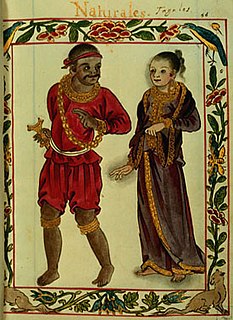
Calumpit was already an established barangay under the leadership of Gat Maitim prior to the Fall of the Kingdom of Tondo in June 1571. Other nearby villages were Gatbuka, Meyto, Meysulao, Pandukot, Malolos, Macabebe, Hagonoy, and Apalit. When Calumpit was hispanised and established as a political and geographical entity in 1572, they chose what is today Barangay Población as the site of the church and the administrative center of the aforementioned villages, which were annexed to it.
In early Philippine history, the barangay was a complex sociopolitical unit which scholars have historically considered the dominant organizational pattern among the various peoples of the Philippine archipelago.
Malolos, officially the City of Malolos,, or simply known as Malolos City, is a 3rd class city in the province of Bulacan, Philippines. According to the 2015 census, it has a population of 252,074 people.
Macabebe, officially the Municipality of Macabebe, is a 1st class municipality in the province of Pampanga, Philippines. According to the 2015 census, it has a population of 75,850 people.
Spanish period
Upon hearing that the Kingdom of Tondo was conquered by Martín de Goíti and Juan Salcedo, and that Rajah Matanda allied with the Spaniards in May 1571, Bambalito formed a fleet of two thousand natives mostly from Hagonoy and Macabebe. They sailed across Manila Bay to Tondo on June 3, 1571, facing Goíti and Salcedo in the historic Battle of Bangkusay. Bambalito and the natives were defeated and the conquerors proceeded northwards to pacify other villages along the coast of Manila Bay.
Juan de Salcedo was a Spanish conquistador. He was born in Mexico in 1549 and he was the grandson of Miguel López de Legazpi and brother of Felipe de Salcedo. Salcedo was one of the soldiers who accompanied the Spanish colonization of the Philippines in 1565. He joined the Spanish military in 1564 for their exploration of the East Indies and the Pacific, at the age of 15. In 1567, Salcedo led an army of about 300 Spanish and Mexican soldiers and 600 Visayan (Filipino) allies along with Martín de Goiti for their conquest of Islamic Manila. There they fought a number of battles against the Muslim leaders, mainly against Tarik Sulayman. The Spanish officers, Mexican recruits and Filipino warriors coalesced in 1570 and 1571 to attack the Islamised areas of Luzon, for control of lands and settlements.
Rajah Ache, better known by his title Rajah Matanda (1480–1572), was one of the rulers of Maynila, a pre-colonial Indianized Tagalog polity along the Pasig River in what is now Manila, Philippines.
Manila Bay is a natural harbour which serves the Port of Manila, in the Philippines. Strategically located around the capital city of the Philippines, Manila Bay facilitated commerce and trade between the Philippines and its neighbouring countries, becoming the gateway for socio-economic development even prior to Spanish occupation. With an area of 1,994 km2 (769.9 sq mi), and a coastline of 190 km (118.1 mi), Manila Bay is situated in the western part of Luzon and is bounded by Cavite and Metro Manila on the east, Bulacan and Pampanga on the north, and Bataan on the west and northwest. Manila Bay drains approximately 17,000 km2 (6,563.7 sq mi) of watershed area, with the Pampanga River contributing about 49% of the freshwater influx. With an average depth of 17 m (55.8 ft), it is estimated to have a total volume of 28.9 billion cubic metres. Entrance to the bay is 19 km (11.8 mi) wide and expands to a width of 48 km (29.8 mi). However, width of the bay varies from 22 km (13.7 mi) at its mouth and expanding to 60 km (37.3 mi) at its widest point.
In September 1571, Goíti and Salcedo, along with the invading forces, arrived at Lubao. On November 14, 1571, they reached Calumpit and Malolos and reported it to Miguel López de Legazpi, the first Spanish Governor-General of the Philippines. The two settlements were then constituted as the Encomienda de Calumpit and Encomienda de Malolos, respectively. The Encomienda de Calumpit was entrusted to Sargento Juan Moron, one of the conquerors in the Legazpi Expedition.[5]
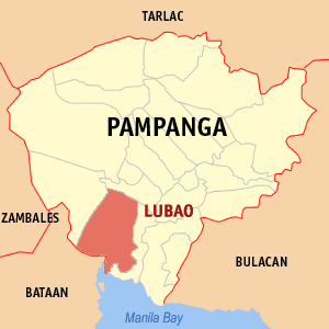
Lubao, officially the Municipality of Lubao, is a 1st class municipality in the province of Pampanga, Philippines. According to the 2015 census, it has a population of 160,838 people.
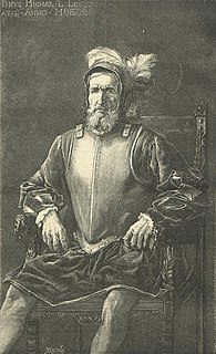
Miguel López de Legazpi, also known as El Adelantado and El Viejo, was a Basque-Spanish navigator and governor who established the first Spanish settlement in the East Indies when his expedition crossed the Pacific Ocean from the Viceroyalty of New Spain in modern-day Mexico, arrived in Cebu of the Philippine Islands, 1565. He was the first Governor-General of the Spanish East Indies which included the Philippines and other Pacific archipelagos, namely Guam and the Marianas Islands. After obtaining peace with various indigenous nations and kingdoms, Miguel López de Legazpi made Manila the capital of the Spanish East Indies in 1571. The capital city of the province of Albay bears his name.
The Governor-General of the Philippines was the title of the government executive during the colonial period of the Philippines, governed mainly by Spain (1565–1898) and the United States (1898–1946), and briefly by Great Britain (1762–1764) and Japan (1942–1945). They were also the representative of the executive of the ruling power.
Christianization
It is uncertain as to exactly when the Augustinians first set foot in Calumpit, but according to the documents, Calumpit was already a parish by May 3, 1572, when Fray Martín de Rada was elected Prior Provincial. Calumpit was simultaneously established with the conventos of Bay, Laguna, Tondo and Lubao, Pampanga, with De Rada as its prior and Fray Diego Vivar as his vicar.
Bay,, officially the Municipality of Bay,, is a 2nd class municipality in the province of Laguna, Philippines. According to the 2015 census, it has a population of 62,143 people.
Tondo is a district located in Manila, Philippines. It is the largest in terms of area and population of Manila's sixteen districts, with a Census-estimated 631,313 people in 2015 and consists of two congressional districts. It is also the most densely populated district in the city.
Accounts state that the Augustinian missionaries planted a wooden cross along the bank of the Meyto River to symbolise the baptism of the land, and they built a chapel made of nipa and bamboo. Later, they moved to Meysulao and built another visita, and then in Panducot, where they built another chapel dedicated to Our Lady of the Visitation as Fray Gaspar de San Agustín mentioned in his Conquistas delas Isla Philipinas (Libro Segundo, Chapter 9). Subsequently, the missionary headquarters was moved again to a much higher place where a very huge and prominent tree called "Kalumpit" (Terminalia macrocarpa decne) stands as the original settlers named the place. Another notable characteristic of the village of Calumpit is that it was bounded by rivers which served as a natural moat-like feature. Primarily, Meyto, Meysulao, Panducot and Calumpit was independent barangays under their own chiefs, it is same with Gatbuka, Bugyon and other old settlements. On April 5, 1572, Legaspi merged the villages of Meyto, Meysulao, Panducot, Calumpit, Candaba, Apalit and Malolos and these villages became ministerios and visitas and these settlements first formed the town named Calumpit, with present-day Calumpit as center. On December 28, 1575, Gov. General Francisco Sande ordered the inclusion of the villages of Agonoy (Hagonoy), Quinabalonan (now Santa Monica and San Jose, Hagonoy), and some villages along Macabebe river to the town of Calumpit.
Early Spanish presence
When Calumpit was already pacified by Spaniards and submitted under the colonial rule, In April 5, 1572, Encomiendas of Calumpit and Malolos was unified under the shared administration of their encomenderos Don Marcos de Herrera and Sargento Mayor Juan Moron. One month later on the same year Calumpit was created as one of the centers of the Augustinian ministry in Northern Luzon with Convento de Lubao Pampanga, which includes Betis and Bacolor and Convento de Taal Batangas established in May 3, 1572, upon the election of Fray Martín de Rada as the new Prior Provincial of the Augustinians replacing Fray Diego de Herrera who was recalled to Mexico. This parochial beginnings of Calumpit has included the old villages of Hagonoy, Apalit, Candaba, Malolos and Macabebe as its missions. The town of Calumpit was originally dedicated to Saint Nicholas of Tolentino, but in December 1576, the town was re-dedicated to the patronage of Saint John the Baptist.[6]
Province of Calumpit
On December 28, 1575 Governor-General Francisco de Sande established Calumpit as an Alcaldia (Province) with Marcos de Arce as the first Alcalde Mayor, with Calumpit and nearby visitas and settlements such as Malolos, Hagonoy, Macabebe, Apalit and Candaba. Later in 1576, jurisdiction of Macabebe transferred to the town of Lubao and Candaba separated an became town, then on June 11, 1580, Malolos became a town and it was transffered to Alcaldia de Bulacan. In 1581, Hagonoy had its own convent but still under the Governor of Calumpit, while in 1591 Apalit officially separated and established as an independent town and it was transferred in the reconfigured territory of Pampanga province. In Miguel de Loarca's document in 1581 called Relación de las Islas Filipinas and the June 1591 document of Governor-General Luis Pérez de Dasmariñas, it is proven that Calumpit appears as an independent Alcaldia, independent of those of Bulacan and Lubao and Betis.[7] It was therefore established as an Encomienda and Alcaldia separate to Province of Bulacan. Contrary to popular belief, Calumpit was not only the first town founded in Bulacan but it existed as a Province.
Abolition
The Alcaldia de Calumpit was eventually abolished and the towns of Calumpit and Hagonoy were annexed to the Province of Bulacan. Neighbouring Apalit was meanwhile annexed to Pampanga.
Philippine Revolution and Philippine-American War
During the Philippine Revolution in 1896, Calumpiteños participated in battles launched by the Katipunan against the Spanish Empire. Many notable Calumeteños helped establish and support the Malolos Republic, with the town serving as a defense line due to its proximity to the new capital. When the Philippine–American War erupted, Calumpit become the headquarters of General Antonio Luna in 1898. In the bloody encounters at Barrio Bagbag on April 25, 1899, many people joined the army of General Luna.
Civil administration under the United States-led Insular Government was established in Calumpit in April 1901, with Juan Galang serving as the first elected American-era mayor of the town.
American Occupation and World War II
Calumpit played an important role at the outbreak of the Second World War in the Pacific theater. The bridge of Calumpit, on the way to Bataan was demolished by the Engineering Battalion of the U.S., impeding movement of the Japanese forces on their way to Bataan. In January 1942, the Japanese Government occupied Calumpit for three years, during which many of the townsfolk died.
In the middle of 1943, the first part of the USAFFE guerrilla was established under the leadership of Luis Macam, with most of the members from Calumpit.
In June 1944, the 4th Battalion of the Del Pilar Regiment was established under the leadership of Major Francisco del Rosario. They continued fighting until the returned of the USAFFE under the leadership of General Douglas MacArthur.
In January 1945, the combined Filipino and American troops arrived in the town, liberating it from Japanese control.
Geography
Calumpit is 50 kilometres (31mi) from Manila and 5 kilometres (3.1mi) from Malolos City.
Calumpit is sprawled over an area of 5,625 has. of flat terrain classified accordingly to use for agricultural (66.81%), residential (10.42%), industrial (2.48%), commercial, (0.89%) and other (1.05%) purposes. It occupies around 2.06% of the total land area of Bulacan. The municipality has 144.33 kilometers of concrete roads that easily link its 29 barangays.
Two distinct seasons characterize the town’s climate: rainy season which starts late May and ends around November; and dry season which begins November and lasts until April.
Calumpit has two types of soil – the silt loam which is found in almost 90% of the entire municipality and the clay loam in the south-east far end of the town. Both types are basically suited for agricultural purposes as per Department of Agriculture (Philippines) classifications.
Calumpit River
Calumpit River
This river has shaped the lives of Bulakeños since time immemorial. With the longest river system in Bulacan, Calumpit River traverses the towns of Calumpit, Pulilan and Plaridel on the east, Paombong and Hagonoy in the West and winds up through Apalit, Macabebe and Masantol, Pampanga.
It was the major route for trade and commerce in this part of the Luzon prior to the arrival of Spain. The Pampanga and Quingua Rivers[8] served as arteries through which goods coming in and going out of Calumpit passed. At present, the river is a valued resource as a rich fishing ground and providing farmers with irrigation.
Climate
The climate of Calumpit is similar to that of the rest of the other municipalities in the province of Bulacan. It is characterized by two (2) distinct seasons namely; the rainy and the dry. The rainy seasons starts from late May and ends around November, the dry season from December to April. The average annual rainfall is 255.3 millimetres (10.05in) with the month of August having the highest month average rainfall, about 304 millimetres (12.0in). The annual number of rainy days is 175 days.
In the 2015 census, the population of Calumpit was 108,757, [3] with a density of 1,900 inhabitants per square kilometre or 4,900 inhabitants per square mile.
Calumpit's population was 101,068 in the Philippine Statistics Authority (NSO) 2010 census. Historically, its population grew at an average of 3.71% per annum.
The barangay with the largest population is Iba Oeste, with 10,610 residents, while the smallest is Sucol with 1,410 residents.
Calumpit has a relatively young population, with the age group 1–19 years old, constituting 46.01% of the total population. The rest consists mainly of the working group between the ages of 20 to 59 years old accounting for about 47.96% and the elderly comprising 6.02%.
In terms of sex distribution, males exceeded the number of females very slightly with a count of 35,710 and 35,087, respectively.
Language
Calumpit is a predominantly Tagalog-speaking town, with about 96.3% of its people being fluent speakers. Others residents speak Kapampangan while a minority speak other Philippine languages.
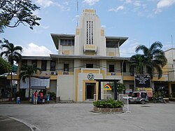
Among the oldest churches in Bulacan found in Calumpit is the San Juan Bautista Church. Constructed under Augustinian friars Martín de Rada and Diego Vivar, it was initially made of nipa and bamboo and gradually built of stone in 1700. It enshrines the local patron saint, John the Baptist, whose liturgical birthday on 24 June is celebrated as the town fiesta.
Inside the church is a tunnel that, as legend would have it, was used by priests during the Spanish era as an escape route in the event of Chinese and Moro pirate attacks. It is a declared Diocesean Shrine of the Diocese of Malolos.[13]
Meyto Shrine
The Meyto Shrine marks the cradle of Christianity in western Bulacan, where a wooden cross was first planted and first mass in the region was said in May 1572. The shrine, located in the western part of town, is also the site of the original church of Calumpit, predating the existing one in the town centre. During the Philippine Revolution, the Iglesia Filipina Independiente – which had by then separated rom the Catholic Church – took over Meyto Shrine.
Labour and employment
In 1995, Calumpit had a relatively big labor force of 24,095 or 66% of the population aged 20–59. Around 35% of these skilled and were employed in their respective occupations; 28% were housewives with occasional employment as farmhands, selling farm produce in the market and doing marginal odd jobs. Others were unclassified and consisted mostly of students, out-of-school youth and the unemployed.
Total household income per annum is ₱705 million, with the annual average household income is ₱66,600 and per capita income annually is ₱12,198.
Literacy
The high literacy rate (98.5%) is maintained by its 24 elementary schools and six secondary or high schools. The Bulacan Manpower and Livelihood Training Center (BMLTC), based at the heart of the town, offers vocational courses and serves as the training ground for both unskilled and highly skilled workers. As a result, most Calumpiteños have acquired and maintained skills suited for employment especially in the agri-industrial field.
Economy
The infamous Longganisang Calumpit
Major industries:
Industrial estates
Handicrafts
Food processing
Paper
Garments
Ceramics/pottery
Flowers/ornamental plants
Houseware
Major products:
Longganisang Calumpit
Key chains, key holders, pen holders
Industrial estates:
Bulacan Agro-Industrial Subdivision (Brgy. Pio Cruzcosa)
Tourism and culture
Festivals
The Libad is a river procession held every Saint John's Eve on June 23 to honour the town's patron. Calumpiteños sing, dance and douse water to "baptize" passers-by, recalling the saint's characteristic act. The ritual and its traditional route are relics of the old fluvial procession held when Apalit and Hagonoy were still governed from Calumpit.
One of the oldest barangays in the town, established in 1575, Santa Lucia is very popular and famous because of the supposedly miraculous image of its patroness, Saint Lucy. During the village festival, every December 12–13, the streets of the village are strung with colorful banderitas, as is the façade of Santa Lucia Church. Pilgrims visit the church for the two-day celebration, with the novena to the saint beginning on December 4.
Bagbag Bridge
Bagbag Bridge was the site of the longest battle between the Americans and Filipinos led by General Gregorio del Pilar on April 25, 1899. The bridge is now a reminder of the valor displayed by the Filipino who triumphed against the American forces.
Resorts
Jed's Island Resort
Leticia's Garden Resort and Events Place
Lawiswis Kawayan
Amazing Grace Resort
El Bueno Resort
Education
Colegio de Calumpit (formerly Calumpit Institute)
Calumpit has several elementary and secondary schools. It also has some private colleges and the most well-known of it is Colegio de Calumpit which is established in 1940 and over many decades has maintained its quality education. Calumpit doesn't host big universities so most residents study in Malolos where Bulacan State University and other universities are located.
José Zabala-Santos - one of the most popular cartoonists in the Philippines during the 1950s for characters such Popoye, Sianong Sano, and Lukas Malakas.[14]
Gallery
Calumpit Welcome Arch, viewed from the Calumpit-Pulilan Road
St. Mark the Evangelist Parish Church
St. Joseph Parish Church
Calumpit Wet and Dry Public Market
Rotary Club of Calumpit - Calumpit Public Library
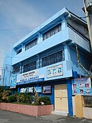
Calumpit Water District
Labangan Bridge
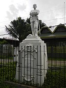
Gen. Gregorio del Pilar Statue (Brgy. Caniogan)
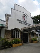
The Rev. Agustin Samson Memorial United Methodist Church (Brgy. Gugo)
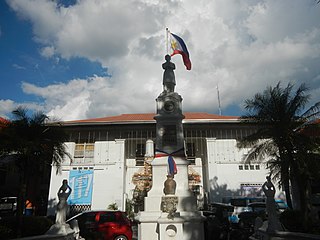
Battle of Bagbag Centennial Marker (1896-1996)
Sub-Parish Church of San Pedro (Brgy. Iba O'Este)
Holy Cross Parish Church - Iglesia Filipina Independiente
La Casa Azul
Notes
↑ "Municipality". Quezon City, Philippines: Department of the Interior and Local Government. Retrieved 31 May 2013.
↑ Administracion espiritual de los Padres Agustinos calsados de la Provincia del Duche Nombre de Jesus de las islas Filipinas, Valladolid, Imprenta de H. Roldan, Mayo de 1833, p. 47
1 2 Census of Population and Housing (2010). "Region III (Central Luzon)". Total Population by Province, City, Municipality and Barangay. NSO. Retrieved 29 June 2016.
This page is based on this Wikipedia article Text is available under the CC BY-SA 4.0 license; additional terms may apply. Images, videos and audio are available under their respective licenses.
Related Research Articles
Pampanga is a province in the Central Luzon region of the Philippines. Lying on the northern shore of Manila Bay, Pampanga is bordered by Tarlac to the north, Nueva Ecija to the northeast, Bulacan to the east, the Manila Bay to the central-south, Bataan to the southwest and Zambales to the west. Its capital is the City of San Fernando. Angeles City, while geographically within Pampanga, is classified as a first-class, highly urbanized city and is governed independently of the province.
Central Luzon, designated as Region III, is an administrative region in the Philippines, primarily serving to organize the 7 provinces of the vast central plains of the island of Luzon, for administrative convenience. The region contains the largest plain in the country and produces most of the country's rice supply, earning itself the nickname "Rice Granary of the Philippines". Its provinces are: Aurora, Bataan, Bulacan, Nueva Ecija, Pampanga, Tarlac and Zambales.
Candaba, officially the Municipality of Candaba,, is a 1st class municipality in the province of Pampanga, Philippines. According to the 2015 census, it has a population of 111,586 people.
Apalit, officially the Municipality of Apalit, is a 1st class municipality in the province of Pampanga, Philippines. According to the 2015 census, it has a population of 107,965 people.
Bulakan, officially the Municipality of Bulakan,, is a 1st class municipality in the province of Bulacan, Philippines. According to the 2015 census, it has a population of 76,565 people.
Floridablanca, officially the Municipality of Floridablanca, is a 1st class municipality in the province of Pampanga, Philippines. According to the 2015 census, it has a population of 125,163 people.
Masantol, officially the Municipality of Masantol, is a 2nd class municipality in the province of Pampanga, Philippines. According to the 2015 census, it has a population of 57,063 people.
Balagtas, officially the Municipality of Balagtas,, is a 1st class municipality in the province of Bulacan, Philippines. According to the 2015 census, it has a population of 73,929 people.
Hagonoy, officially the Municipality of Hagonoy,, is a 1st class municipality in the province of Bulacan, Philippines. According to the 2015 census, it has a population of 129,807 people.
Paombong, officially the Municipality of Paombong,, is a 3rd class municipality in the province of Bulacan, Philippines. According to the 2015 census, it has a population of 53,294 people.
The Kapampangan people, also known as Pampangueños or Pampangos, are the fifth largest ethnolinguistic group in the Philippines, numbering about 2.89 million. They live mainly in the provinces of Pampanga, Bataan and Tarlac, as well as Bulacan, Nueva Ecija and Zambales.
The Legislative Districts of Pampanga, namely the first, second, third and fourth districts, are the current representations of the Province of Pampanga and the independent city of Angeles in the Philippine House of Representatives.
The Malolos Cathedral, also known as the Minor Basilica of Our Lady of Immaculate Conception, is a historical church in the Philippines located in City of Malolos, the capital of the province of Bulacan. The Cathedral is also the ecclesiastical seat of the Bishop of the Diocese of Malolos, a suffragan of the Archdiocese of Manila.
The Roman Catholic Diocese of Malolos is a Roman Rite diocese of the Latin Church of the Catholic Church in the Philippines. The mother church of the Diocese is the Cathedral-Basilica of the Immaculate Conception located in Malolos City, Bulacan.
Bulacan is a province of the Philippines. It was established on 15 August 1578.
San Juan Bautista Parish Church, locally referred to as Calumpit Church, is a 17th-century, Roman Catholic, baroque church located in Calumpit, Bulacan, Philippines.
The National Shrine and Parish of Saint Anne, commonly known as the Santa Ana Shrine or Hagonoy Church, is an 18th-century, Baroque church located at Brgy. Santo Niño, Hagonoy, Bulacan, Philippines. The parish church, under the aegis of Saint Anne, is under the jurisdiction of the Roman Catholic Diocese of Malolos. It was declared a National Shrine in 1991. In 1981, a marker bearing a brief history of the church was installed on the church by the National Historical Institute, precursor of the National Historical Commission of the Philippines.