Camp Wood, Texas

Last updated

Camp Wood, Texas
Camp Wood, TX IMG 1325.JPG
A glimpse of along Nueces Street (Texas State Highway 55) in Camp Wood, March 2011
TXMap-doton-CampWood.PNG
Location of Camp Wood, Texas
Real County CampWood.svg
Coordinates: 29°40′9″N100°0′42″W / 29.66917°N 100.01167°W / 29.66917; -100.01167
CountryUnited States
State Texas
County Real
Area
[1]
  Total0.50 sq mi (1.30 km2)
  Land0.50 sq mi (1.30 km2)
  Water0.00 sq mi (0.00 km2)
Elevation
1,457 ft (444 m)
Population
 (2010)
  Total706
  Estimate 
(2019) [2]
731
  Density1,450.40/sq mi (560.52/km2)
Time zone UTC-6 (Central (CST))
  Summer (DST) UTC-5 (CDT)
ZIP code
78833
Area code 830
FIPS code 48-12388 [3]
GNIS feature ID1332024 [4]

Camp Wood is a city in Real County, Texas, United States, in the Texas Hill Country, which is part of the Edwards Plateau. The population was 706 at the 2010 census.

Contents

History

The town was established in 1920. [5]

Geography

Camp Wood is located at 29°40′9″N100°0′42″W / 29.66917°N 100.01167°W / 29.66917; -100.01167 (29.669084, –100.011641). [6]

According to the United States Census Bureau, the city has a total area of 0.5 square miles (1.3 km2), all land.

Demographics

2020 census

Camp Wood racial composition [7]
(NH = Non-Hispanic) [lower-alpha 1]
RaceNumberPercentage
White (NH)29256.48%
Black or African American (NH)10.19%
Asian (NH)20.39%
Pacific Islander (NH)10.19%
Mixed/Multi-Racial (NH)193.68%
Hispanic or Latino 20239.07%
Total517

As of the 2020 United States census, there were 517 people, 262 households, and 179 families residing in the city.

2000 census

Historical population
CensusPop.Note
1940 778
1950 7850.9%
1960 87912.0%
1970 660−24.9%
1980 72810.3%
1990 595−18.3%
2000 73423.4%
2010 706−3.8%
2019 (est.)731 [2] 3.5%
U.S. Decennial Census [9]
Camp Wood Public Library, March 2011 Camp Wood, TX, Public Library IMG 1324.JPG
Camp Wood Public Library, March 2011
Scenic view from Texas State Highway 55 south of Camp Wood, March 2011 Scenic view south of Camp Wood, TX IMG 1321.JPG
Scenic view from Texas State Highway 55 south of Camp Wood, March 2011

As of the census [3] of 2000, 822 people, 281 households, and 198 families resided in the city. The population density averaged 1,629.8/mi2 (634.8/km2). The 352 housing units averaged 697.9/mi2 (271.8/km2). The racial makeup of the city was 90.27% White, 0.12% African American, 0.97% Native American, 0.36% Asian, 6.69% from other races, and 1.58% from two or more races. Hispanics or Latinos of any race were 39.66% of the population.

Of the 281 households, 34.5% had children under the age of 18 living with them, 51.6% were married couples living together, 13.5% had a female householder with no husband present, and 29.2% were not families. About 27.0% of all households were made up of individuals, and 13.5% had someone living alone who was 65 years of age or older. The average household size was 2.67 and the average family size was 3.19.

In the city, the population was distributed as 28.2% under the age of 18, 5.2% from 18 to 24, 22.7% from 25 to 44, 24.1% from 45 to 64, and 19.7% who were 65 years of age or older. The median age was 40 years. For every 100 females, there were 103.0 males. For every 100 females age 18 and over, there were 95.4 males.

The median income for a household in the city was $19,792, and for a family was $21,648. Males had a median income of $17,500 versus $13,182 for females. The per capita income for the city was $11,170. About 32.2% of families and 33.6% of the population were below the poverty line, including 40.0% of those under age 18 and 36.6% of those age 65 or over.

Climate

The climate in this area is characterized by hot, humid summers and generally mild to cool winters. Camp Wood has a humid subtropical climate, Cfa on climate maps according to the Köppen climate classification system. [10]

Education

The City of Camp Wood is served by the Nueces Canyon Consolidated Independent School District.

See also

Notes

  1. Note: the US Census treats Hispanic/Latino as an ethnic category. This table excludes Latinos from the racial categories and assigns them to a separate category. Hispanics/Latinos can be of any race. [8]

Related Research Articles

<span class="mw-page-title-main">Anthonyville, Arkansas</span> Town in Arkansas, United States

Anthonyville is a town in Crittenden County, Arkansas, United States. The population was 161 at the 2010 census, down from 250 in 2000.

<span class="mw-page-title-main">Bithlo, Florida</span> Census-designated place & Unincorporated community in Florida, United States

Bithlo is a census-designated place and an unincorporated community in Orange County, Florida, United States. The population was 8,268 at the 2010 census, up from 4,626 at the 2000 census. It is part of the Orlando–Kissimmee Metropolitan Statistical Area.

<span class="mw-page-title-main">Meadow Woods, Florida</span> Census-designated place in Florida, United States

Meadow Woods is a census-designated place (CDP) and an unincorporated suburban development area located in southern Orange County, Florida, United States, between Orlando International Airport and Kissimmee. It is part of the Orlando–Kissimmee–Sanford, Florida Metropolitan Statistical Area. As of 2020, the population was 43,790.

Seminole Manor is a census-designated place (CDP) in Palm Beach County, Florida, United States. The CDP was developed in the late 1950s, with the majority of houses built in 1958 and 1959. It is part of the Miami metropolitan area of South Florida. The population was 2,562 at the 2020 US census.

<span class="mw-page-title-main">Harbor Bluffs, Florida</span> Census-designated place in Florida, United States

Harbor Bluffs is a census-designated place (CDP) in Pinellas County, Florida, United States. The population was 2,860 at the 2010 census.

<span class="mw-page-title-main">Lyndon, Kansas</span> City in Osage County, Kansas

Lyndon is a city in, and the county seat of Osage County, Kansas, United States. As of the 2020 census, the population of the city was 1,037.

<span class="mw-page-title-main">Clearwater, Kansas</span> City in Sedgwick County, Kansas

Clearwater is a city in Sedgwick County, Kansas, United States. As of the 2020 census, the population of the city was 2,653.

<span class="mw-page-title-main">Hamlin Township, McKean County, Pennsylvania</span> Township in Pennsylvania, United States

Hamlin Township is a township in McKean County, Pennsylvania, United States. The population was 685 at the 2020 census.

<span class="mw-page-title-main">Coleman, Texas</span> City in Texas, United States

Coleman is a town in and the county seat of Coleman County, Texas, United States. As of the 2010 census, its population was 4,709.

<span class="mw-page-title-main">Dickens, Texas</span> City in Texas, United States

Dickens is a city in and the county seat of Dickens County, Texas, United States. The population was 286 at the 2010 census, down from 332 at the 2000 census.

<span class="mw-page-title-main">Rotan, Texas</span> City in Texas, United States

Rotan is a city in Fisher County, Texas, United States. The population was 1,508 at the 2010 census, down from 1,611 at the 2000 census.

<span class="mw-page-title-main">Waelder, Texas</span> City in Texas, United States

Waelder is a city in Gonzales County, Texas, United States and is also part of the Texas-German belt. The population was 933 at the 2020 census.

<span class="mw-page-title-main">Ingram, Texas</span> City in Texas, United States

Ingram is a city in Kerr County, Texas, United States. The population was 1,804 at the 2010 census.

<span class="mw-page-title-main">Balmorhea, Texas</span> City in the United States

Balmorhea is a city in Reeves County, in the U.S. state of Texas. The population was 479 in the U.S. Census of 2010.

<span class="mw-page-title-main">Gilmer, Texas</span> City in Texas, United States

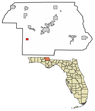
Gilmer is a city in, and the county seat of, Upshur County, Texas, United States. It is best known for being the home of the East Texas Yamboree and the birthplace of popular music singers Don Henley of the Eagles band and Johnny Mathis, as well as blues musician Freddie King. Its population was 4,843 at the 2020 census.

<span class="mw-page-title-main">Wheeler, Texas</span> City in Texas, United States

Wheeler is a city, and the county seat of Wheeler County, Texas, United States, located on the eastern border of the Texas Panhandle. The population was last reported at 1,592 in the 2010 census.

<span class="mw-page-title-main">Hawkins, Texas</span> City in Texas, United States

Hawkins is a city in Wood County, Texas, United States. The population was 1,274 at the 2020 census. It is located twenty miles north of the larger city of Tyler. Just east of the community is Jarvis Christian University, a historically black institution of higher learning.

<span class="mw-page-title-main">Aransas Pass, Texas</span> City in Texas, United States

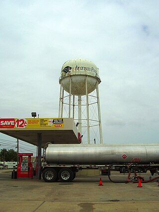
Aransas Pass is a city in Aransas, Nueces, and San Patricio Counties in the U.S. state of Texas. The population was 8,011 at the 2021 Census.

<span class="mw-page-title-main">Winnsboro, Texas</span> City in Texas, United States

Winnsboro is a city in Franklin and Wood counties in northeastern Texas, United States, north of Tyler. The population was 3,434 at the 2010 census, down from 3,584 at the 2000 census. Settlement of Winnsboro began in the 1850s with a post office established between 1854 and 1855.

<span class="mw-page-title-main">Sharon (CDP), Massachusetts</span> CDP in Massachusetts, United States

Sharon is a census-designated place (CDP) in the town of Sharon in Norfolk County, Massachusetts, United States. The population was 6,184 at the 2020 census.

References

  1. "2019 U.S. Gazetteer Files". United States Census Bureau. Retrieved August 7, 2020.
  2. 1 2 "Population and Housing Unit Estimates". United States Census Bureau. May 24, 2020. Retrieved May 27, 2020.
  3. 1 2 "U.S. Census website". United States Census Bureau . Retrieved January 31, 2008.
  4. "US Board on Geographic Names". United States Geological Survey. October 25, 2007. Retrieved January 31, 2008.
  5. "Camp Wood, Texas". Texas State Historical Association. Retrieved February 6, 2012.
  6. "US Gazetteer files: 2010, 2000, and 1990". United States Census Bureau. February 12, 2011. Retrieved April 23, 2011.
  7. "Explore Census Data". data.census.gov. Retrieved May 19, 2022.
  8. "About the Hispanic Population and its Origin". www.census.gov. Retrieved May 18, 2022.
  9. "Census of Population and Housing". Census.gov. Retrieved June 4, 2015.
  10. Climate Summary for Camp Wood, Texas