
The Andaman and Nicobar Islands is a union territory of India. It consists of 836 islands grouped into two island groups: the northern Andaman Islands and the southern Nicobar Islands, separated by a 150 km (93 mi) wide channel. Port Blair is the capital and largest city of the territory, located about 1,190 km (740 mi) from Chennai and 1,255 km (780 mi) from Kolkata in mainland India. The islands are sandwiched between the Bay of Bengal to the west and the Andaman Sea to the east with the northern-most point located 901 km (560 mi) from the mouth of Hooghly river. Indira Point at 6°45’10″N and 93°49’36″E at the southern tip of Great Nicobar is the southernmost point of India.
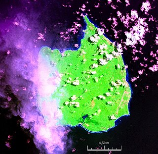
Car Nicobar is the northernmost of the Nicobar Islands. It is also one of three local administrative divisions of the Indian district of Nicobar, part of the Indian union territory of Andaman and Nicobar Islands. Annual rainfall is 2800 millimetres.

Port Blair is the capital city of the Andaman and Nicobar Islands, a union territory of India in the Bay of Bengal. It is also the local administrative sub-division (tehsil) of the islands, the headquarters for the district of South Andaman, and the territory's only notified town.
South Andaman Island is the southernmost island of the Great Andaman and is home to the majority of the population of the Andaman Islands. It belongs to the South Andaman administrative district, part of the Indian union territory of Andaman and Nicobar Islands. It is the location of Port Blair, capital of the Andaman and Nicobar Islands.
Great Nicobar is the southernmost and largest of the Nicobar Islands of India, north of Sumatra. It is part of India, in the Nicobar district within the union territory of the Andaman and Nicobar Islands.

Middle Andaman Island is an island of the Andaman Islands. It belongs to the North and Middle Andaman administrative district, part of the Indian union territory of Andaman and Nicobar Islands.
Rutland Island is an island of the Andaman Islands. It belongs to the South Andaman administrative district, part of the Indian union territory of Andaman and Nicobar Islands. The island is located 20 km (12 mi) south from Port Blair.
Indira Point, the southernmost point of India's territory, is a village in the Nicobar district at Great Nicobar Island of Andaman and Nicobar Islands in India. It is located in the Great Nicobar tehsil.
Baratang Island is an island of the Andaman Islands. It belongs to the North and Middle Andaman administrative district, part of the Indian union territory of Andaman and Nicobar Islands. The island lies 150 km (93 mi) north of Port Blair.
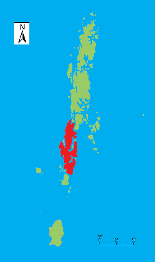
Nicobar district is one of three districts in the Indian union territory of the Andaman and Nicobar Islands. The district's administrative territory encompasses all of the Nicobar Islands, which are located in the Indian Ocean, between the Bay of Bengal and the Andaman Sea. The headquarters of the district is the village of Malacca, located on the island of Car Nicobar.
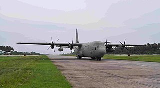
Car Nicobar Air Force Station is located in IAF Camp village, on Car Nicobar Island in the union territory of the Andaman and Nicobar Islands, India.
Interview Island is an island of the Andaman Islands. It belongs to the North and Middle Andaman administrative district, part of the Indian union territory of Andaman and Nicobar Islands. It lies 125 km (78 mi) north of Port Blair.
The Andaman and Nicobar Command (ANC) is a integrated tri-services command of the Indian Armed Forces, based at Port Blair in the Andaman and Nicobar Islands, a Union Territory of India. It was created in 2001 to safeguard India's strategic interests in Southeast Asia and the Strait of Malacca by increasing rapid deployment of military assets in the region. It provides logistical and administrative support to naval ships which are sent on deployment to East Asia and the Pacific Ocean.
INS Utkrosh, is an Indian naval air station under the joint-services Andaman and Nicobar Command of the Indian Armed Forces. It is located near naval base INS Jarawa on Port Blair, the capital city of the Andaman and Nicobar Islands.

INS Jarawa is a naval base of the Indian Armed Forces under the joint-services Andaman and Nicobar Command located in Port Blair in the Andaman & Nicobar Islands. It was commissioned in 1964.

INS Baaz is an Indian naval air station under the joint-services Andaman and Nicobar Command (ANC) of the Indian Armed Forces. It is located near Campbell Bay, on Great Nicobar island in the Andaman & Nicobar Islands. It is the southernmost air station of the Indian Armed Forces. It overlooks the Strait of Malacca as well as the Six Degree channel between Great Nicobar and the Indonesian island of Sumatra.
Landfall Island is the northernmost island of the Indian union territory of Andaman and Nicobar Islands. It belongs to the territory's North and Middle Andaman administrative district. The island lies 220 km (137 mi) north of Port Blair, and is situated 300 km (186 mi) south of Myanmar. It is home to the Kari tribe.
INS Kohassa is an Indian naval air station under the Andaman and Nicobar Command of the Indian Armed Forces. It is located at Shibpur, a village located on North Andaman Island.
The Andaman and Nicobar Islands is an archipelago of 572 islands of which 37 are inhabited. It is a union territory of India.
Great Nicobar Development Plan is a planned mega-infrastructure project for the southern tip of Great Nicobar Island in Andaman Sea of India. The island comes under the Nicobar district administriation in the Indian union territory of Andaman and Nicobar Islands.

