The Arctic Archipelago, also known as the Canadian Arctic Archipelago, is a group of islands north of the Canadian mainland.

Ludlow is a town in Aroostook County, Maine, United States. The population was 404 at the 2010 census.

Perham is a town in Aroostook County, Maine, United States. The population was 386 at the 2010 census. The town was named after Maine's 33rd governor, Sidney Perham.

Langor Township is a township in Beltrami County, Minnesota, United States. The population was 186 as of the 2000 census.

Elrosa is a city in Stearns County, Minnesota, United States. The population was 211 at the 2010 census. It is part of the St. Cloud Metropolitan Statistical Area.

Neck City is a city in Jasper County, Missouri, United States. The population was 186 at the 2010 census.

Stony Point is a census-designated place (CDP) in Sequoyah County, Oklahoma, United States. It is part of the Fort Smith, Arkansas-Oklahoma Metropolitan Statistical Area. The population was 177 at the 2000 census.

La Rosita is a census-designated place (CDP) in Starr County, Texas, United States. The population was 85 at the 2010 census down from 1,729 at the 2000 census.
Bowstring Lake is an unorganized territory in Itasca County, Minnesota, United States. The population was 1,166 at the 2010 census.

Ormsby is a city in Martin and Watonwan counties in the U.S. state of Minnesota. The population was 131 at the 2010 census.
6247 Amanogawa, provisional designation 1990 WY3, is a background asteroid from the inner regions of the asteroid belt, approximately 7 kilometers (4 miles) in diameter. It was discovered on 21 November 1990, by Japanese amateur astronomers Kin Endate and Kazuro Watanabe at the Kitami Observatory. The X-type asteroid has a rotation period of 12.38 hours. It was named after the Amanogawa River on the island of Hokkaido, Japan.

Canta District is one of seven districts of the province Canta in Peru.

Nandagaon is a village in the southern state of Karnataka, India. It is located in the Athni taluk of Belgaum district in Karnataka.

The Ryan YQM-98 R-Tern was a developmental aerial reconnaissance drone developed by Ryan Aeronautical. It could take off and land from a runway like a manned aircraft, and operate at high altitudes for up to 24 hours to perform surveillance, communications relay, or atmospheric sampling.
Pedro is an unincorporated community in Benton County, Arkansas, United States.

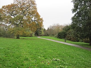
Stoneyfields Park is a three hectare public park in Edgware in the London Borough of Barnet.

East Millinocket is a census-designated place (CDP) consisting of the main settlement in the town of East Millinocket in Penobscot County, Maine, United States. The population was 1,567 at the 2010 census.
Thomas Township is an inactive township in Ripley County, in the U.S. state of Missouri.
Chariton Township is an inactive township in Schuyler County, in the U.S. state of Missouri.


