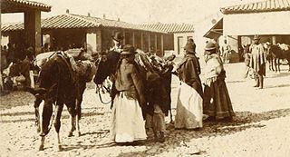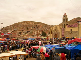
The Aymara or Aimara people are an indigenous nation in the Andes and Altiplano regions of South America; about 1 million live in Bolivia, Peru and Chile. Their ancestors lived in the region for many centuries before becoming a subject people of the Inca in the late 15th or early 16th century, and later of the Spanish in the 16th century. With the Spanish American Wars of Independence (1810–25), the Aymaras became subjects of the new nations of Bolivia and Peru. After the War of the Pacific (1879–83), Chile annexed territory occupied by the Aymaras.

Pocona Municipality is the third municipal section of the Carrasco Province in the Cochabamba Department in Bolivia. Its seat is Pocona. At the time of census 2001 the municipality had 13,488 inhabitants.

Laq'a Jawira is a river in Bolivia which runs from Lake Poopó. Its length is entirely within the territory of Oruro Department.

Machacamarca is a small town in the La Paz Department in Bolivia. It is the seat of the Nueva Esperanza de Machacamarca Canton, one of the five cantons of the Colquencha Municipality which is the sixth municipal section of the Aroma Province. The town is situated at the railway that leads from La Paz to Oruro. At the time of census 2001 Machacamarca had a population of 1,400.

Villa Rosario de Wilacala is a village in the La Paz Department in Bolivia. It is the seat of the Villa Rosario de Wila Khala Canton, one of the five cantons of the Mocomoco Municipality which is the second municipal section of the Eliodoro Camacho Province. The village is situated 4,264 m high at the north-western edge of the Muñecas Mountain Range (Cordillera Muñecas) near the border to Peru. At the time of census 2001 it had a population of 303.

Kuntur Ikiña is a 5,044-metre-high (16,549 ft) mountain in the Andes located in the Cordillera Occidental of Bolivia. It is situated in the Oruro Department, Sajama Province, Turco Municipality, north-east of Umurata and south of the Bolivian Route 4 that leads to Tambo Quemado on the border with Chile.

Salla Qullu is a 4,990-metre-high (16,371 ft) mountain in the Cordillera Occidental in the Andes of Bolivia. It is situated in the Oruro Department, Sajama Province, Turco Municipality, Chachacomani Canton, south-east of the mountain Capurata and the Acotango volcano and south of the Bolivian Route 4 that leads to Tambo Quemado on the border with Chile.

Wila Qullu is a 4,730-metre-high (15,518 ft) mountain in the Cordillera Occidental in the Andes of Bolivia. It is located in the Oruro Department, Sajama Province, Turco Municipality, Chachacomani Canton. The mountain is situated east of the volcanoes Capurata, Acotango and Wallatiri and north-east of the mountain Ari Qullu Phujru. It lies south of the Bolivian Route 4 that leads to Tambo Quemado on the border with Chile.

Machu Such'i Qhuchi or Machu Such'i Q'uchi is a mountain in the Apolobamba mountain range in the Bolivian Andes, about 5,679 metres (18,632 ft) high. It is situated near the Peruvian border in the La Paz Department, Franz Tamayo Province, Pelechuco Municipality, east of Such'i Lake.

Jatun Wila Qullu is a mountain in the Andes in Bolivia, about 5,214 m (17,106 ft) high. It is located south east of Poopó Lake in the Oruro Department, Challapata Province, Quillacas Municipality, Soraga Canton, east of Sevaruyo and near the border to the Potosí Department.

Kimsa Chata is a mountain in the Andes of Bolivia, about 4,648 m (15,249 ft) high. It is one of the highest elevations of the Waylla Marka mountain range that runs down from Waylla Marka (Huayllamarca) to Qhurqhi (Corque) west of Uru Uru Lake. Kimsa Chata is located in the Oruro Department, Carangas Province, Qhurqhi Municipality, Tarukachi Canton, or on the border of the Carangas Province and the Saucari Province.
Jach'a Jawira is a Bolivian river north of Coipasa Lake in the Oruro Department. Coming from the Waylla Marka range northwest of Poopó Lake the river flows in a south-western direction along the village of Belén de Choquecota in the Nor Carangas Province towards the Carangas Province. In the Choquecota Municipality, southwest of Choquecota, it empties into the Barras River which ends in Coipasa Lake.

Wila Qullu is a 5,125-metre-high (16,814 ft) mountain in the Andes in Bolivia. It is located in the Oruro Department, Challapata Province, Challapata Municipality, Challapata Canton. Wila Qullu is situated south-east of Chunkara Lake.

Machaq Marka is a mountain in the Bolivian Andes which reaches a height of approximately 3,400 m (11,200 ft). It is located in the La Paz Department, Loayza Province, Luribay Municipality. Machaq Marka lies northeast of Lawrani and Qullpani.

P'iq'iñ Q'ara Punta is a 4,551-metre-high (14,931 ft) mountain in the Bolivian Andes. It is located in the Cochabamba Department, Tapacari Province. P'iq'iñ Q'ara Punta lies west of the village of Machaqa Marka (Machacamarca).

Wila Jaqhi is a 4,114-metre-high (13,497 ft) mountain in the Bolivian Andes. It is located in the Cochabamba Department, Tapacari Province. Wila Jaqhi lies northeast of the village of Machaqa Marka (Machacamarca).

Machaqa Marka is a 3,862-metre-high (12,671 ft) mountain in the Bolivian Andes near a village of that name. It is located in the Cochabamba Department, Carrasco Province, Pocona Municipality, north of the UNESCO World Heritage site of Inkallaqta. Machaqa Marka lies southeast of Jatun Salla and Mama Wasi.
Machaqa Marka or Machaq Marka may refer to:


