Carl Side

Last updated

Carl Side
Carl Side from Portinscale.jpg
Carl Side from the village of Portinscale with Skiddaw rising on the right
Highest point
Elevation 746 m (2,448 ft)
Prominence c. 30 metres (98 ft)
Parent peak Skiddaw
Listing Hewitt, Nuttall, Wainwright
Coordinates 54°38′30″N3°09′21″W / 54.64159°N 3.15588°W / 54.64159; -3.15588
Geography
Lake District National Park UK relief location map.png
Red triangle with thick white border.svg
Carl Side
Location in Lake District, UK
Location Cumbria, England
Parent range Lake District, Northern Fells
OS grid NY255280
Topo map OS Landrangers 89, 90, Explorer OL4
sketch map of Carl Side Carl Side sketch map.JPG
sketch map of Carl Side
A distant shot of the three fells on Long Side Edge Long Side Edge above Derwent Water.jpg
A distant shot of the three fells on Long Side Edge

Carl Side is a fell in the English Lake District, forming a part of the Skiddaw "family" near the town of Keswick and prominently visible from its streets. It is listed in Alfred Wainwright's Pictorial Guides to the Lakeland Fells as one of the Northern Fells.

Contents

Summit

The summit is a predominantly grassy plateau smoothly sloping away on all sides except to the north, where some shattered crags look down upon Southerndale. A small cairn marks the highest point. The view southward down Derwentwater is excellent, backed by a wide vista of fells from Clough Head to Sale Fell. Tewet Tarn on High Rigg is the only other significant visible body of water. Nearer at hand the grey flanks of Skiddaw and Little Man loom above the summit. [1]

Topography

A ridge, known as Longside Edge, descends south-westward from the summit plateau of Skiddaw before swinging around to the west and finally north, descending the three fells of Carl Side, Long Side and Ullock Pike. Between Longside Edge and the mass of Skiddaw is the valley of Southerndale. Carl Side stands at the southern extremity of the curving ridge, having a triangular plan with ridges to the north-west, north-east and south.

To the north-east the fell is separated from Skiddaw by Carlside Col (2,345 feet, 715 m), a depression that contains Carlside Tarn, the only standing water found at any altitude in the Skiddaw group. Very shallow and frequently dry in summer, the tarn has no plant life. Set in a particularly windy location, the slight retaining bank at the south-eastern edge may be in danger of erosion. [2] The Skiddaw side of the col is a rough scree slope while the Carl Side slope is gentler and grassed.

From the summit of Carl Side a system of ridges descends southward towards Millbeck. The main spur runs straight for a mile, the first half being of gentler gradient and culminating in a large patch of white stones at about 1,600 feet (490 m). There is a very short rocky arête here, before the spur falls abruptly to the valley floor. On the eastern side of this section are the crags of Doups. The southern ridge sends out shorter branches on either side, just above the patch of white stones. On the western side across the rocky col of Long Doors is Dodd, a fell on Forestry Commission land that is largely wooded. To the east is Carlsleddam, a steep sided spur that appears sharply peaked from below: though less inspiring close up it does have a narrow and airy summit ridge. [1]

The north-western connection to Long Side is a narrower ridge with rough ground to the north, bounding the head of Southerndale. Southerndale Beck, like all of the waters of Carl Side, ultimately finds its way to Bassenthwaite Lake, curving around the northern tip of Ullock Pike.

The eastern boundary of the fell is formed by Slade's Beck, a stream flowing over several dams and weirs to Millbeck. Across the valley is Skiddaw Little Man. To the south west Skill Beck falls from Long Doors through a heavily forested valley between Carl Side and Dodd.

Geology

In common with much of the Northern Fells the Kirk Stile Formation of the Skiddaw Group predominates. This is composed of laminated mudstone and siltstone with greywacke sandstone and is of Ordovician age. [3]

A trial level can be found in the little valley between Carlsleddam and the south ridge. This exploited a vein containing baryte and galena and operated in the 1870s. [4]

Ascents

Carl Side is often climbed indirectly via Ullock Pike and Long Side, the narrow ridge providing a fine walk which is often continued to Skiddaw. Millbeck provides the nearest starting point, with variations possible via Carlsleddam, the south ridge, the intervening valley and Slade's Beck.

A start can also be made from Little Crosthwaite, a small settlement at the foot of Dodd along the Carlisle road, climbing through the forestry to Long Doors before joining the south ridge. Indirect climbs via Dodd are also possible although the going can be very rough.

From High Side near Bassenthwaite an approach can be made along the length of Southerndale, ascending finally to Carlside Col. [1] [5]

Related Research Articles

<span class="mw-page-title-main">Skiddaw</span> Mountain in the Lake District, England

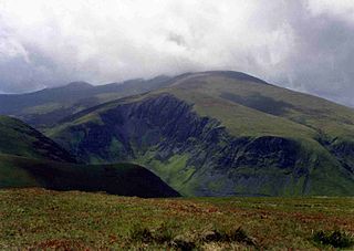
Skiddaw is a mountain in the Lake District National Park in England. Its 931-metre (3,054 ft) summit is the sixth-highest in England. It lies just north of the town of Keswick, Cumbria, and dominates the skyline in this part of the northern lakes. It is the simplest of the Lake District mountains of this height to ascend and, as such, many walking guides recommend it to the occasional walker wishing to climb a mountain. This is the first summit of the fell running challenge known as the Bob Graham Round when undertaken in a clockwise direction.

<span class="mw-page-title-main">Bowfell</span> Mountain in the English Lake District, Cumbria, England

Bowfell is a pyramid-shaped mountain lying at the heart of the English Lake District, in the Southern Fells area. It is the sixth-highest mountain in the Lake District and one of the most popular of the Lake District fells for walkers. It is listed in Alfred Wainwright's 'best half dozen' Lake District fells.

<span class="mw-page-title-main">Fairfield (Lake District)</span> Fell in the English Lake District

Fairfield is a fell in the English Lake District. It is the highest of a group of hills in the Eastern Fells, standing to the south of the Helvellyn range.

<span class="mw-page-title-main">Dale Head</span> Mountain in the Lake District, England

Dale Head is a fell in the north-western sector of the Lake District, in northern England. It is 753 metres or 2,470 feet above sea level and stands immediately north of Honister Pass, the road between Borrowdale and Buttermere.

<span class="mw-page-title-main">Grasmoor</span> Mountain in the English Lake District, Cumbria, England

Grasmoor is a mountain in the north-western part of the Lake District, northern England. It is the highest peak in a group of hills between the villages of Lorton, Braithwaite and Buttermere, and overlooks Crummock Water.

<span class="mw-page-title-main">Dollywaggon Pike</span> Mountain in the English Lake District, Cumbria, England

Dollywaggon Pike is a fell in the English Lake District. It stands on the main spine of the Helvellyn range in the Eastern Fells, between Thirlmere and the Ullswater catchment.

<span class="mw-page-title-main">Crag Hill</span>

Crag Hill is a mountain in the North Western part of the English Lake District. It was formerly known as Eel Crag; however, the Ordnance Survey now marks Eel Crag as referring to the northern crags of the fell. It is not to be confused with another Crag Hill lying on the border of North Yorkshire.

<span class="mw-page-title-main">High Stile</span> Fell in the Lake District, Cumbria, England

High Stile is a mountain in the western part of the Lake District in North West England. It is the eleventh-highest English Marilyn, standing 807 metres (2,648 ft) high, and has a relative height of 362 metres (1,187 ft).

<span class="mw-page-title-main">Kirk Fell</span>

Kirk Fell is a fell in the Western part of the English Lake District. It is situated between Great Gable and Pillar on the long ring of fells surrounding the valley of Ennerdale, and also stands over Wasdale to the south. However, it is separated from its two higher neighbours by the low passes of Black Sail and Beck Head, giving it a high relative height and making it a Marilyn, the thirteenth highest in the Lake District.

<span class="mw-page-title-main">Stony Cove Pike</span> Mountain in the English Lake District, Cumbria, England

Stony Cove Pike is a fell in the Far Eastern part of the English Lake District. It stands on the other side of the Kirkstone Pass from Red Screes, and is on the end of a ridge coming down from High Street. It is separated from its neighbours by the deep col of Threshthwaite Mouth, so is a Marilyn – the sixteenth highest in the Lake District.

<span class="mw-page-title-main">Outerside</span> Fell in the Lake District, Cumbria, England

Outerside is a fell in the Lake District in Cumbria, England. It is located 6 kilometres west of Keswick in the north western part of the national park and is a smaller member of the Coledale group of fells with a height of 568 metres (1863 feet). The fell is part of a ridge on the southern side of Coledale which descends from the higher fell of Scar Crags and continues over the neighbouring smaller fell of Barrow before reaching the valley at the village of Braithwaite.

<span class="mw-page-title-main">Dow Crag</span> Fell in the Lake District, Cumbria, England

Dow Crag is a fell in the English Lake District near Coniston, Cumbria. The eastern face is one of the many rock faces in the Lake District used for rock climbing.

<span class="mw-page-title-main">Red Pike (Buttermere)</span> Mountain in the English Lake District, Cumbria, England

Red Pike is a fell in the High Stile range in the western English Lake District, which separates Ennerdale from the valley of Buttermere and Crummock Water. It is 2,476 ft (755 m) high. The direct ascent of Red Pike from Buttermere is very popular and the ridge walk from Red Pike to Haystacks is regarded as one of the finest in the area, with excellent views of the Scafells, Great Gable and Pillar.

<span class="mw-page-title-main">Bakestall</span>

Bakestall is a fell in the English Lake District, it is situated seven kilometres north of Keswick in the quieter, even secluded northern sector of the national park known as ‘Back o’ Skiddaw’.

<span class="mw-page-title-main">Ullock Pike</span>

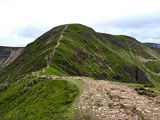
Ullock Pike is a fell situated in northern part of the English Lake District. It is located seven kilometres north west of Keswick and achieves a height of 691 metres. The fell sits on Skiddaw’s south western ridge along with two other fells, this ridge is regarded as the finest way to ascend Skiddaw, with Alfred Wainwright commenting:

<span class="mw-page-title-main">Long Side</span>

Long Side is a fell in the English Lake District, it is situated six kilometres north west of Keswick in the northern sector of the national park and is part of the Skiddaw group of fells. Long Side which reaches a height of 734 m (2,408 ft) is located on Skiddaw’s north western ridge, the middle section of which is known as Longside Edge. Strictly speaking the actual summit of the fell is nameless with the name Long Side applying to the south western slope below the summit and is so marked on maps. The fell is often climbed by walkers on their way to the summit of Skiddaw, the route up the north west ridge which passes over Long Side is regarded as being the finest and quietest ascent of that 3,000-foot (910 m) mountain by guide book writers.

Middle Fell is a hill or fell in the English Lake District. It is a satellite of Seatallan standing above the northern shore of Wastwater. Middle Fell can be climbed from Greendale near the foot of Wastwater, and a fine view of the lake backed by the Wastwater Screes is visible from the summit.

<span class="mw-page-title-main">Bannerdale Crags</span>

Bannerdale Crags is a fell in the English Lake District. It stands between Blencathra and Bowscale Fell in the Northern Fells.

<span class="mw-page-title-main">Bowscale Fell</span>

Bowscale Fell is a hill in the English Lake District. It rises above the village of Mungrisdale in the Northern Fells. Bowscale Fell stands at the extreme north east the Blencathra group, connected to this higher fell by the intervening Bannerdale Crags. In common with many fells the western slopes are smooth and convex while the eastern side exhibits crags.

<span class="mw-page-title-main">Northern Fells</span>

The Northern Fells are a mountain range in the English Lake District. Including Skiddaw, they occupy a wide area to the north of Keswick. Smooth, sweeping slopes predominate, with a minimum of tarns or crags. Blencathra in the south-east of the group is the principal exception to this trend.

References

  1. 1 2 3 Wainwright, Alfred: A Pictorial Guide to the Lakeland Fells,Book 5 The Northern Fells: ISBN   0-7112-2458-7
  2. Blair, Don: Exploring Lakeland Tarns: Lakeland Manor Press (2003): ISBN   0-9543904-1-5
  3. British Geological Survey: 1:50,000 series maps, England & Wales Sheet 29: BGS (1999)
  4. Adams, John: Mines of the Lake District Fells: Dalesman (1995) ISBN   0-85206-931-6
  5. Birkett, Bill: Complete Lakeland Fells: Collins Willow (1994): ISBN   0-00-218406-0