
Helvellyn is a mountain in the English Lake District, the highest point of the Helvellyn range, a north–south line of mountains to the north of Ambleside, between the lakes of Thirlmere and Ullswater.

Dale Head is a fell in the north-western sector of the Lake District, in northern England. It is 753 metres or 2,470 feet above sea level and stands immediately north of Honister Pass, the road between Borrowdale and Buttermere.

Place Fell is a hill in the English Lake District. It stands at the corner of the upper and middle reaches of Ullswater, with steep western flanks overlooking the villages of Glenridding and Patterdale.

High Raise is a fell in the Central Fells of the English Lake District, not to be confused with another High Raise situated in the Far Eastern Fells. High Raise is not one of the most spectacular mountains in the district; however, with a height of 762 metres (2,500 ft) it is the highest point in the central fells of Lakeland.
Nethermost Pike is a fell in Cumbria, England, and a part of the Lake District. At 891 metres (2,923 ft) it is the second highest Wainwright in the Helvellyn range, the highest of which is Helvellyn itself. It is located close to the southern end of the ridge, with Helvellyn to the north, and High Crag and Dollywaggon Pike to the south. Nethermost Pike, along with many of the Eastern Fells, lies between Thirlmere in the west and the Ullswater catchment in the east. The closest villages are Glenridding and Patterdale on the shores of Ullswater, over 8 kilometres (5 mi) away.

Raise is a fell in the English Lake District. It stands on the main spine of the Helvellyn range in the Eastern Fells, between Thirlmere and Ullswater.

High Seat is a fell in the centre of the English Lake District. Despite being below 2,000 ft it is the highest point for about 5 miles in any direction; a consequence of the curious fact that the centre of the district is lower than the surrounding parts.

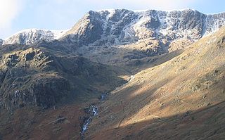
White Side is a fell in the English Lake District. It is situated to the east of Thirlmere and to the west of Glenridding valley. This places White Side in the Helvellyn range of the Eastern Fells, with Raise to the north and Helvellyn Lower Man to the south, both of which are of greater height.

Dollywaggon Pike is a fell in the English Lake District. It stands on the main spine of the Helvellyn range in the Eastern Fells, between Thirlmere and the Ullswater catchment.

Pike of Blisco, or Pike o' Blisco, is a mountain in the Lake District in Cumbria, England. Located between the valleys of Great Langdale and Little Langdale, its relative isolation from neighbouring fells together with slopes falling away immediately from the summit in all directions mean it has excellent views: the view of the Langdale Pikes across Great Langdale is particularly arresting.

Low Fell is a fell in the English Lake District. It overlooks the lake of Loweswater to the south and to the north is bordered by its neighbour Fellbarrow. It is usually climbed from the villages of Loweswater or Thackthwaite. The fell is largely occupied by grassed enclosures, although there are some rocky outcrops near the top. Low Fell has fairly steep slopes to the south and east.

Ullscarf is a fell in the English Lake District close to the geographical centre of the Cumbrian hills. It forms part of the watershed between the Derwentwater and Thirlmere catchments, a ridge running broadly north-south.
Armboth Fell is a fell in the English Lake District, regarded by Alfred Wainwright as the centre of Lakeland. It is named for the former settlement of Armboth. The fell is a domed plateau, three-quarters of a mile across, jutting out to the east of the Derwentwater-Thirlmere watershed, in the Borough of Allerdale. The fell is wet underfoot, with large areas clad in heather. The eastern slopes above Thirlmere have been planted with conifers.

Raven Crag is a fell in the English Lake District that overlooks Thirlmere reservoir. It has subsidiary summits The Benn and Castle Crag.

Tarn Crag is a fell in the Central Fells of the English Lake District. Strictly the name refers only to the rock face looking down upon Easedale Tarn, but Alfred Wainwright applied it to the entire ridge lying between the Easedale and Far Easedale valleys in his Pictorial Guide to the Lakeland Fells
Blea Rigg is a fell in the English Lake District, lying between the valleys of Easedale and Great Langdale. One of the Central Fells, it is a broad plateau with a succession of rocky tops. Many routes of ascent are possible, beginning either from Grasmere or Great Langdale, though the paths are often poorly marked and hard to follow.

Watson's Dodd is a fell in the English Lake District, a minor rise on the main ridge of the Helvellyn range in the Eastern Fells, but a prominent shoulder on the west side of that range.

Green Crag is a fell in the English Lake District. It stands between Eskdale and the Duddon valley in the Southern Fells.

Bowscale Fell is a hill in the English Lake District. It rises above the village of Mungrisdale in the Northern Fells. Bowscale Fell stands at the extreme north east the Blencathra group, connected to this higher fell by the intervening Bannerdale Crags. In common with many fells the western slopes are smooth and convex while the eastern side exhibits crags.
The Central Fells are a group of hills in the English Lake District. Reaching their highest point at High Raise, they occupy a broad area to the east of Borrowdale. The Central Fells are generally lower than the surrounding hills, the Lake District's dome-like structure having a slight dip in the middle. The range extends from the boggy ridge between Derwentwater and Thirlmere in the north, to the rock peaks of the Langdale Pikes in the south.


