Whitbarrow

Last updated

Whitbarrow
Whitbarrow from near Witherslack School.jpg
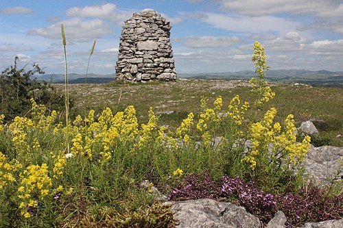
Whitbarrow from near Oversands School
Highest point
Elevation 215 m (705 ft)
Prominence 182 m (597 ft)
Parent peak High Street
Listing Marilyn, Outlying Wainwright
Coordinates 54°16′32″N2°51′36″W / 54.27557°N 2.85996°W / 54.27557; -2.85996 Coordinates: 54°16′32″N2°51′36″W / 54.27557°N 2.85996°W / 54.27557; -2.85996
Geography
Lake District National Park UK relief location map.png
Red triangle with thick white border.svg
Whitbarrow
OS grid SD441870
Topo map OS Landranger 97

Whitbarrow is a hill in Cumbria, England. Designated a biological Site of Special Scientific Interest [1] [2] and national nature reserve, it forms part of the Morecambe Bay Pavements Special Area of Conservation due to its supporting some of the best European examples of natural limestone habitats. Also known as Whitbarrow Scar (though properly that term applies to the cliffs lining its western edge), the hill lies about 9 kilometres (5.6 mi) south-west of Kendal, just north of the A590 road, close to the village of Witherslack. [3] Part of the site is a local nature reserve called Whitbarrow Scar. [4] [5]

It is a mixture of woodland, grassland and limestone pavement. The hill is prominent from the A590 road with its steep limestone cliffs, laid down in the Carboniferous period some 350 million years ago. The main cliff faces are made up of rocks known as Dalton Beds, above which are Urswick Limestones, of which the limestone pavement (here and elsewhere around Morecambe Bay, including Hutton Roof Crags) has been formed.

Whitbarrow, like most of the Lake District, shows many signs of the last ice age, including glacial erratics (boulders left behind when the ice retreated), and the limestone pavement itself, formed when ice left bare limestone exposed to the elements which eroded it and left us with the grikes and clints we see today. The limestone has been used for many purposes including building, agricultural fertiliser, and production of millstones, but is now protected by law and it is an offence to remove any. Whitbarrow NNR is owned and managed by the Forestry Commission, Lake District National Park Authority and the Cumbria Wildlife Trust.

Much of Whitbarrow is covered in woodland, initially naturally and from 1919 following planting; the Forestry Commission now holds leases on parts of the hill. A variety of techniques are used to manage the woodland, including coppicing; the variety of methods adds to the range of wildlife resulting.

The summit of Whitbarrow Scar is known as Lord's Seat, and a 6.5-mile (10.5 km) anticlockwise walk to here from Witherslack, returning along the valley to the west, forms a chapter in The Outlying Fells of Lakeland by Alfred Wainwright. He describes it as "the most beautiful [walk] in this book; beautiful it is every step of the way. ... All is fair to the eye on Whitbarrow." [6]

Related Research Articles

National nature reserves in England were established by English Nature, now Natural England, which manages them either directly or through non-governmental organisations such as the Royal Society for the Protection of Birds or the National Trust.

Grange-over-Sands Human settlement in England

Grange-over-Sands is a town and civil parish located on the north side of Morecambe Bay in Cumbria, England, a few miles south of the Lake District National Park. In the 2001 census the parish had a population of 4,042, increasing at the 2011 census to 4,114. Historically part of Lancashire, the town was created as an urban district in 1894. Since the 1974 local government re-organisation, it has been of the South Lakeland district of Cumbria, though it remains part of the Duchy of Lancaster.

Cumbria Wildlife Trust is a wildlife trust covering the county of Cumbria, England. It runs more than 40 nature reserves, and aims to broaden the awareness and knowledge of the wildlife in the county.

Hutton Roof Crags

Hutton Roof Crags is a hill in south-eastern Cumbria in north-west England, located near to the village of Hutton Roof. It has extensive areas of limestone pavement as well as grassland and woodland. The hill forms the Hutton Roof Crags Site of Special Scientific Interest and is part of the Morecambe Bay Pavements Special Area of Conservation. A significant proportion of the UK's 20 km2 (7.7 sq mi) of limestone pavement is to be found on Hutton Roof Crags and the neighbouring Farleton Knott.

Cunswick Scar

Cunswick Scar is a limestone scar in the Lake District, England. There are extensive views from the large cairn at the top. The scar is listed in the Scout Scar chapter of Wainwright's The Outlying Fells of Lakeland.

Shipman Knotts

Shipman Knotts is a fell in the English Lake District in Cumbria, England. It reaches a height of 587 metres (1,926 ft) and is situated in one of the quieter areas of the national park, 2 kilometres (1.2 mi) north-east of Kentmere village. Although not one of the best-known Lake District fells and strictly speaking it is just the southern shoulder of Kentmere Pike it earned a separate chapter in Alfred Wainwright’s Pictorial Guide to the Lakeland Fells due to “Its characteristic roughness…rocky outcrops are everywhere on its steep slopes”.

Beacon Fell, Cumbria Fell in the southern Lake District of England

Beacon Fell is a fell in the southern Lake District of England with an altitude of 836 feet (255 m). It is the subject of a chapter of Wainwright's book The Outlying Fells of Lakeland.

Clints Crags

Clints Crags is a small fell in the north of the English Lake District near Blindcrake, Cumbria. It has its own chapter in Alfred Wainwright's The Outlying Fells of Lakeland. He describes a circular walk from Blindcrake, and laments that at the time of writing (1974): "This is a walk on public footpaths, but until somebody removes the barbed wire and other obstacles to legitimate progress it can be recommended only to gymnasts." It reaches 804 feet (245 m). Since the time of writing the barbed wire has been removed and the path to the summit is clear of obstructions.

<i>The Outlying Fells of Lakeland</i> Wainwright book on Lake District peaks

The Outlying Fells of Lakeland is a book written by Alfred Wainwright, dealing with hills in and around the Lake District of England. It differs from Wainwright's Pictorial Guides in that each of its 56 chapters describes a walk, sometimes taking in several summits, rather than a single fell. This has caused some confusion on the part of authors attempting to prepare a definitive list of peaks. The Outlying Fells do not form part of the 214 hills generally accepted as making up the Wainwrights, but they are included in Category 2B of the Hill Walkers' Register maintained by the Long Distance Walkers Association.

Meathop and Ulpha Human settlement in England

Meathop and Ulpha is a former civil parish, now in the parish of Witherslack, Meathop and Ulpha, in the South Lakeland district of the English county of Cumbria. Historically in Westmorland, it is located 3.6 miles (5.8 km) north east of Grange-over-Sands, 10.6 miles (17.1 km) south west of Kendal and 64.0 miles (103.0 km) south of Carlisle, between the confluence of the River Kent estuary and the River Winster. In 2001 it had a population of 143, increasing slightly to 154 at the Census 2011. It included the village of Meathop.

Witherslack Human settlement in England

Witherslack is a small village and former civil parish, now in the parish of Witherslack, Meathop and Ulpha, in the south of Cumbria. It lies on the north eastern side of Morecambe Bay, England. The eastern side of the village borders Whitbarrow Scar with Yewbarrow, which is a small limestone hill, located in the centre of the village.

Humphrey Head

Humphrey Head is a limestone outcrop situated south of the village of Allithwaite in Cumbria, England. It is whale-back-shaped and accessible for walkers, giving views over Morecambe Bay to Lancaster, Morecambe, Heysham and over the Leven estuary to Ulverston. There is an Ordnance Survey trig point at the top.

Claife Heights

Claife Heights is an upland area in the Lake District, near to Windermere in Cumbria, England. It has a topographic prominence of 177 metres (581 ft) so is classified as a Marilyn.

Scout Scar

Scout Scar, also called Underbarrow Scar, is a hill in the English Lake District, west of Kendal, Cumbria and above the village of Underbarrow. It reaches 771 feet (235 m). Scout Scar is the subject of a chapter of Wainwright's book The Outlying Fells of Lakeland, but the summit he describes is a lower summit at 764 feet (233 m), 270m south of the highest point. Wainwright's anticlockwise recommended route also includes Cunswick Scar at 679 feet (207 m). The higher summit of Scout Scar has a topographic prominence of 109m and is thus classified as a HuMP, a hill with a prominence of at least 100m.

Wasdale Horseshoe

The Wasdale Horseshoe is a group of hills on the eastern fringe of the English Lake District, to the west of the A6, south of Shap, Cumbria. They surround the valley of Wasdale Beck, a tributary of Birk Beck and ultimately of the River Lune. The horseshoe is the subject of a chapter of Wainwright's book The Outlying Fells of Lakeland. This Wasdale should not be confused with the better known Wasdale, containing Wast Water, on the west of the Lake District.

Wet Sleddale Horseshoe

The Wet Sleddale Horseshoe is an upland area in the English Lake District, around the Wet Sleddale Reservoir, Cumbria. It is the subject of a chapter of Wainwright's book The Outlying Fells of Lakeland. His walk starts at the reservoir dam and follows a clockwise circuit over Sleddale Pike at 1,659 feet (506 m), Great Saddle Crag at 1,850 feet (560 m) and Ulthwaite Rigg at 1,648 feet (502 m).

Knipescar Common

Knipescar Common, or Knipe Scar, is an upland area in the east of the English Lake District, above the River Lowther, near Bampton, Cumbria. It is the subject of a chapter of Wainwright's book The Outlying Fells of Lakeland. The summit is "indefinite" but reaches 1,118 feet (341 m) and there are limestone outcrops and an ancient enclosure. Wainwright commends the views which include Blencathra to the north and "a continuous skyline of the higher Pennines."

Shorn Cliff and Caswell Woods Biological Site of Special Scientific Interest in Gloucestershire, England

Shorn Cliff And Caswell Woods is a 69.2-hectare (171-acre) biological Site of Special Scientific Interest in Gloucestershire, notified in 1986. The site is listed in the 'Forest of Dean Local Plan Review' as a Key Wildlife Site (KWS).

Morecambe Bay Pavements

Morecambe Bay Pavements is a multi-site Special Area of Conservation comprising limestone pavements around Morecambe Bay in North-West England. It was designated in 2005 under the Habitats Directive. The SAC does not include any marine areas; Morecambe Bay itself is a separate SAC, which was designated the same year.

Great Asby Scar Limestone pavement in Cumbria

Great Asby Scar is a Site of Special Scientific Interest (SSSI) and National Nature Reserve in Cumbria, UK. It is an area of limestone pavement, south of the village of Great Asby.

References

  1. "Whitbarrow citation" (PDF). Sites of Special Scientific Interest. Natural England. Retrieved 26 July 2013.
  2. "Map of Whitbarrow". Sites of Special Scientific Interest. Natural England. Retrieved 26 July 2013.
  3. "Whitbarrow - Hervey Memorial Reserve" . Retrieved 5 April 2017.
  4. "Whitbarrow Scar". Local Nature Reserves. Natural England. Retrieved 26 July 2013.
  5. "Map of Whitbarrow Scar". Local Nature Reserves. Natural England. Retrieved 26 July 2013.
  6. Wainwright, A. (1974). "Whitbarrow". The Outlying Fells of Lakeland . Kendal: Westmorland Gazette. pp. 36–41.
Cairn on Whitbarrow Cairn on Whitbarrow, Cumbria.jpg
Cairn on Whitbarrow
Northerly panorama from Lord's Seat (the summit of Whitbarrow Scar), extending from Old Man of Coniston to the Howgill Fells Whitbarrow Scar.jpg
Northerly panorama from Lord's Seat (the summit of Whitbarrow Scar), extending from Old Man of Coniston to the Howgill Fells