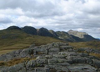
Crinkle Crags is a fell in the English Lake District in the county of Cumbria. It forms part of two major rings of mountains, surrounding the valleys of Great Langdale and Upper Eskdale. The name reflects the fell's physical appearance as its summit ridge is a series of five rises and depressions (crinkles) that are very distinctive from the valley floor. In Old English, cringol means twisted or wrinkled.

Whitfell is a hill of 573 metres (1,880 ft) in the southwestern part of the Lake District. It is the highest point between Black Combe and Harter Fell on the broad ridge to the west of the Duddon Valley. Views from the summit include the full length of the Duddon Valley including its estuary; the western side of the Coniston fells; the Eskdale fells including Scafell and Bowfell; much of western Cumbria including the estuary of the Rivers Esk, Mite and Irt; the Isle of Man; as well as the hills to the south culminating in Black Combe.
Haystacks, or Hay Stacks, is a hill in England's Lake District, situated at the south-eastern end of the Buttermere Valley. Although not of any great elevation, Haystacks has become one of the most popular fells in the area. This fame is partly due to the writings of Alfred Wainwright, who espoused its attractions and chose it as the place where he wanted his ashes scattered. Its large, undulating summit contains many rock formations, tarns and hidden recesses.
Seathwaite Fell is an area of the Lake District in Cumbria, England. It stands above the hamlet of the same name at the head of Borrowdale.

Devoke Water is a small lake in the mid-west region of the English Lake District, in the county of Cumbria. It is the largest tarn in the Lake District.

Stickle Pike is an outlying fell located in the southern Lake District near the small town of Broughton-in-Furness, with the summit situated between the lower Duddon Valley and the quiet smaller valley of Dunnerdale. Despite its low altitude the sharp, conical summit is prominent in views from the Broughton and high Furness areas. As with many of the Dunnerdale and Coniston fells, there are reminders of the area's former mining past in the form of many spoil heaps, disused levels and shafts. The fell is also notable for its wide-ranging views despite its low altitude, especially to the Scafells to the north and the sands of the Duddon Estuary to the south. A "stickle" is a hill with a prominent rocky top.

Shipman Knotts is a fell in the English Lake District in Cumbria, England. It reaches a height of 587 metres (1,926 ft) and is situated in one of the quieter areas of the national park, 2 kilometres (1.2 mi) north-east of Kentmere village. Although not one of the best-known Lake District fells and strictly speaking it is just the southern shoulder of Kentmere Pike it earned a separate chapter in Alfred Wainwright’s Pictorial Guide to the Lakeland Fells due to “Its characteristic roughness…rocky outcrops are everywhere on its steep slopes”.

Muncaster Fell is a fell at the far western edge of the Lake District National Park, in Cumbria, England. Muncaster Fell is a long, narrow ridge of land, approximately 1.2 km wide and 6 km long, lying between the River Mite to the north, and River Esk to the south. The fell rises from the coast near Ravenglass village to its highest point at Hooker Crag (231 m). The ridge then continues to the north-east, dropping gently to its furthest prominence at Silver Knott (174 m). The fell then falls away rapidly to the village of Eskdale Green at its north-eastern tip.

The Outlying Fells of Lakeland is a book written by Alfred Wainwright, dealing with hills in and around the Lake District of England. It differs from Wainwright's Pictorial Guides in that each of its 56 chapters describes a walk, sometimes taking in several summits, rather than a single fell. This has caused some confusion on the part of authors attempting to prepare a definitive list of peaks. The Outlying Fells do not form part of the 214 hills generally accepted as making up the Wainwrights, but they are included in Category 2B of the Hill Walkers' Register maintained by the Long Distance Walkers Association.
Reston Scar is a fell in the Lake District of Cumbria, England. It overlooks the north side of Staveley village, and is listed among Alfred Wainwright's "Outlying Fells of Lakeland" guide. The summit offers good views of the Coniston Fells, the Sca Fells and the Langdale Pikes.

Caer Mote is a hill of 289 metres (948 ft) in the north of the English Lake District near Bothel, Cumbria. Its summit lies just outside the boundary of the Lake District National Park and offers a view of Bassenthwaite Lake. Under the name Caermote Hill it is the subject of a chapter of Wainwright's book The Outlying Fells of Lakeland. Wainwright's route is an ascent from Bothel to the northern summit St. John's Hill at 285 metres (935 ft), continuing south to the main summit and south east to meet a minor road beside the Roman fort and follow that road north for an anticlockwise circuit. In his original book Wainwright lists the height as 920 feet, but in the 2011 2nd edition Chris Jesty corrects this to 948 feet.
Claife Heights is an upland area in the Lake District, near to Windermere in Cumbria, England. It has a topographic prominence of 177 metres (581 ft) so is classified as a Marilyn.

School Knott is a hill in the Lake District, England, to the east of Windermere town, Cumbria. It is the subject of a chapter of Wainwright's book The Outlying Fells of Lakeland. His recommended route starts at Windermere railway station and includes Grandsire at 818 feet (249 m) and a nameless summit at 806 feet (246 m). The summit is at 760 feet (230 m) and offers a view of four sections of Windermere, the lake. It has a rocky outcrop but no trig point and, as reported by Wainwright, no cairn. Schoolknott Tarn is to the south-east of the summit.

The Naddle Horseshoe is a group of summits in the English Lake District, south of Mardale valley, Cumbria. It is the subject of a chapter of Wainwright's book The Outlying Fells of Lakeland.
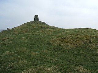
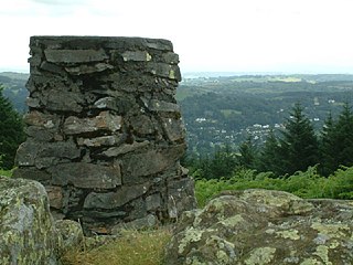
High Knott, marked on some Ordnance Survey maps as Williamson's Monument, is a hill in the eastern part of the English Lake District, near Staveley, Cumbria. The monument on its summit was built by the Reverend T. Williamson in 1803, in memory of his father Thomas Williamson, who had climbed the fell every day before breakfast. The fell is the subject of a chapter of Wainwright's book The Outlying Fells of Lakeland. It reaches 901 feet (275 m) and Wainwright's route starts near the 17th-century Ulthwaite Bridge on the River Kent, climbing High Knott and then making a clockwise circuit to the early British village site at Hugill and "over the pleasant heights on the west side of mid-Kentmere".

Hugill Fell is a hill in the English Lake District, near Staveley, Cumbria, on the western side of the Kentmere valley. It is the subject of a chapter of Wainwright's book The Outlying Fells of Lakeland. It reaches 840 feet (260 m) and Wainwright's walk is an ascent from Staveley and return on the same route. There is a cairn on the summit.

Green Quarter Fell is an upland area in the east of the English Lake District, near Kentmere village, Cumbria. It is the subject of a chapter of Wainwright's book The Outlying Fells of Lakeland. Wainwright's walk is an anticlockwise circuit from Kentmere, reaching the summit of Hollow Moor at 1,394 feet (425 m) and a nameless summit at 1,370 feet (420 m) and making a detour to admire the tarn of Skeggles Water. He says that the walk offers: "... a perfectly-balanced and lovely view of upper Kentmere ... that cries aloud for a camera."
Woodland Fell is an upland area in the south of the English Lake District, south of Torver, Cumbria. It is the subject of a chapter of Wainwright's book The Outlying Fells of Lakeland. Wainwright's route is a clockwise circuit from the hamlet of Woodland, and includes the summits of Yew Bank at 678 feet (207 m) and Wool Knott at 730 feet (220 m), with Beacon Tarn between them. He describes the walk as: "a connoisseur's piece, every step an uninhibited joy, every corner a delight."


