Alfred Wainwright MBE, who preferred to be known as A. Wainwright or A.W., was a British fellwalker, guidebook author and illustrator. His seven-volume Pictorial Guide to the Lakeland Fells, published between 1955 and 1966 and consisting entirely of reproductions of his manuscript, has become the standard reference work to 214 of the fells of the English Lake District. Among his 40-odd other books is the first guide to the Coast to Coast Walk, a 182-mile (293-kilometre) long-distance footpath devised by Wainwright which remains popular today.

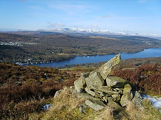
Troutbeck Tongue is a small fell in the English Lake District, three miles ENE of Ambleside. It is one of 214 hills listed in Alfred Wainwright's Pictorial Guides to the Lakeland Fells, making it a popular attraction for walkers aiming to complete the "Wainwrights". Its moderate height and proximity to a main road mean it is a pleasant half-day excursion that can be done when the higher fells are in cloud.

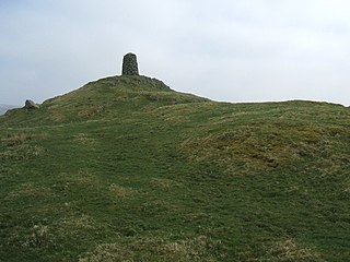
Castle Crag is a hill in the North Western Fells of the English Lake District. It is the smallest hill included in Alfred Wainwright's influential Pictorial Guide to the Lakeland Fells, the only Wainwright below 1,000 feet (300 m).

Black Combe is a fell in the south-west corner of the Lake District National Park, England, just 4 miles (6.4 km) from the Irish Sea. It lies near the west coast of Cumbria in the borough of Copeland and more specifically, in the ancient district of Millom. It is 1,970 ft (600 m) high and stands in isolation, some 10 mi (16 km) away from any higher ground; this factor offers an excellent all-round panoramic view of land and sea, weather permitting.

A Pictorial Guide to the Lakeland Fells is a series of seven books by A. Wainwright, detailing the fells of the Lake District in northwest England. Written over a period of 13 years from 1952, they consist entirely of reproductions of Wainwright's manuscript, hand-produced in pen and ink with no typeset material.

Stickle Pike is an outlying fell located in the southern Lake District near the small town of Broughton-in-Furness, with the summit situated between the lower Duddon Valley and the quiet smaller valley of Dunnerdale. Despite its low altitude the sharp, conical summit is prominent in views from the Broughton and high Furness areas. As with many of the Dunnerdale and Coniston fells, there are reminders of the area's former mining past in the form of many spoil heaps, disused levels and shafts. The fell is also notable for its wide-ranging views despite its low altitude, especially to the Scafells to the north and the sands of the Duddon Estuary to the south. A "stickle" is a hill with a prominent rocky top.

Great Stickle is a fell located in the southern Lake District of England with an altitude of 305 m (1,001 ft). Alfred Wainwright included it in the Stickle Pike chapter of his "The Outlying Fells of Lakeland". Geographically the fell is located on the southern ridge of Stickle Pike and is located between the lower Duddon Valley (west) and the valley of Dunnerdale Beck (east). A "stickle" is a hill with a prominent rocky top.

Shipman Knotts is a fell in the English Lake District in Cumbria, England. It reaches a height of 587 metres (1,926 ft) and is situated in one of the quieter areas of the national park, 2 kilometres north-east of Kentmere village. Although not one of the best-known Lake District fells, it earned a separate chapter in Alfred Wainwright’s Pictorial Guide to the Lakeland Fells due to “Its characteristic roughness. .. rocky outcrops are everywhere on its steep slopes”.

Great Cockup is a fell in the northern region of the English Lake District, one of the four Uldale Fells.

Clints Crags is a small fell in the north of the English Lake District near Blindcrake, Cumbria. It has its own chapter in Alfred Wainwright's The Outlying Fells of Lakeland. He describes a circular walk from Blindcrake, and laments that at the time of writing (1974): "This is a walk on public footpaths, but until somebody removes the barbed wire and other obstacles to legitimate progress it can be recommended only to gymnasts." It reaches 804 feet (245 m). Since the time of writing the barbed wire has been removed and the path to the summit is clear of obstructions.
The Outlying Fells of Lakeland is a 1974 book written by Alfred Wainwright dealing with hills in and around the Lake District of England. It differs from Wainwright's Pictorial Guides in that each of its 56 chapters describes a walk, sometimes taking in several summits, rather than a single fell. This has caused some confusion on the part of authors attempting to prepare a definitive list of peaks. The Outlying Fells do not form part of the 214 hills generally accepted as making up the Wainwrights, but they are included in Category 2B of the Hill Walkers' Register maintained by the Long Distance Walkers Association.

Potter Fell is a fell near the villages of Burneside and Staveley, Cumbria, England, reaching a maximum height of 1,400 feet (430 m) at Brunt Knott. Alfred Wainwright in his The Outlying Fells of Lakeland identifies four summits on Potter Fell: Brunt Knott, Ulgraves and two unnamed summits, all of which are thus recognised by the Database of British and Irish Hills. There are a number of tarns on the fell, including Gurnal Dubs and Potter Tarn.

Caer Mote is a hill of 289 metres (948 ft) in the north of the English Lake District near Bothel, Cumbria. Its summit lies just outside the boundary of the Lake District National Park and offers a view of Bassenthwaite Lake. Under the name Caermote Hill it is the subject of a chapter of Wainwright's book The Outlying Fells of Lakeland. Wainwright's route is an ascent from Bothel to the northern summit St. John's Hill at 285 metres (935 ft), continuing south to the main summit and south east to meet a minor road beside the Roman fort and follow that road north for an anticlockwise circuit. In his original book Wainwright lists the height as 920 feet, but in the 2011 2nd edition Chris Jesty corrects this to 948 feet.

Hugill is a civil parish in Cumbria, England. Hugill includes the village of Ings and the hamlets of Grassgarth, and Reston plus a large part of the village of Staveley and the west bank of the River Kent north of Barley Bridge. It was formerly a part of the Barony of Kendal. In the 2001 census the parish had a population of 416, increasing at the 2011 census to 446. Approximately 60% of the population live in Staveley or the Kent valley.
High Knott, marked on some Ordnance Survey maps as Williamson's Monument, is a hill in the eastern part of the English Lake District, near Staveley, Cumbria. The monument on its summit was built by the Reverend T. Williamson in 1803, in memory of his father Thomas Williamson, who had climbed the fell every day before breakfast. The fell is the subject of a chapter of Wainwright's book The Outlying Fells of Lakeland. It reaches 901 feet (275 m) and Wainwright's route starts near the 17th-century Ulthwaite Bridge on the River Kent, climbing High Knott and then making a clockwise circuit to the early British village site at Hugill and "over the pleasant heights on the west side of mid-Kentmere".

Hugill Fell is a hill in the English Lake District, near Staveley, Cumbria, on the western side of the Kentmere valley.

Staveley-in-Cartmel is a village and civil parish in Westmorland and Furness Unitary Authority, Cumbria, England. It lies east of Newby Bridge, near the south end of Windermere, 9 miles (14 km) northeast of Ulverston. It is sometimes known as Staveley-in-Furness. Both names distinguish it from another Staveley in Cumbria. In the 2001 census the parish had a population of 428, decreasing at the 2011 census to 405.
Staveley Fell is an upland area in the English Lake District, near Staveley-in-Cartmel, Cumbria, east of the southern end of Windermere. It is the subject of a chapter of Wainwright's book The Outlying Fells of Lakeland, but he admits that: "Strictly it has no name, not even locally, being referred to on Ordnance maps as Astley's and Chapel House Plantations, which are new forests severely encroaching upon it". He says it "commands a fine aerial view of the foot of Windermere." The fell reaches 870 feet (270 m) and Wainwright's route is a clockwise loop starting from Staveley-in-Cartmel. Chris Jesty in his revised edition of Wainwright's book provides an alternative route and comments that "There must be many people who, encouraged by the ordnance Survey map, or by the first edition of this book, have ... been turned back by an uncrossable fence."
Chris Jesty is a British author and cartographer who revised Alfred Wainwright's Pictorial Guide to the Lakeland Fells to produce the second edition (2005–2009) of the books, which were originally published in 1955–1966. He used GPS to survey all the routes and the work involved 3,000 hand-drawn changes in the first volume alone, reflecting changes such as walls having fallen down or a quarry being opened on the line of a footpath, and adding information such as car parking.


